


Why visit Madgaon
Townapedia lists 7 museums and landmarks, 10 parks and trails, 256 places to eat, 55 places to stay and 9 attractions in and around town.
Highlights include Govind Ramnath Kare College of Law, Jakni Bandh bridge, Ashvek Vintage World and Goa Chitra museum.
Weather in Madgaon
Forecast from MET Norway (CC BY 4.0). Full forecast
About Madgaon
Margao (Goan Konkani: Modgaum, IPA: [mɵɖɡãʋ]; Portuguese: Margão, IPA: [mɐɾɡɐ̃ũ]) is the commercial capital of the Indian state of Goa. It stands on the banks of the river Sal. It is the district headquarters of South Goa, and administrative headquarters of Salcete sub-district. It is Goa's second largest city by population after Mormugao.
From the Wikipedia article Margao (this version), under CC BY-SA 4.0.
Travel tips from other travellers: Madgaon on Wikivoyage (CC BY-SA 4.0).
Things to do9

Govind Ramnath Kare College of Law
School · 0.7 km
Law college in Goa

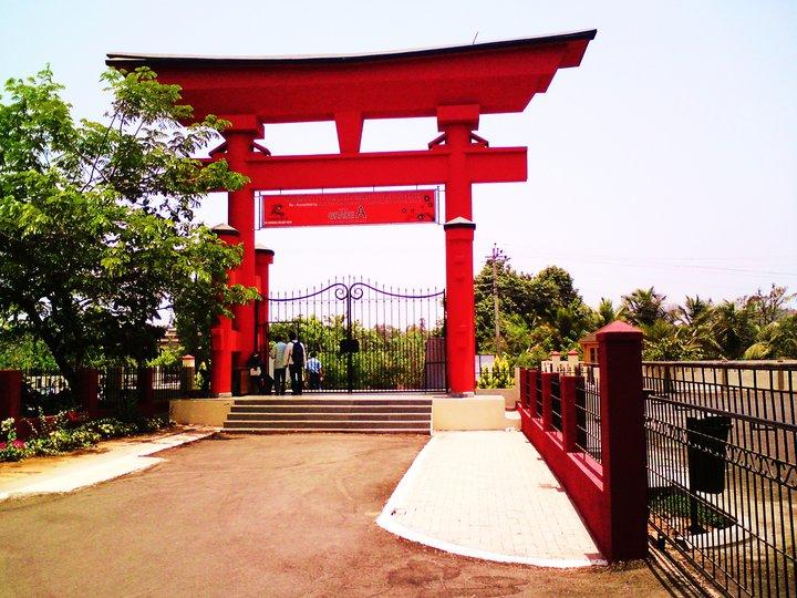
Parvatibai Chowgule College of Arts and Science
School · 2.5 km
College in Goa, India


Museums and landmarks7

Ashvek Vintage World
Museum · 5.4 km
Vintage car museum in South Goa, India


Parks, trails and playgrounds10





Restaurants and cafes256


Utsav (inside of Nanutel)
Restaurant · Regional, Indian, International
Mo-Su 11:00-15:00, 19:00-23:30


Aroma cafe
Bar and pub · Breakfast, Italian, Coffee Shop, Burger · 3.4 km
Mo-Su 08:00-22:00

Once upon a time
Restaurant · Regional, Sandwich, Grill, Asian, Beef Bowl, Pasta, Russian, Pizza, Chicken, Fish And Chips, Curry, Indian, Thai, Fish, Breakfast, Seafood, Local, Chinese, Italian, Kebab · 3.7 km
Mo-Su 09:00-23:00
Spicy Family Restaurant
Restaurant · 0.7 km
near Hari Mandir, margao
244 more on the map.
History
Prior to Portuguese rule, Margao was an important settlement and known as Maṭhagrāma (the village of monasteries) as it enshrined nine mathas in temple schools. Its replacement in 1579 was destroyed by raiders. The present church was built in 1675.
While the western side of the Holy Spirit Church developed as a market place, the settlement grew on the eastern side, that is, the Borda region.
From the History section of Margao on Wikipedia, under CC BY-SA 4.0.
Where to stay55
Victoria Paradise Inn Boutique (Ex. Hotel Royal Anthurium)
Motel and hotel · 3.7 km
Taj Exotica Road, Benaulim, Goa, India
Colva South Goa 3br Luxury Villa Felicia with private pool
Motel and hotel · 3.2 km
Ocean Residency
Motel and hotel · 3.2 km
Queeny Crown Building, Villa Nova, Vanelim Colva, Goa
Churches and places of worship28
Shopping78
The Dogears Bookshop
Shop
Shop No. SH-1, Adolfo Mansion Bernardo da Costa Road, , Near Dr Menezes Nursing Home, Nehrunagar,, Margao, Goa
Gas and EV charging10
Schools, colleges and libraries30
Healthcare105
Map of Madgaon
250 places. The map loads OpenStreetMap tiles when you open it.
Getting there and nearby towns
Goa International Airport (GOI) is the nearest airport with scheduled flights listed in OpenStreetMap, 18 km away.
- Navelim 2 km southeast, about 2 min by car
- Raia 4 km northeast, about 4 min by car
- Taleigao 25 km northwest, about 25 min by car
- Panjim 28 km northwest, about 28 min by car
- Canacona 33 km south, about 33 min by car
- Serula 33 km north, about 33 min by car
- Mapusa 39 km northwest, about 39 min by car
- Solim 43 km northwest, about 43 min by car
- Sāvantvādi 71 km north, about 1 h 15 min by car
- Belagavi 87 km northeast, about 1 h 30 min by car
Drive times are estimates from straight-line distance, not routes.
Local news
Headlines from INDB.
Reviews, tips and questions
Loading what members have shared...
Sources and licences
- GeoNames (CC BY 4.0): population, coordinates, regions and time zone
- OpenStreetMap contributors (ODbL 1.0): places, airports, map data
- Wikidata (CC0 1.0): elevation, founding date, time zone, website, landmarks and historic places
- Wikimedia Commons (see each image): photos
- Wikipedia (CC BY-SA 4.0): overview and history text
Photo credits
- Front Elevation of Margao Municipal Council (cropped), iMahesh, CC BY-SA 4.0
- Rachol Church, Historic Discoveries, CC BY-SA 3.0
- Holy Spirit Church. Margao. Goa. India. Церковь Святого Духа. Маргао. Гоа. Индия - panoramio (2), kikiwis, CC BY 3.0
- Fatorda stadium exterior 1, The original uploader was Vrlobo888 at English Wikipedia ., Public domain
- Victor Hugo Gomes, Victor Hugo Gomes, Public domain
- Fatorda Stadium, Goa, Donkey335, CC BY-SA 4.0
- Chowgule, pravinsilva, Public domain
- Govind Ramnath Kare College, Rejoy2003, CC BY-SA 4.0
- Jakni Bandh from above the culvert, Joegoauk Goa, CC BY-SA 2.0
Page built November 3, 2026. Spotted a mistake? Tell us or suggest a place.