


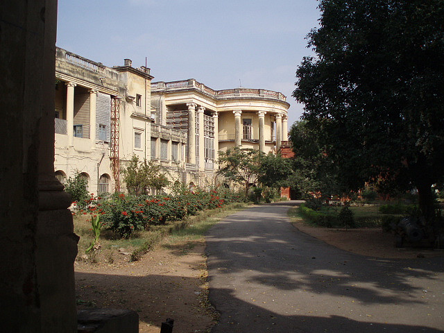


Why visit Shamshabad
Townapedia lists 5 museums and landmarks, 25 parks and trails, 25 places to eat, 10 places to stay and 12 attractions in and around town.
Highlights include National Fisheries Development Board building, Acharya N. G. Ranga Agricultural University, Charminar and Sudha Cars Museum.
Weather in Shamshabad
Forecast from MET Norway (CC BY 4.0). Full forecast
Things to do12
National Fisheries Development Board building
Monument and historic site · 10.0 km
Fish-shaped building in Hyderabad, India

Acharya N. G. Ranga Agricultural University
School · 7.8 km
State public university in Guntur, Andhra Pradesh, India

Professor Jayashankar Telangana Agricultural University
School · 7.9 km
State public university in Hyderabad, Telangana, India

Sri Konda Laxman Telangana State Horticultural University
School · 9.0 km
State public university in Siddipet, Telangana, India
Sri P.V. Narasimha Rao Telangana State University for Veterinary, Animal and Fishery Sciences
School · 8.3 km
State public university in Ranga Reddy, Telangana, India
University College for Women, Koti
School · 13.5 km
State public university in Hyderabad, Telangana, India


Museums and landmarks5

Charminar
Monument and historic site · 13.6 km
Mosque in Hyderabad, India

Sudha Cars Museum
Museum · 12.3 km
Automobile museum located in Hyderabad, India


Parks, trails and playgrounds25

Kothwalguda Eco Park
Park · 8.6 km
Eco Park in Kothwalguda, Hyderabad, Telangana


Nehru Zoological Park
Park · 11.5 km
Zoo located near Mir Alam Tank in Hyderabad, Telangana, India
Singhs Park Cricket Ground
Park · 9.9 km
Cricket ground for Rent
kismatpur Road kismatpur, R R District
Dhatri Park
Park · 11.0 km
ward 18 Dhatri, Bandlaguda Jagir Municipal Corporation


13 more on the map.
Restaurants and cafes25

Vibrant Living
Restaurant · 2.5 km
Level - F DSRA, GMR Airport, East Pier Bulb Area, F-049, Shamshabad, Hyderabad
24/7
Terracotta Italian Kitchen
Restaurant · Italian, Pizza, Pasta · 2.5 km
Level - F DSRA, GMR Airport, East Pier Bulb Area, F-049, Shamshabad
Doner & Gyros
Restaurant · 2.5 km
Level - F DSRA, GMR Airport, East Pier Bulb Area, F-049, Shamshabad

Karachi Bakery
Bakery · 2.5 km
Level - F DSRA, GMR Airport, East Pier Bulb Area, F-049, Shamshabad

Millet Travels
Cafe · 2.5 km
Level - F DSRA, GMR Airport, East Pier Bulb Area, F-049, Shamshabad
13 more on the map.
Where to stay10
Churches and places of worship42
Maisamma Devalayam
Place of worship · Hindu · 9.5 km
Kismatpur Village Kismatpur, R R District
Dargah Hazrat Aashiq-e-Khwaja (Peeli Dargah)
Place of worship · 9.4 km
Salalah ,Barkas road, Hyderabad
Sri Sita Rama Chandra Swami Temple
Place of worship · 7.8 km
784W+V4G, Nagarguda - Shamshabad Rd, Near Rajeev Gandhi International Airport, Shamshabad, Ammapalle, Telangana Nethaji Rd, Hyderabad
Shopping7
Best Price Modern Wholesale
Grocery · 9.4 km
Opposite Pillar 267, PV Narasimha Rao Expressway Sivarampally, Rajendranagar
Pen 'N' Paper Stationary & More
Shop · 9.2 km
68XJ+JJ Chowdariguda, Telangana Telangana, Hyderabad
Gas and EV charging11
Schools, colleges and libraries31
P.V. Narsimha Rao Telangana Veterinary University Administrative Office
School · 8.3 km
rajendra nagar, HYDERABAD
PVN Telangana State Veterinary University
School · 7.8 km
Rajendra Nagar, Hyderabad
Healthcare34
Urban Primary Health Centre, Barkas
Clinic and pharmacy · 10.4 km
chandrayan gutta bus stop
Primary Health Centre, Myladeverpally
Clinic and pharmacy · 8.2 km
Myladeverpally
Map of Shamshabad
202 places. The map loads OpenStreetMap tiles when you open it.
Getting there and nearby towns
RGIA Phase II (HYD) is the nearest airport with scheduled flights listed in OpenStreetMap, 0 km away.
- Kottapeta 10 km northeast, about 10 min by car
- Hyderabad 15 km north, about 15 min by car
- Lal Bahadur Nagar 18 km northeast, about 18 min by car
- Gaddi Annaram 17 km northeast, about 17 min by car
- Uppal Kalan 23 km northeast, about 23 min by car
- Malkajgiri 25 km northeast, about 25 min by car
- Kukatpally 26 km north, about 26 min by car
- Secunderabad 31 km northeast, about 31 min by car
- Vikārābād 55 km west, about 55 min by car
- Mahbūbnagar 73 km southwest, about 1 h 15 min by car
Drive times are estimates from straight-line distance, not routes.
Local news
Headlines from INDB.
Reviews, tips and questions
Loading what members have shared...
Sources and licences
- GeoNames (CC BY 4.0): population, coordinates, regions and time zone
- OpenStreetMap contributors (ODbL 1.0): places, airports, map data
- Wikidata (CC0 1.0): elevation, founding date, time zone, website, landmarks and historic places
- Wikimedia Commons (see each image): photos
Photo credits
- Fish shaped building, Nagaraju raveender, CC BY-SA 3.0
- Acharya N G Ranga Agriculture university, Munna Aawara, CC BY-SA 4.0
- Puranapul, Aditya369, CC BY-SA 3.0
- Kothi college, Abdul Bari (Black Strider), CC BY-SA 2.0
- Charminar-Pride of Hyderabad, Gopikrishna Narla, CC BY-SA 3.0
- Snap from Sudha Cars Museum Hyderabad 3767, Rameshng, CC BY-SA 3.0
- Hyderabad zoo, Cephas 405 at en.wikipedia ), CC BY-SA 3.0
- Falaknuma Palace 01, Bernard Gagnon, CC BY-SA 3.0
- Sitarama Swamy Temple, Shamshabad, Hyderabad, Nikhilb239, CC BY-SA 4.0
- RGIA airport route, Adbh266, CC BY-SA 3.0
- ©India.Andhra Pradesh.Hyderabad.Rajiv Gandhi International Airport-11, SridharSaraf, CC BY-SA 3.0
- Gates 24 and 26 at RGIA (2910974669), Harikrishnan Tulsidas from Vienna, Austria, CC BY-SA 2.0
- Rajiv Gandhi International Airport, Hyderabad, India, SamuelDutta, CC BY 4.0
- Long view of International Departure Building, Munna Aawara, CC BY-SA 4.0
- ©India.Andhra Pradesh.Hyderabad.Rajiv Gandhi International Airport-10, SridharSaraf, CC BY-SA 3.0
- RGI Airport Departure premises, Munna Aawara, CC BY-SA 4.0
- ©India.Andhra Pradesh.Hyderabad.Rajiv Gandhi International Airport-1, SridharSaraf, CC BY-SA 3.0
- Wikimedia Technology Summit 2024 by Manoj Karingamadathil 04, Manojk, CC BY-SA 4.0
- Wikimedia Technology Summit 2024 by Manoj Karingamadathil 01, Manojk, CC BY-SA 4.0
- Wikimedia Technology Summit 2024 by Manoj Karingamadathil 02, Manojk, CC BY-SA 4.0
- Wikimedia Technology Summit 2024 by Manoj Karingamadathil 03, Manojk, CC BY-SA 4.0
- Encalm Privé lounge in Hyderabad (entrance), Oleg Yunakov, CC BY-SA 4.0
- Boeing B789 - Etihad Airways - 02, Oleg Yunakov, CC BY-SA 4.0
- Encalm Privé lounge in Hyderabad (inside), Oleg Yunakov, CC BY-SA 4.0
- Wikimedia Technology Summit 2024 by Manoj Karingamadathil 05, Manojk, CC BY-SA 4.0
- Wikimedia Technology Summit 2024 by Manoj Karingamadathil 06, Manojk, CC BY-SA 4.0
- Boeing B789 - Etihad Airways - 01, Oleg Yunakov, CC BY-SA 4.0
- Bonda from Karnataka 2023, Vis M, CC BY-SA 4.0
- Wikimedia Technology Summit 2024 by Manoj Karingamadathil 07, Manojk, CC BY-SA 4.0
- Hyderabad Airport-Domestic Arrivals, Reema Jalihal, CC BY-SA 4.0
- ©India.Andhra Pradesh.Hyderabad.Rajiv Gandhi International Airport-3, SridharSaraf, CC BY-SA 3.0
- Cafe Niloufer Hyderabad Airport, Telangana JEG IMG 20260829 112743370, PJeganathan, CC BY-SA 4.0
- Tea and Bun Muska from Cafe Niloufer Hyderabad JEG IMG 20260829 112104521, PJeganathan, CC BY-SA 4.0
- Hanuman Leela at RGIA 01, Pratishkhedekar, CC BY-SA 4.0
- Cafe Niloufer Hyderabad Airport, Telangana JEG IMG 20260829 112748018, PJeganathan, CC BY-SA 4.0
- ©India.Andhra Pradesh.Hyderabad.Rajiv Gandhi International Airport-2, SridharSaraf, CC BY-SA 3.0
- ©India.Andhra Pradesh.Hyderabad.Rajiv Gandhi International Airport-6, SridharSaraf, CC BY-SA 3.0
- Cafe Niloufer Hyderabad Airport, Telangana JEG IMG 20260829 112824721, PJeganathan, CC BY-SA 4.0
- ©India.Andhra Pradesh.Hyderabad.Rajiv Gandhi International Airport-4, SridharSaraf, CC BY-SA 3.0
- A sculpture of a dog with glasses, Oleg Yunakov, CC BY-SA 4.0


Page built November 3, 2026. Spotted a mistake? Tell us or suggest a place.