


Why visit Āmol
Townapedia lists 9 museums and landmarks, 15 parks and trails, 64 places to eat, 2 places to stay and 4 attractions in and around town.
Highlights include Amol First Metal Bridge, Davazdah Cheshmeh Bridge, Haydar Amuli Mausoleum and Mir Bozorg Mausoleum.
Weather in Āmol
Forecast from MET Norway (CC BY 4.0). Full forecast
About Āmol
Amol (Persian: آمل [ɒˈmol]; ) is a city in the Central District of Amol County, Mazandaran province, Iran, serving as capital of both the county and the district.
From the Wikipedia article Amol (this version), under CC BY-SA 4.0.
Things to do4

Amol First Metal Bridge
Bridge
Bridge in Amol, Iranian national heritage site

Davazdah Cheshmeh Bridge
Bridge
Bridge in Amol, Iranian national heritage site


Museums and landmarks9

Haydar Amuli Mausoleum
Monument and historic site · 1.2 km
Mausoleum tower in Amol, Iranian national heritage site

Mir Bozorg Mausoleum
Monument and historic site
Mausoleum in Amol, Iranian national heritage site

Shams al-Rasul Mausoleum
Monument and historic site · 1.4 km
Mausoleum tower in Amol, Iranian national heritage site

آمل روستای پاشاکلا ،کمانگرکلا دشت سر هراز پی جنوبی ۱۴۰۴.۱۰.۱۴
Monument and historic site · 3.9 km
آمل روستای پاشکلا. کمانگرکلا دشت سر هرازپی جنوبی باغ۱۴۰۴.۱۰.۱۴
Monument and historic site · 3.9 km

Parks, trails and playgrounds15


3 more on the map.
Restaurants and cafes64

Bazarcheh
Cafe · Tea, Asian
One of the best shisha(hookah) bars in the province with high capacity and welcoming people that are always ready for serveing you best...
اندیشه ۳, آمل
08:00-22:00
کافه رستوران بهار نارنج
Cafe · قیمه،قرمه،چلوگوشت،چلومرغ،شامی،جوجه کباب،کوبیده،املت،خوراک گوشت و چرخکرده و دل قلوه،نیمرو و... · 3.8 km
بلوارسردار شهید نعیمی - کمربندی, امل
شنبه تا پنجشنبه ۷:۳۰ تا ۲۲:۳۰ جمعه ها ۱۰:۳۰تا ۲۲:۳۰
کافه شکوویچ
Cafe · Coffee Shop, Donut, Cake, Tea, Pancake, Dessert, Persian, Pastry · 1.0 km
Sa-fr 08:00-23:00
Cafe Rio
Cafe · Coffee Shop · 1.5 km
28 خیابان طالب آملی, Amol
24/7
Road Cafe
Cafe · Western, American, Persian · 0.9 km
اسپه کلا - طبری ۵, آمل
Mo-Fr 8:00-23:00
Wood Cafe کافه وود
Cafe · Coffee Shop, American, French, Donut · 1.1 km
شهدا ۳۰, آمل
24/7
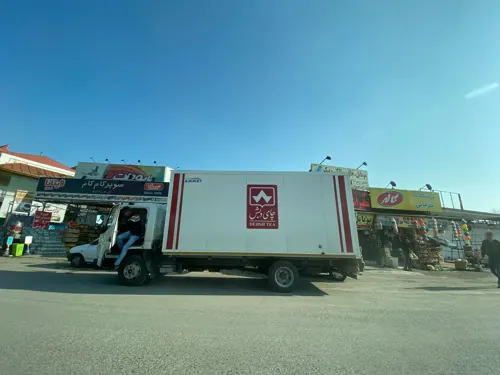


اشپزخانه و فست فود و قلیان سرا سانسیتی
Restaurant · 4.0 km
میدان هزار سنگر, آمل
7-24

52 more on the map.
Where to stay2
Churches and places of worship15
مجتمع عبادی ، فرهنگی ، رفاهی سجادیه آمل
Place of worship · Shia · 1.2 km
زابلی ۱۵, آمل
Shopping37
Gas and EV charging4
جایگاه CNG فجر - قنبری
Gas station · 1.7 km
بلوار شیخ فضل الله نوری, مازندران - آمل
Schools, colleges and libraries22
هیئت کوهنوردی و صعود های ورزشی آمل
School · 1.5 km
طالب آملی-خیابان محمودآباد, آمل
Healthcare24
کلینیک تخصصی زنان دکتر رمضانی و دکتر اصغرزاده
Clinic and pharmacy · 1.0 km
آفتاب ۲۶- شهید حقیقی, آمل
بیمارستان امام علی آمل
Hospital · 4.0 km
بلوار امام علی - آمل چمستان, پائین خیابان لیتکوه
مرکز بهداشت خانوار شیخ فضل الله نوری
Clinic and pharmacy · 1.1 km
بلوار شیخ فضل الله نوری, آمل
Map of Āmol
196 places. The map loads OpenStreetMap tiles when you open it.
Getting there and nearby towns
Bishe Kola Air Base (BSM) is the nearest airport with scheduled flights listed in OpenStreetMap, 21 km away.
- Kolāksar 3 km north, about 3 min by car
- Fereydūn Kenār 28 km northeast, about 28 min by car
- Bābol 31 km east, about 31 min by car
- Kalleh Bast 31 km northeast, about 31 min by car
- Nūr 32 km west, about 32 min by car
- Ojāksar 34 km northeast, about 34 min by car
- Bābolsar 37 km northeast, about 37 min by car
- Bāqer Tangeh 41 km northeast, about 41 min by car
- Qā’em Shahr 46 km east, about 46 min by car
- Sari 64 km east, about 1 h by car
Drive times are estimates from straight-line distance, not routes.
Local news
Headlines from INDB.
Reviews, tips and questions
Loading what members have shared...
Sources and licences
- GeoNames (CC BY 4.0): population, coordinates, regions and time zone
- Mapillary (see each image): photos
- OpenStreetMap contributors (ODbL 1.0): places, airports, map data
- Wikidata (CC0 1.0): elevation, founding date, time zone, website, landmarks and historic places
- Wikimedia Commons (see each image): photos
- Wikipedia (CC BY-SA 4.0): overview and history text
Photo credits
- Davazdah Cheshmeh And Moalagh Bridge -Amol-Iran, Mirasir, CC BY-SA 3.0
- Amol Cantilever bridge arch Pahlavi IRAN, Mirasir, CC BY-SA 3.0
- Davazdah Cheshmeh Bridge Iran, Muntirala, CC BY-SA 4.0
- Tomb Mausoleum Mir sayyed Heydar Amuli (Seyyed 3 tan)fakhrul islam and rukn al din Amuli, Mirasir, CC BY-SA 3.0
- Amol City Iran -Tourism - Tomb Mir bozorg, Mirasir, CC BY-SA 3.0
- تابلوی معرفی آتشگاه (بقعۀ شمس آل رسول) آمل, Sasan77Abdi, CC0
- ساختمان دارایی قدیم, Fateme-k75, CC BY-SA 4.0
- Golestan Palace Album No. 130-72, Aqa Reza Akasbashi, Public domain
- Tirang Noor Complex - panoramio (4), Ali Safdarian, CC BY 3.0
- Amol - panoramio, Ali Safdarian, CC BY 3.0
- Spring - panoramio - Brightness, Brightness, CC BY 3.0
- Tirang Noor Complex - panoramio (5), Ali Safdarian, CC BY 3.0
- Tirang Tower برج تیرنگ - panoramio, Ali Safdarian, CC BY 3.0
- Tirang Noor Complex - panoramio (3), Ali Safdarian, CC BY 3.0
- Tirang Noor Complex - panoramio (2), Ali Safdarian, CC BY 3.0
- Kaj Amol, Lacipetom, CC BY-SA 4.0
- آمل, Pendar83, CC BY-SA 4.0
- Imam Reza Hospital, Lacipetom, CC BY-SA 4.0
- Imam Reza Street Amol, Lacipetom, CC BY-SA 4.0
- Building Haraz street Amol, Lacipetom, CC BY-SA 4.0
- Tirang Noor Complex - panoramio (1), Ali Safdarian, CC BY 3.0
- Roof of Imamzadeh Qasem (Amol), V.Kavusi, CC BY-SA 4.0
- Tirang Noor Complex - panoramio, Ali Safdarian, CC BY 3.0
- Imam Reza Street Amol 2, Lacipetom, CC BY-SA 4.0
- Takyeh Hedayat Amol, Lacipetom, CC BY-SA 4.0
- Tabari boulevard 3, Lacipetom, CC BY-SA 4.0
- Ab-tabariblv, Lacipetom, CC BY-SA 4.0
- Haraz street 25, Lacipetom, CC BY-SA 4.0
- Haraz Street 5, Lacipetom, CC BY-SA 4.0
- Haraz Street 22, Lacipetom, CC BY-SA 4.0
- Haraz Street 14, Lacipetom, CC BY-SA 4.0
- Haraz Street 23, Lacipetom, CC BY-SA 4.0
- Haydar Amuli Mausoleum, V.Kavusi, CC BY-SA 4.0
- Haydar Amuli Mausoleum 2, V.Kavusi, CC BY-SA 4.0
- Haraz Street 3, Lacipetom, CC BY-SA 4.0
- Haraz Street 6, Lacipetom, CC BY-SA 4.0
- Haraz Street 7, Lacipetom, CC BY-SA 4.0
- Building Haraz street Amol 2, Lacipetom, CC BY-SA 4.0
- Haraz Street 10, Lacipetom, CC BY-SA 4.0
- Haraz Street 17, Lacipetom, CC BY-SA 4.0
- Street-level photo, rocodos780, CC BY-SA 4.0
- Street-level photo, yeydihagnu, CC BY-SA 4.0
- Street-level photo, rocodos780, CC BY-SA 4.0


Page built November 8, 2026. Spotted a mistake? Tell us or suggest a place.