


Aoki, Japan
青木村
Aoki is a town of 4,121 people in Nagano, Japan, founded in April 1, 1889.
Why visit Aoki
Townapedia lists 13 museums and landmarks, 3 parks and trails, 9 places to eat, 6 places to stay and 8 attractions in and around town.
Highlights include Mt. Komayumi, Mt. Okami, モハ5252 and 別所温泉.
Weather in Aoki
Forecast from MET Norway (CC BY 4.0). Full forecast
About Aoki
Aoki (青木村, Aoki-mura) is a village in Nagano Prefecture, Japan. As of 28 February 2019, the village had an estimated population of 4,360 in 1742 households, and a population density of 76 persons per km2. The total area of the village is 57.10 square kilometres (22.05 sq mi).
From the Wikipedia article Aoki, Nagano (this version), under CC BY-SA 4.0.
Things to do8



Museums and landmarks13


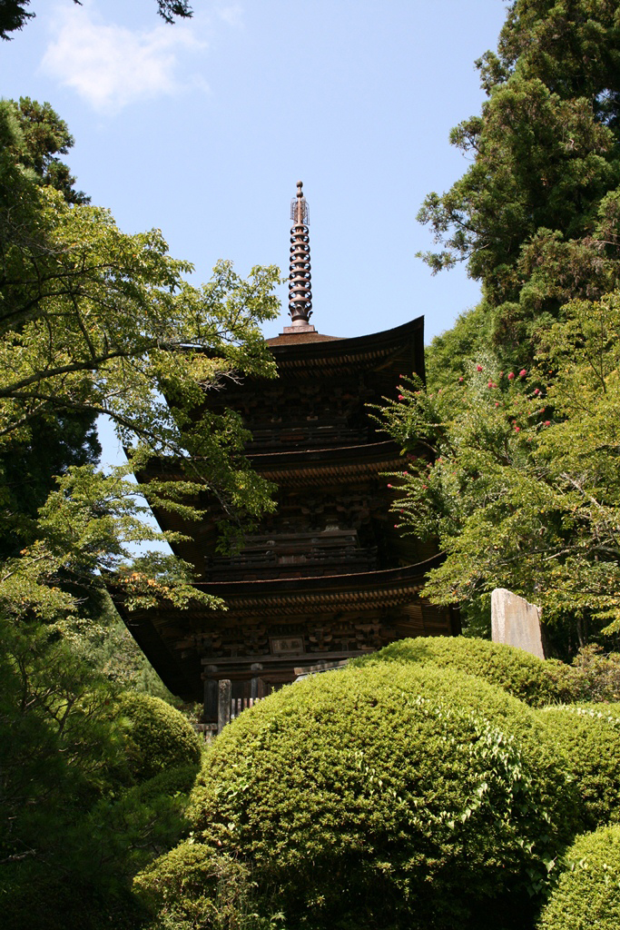




1 more on the map.
Parks, trails and playgrounds3

Restaurants and cafes9



History
The area of present-day Aoki was part of ancient Shinano Province. The area was part of the holdings of Ueda Domain during the Edo period. The modern village of Aoki was established on April 1, 1889 by the establishment of the municipalities system. A proposal to merge with the neighboring city of Ueda was rejected by voters in 2002.
From the History section of Aoki, Nagano on Wikipedia, under CC BY-SA 4.0.
Where to stay6
Churches and places of worship8
Gas and EV charging1
Schools, colleges and libraries6
Healthcare1
Map of Aoki
55 places. The map loads OpenStreetMap tiles when you open it.
Getting there and nearby towns
Shinshu-Matsumoto Airport (MMJ) is the nearest airport with scheduled flights listed in OpenStreetMap, 29 km away.
- Sakaki 12 km northeast, about 12 min by car
- Omi 11 km northwest, about 11 min by car
- Ueda 14 km east, about 14 min by car
- Chikuma 18 km north, about 18 min by car
- Matsumoto 21 km southwest, about 21 min by car
- Tōmi 21 km east, about 21 min by car
- Azumino 23 km southwest, about 23 min by car
- Hotaka 22 km west, about 22 min by car
- Ikeda 22 km west, about 22 min by car
- Komoro 28 km east, about 28 min by car
Drive times are estimates from straight-line distance, not routes.
Local news
Headlines from INDB.
Reviews, tips and questions
Loading what members have shared...
Sources and licences
- GeoNames (CC BY 4.0): population, coordinates, regions and time zone
- OpenStreetMap contributors (ODbL 1.0): places, airports, map data
- Wikidata (CC0 1.0): elevation, founding date, time zone, website
- Wikimedia Commons (see each image): photos
- Wikipedia (CC BY-SA 4.0): overview and history text
Photo credits
- Aoki village office, photo: Qurren ( talk ) Taken with Canon IXY 10S, CC BY-SA 3.0
- Michinoeki Aoki, アラツク, CC BY-SA 4.0
- Michinoeki Aoki 20180901 sa, Araisyohei, CC BY 3.0
- Yugawa River in Aoki Nagano Japan, Triglav, CC BY-SA 3.0
- Anrakuji Hakkakusanjyuunotou BessyoOnsen, Rsa, CC BY-SA 3.0
- 260828 Kitamuki-kannon Ueda Nagano pref Japan01s3, 663highland, CC BY-SA 4.0
- Daihouji-aoki, ja:User:Masanori88, CC BY-SA 3.0
- Chuzen-ji, Ueda, ぷんすけ, CC BY-SA 4.0
- 260828 Joraku-ji Ueda Nagano pref Japan02s3, 663highland, CC BY-SA 4.0
- 260828 Anraku-ji Ueda Nagano pref Japan25s3, 663highland, CC BY-SA 4.0
- Entrance to Bessho Onsen, Abasaa, Public domain
- UEDA-ONSEN-DENKI Type DeNa 200 EMU No.202, Unknown author Unknown author, Public domain
- Sakura International High School, Abasaa, Public domain
- 上田市立浦里小学校正門, Notoexp, CC BY-SA 3.0
- 260828 Kitamuki-kannon Ueda Nagano pref Japan12s3, 663highland, CC BY-SA 4.0
- Mount Okami seen from the north, ラルド, Public domain
- 五島慶太未来創造館, Villeneuve1982, CC BY-SA 4.0
- 上田市立浦里小学校本校舎, Notoexp, CC BY-SA 3.0
- Jukkan-zan, ラルド, Public domain
- Mount Komayumi, ラルド, Public domain
- R143-045, Puchi-masashi, CC BY-SA 4.0
- R143-2020-047, Puchi-masashi, CC BY-SA 4.0
- 田沢温泉街 - panoramio, mapplefan8, CC BY-SA 3.0
- Shionoiri Pond dam, photo: Qurren ( talk ) Taken with Canon IXY DIGITAL 450 (Digital IXUS 430), CC BY-SA 3.0
- Shionoiri Pond boathouse, photo: Qurren ( talk ) Taken with Canon IXY DIGITAL 450 (Digital IXUS 430), CC BY-SA 3.0
- Shionoiri Pond, photo: Qurren ( talk ) Taken with Canon IXY DIGITAL 450 (Digital IXUS 430), CC BY-SA 3.0
- R143-047, Puchi-masashi, CC BY-SA 4.0
- The Fujiya Gohonjin Building in Nagano Japan, Waterpenbird, CC BY-SA 4.0
- Octagonal three storied pagoda, Anrakuji temple - Jan 6, 2011, KANEI, CC BY 2.0
- 李花小県開拓団引揚者記念碑, Komoro no kaze, CC BY-SA 4.0
- 李花小縣開拓團物故者慰霊碑, Komoro no kaze, CC BY-SA 4.0
- 満州開拓物故者供養塔(安楽寺)2, Komoro no kaze, CC BY-SA 4.0
- 満州開拓物故者供養塔(安楽寺), Komoro no kaze, CC BY-SA 4.0
- Anrakuji - panoramio, Koichi Shibata, CC BY-SA 3.0
- 上田市別所温泉 常楽寺境内 Jōrakuji 2010.12.31 - panoramio, Nankou Oronain (as36…, CC BY-SA 3.0
- 常楽寺, Komoro no kaze, CC0
- A Building of Bessho Jinja, Kuruman, CC BY 2.0
- 別所村道路元標, Komoro no kaze, CC BY-SA 4.0
- 別所村道路元標 2, Komoro no kaze, CC BY-SA 4.0
- 入浴券 ご入館に際して (24106167993), cage.okada, CC BY 2.0


Page built November 5, 2026. Spotted a mistake? Tell us or suggest a place.