


Why visit Arashiyama
Townapedia lists 243 museums and landmarks, 26 parks and trails, 149 places to eat, 21 places to stay and 18 attractions in and around town.
Highlights include Monkey Park Iwatayama, Hanazono University, Fukuda Art Museum and Saga Arashiyama Museum of Arts and Culture.
Weather in Arashiyama
Forecast from MET Norway (CC BY 4.0). Full forecast
About Arashiyama
Arashiyama (嵐山, Storm Mountain) is a district on the western outskirts of Kyoto, Japan. It also refers to the mountain across the Ōi River, which forms a backdrop to the district. Arashiyama is a nationally designated historic site and place of scenic beauty.
From the Wikipedia article Arashiyama (this version), under CC BY-SA 4.0.
Travel tips from other travellers: Arashiyama on Wikivoyage (CC BY-SA 4.0).
Things to do18


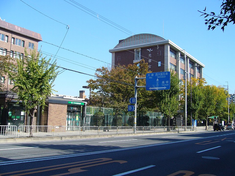
Kyoto Koka Women's University
School · 4.2 km
A private college in Kyoto, Japan

Kyoto Saga University of Arts
School · 1.0 km
Higher education institution in Kyoto Prefecture, Japan

Kyoto University of Advanced Science
School · 3.8 km
Higher education institution in Kyoto Prefecture, Japan

Kyoto University of Foreign Studies
School · 4.0 km
Foreign language university in Kyoto, Japan

Ritsumeikan University
School · 4.7 km
Private university in Kyoto, Japan



6 more on the map.
Museums and landmarks243


Bukkyo University Museum of Religious Culture
Museum · 1.4 km
Museum in Kyoto, Japan

Katagihara temple ruins
Monument and historic site · 5.1 km
Temple ruins in Kyoto, Japan


Saihō-ji Temple
Monument and historic site · 2.6 km
Rinzai Zen Buddhist temple located in Matsuo, Japan




231 more on the map.
Parks, trails and playgrounds26




14 more on the map.
Restaurants and cafes149

Kyoto Arashiyama Wagyu Rokueitei
Restaurant · Japanese
Kyoto Arashiyama Wagyu Rokkutei – Experience Kyoto’s finest Wagyu and seasonal Japanese cuisine. “Kyoto Arashiyama Wagyu Rokkutei” is a...
1F, Arashiyama Square, 右京区
10:00-19:00


137 more on the map.
Where to stay21
Churches and places of worship64
Daihikaku Senkoji
Place of worship · 1.1 km
Nakao Shimo-machi Arashiyama NIshikyo-ku, Kyoto
Shopping29
Gas and EV charging2
Schools, colleges and libraries18
Healthcare9
Map of Arashiyama
250 places. The map loads OpenStreetMap tiles when you open it.
Getting there and nearby towns
Osaka Itami Airport (ITM) is the nearest airport with scheduled flights listed in OpenStreetMap, 34 km away.
- Kyoto 7 km east, about 7 min by car
- Mukō 6 km southeast, about 6 min by car
- Yawata 16 km south, about 16 min by car
- Ōtsu 17 km east, about 17 min by car
- Takatsuki 19 km south, about 19 min by car
- Ibaraki 24 km southwest, about 24 min by car
- Kusatsu 26 km east, about 26 min by car
- Settsu 27 km south, about 27 min by car
- Minoh 28 km southwest, about 28 min by car
- Kawanishi 32 km southwest, about 32 min by car
Drive times are estimates from straight-line distance, not routes.
Local news
Headlines from INDB.
Reviews, tips and questions
Loading what members have shared...
Sources and licences
- GeoNames (CC BY 4.0): population, coordinates, regions and time zone
- OpenStreetMap contributors (ODbL 1.0): places, airports, map data
- Wikidata (CC0 1.0): elevation, founding date, time zone, website, landmarks and historic places
- Wikimedia Commons (see each image): photos
- Wikipedia (CC BY-SA 4.0): overview and history text
Photo credits
- Arashiyama (8741759830), Takeshi Kuboki from Amagasaki, Japan, CC BY 2.0
- A Board of Restaurant "Yoshidaya” with the name written in Hentaigana, near Arashiyama, そらみみ, CC BY-SA 3.0
- 20160402 Arashiyama 1846 (26102151024), Ray Swi-hymn from Sijhih-Taipei, Taiwan, CC BY-SA 2.0
- 20160402 Arashiyama 1867 (26103966173), Ray Swi-hymn from Sijhih-Taipei, Taiwan, CC BY-SA 2.0
- 20160402 Arashiyama 1850 (26102132644), Ray Swi-hymn from Sijhih-Taipei, Taiwan, CC BY-SA 2.0
- 20160402 Arashiyama 1845 (26615100732), Ray Swi-hymn from Sijhih-Taipei, Taiwan, CC BY-SA 2.0
- 20160402 Arashiyama 1847 (26615098422), Ray Swi-hymn from Sijhih-Taipei, Taiwan, CC BY-SA 2.0
- 20160402 Arashiyama 1864 (26681465086), Ray Swi-hymn from Sijhih-Taipei, Taiwan, CC BY-SA 2.0
- 20160402 Arashiyama 1866 (26681445846), Ray Swi-hymn from Sijhih-Taipei, Taiwan, CC BY-SA 2.0
- 20160402 Arashiyama 1848 (26102146794), Ray Swi-hymn from Sijhih-Taipei, Taiwan, CC BY-SA 2.0
- 20160402 Arashiyama 1849 (26708021295), Ray Swi-hymn from Sijhih-Taipei, Taiwan, CC BY-SA 2.0
- 20160402 Arashiyama 1865 (26615011172), Ray Swi-hymn from Sijhih-Taipei, Taiwan, CC BY-SA 2.0
- 20160402 Arashiyama 1863 (26615024772), Ray Swi-hymn from Sijhih-Taipei, Taiwan, CC BY-SA 2.0
- Arashiyama Station (Randen) 202605, Sashimiteishoku, CC0
- Arashiyama Misora Hibari Theater at dusk, そらみみ, CC BY-SA 3.0
- Arashiyama Station (Randen) 20140317, そらみみ, CC BY-SA 3.0
- Arashiyama, Kyoto on May 14th, 2018, Choi2451, CC BY-SA 3.0
- Shōryūen, Arashiyama, Kyōto - Nov 27, 2018, Rosewoman, CC BY 2.0
- Platforms of Randen Arashiyama Station at night 20260920, 掬茶, CC BY-SA 4.0
- Keifuku Randen Arashiyama Line, Mount Hiei in distance, Rosewoman, CC BY 2.0
- Arashiyama Station (Randen) concourse 202605, Sashimiteishoku, CC0
- 20160402 Arashiyama 1855 (26104046093), Ray Swi-hymn from Sijhih-Taipei, Taiwan, CC BY-SA 2.0
- 20160402 Arashiyama 1852 (26435380130), Ray Swi-hymn from Sijhih-Taipei, Taiwan, CC BY-SA 2.0
- 20160402 Arashiyama 1853 (26708012365), Ray Swi-hymn from Sijhih-Taipei, Taiwan, CC BY-SA 2.0
- 20160402 Arashiyama 1856 (26104042623), Ray Swi-hymn from Sijhih-Taipei, Taiwan, CC BY-SA 2.0
- 20160402 Arashiyama 1854 (26435369850), Ray Swi-hymn from Sijhih-Taipei, Taiwan, CC BY-SA 2.0
- 20160402 Arashiyama 1851 (26435384730), Ray Swi-hymn from Sijhih-Taipei, Taiwan, CC BY-SA 2.0
- Hanazono University Saisho-kan, Blancoyrojo, CC BY-SA 4.0
- Kyoto Gakuen University Uzumasa Campus ac, Asturio Cantabrio, CC BY-SA 4.0
- Kyoto University of Foreign Studies140512NI1, Atelier Verde, CC BY-SA 3.0
- Zonshinkan Hall at Ritsumeikan Univ, AngloFrench91, CC BY-SA 4.0
- Saga Arashiyama Museum of Arts and Culture, Vanbasten 23, CC BY-SA 3.0
- Bukkyo University Museum of Religious Culture140513NI1, Atelier Verde, CC BY-SA 3.0
- Katagiharahaiji, dragon2850, CC BY-SA 3.0
- Ritsumeikan-Univ-Kinugasa-04, J o, CC BY-SA 3.0
- Saihouji-kokedera01, Ivanoff~commonswiki, CC BY-SA 3.0
- Kyoto Saga University of Arts140513NI1, Atelier Verde, CC BY-SA 3.0
- Togetsukyo in Kyoto Arashiyama, Blue Lotus from Arashiyama, Kyoto, CC BY 2.0
- Iwatayama Monkey Park, Minseong Kim, CC BY-SA 4.0
- Seiryōji No,1, Mti, CC BY-SA 3.0
- Matsunoo-taisha honden-1, Saigen Jiro, CC0
- Daigakuji, PlusMinus, CC BY-SA 3.0
- Tenryuji Kyoto, osakaosaka, CC BY-SA 3.0
- Adashino nenbutsuji01s3200, 663highland, CC BY-SA 4.0
- Otagi nenbutsuji09s3200, 663highland, CC BY 2.5
- Okochi Sanso13n4410, 663highland, CC BY 2.5
- Jojakkoji01s3200, 663highland, CC BY 2.5
- Diorama Kyoto 01, Braveheart, CC BY-SA 4.0
- Kyoto city Arashiyama-higashi elem-sch, Bakkai, CC BY 3.0
- Sagano High School, Bakkai, CC BY-SA 3.0
- Senkouji, user:Hiroyuki0904, Public domain
- TenryujiHogonin Shishiiwa, PlusMinus, CC BY-SA 3.0
- Giouji, じゃんもどき on Japanese Wikipedia, CC BY-SA 3.0
- Le Temple Bouddhiste Kegon-ji - Le jardin1, Yanajin33, CC BY-SA 3.0
- Hebizuka Kofun-2, Saigen Jiro, CC0
- Utano youth hostel, 運動会プロテインパワー, CC BY-SA 4.0
- 2021 Sagano Bamboo forest in Arashiyama, Kyoto, Japan, Naokijp, CC BY-SA 4.0
- 京都 嵐山 大堰川より小倉山(286m) Kyouto Arashiyama - panoramio, Yoshio Kohara, CC BY 3.0
- Tarumiyama Kofun, enkei, Saigen Jiro, CC0
- Muni Kyoto, Vanbasten 23, CC BY-SA 3.0
- Fukuda art museum, 運動会プロテインパワー, CC BY-SA 4.0
- Kyoto Saga University of Arts140513NI2, Atelier Verde, CC BY-SA 3.0
- Kyoto city Sagano elem-sch, Bakkai, CC BY 3.0
- Kyoto city Tokiwano elem-sch, Bakkai, CC BY 3.0
- Kyoto city Uzumasa jhs, Bakkai, CC BY 3.0
- Kyoto Koka Womens Univ, Bakkai at Japanese Wikipedia, CC BY-SA 3.0
- Arashiyama - Bamboo Forest, Kyoto, Japan11, dconvertini, CC BY-SA 2.0
- Kimono Forest at night, Arashiyama Station, Arashiyama, Kyoto, Japan, Yasumichi Morita (designer) Basile Morin (photographer), CC BY-SA 4.0
- Japanese people having a picnic, Heian-kyo garden, Kyoto, 2016, DimiTalen, CC0
- Arashiyama Park (8278674903), KimonBerlin, CC BY-SA 2.0


Page built November 5, 2026. Spotted a mistake? Tell us or suggest a place.