


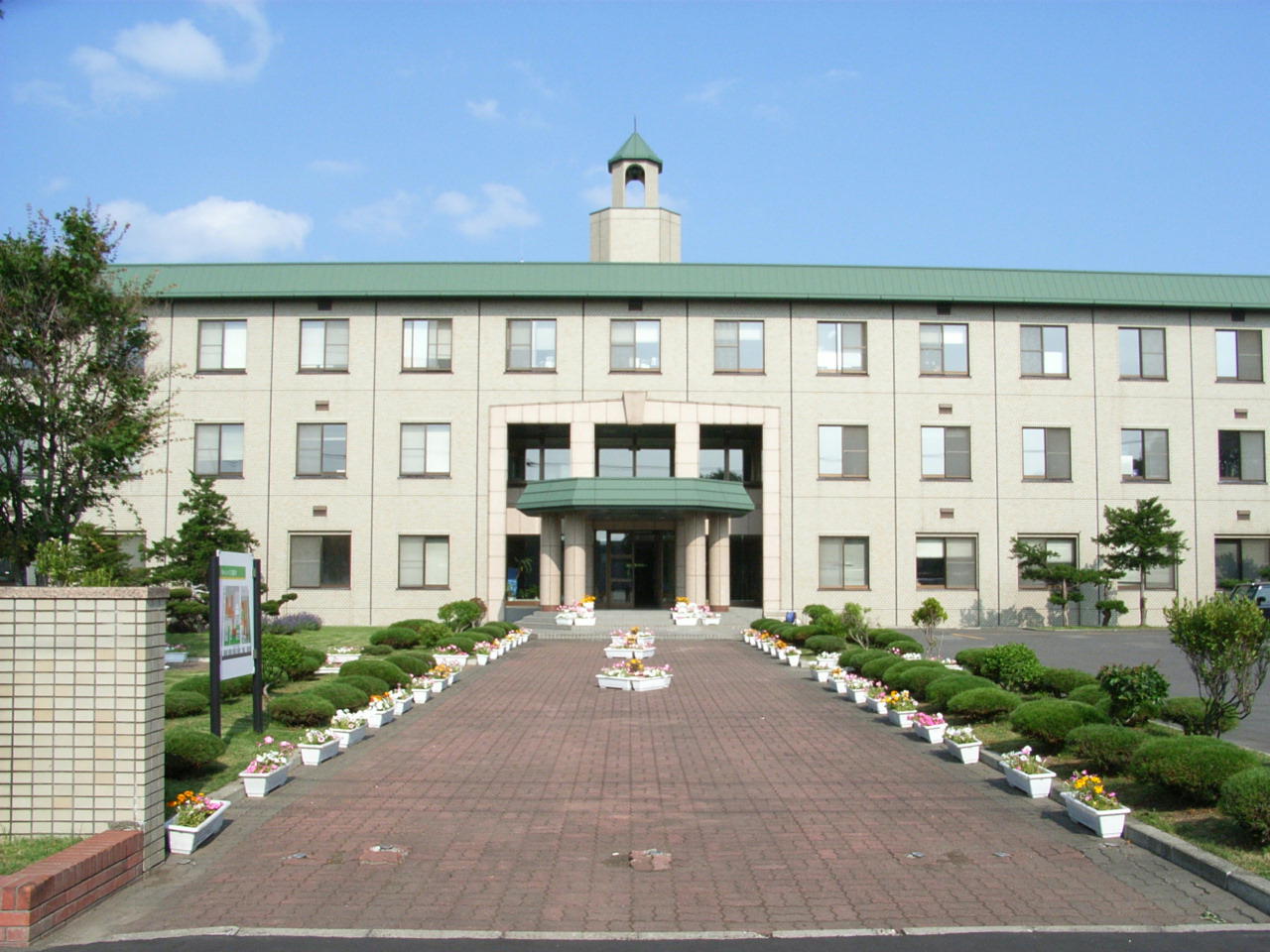

Bifuka, Japan
美深町
Bifuka is a town of 4,609 people in Hokkaido, Japan, founded in April 1, 1923.
Why visit Bifuka
Townapedia lists 1 museum or landmark, 1 park or trail, 7 places to eat, 5 places to stay and 18 attractions in and around town.
Highlights include Nayoro City University and 九度山.
Weather in Bifuka
Forecast from MET Norway (CC BY 4.0). Full forecast
About Bifuka
Bifuka (美深町, Bifuka-chō) is a town in Kamikawa Subprefecture, Hokkaido, Japan. As of 31 January 2025, the town had an estimated population of 3,665 in 2016 households, and a population density of 5.5 people per km2. The total area of the town is 672.09 km2 (259.50 sq mi).
From the Wikipedia article Bifuka, Hokkaido (this version), under CC BY-SA 4.0.
Things to do18



6 more on the map.
Museums and landmarks1

Parks, trails and playgrounds1

Restaurants and cafes7



History
The area of Bifuka has been inhabited since the Jōmon period, and was the site of a kotan was built by the Ainu people. On June 1, 1920, Chiebun Village (now part of Nayoro City) was divided, and Shimonayoro Village is renamed Bifuka Village. In the first census on October 1, 1920, Bifuka Village has 2,045 households and 10,991 inhabitants. It was raised to town status on April 1, 1923.
From the History section of Bifuka, Hokkaido on Wikipedia, under CC BY-SA 4.0.
Where to stay5
Churches and places of worship14
Shopping3
Gas and EV charging3
Schools, colleges and libraries6
Healthcare1
Map of Bifuka
59 places. The map loads OpenStreetMap tiles when you open it.
Getting there and nearby towns
Monbetsu Airport (MBE) is the nearest airport with scheduled flights listed in OpenStreetMap, 87 km away.
- Nayoro 17 km southeast, about 17 min by car
- Minamishibetsuchō 36 km south, about 36 min by car
- Shosanbetsu 46 km west, about 46 min by car
- Tomamae 58 km west, about 58 min by car
- Pippu 68 km south, about 1 h 15 min by car
- Tōma 74 km south, about 1 h 15 min by car
- Asahikawa 78 km south, about 1 h 15 min by car
- Mombetsu 81 km east, about 1 h 15 min by car
- Rumoi 82 km southwest, about 1 h 15 min by car
- Fukagawa 89 km south, about 1 h 30 min by car
Drive times are estimates from straight-line distance, not routes.
Local news
Headlines from INDB.
Reviews, tips and questions
Loading what members have shared...
Sources and licences
- GeoNames (CC BY 4.0): population, coordinates, regions and time zone
- OpenStreetMap contributors (ODbL 1.0): places, airports, map data
- Wikidata (CC0 1.0): elevation, founding date, time zone, website, landmarks and historic places
- Wikimedia Commons (see each image): photos
- Wikipedia (CC BY-SA 4.0): overview and history text
Photo credits
- Bifuka town hall, アラツク, CC BY-SA 4.0
- Hokkaido Prefectural Police Bifuka Police Station, Yasu ( talk ), CC BY-SA 3.0
- JR Hokkaido Bifuka Station interior, Yasu ( talk ), CC BY-SA 3.0
- Nayoro-Bifuka Road Bifuka Interchange, Yasu ( talk ), CC BY-SA 3.0
- Michinoeki Bifuka, Him56, CC BY-SA 3.0
- Nayoro-City-University Building, Birdman at ja.wikipedia, CC BY-SA 3.0
- Hokkaido-Bifuka-High-School, RJD, CC BY 3.0
- Wakkanai station001, Sengoku40, CC BY-SA 3.0
- 南美深待合所, Rory trains, CC BY-SA 4.0
- ISS038-E-38497 - View of Earth, Earth Science and Remote Sensing Unit , Lyndon B. Johnson Space Center, Public domain
- ISS038-E-38498 - View of Earth, Earth Science and Remote Sensing Unit , Lyndon B. Johnson Space Center, Public domain
- 旧美幸線橋梁 - panoramio (1), Yobito KAYANUMA, CC BY-SA 3.0
- Hokkaido Pref Route 445, えいじぇい, CC0
- Hokusei Station Waiting room Aug. 2020, Rory trains, CC BY-SA 4.0
- Hokusei Station Platform, Rory trains, CC BY-SA 4.0
- 旧美幸線橋梁 - panoramio, Yobito KAYANUMA, CC BY-SA 3.0
- 旧美幸線橋梁 - panoramio (2), Yobito KAYANUMA, CC BY-SA 3.0
- 道道49号線 - panoramio, Yobito KAYANUMA, CC BY-SA 3.0


Page built November 5, 2026. Spotted a mistake? Tell us or suggest a place.