


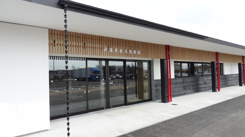


Date, Japan
伊達市
Date is a town of 34,898 people in Hokkaido, Japan, founded in March 1, 2006.
Why visit Date
Townapedia lists 59 museums and landmarks, 78 parks and trails, 75 places to eat, 43 places to stay and 35 attractions in and around town.
Highlights include Hakuchō Bridge, Mount Yosomi, Volcano Science Museum and Kitakogane Shell Mound.
Weather in Date
Forecast from MET Norway (CC BY 4.0). Full forecast
About Date
Date (伊達市, Date-shi; [date], DAH-tay) is a city in Iburi Subprefecture, Hokkaido, Japan. Date was established around 1869, and became a city on April 1, 1972.
From the Wikipedia article Date, Hokkaido (this version), under CC BY-SA 4.0.
Things to do35





23 more on the map.
Museums and landmarks59

Volcano Science Museum
Museum · 11.5 km
5, 洞爺湖町
Apr-Sep: Tu-Su 09:00-17:00; Oct-Mar: Tu-Su 10:00-16:00; Mo off;...




47 more on the map.
Parks, trails and playgrounds78


66 more on the map.
Restaurants and cafes75


cafe ねうねう
Restaurant · Coffee, Pasta, Curry · 11.4 km
24, 室蘭市
Tu-Sa 11:00-18:00
Fukuda Café
Restaurant · Cake, Coffee Shop, Curry, Pasta, Pizza, Sandwich · 11.5 km
We, Fr-Mo 09:00-21:00
めしどころ松前屋
Restaurant · 11.4 km
洞爺湖温泉40-16
Mo-Su 12:00-15:00, 17:00-22:00
炭火ダイニングアペコロ
Restaurant · Beef Bowl, Japanese · 11.5 km
Mo-Su 11:00-15:00, 17:00-20:00
The Toya
Restaurant · Curry, Japanese · 11.6 km
Sa-Mo 11:00-16:00; Tu-Fr 00:00-24:00
63 more on the map.
History
Remains of settlements from the Jōmon period have been found in the Date area. The Ainu, the native inhabitants of Hokkaido, also maintained a settlement at another location nearby until the beginning of the 20th century, when the Ainu were mostly assimilated into Japanese society.
The name of the area comes from the Date clan, who rose to power in the 12th century in Fukushima, on the mainland. Before the Edo period, their home castle was the Yanagawa castle in Date District, Fukushima. Later, it became the Sendai castle. The Date clan ruled the whole of Miyagi Prefecture as well as the southern part of Iwate Prefecture, and was one of the most influential daimyōs.
During the Meiji period, many samurai, including the Date clan, lost their territories due to the abolition of the han system. In 1869, a branch family of the Date clan from Watari-Date moved to and settled at the south coast of the then-uncultivated Hokkaido. This was the foundation of Date.
On March 1, 2006, the village of Ōtaki, from Usu District, was merged into Date.
From the History section of Date, Hokkaido on Wikipedia, under CC BY-SA 4.0.
Where to stay43
Churches and places of worship50
Shopping19
Gas and EV charging17
Schools, colleges and libraries23
Healthcare11
Map of Date
250 places. The map loads OpenStreetMap tiles when you open it.
Getting there and nearby towns
New Chitose Airport (CTS) is the nearest airport with scheduled flights listed in OpenStreetMap, 75 km away.
- Muroran 19 km southeast, about 19 min by car
- Noboribetsu 26 km east, about 26 min by car
- Shiraoi 41 km east, about 41 min by car
- Kutchan 49 km north, about 49 min by car
- Yakumo 55 km southwest, about 55 min by car
- Honchō 65 km south, about 1 h by car
- Sapporo 77 km northeast, about 1 h 15 min by car
- Hakodate 78 km south, about 1 h 15 min by car
- Kitahiroshima 80 km northeast, about 1 h 15 min by car
- Yoichi 82 km north, about 1 h 15 min by car
Drive times are estimates from straight-line distance, not routes.
Local news
Headlines from INDB.
Reviews, tips and questions
Loading what members have shared...
Sources and licences
- GeoNames (CC BY 4.0): population, coordinates, regions and time zone
- OpenStreetMap contributors (ODbL 1.0): places, airports, map data
- Wikidata (CC0 1.0): elevation, founding date, time zone, website, landmarks and historic places
- Wikimedia Commons (see each image): photos
- Wikipedia (CC BY-SA 4.0): overview and history text
Photo credits
- Date City Hall, Ozizo, Public domain
- Mt Date Monbetsu, Highten31, CC BY-SA 3.0
- Michinoeki date 20120401, Nekokichi0404, CC BY-SA 3.0
- Date rekisinomori Culture center, クリオネサラダ, CC BY-SA 3.0
- Date 20210811114716 (51812322456), inunami, CC BY 2.0
- Date 20210811111809 (51812322636), inunami, CC BY 2.0
- Date 20210811111324 (51812428458), inunami, CC BY 2.0
- Date 20210811111439 (51813051225), inunami, CC BY 2.0
- Date spa 2011, Soica2001 ( talk ), Public domain
- Mejiro farm date - panoramio, [email protected]…, CC BY-SA 3.0
- Hakucho Bridge 9086532 2, Hiroshi Nakai, CC BY 2.0
- John Batchelor b, AleksandrGertsen, Public domain
- Moto-Wanishi Parking Area - For Hakodate, Him56, CC BY-SA 3.0
- View of Tōyako-onsen town, Wakimasa, Public domain
- Mt WASHIBETSU 1, Highten31, CC BY-SA 3.0
- 善光寺, 高野博文, CC BY-SA 4.0
- Toya SunPalace Resort&Spa, Braveheart, CC BY-SA 4.0
- Toyako volcano science museum, 橄欖岩, CC BY-SA 3.0
- 高砂貝塚 03, Indiana jo, CC BY-SA 4.0
- Nakashima.touyalake1, ブルーノ・プラス, CC BY-SA 4.0
- 入江貝塚 04, Indiana jo, CC BY-SA 4.0
- Mt.Muroran-dake, wakimasa, Public domain
- Tomiko miyao memorials literature, Him56, CC BY-SA 3.0
- Muroran line 20161230125100 (31828033010), inunami, CC BY 2.0
- Muroran line 20161230163010 (31828120540), inunami, CC BY 2.0
- Muroran line 20161230163000 (32055079492), inunami, CC BY 2.0
- 胆振線跡 - panoramio, Yobito KAYANUMA, CC BY-SA 3.0
- 有珠山, Wakimasa, CC BY-SA 3.0
- Showashinzan UsuzanSA veiw 201409, アルトクール, CC BY-SA 4.0
- The red bear - panoramio, 柴田拓, CC BY-SA 3.0
- Muroran line 20161230125545 (31828042370), inunami, CC BY 2.0
- Osarugawa-bashi, アラツク, CC BY-SA 4.0
- ISS054-E-62693 - View of Earth, Earth Science and Remote Sensing Unit, NASA Johnson Space Center, Public domain
- Muroran line 20161230124246 (31362345624), inunami, CC BY 2.0
- Sobetsu 20210811122952 (51822345620), inunami, CC BY 2.0
- Muroran line 20161230124125 (31828007550), inunami, CC BY 2.0
- 昭和新山熊牧場 Showashinzan Bear Ranch - panoramio (2), lienyuan lee, CC BY 3.0
- 昭和新山熊牧場2, MiNe, CC BY 2.0
- 昭和新山熊牧場3, MiNe (sfmine79) さん https://www.flickr.com/photos/sfmine79/, CC BY 2.0
- 昭和新山熊牧場4, MiNe (sfmine79) さん https://www.flickr.com/photos/sfmine79/, CC BY 2.0


Page built November 5, 2026. Spotted a mistake? Tell us or suggest a place.