


Fujioka, Japan
藤岡市
Fujioka is a town of 64,539 people in Gunma, Japan, founded in April 1, 1954.
Why visit Fujioka
Townapedia lists 44 museums and landmarks, 109 parks and trails, 88 places to eat, 5 places to stay and 15 attractions in and around town.
Highlights include Gumma Paz University, Gunma Prefectural Women's University, Gunma Prefectural Museum of History and Hongō Haniwa Kiln Site.
Weather in Fujioka
Forecast from MET Norway (CC BY 4.0). Full forecast
About Fujioka
Fujioka (藤岡市, Fujioka-shi) is a city located in Gunma Prefecture, Japan. As of 1 August 2020, the city had an estimated population of 64,539 in 27,616 households, and a population density of 360/km2 (930/sq mi). The total area of the city is 180.29 km2 (69.61 sq mi).
From the Wikipedia article Fujioka, Gunma (this version), under CC BY-SA 4.0.
Travel tips from other travellers: Fujioka on Wikivoyage (CC BY-SA 4.0).
Things to do15

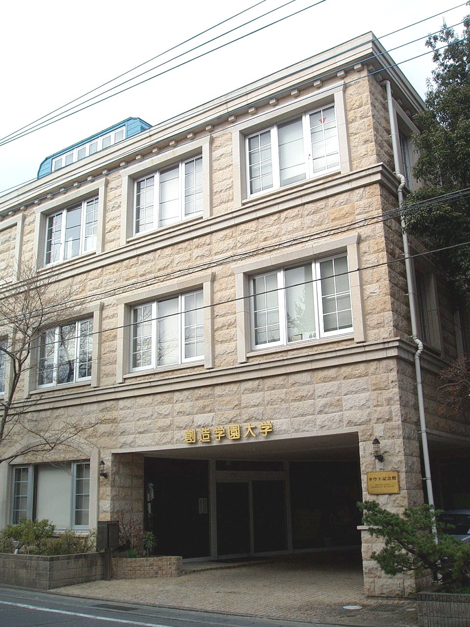
Gumma Paz University
School · 12.8 km
Higher education institution in Gunma Prefecture, Japan

Gunma Prefectural Women's University
School · 6.7 km
Public university in Japan

Gunma University of Social Welfare
School · 12.4 km
Higher education institution in Gunma Prefecture, Japan

Jobu University
School · 10.2 km
Higher education institution in Gunma Prefecture, Japan
Maebashi Institute of Technology
School · 13.2 km
Higher education institution in Gunma Prefecture, Japan




3 more on the map.
Museums and landmarks44


Hongō Haniwa Kiln Site
Monument and historic site · 2.0 km
Archaeological site

Kanaizawa Stele
Monument and historic site · 6.7 km
8th century Japanese stele

Sai District Shōsō ruins
Monument and historic site · 13.3 km
Archaeological site in Japan
Tago District Shōsō ruins
Monument and historic site · 7.0 km
Archaeological site in Japan

Tago Stele
Monument and historic site · 7.1 km
Stone memorial in Japan
Takasaki Byakue Daikannon
Monument and historic site · 10.9 km
Large statue in Takasaki, Japan

The Museum of Modern Art, Gunma
Museum · 5.9 km
Art museum in Gunma, Japan

Yamanoue Stele
Monument and historic site · 5.2 km
Stele, kofun in Gunma, Japan


32 more on the map.
Parks, trails and playgrounds109




県央水質浄化センター緑地広場
Park · 6.7 km
Opening hours: 9:00 - 17:00 Closed: Mondays (on the following day if it falls on a public holiday), the year-end and New Year holidays.

97 more on the map.
Restaurants and cafes88

シントミ
Restaurant · Chinese, Noodle, Japanese · 1.7 km
2, 藤岡市
Mo-Tu,Th-Su 11:30-15:30,16:30-22:00; We off


76 more on the map.
History
Fujioka is located within traditional Kōzuke Province. During the late Sengoku period it developed as a jōkamachi around Ashida Castle, the center of a 30,000 koku holding by the Ashida clan, retainers of Tokugawa Ieyasu. However, with the foundation of the Edo period Tokugawa shogunate, the area became tenryō territory, under the direct control of the shogunate.
Following the Meiji Restoration and the creation of the modern municipalities system, Fujioka and Onishi towns, and Kanna, Ono, Midori, Mikuri, Hirai, Hino, and Sanbagawa Village were created in Midorino District, Gunma Prefecture and Mihara village in Minamikanra District, Gunma Prefecture on April 1, 1889. In 1896, Minamikanra District was united with Midorino District and Tago District to create Tano District. On April 1, 1954, Fujioka annexed Kanna, Ono, Midori and Mikuri villages and was elevated to city status. On March 1, 1955 Fujioka annexed neighboring Hirai and Sanbagawa villages. On January 1, 2006 Onishi Village was merged into Fujioka City.
From the History section of Fujioka, Gunma on Wikipedia, under CC BY-SA 4.0.
Where to stay5
Churches and places of worship181
Shopping24
Gas and EV charging20
Schools, colleges and libraries57
Healthcare46
Map of Fujioka
250 places. The map loads OpenStreetMap tiles when you open it.
Getting there and nearby towns
Yokota Air Base (OKO) is the nearest airport with scheduled flights listed in OpenStreetMap, 61 km away.
- Yoshii 8 km west, about 8 min by car
- Takasaki 11 km northwest, about 11 min by car
- Tomioka 16 km west, about 16 min by car
- Kanekomachi 20 km north, about 20 min by car
- Ōta 27 km east, about 27 min by car
- Ōmamachō-ōmama 28 km northeast, about 28 min by car
- Kiryū 29 km northeast, about 29 min by car
- Kumagaya 31 km southeast, about 31 min by car
- Ashikaga 35 km east, about 35 min by car
- Tatebayashi 41 km east, about 41 min by car
Drive times are estimates from straight-line distance, not routes.
Local news
Headlines from INDB.
Reviews, tips and questions
Loading what members have shared...
Sources and licences
- GeoNames (CC BY 4.0): population, coordinates, regions and time zone
- OpenStreetMap contributors (ODbL 1.0): places, airports, map data
- Wikidata (CC0 1.0): elevation, founding date, time zone, website, landmarks and historic places
- Wikimedia Commons (see each image): photos
- Wikipedia (CC BY-SA 4.0): overview and history text
Photo credits
- Fujioka city hall, Altomarina, CC BY-SA 3.0
- Fujioka Chamber of Commerce and Industry, Suikotei, CC BY 4.0
- Fujioka city Japan Airlines Flight 123 accident monument, photo: Qurren ( talk ) Taken with Canon IXY 10S (Digital IXUS 210), CC BY-SA 3.0
- Fujioka City Library, photo: Qurren ( talk ) Taken with Samsung Galaxy J (NTT docomo SC-02F), CC BY-SA 3.0
- Megurun (Fujioka) 02, Suikotei, CC BY 4.0
- Fujioka, Gunma Prefecture 375-0024, Japan - panoramio, Nagono, CC BY-SA 3.0
- Fujioka Tax office, Suikotei, CC BY 4.0
- Joshin-etsu Expressway Fujioka Parking Area, Yasu ( talk ), CC BY-SA 3.0
- Fujioka history museum, photo: Qurren ( talk ) Taken with Canon IXY 10S (Digital IXUS 210), CC BY-SA 3.0
- Gunma University of Health and Welfare, Abasaa, Public domain
- Jobu University Isesaki Campus, WAKA77, CC0
- SouzouGakuen-Univ-Yachiyo01, Hasec, CC0
- 261010 Gunma Prefectural Museum of History Takasaki Japan01s3, 663highland, CC BY-SA 4.0
- Monument of Kanaizawa, 文屋将監, CC BY 3.0
- Monument of Tago (Tagohi), 文屋将監, CC BY 3.0
- 261010 The Museum of Modern Art, Gunma Takasaki Japan04s3, 663highland, CC BY-SA 4.0
- Yamanouehi, 文屋将監, CC BY 3.0
- Takasaki University of Commerce, WAKA77, CC0
- Gunma-Pref-Women's-Univ04, Hasec, CC0
- AEON kamisato SC 002, 第四京浜, CC BY-SA 3.0
- Watanuki Kannon-yama Kofun, funkyu-1, Saigen Jiro, CC0
- Fujioka Central High School, M yanagisawa, CC BY 3.0
- Fujioka North High School, M yanagisawa, CC BY 3.0
- Fujioka Technical High School, M yanagisawa, CC BY 3.0
- Takayama-sha Sericulture School 5, photo: Qurren ( talk ) Taken with Canon IXY 430F (Digital IXUS 245 HS), CC BY-SA 3.0
- IwakiAosakaInamiIkegami-jinja(Kanna-machi) Haiden, Taisuke.Kasuya, CC BY-SA 4.0
- Haiden of Niu-jinja (Jouhouji, Fujioka), Taisuke.Kasuya, CC BY-SA 4.0
- Takasaki University of Health and Welfare, Abasaa, Public domain
- Sai Gunga Site, shoso, Saigen Jiro, CC0
- Shichihongi Elementary School, M yanagisawa, CC0
- Nanakoshiyama Kofun, funkyu-2, Saigen Jiro, CC0
- 261010 Forest of Gunma Takasaki Japan02s3, 663highland, CC BY-SA 4.0
- Daioji Tenko-gu 01, Abasaa, Public domain
- Seki Takakazu monument, photo: Qurren ( talk ) Taken with Canon IXY 10S (Digital IXUS 210), CC BY-SA 3.0
- Seki Takakazu grave, photo: Qurren ( talk ) Taken with Canon IXY 430F (Digital IXUS 245 HS), CC BY-SA 3.0
- Mikabomiraikan 2, photo: Qurren ( talk ) Taken with Canon IXY 430F (Digital IXUS 245 HS), CC BY-SA 4.0
- Mikabomiraikan 3, photo: Qurren ( talk ) Taken with Canon IXY 430F (Digital IXUS 245 HS), CC BY-SA 4.0
- Mikabomiraikan 1, photo: Qurren ( talk ) Taken with Canon IXY 430F (Digital IXUS 245 HS), CC BY-SA 4.0
- Fujinosakuoka Park Fujifureaikan, photo: Qurren ( talk ) Taken with Canon IXY 430F (Digital IXUS 245 HS), CC BY-SA 4.0
- 土手の上の踏み切り - panoramio, 高橋文武, CC BY 3.0


Page built November 4, 2026. Spotted a mistake? Tell us or suggest a place.