


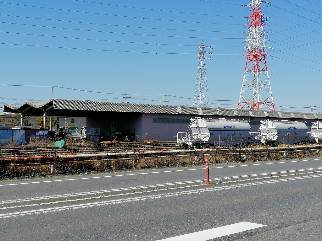


Hekinan, Japan
碧南市
Hekinan is a town of 72,458 people in Aichi, Japan, founded in April 5, 1948.
Why visit Hekinan
Townapedia lists 17 museums and landmarks, 149 parks and trails, 92 places to eat, 7 places to stay and 4 attractions in and around town.
Highlights include Mizkanミュージアム, Handa Red Brick Building, 寺津第4合公園 and 河川敷公園.
Weather in Hekinan
Forecast from MET Norway (CC BY 4.0). Full forecast
About Hekinan
Hekinan (碧南市, Hekinan-shi) is a city in Aichi Prefecture, Japan. As of 1 October 2019, the city had an estimated population of 72,864 in 29,139 households, and a population density of 1,986 persons per km2. The total area of the city was 36.68 square kilometres (14.16 sq mi).
From the Wikipedia article Hekinan (this version), under CC BY-SA 4.0.
Things to do4



Museums and landmarks17


Handa Red Brick Building
Museum · 5.4 km
Building in Handa City, Aichi Prefecture




5 more on the map.
Parks, trails and playgrounds149



137 more on the map.
Restaurants and cafes92





80 more on the map.
Where to stay7
Churches and places of worship41
Shopping19
Gas and EV charging3
Schools, colleges and libraries39
Healthcare28
Map of Hekinan
250 places. The map loads OpenStreetMap tiles when you open it.
Getting there and nearby towns
Chūbu Centrair International Airport (NGO) is the nearest airport with scheduled flights listed in OpenStreetMap, 16 km away.
- Handa 5 km west, about 5 min by car
- Nishio 6 km east, about 6 min by car
- Taketoyo 7 km southwest, about 7 min by car
- Ishiki 10 km south, about 10 min by car
- Kariya 11 km north, about 11 min by car
- Anjō 12 km northeast, about 12 min by car
- Tokoname 12 km west, about 12 min by car
- Ōbu 15 km north, about 15 min by car
- Okazaki 18 km northeast, about 18 min by car
- Toyota 27 km northeast, about 27 min by car
Drive times are estimates from straight-line distance, not routes.
Local news
Headlines from INDB.
Reviews, tips and questions
Loading what members have shared...
Sources and licences
- GeoNames (CC BY 4.0): population, coordinates, regions and time zone
- OpenStreetMap contributors (ODbL 1.0): places, airports, map data
- Wikidata (CC0 1.0): elevation, founding date, time zone, website, landmarks and historic places
- Wikimedia Commons (see each image): photos
- Wikipedia (CC BY-SA 4.0): overview and history text
Photo credits
- Hekinan City Hall 2023-12 ac (1), Asturio Cantabrio, CC BY-SA 4.0
- Hekinan-Rinkai-park-012, HQA02330, CC BY-SA 4.0
- KR-Hekinanshi-station-002, HQA02330, CC BY-SA 4.0
- KR-Hekinanshi-station-001, HQA02330, CC BY-SA 4.0
- Sugi-Seika-Hekinan, HQA02330, CC BY-SA 4.0
- Hekinan-Mazda-shop, HQA02330, CC BY-SA 4.0
- Tsushima-jinja-Mochi-Nage-Hekinan, HQA02330, CC BY-SA 4.0
- Tsushima-jinja-Hekinan, HQA02330, CC BY-SA 4.0
- Tenno-dango-ya-Hekinan, HQA02330, CC BY-SA 4.0
- Tenno-dango-ya-Hekinan-002, HQA02330, CC BY-SA 4.0
- Kashinoki-Hoikuen-Hekinan-002, HQA02330, CC BY-SA 4.0
- Kashinoki-Hoikuen-Hekinan-001, HQA02330, CC BY-SA 4.0
- Tennou-tower-with-bell-Hekinan, HQA02330, CC BY-SA 4.0
- Business-Hotel-Mishima-Hekinan, HQA02330, CC BY-SA 4.0
- Houjou-ji-Hekinan-001, HQA02330, CC BY-SA 4.0
- Kousen-ji-building-Hekinan, HQA02330, CC BY-SA 4.0
- Houjou-ji-Hekinan-002, HQA02330, CC BY-SA 4.0
- Kousen-ji-entrance-Hekinan, HQA02330, CC BY-SA 4.0
- Bench-former-Shinsuma-beach-Hekinan, HQA02330, CC BY-SA 4.0
- Kinuura-inari-Hekinan, HQA02330, CC BY-SA 4.0
- Business-Hotel-Shinsuma-Hekinan, HQA02330, CC BY-SA 4.0
- Hekinan-Rinkai-park-005, HQA02330, CC BY-SA 4.0
- Hekinan-Rinkai-park-003, HQA02330, CC BY-SA 4.0
- Hekinan-Rinkai-park-001, HQA02330, CC BY-SA 4.0
- Rinkai-park-underpass-Hekinan-Aichi, HQA02330, CC BY-SA 4.0
- Hekinan-Rinkai-park-002, HQA02330, CC BY-SA 4.0
- Hekinan-Rinkai-park-004, HQA02330, CC BY-SA 4.0
- Hekinan-Rinkai-park-012 (cropped), HQA02330, CC BY-SA 4.0
- Hekinan-Rinkai-park-010, HQA02330, CC BY-SA 4.0
- Amida-ji-Hekinan, HQA02330, CC BY-SA 4.0
- KR-Hekinanshi-station-buffer-002, HQA02330, CC BY-SA 4.0
- KR-Hekinanshi-station-buffer-001, HQA02330, CC BY-SA 4.0
- Hekinan-Rinkai-gymnasium-Aichi, HQA02330, CC BY-SA 4.0
- PIAGO Hekinan, ブルーノ, CC BY-SA 4.0
- Fresh-Food-Tabuchi-Hekinan, HQA02330, CC BY-SA 4.0
- Amida-ji-temple-name-stone-Hekinan, HQA02330, CC BY-SA 4.0
- Handaakarenga, Bariston, CC BY-SA 4.0
- Iwase bunko, Bariston, CC BY-SA 4.0
- Center One Hotel Handa, Abasaa, Public domain
- Handa City Kamezaki Junior High School, Narutanu, CC BY-SA 4.0
- Handa City Handa Elementary School, Narutanu, CC BY-SA 4.0
- Handa City Hospital in Aichi, アラツク, CC BY-SA 4.0
- Mizkan muesum 20250729, Totti, CC BY-SA 4.0
- Hekinan City Akashi Park, 愛知の暇人, CC0
- Hekinan City Library ac (3), Asturio Cantabrio, CC BY-SA 4.0
- Hekinan Municipal Hospital, 愛知の暇人, CC0
- Kawara Museum of Takahama city, a Hometown Ceramics exterior ac, Asturio Cantabrio, CC BY-SA 4.0
- Takahama Elementary School 2023-07 ac (2), Asturio Cantabrio, CC BY-SA 4.0
- Doujouyama-nishi-park-Hekinan-001, HQA02330, CC BY-SA 4.0
- Kamezaki Owari Sansha ac (2), Asturio Cantabrio, CC BY-SA 4.0
- Kamezaki Kaichoin ac (1), Asturio Cantabrio, CC BY-SA 4.0
- Takahama Onninji ac (1), Asturio Cantabrio, CC BY-SA 4.0
- Handa Nakano Hanroku House ac (1), Asturio Cantabrio, CC BY-SA 4.0
- Handa City Okkawa Junior High School, Narutanu, CC BY-SA 4.0
- Handa City Okkawa Elementary School, Narutanu, CC BY-SA 4.0
- CLACITY HANDA, Kiyok, CC BY-SA 4.0
- HOTEL-CAESAR-Hekinan, HQA02330, CC BY-SA 4.0
- KINUURA-GRAND-HOTEL-Hekinan, HQA02330, CC BY-SA 4.0


Page built November 4, 2026. Spotted a mistake? Tell us or suggest a place.