


Himeji, Japan
姫路市
Himeji is a town of 530,495 people in Hyōgo, Japan, founded in March 1, 1946.
Why visit Himeji
Townapedia lists 129 museums and landmarks, 16 parks and trails, 241 places to eat, 28 places to stay and 15 attractions in and around town.
Highlights include アクリエひめじ, Himeji Central Park, Hyogo Prefectural Museum of History and Ishi-no-Hōden.
Weather in Himeji
Forecast from MET Norway (CC BY 4.0). Full forecast
About Himeji
Himeji (姫路市, Himeji-shi; Japanese pronunciation: [çì.mé̞.(ɟ̟͡)ʑí(.ɕì), çí.mè̞.(ɟ̟͡)ʑì]) is a city located in Hyōgo Prefecture in the Kansai region of Japan. As of 1 June 2022, the city had an estimated population of 525,682 in 227,099 households and a population density of 980 persons per km2. The total area of the city is 534.35 square kilometres (206.31 sq mi).
From the Wikipedia article Himeji (this version), under CC BY-SA 4.0.
Travel tips from other travellers: Himeji on Wikivoyage (CC BY-SA 4.0).
Things to do15


Himeji Central Park
Zoo and aquarium · 7.4 km
Safari park in Himeji, Hyōgo, Japan

Himeji Dokkyo University
School · 6.3 km
Higher education institution in Hyōgo Prefecture, Japan





3 more on the map.
Museums and landmarks129

Hyogo Prefectural Museum of History
Museum · 2.7 km
Building in Hyōgo Prefecture, Japan

Ishi-no-Hōden
Monument and historic site · 9.5 km
Archaeological site in Takasago, Japan


Himeji City Tegarayama Botanical Garden
Monument and historic site · 2.3 km


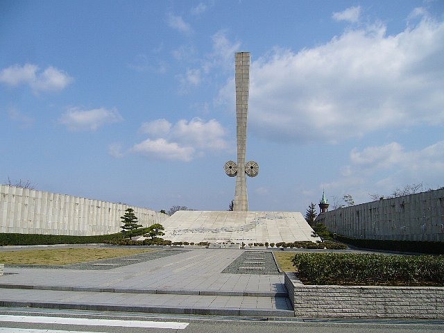




117 more on the map.
Parks, trails and playgrounds16


4 more on the map.
Restaurants and cafes241


Áo bà ba
Restaurant · Vietnamese · 1.9 km
Mo-We,Fr-Sa 11:30-14:30,17:30-22:00; Th off; Su 11:30-14:30,17:30-21:00

おいとおっちゃん
Restaurant · Japanese · 2.0 km
65, 姫路市
Mo-Fr 17:30-04:00
Standing sushi bar Totoro
Restaurant · Sushi · 1.3 km
Mo-Sa 11:30-14:30, 17:00-23:30
229 more on the map.
History
Himeji has been the center of Harima Province since the Nara period, and was the location of the provincial capital and Harima Kokubun-ji. After the Battle of Sekigahara, Ikeda Terumasa received a fief at Harima Province and established the Himeji Domain. He expanded Himeji Castle and its castle town. Due to its location dominating the San'yōdō highway connecting the Kinai region with western Japan, Himeji was a major stronghold of the Tokugawa shogunate through the Bakumatsu period. Following the Meiji restoration, Himeji was the capital of "Himeji Prefecture" (later Shikama Prefecture) from 1871, which was merged into Hyōgo Prefecture in 1876. The city of Himeji was established on April 1, 1889, with the creation of the modern municipalities system. After the 1923 Great Kantō earthquake, the Japanese government reportedly considered moving the nation's capital from Tokyo to Himeji. On April 1, 1996, Himeji attained Core city status, with increased local autonomy.
On March 27, 2006, the town of Yasutomi (from Shisō District), the town of Kōdera (from Kanzaki District), and the towns of Ieshima and Yumesaki (both from Shikama District) were merged into Himeji.
From the History section of Himeji on Wikipedia, under CC BY-SA 4.0.
Where to stay28
Churches and places of worship34
Shopping41
Gas and EV charging3
Schools, colleges and libraries33
Healthcare36
Map of Himeji
250 places. The map loads OpenStreetMap tiles when you open it.
Getting there and nearby towns
Kobe Airport (UKB) is the nearest airport with scheduled flights listed in OpenStreetMap, 52 km away.
- Shirahamachō-usazakiminami 4 km south, about 4 min by car
- Takasago 10 km southeast, about 10 min by car
- Kakogawachō-honmachi 13 km southeast, about 13 min by car
- Akashi 33 km southeast, about 33 min by car
- Kobe 46 km east, about 46 min by car
- Sandachō 49 km east, about 49 min by car
- Takarazuka 60 km east, about 1 h by car
- Itami 64 km east, about 1 h by car
- Kawanishi 65 km east, about 1 h by car
- Osaka 74 km east, about 1 h 15 min by car
Drive times are estimates from straight-line distance, not routes.
Local news
Headlines from INDB.
Reviews, tips and questions
Loading what members have shared...
Sources and licences
- GeoNames (CC BY 4.0): population, coordinates, regions and time zone
- OpenStreetMap contributors (ODbL 1.0): places, airports, map data
- Wikidata (CC0 1.0): elevation, founding date, time zone, website, landmarks and historic places
- Wikimedia Commons (see each image): photos
- Wikipedia (CC BY-SA 4.0): overview and history text
Photo credits
- Himeji Otemae-dori Street 201506 01, SRIA, CC BY-SA 4.0
- 140111 Azuki Museum Himeji Hyogo pref Japan21s3, 663highland, CC BY 2.5
- 140111 Azuki Museum Himeji Hyogo pref Japan15s3, 663highland, CC BY 2.5
- Himeji Castle Restoration 4 roof construction, Mbarratt, CC BY-SA 4.0
- Kobe district court Himeji branch 01, Corpse Reviver, CC BY-SA 3.0
- 140111 Azuki Museum Himeji Hyogo pref Japan13s3, 663highland, CC BY 2.5
- 140111 Azuki Museum Himeji Hyogo pref Japan04s3, 663highland, CC BY 2.5
- 140111 Azuki Museum Himeji Hyogo pref Japan01bs, 663highland, CC BY 2.5
- 140111 Azuki Museum Himeji Hyogo pref Japan07s3, 663highland, CC BY 2.5
- 140111 Azuki Museum Himeji Hyogo pref Japan17s3, 663highland, CC BY 2.5
- 140111 Azuki Museum Himeji Hyogo pref Japan18s3, 663highland, CC BY 2.5
- 140111 Azuki Museum Himeji Hyogo pref Japan20s3, 663highland, CC BY 2.5
- 140111 Azuki Museum Himeji Hyogo pref Japan22s3a, 663highland, CC BY 2.5
- 140111 Azuki Museum Himeji Hyogo pref Japan14s3, 663highland, CC BY 2.5
- 140111 Azuki Museum Himeji Hyogo pref Japan03s3, 663highland, CC BY 2.5
- 140111 Azuki Museum Himeji Hyogo pref Japan11bs, 663highland, CC BY 2.5
- 140111 Azuki Museum Himeji Hyogo pref Japan05s3, 663highland, CC BY 2.5
- 140111 Azuki Museum Himeji Hyogo pref Japan09n, 663highland, CC BY 2.5
- 140111 Azuki Museum Himeji Hyogo pref Japan22s3, 663highland, CC BY 2.5
- 140111 Azuki Museum Himeji Hyogo pref Japan08n, 663highland, CC BY 2.5
- 140111 Azuki Museum Himeji Hyogo pref Japan12n, 663highland, CC BY 2.5
- 140111 Azuki Museum Himeji Hyogo pref Japan19s3, 663highland, CC BY 2.5
- 140111 Azuki Museum Himeji Hyogo pref Japan22s3b, 663highland, CC BY 2.5
- 140111 Azuki Museum Himeji Hyogo pref Japan16n, 663highland, CC BY 2.5
- Himeji - panoramio (3), DVMG, CC BY 3.0
- Himeji - panoramio (8), DVMG, CC BY 3.0
- Himeji - panoramio (4), DVMG, CC BY 3.0
- THE ROYAL CLASSIC HIMEJI - panoramio, DVMG, CC BY 3.0
- Himeji - panoramio (1), DVMG, CC BY 3.0
- HIMEJI CASTLE GRANDVRIO HOTEL - panoramio, DVMG, CC BY 3.0
- Himeji-central-park-entrance, Rsa, CC BY-SA 3.0
- HimejiDokkyoPicture, [HimejiDokkyo], CC BY-SA 3.0
- Hyogo Prefectural Museum of History01s3872, 663highland, CC BY 2.5
- Ishi-no-hoden , 石の宝殿 - panoramio (3), z tanuki, CC BY 3.0
- Himeji City Aquarium Himeji Hyogo pref Japan01n, 663highland, CC BY 2.5
- Himeji City Tegarayama Botanical Garden Himeji Hyogo pref Japan02n, 663highland, CC BY 2.5
- Hotel Nikko Himeji, KishujiRapid, CC BY-SA 3.0
- Hyogoken-Himeji-Gokoku-jinja haiden, KENPEI, CC BY-SA 3.0
- Tegarayama 4, Bakkai, CC BY 3.0
- Himeji-peace-museum, Terumasa, CC BY-SA 3.0
- Gate of Himeji City Zoo, そらみみ, CC BY-SA 4.0
- Itate-Hyozu-jinja, shinmon, Saigen Jiro, CC0
- Ekimaecho, Himeji, Hyogo Prefecture 670-0927, Japan - panoramio, jetsun, CC BY-SA 3.0
- Tegarayama 01, Corpse Reviver, CC BY-SA 3.0
- Tegarayama-koryustation, Terumasa, CC BY-SA 3.0
- National Hospital Organization Himeji Medical Center, Waka77, Public domain
- Osakabe-jinja, Terumasa, CC BY-SA 3.0
- Himeji-monolith, Terumasa, CC BY-SA 3.0
- Piole Himeji Main Building, KishujiRapid, CC BY-SA 4.0
- Terasso-himeji2, Terumasa, CC BY-SA 4.0
- Himeji City Joto elementary school, KishujiRapid, CC BY-SA 4.0
- Hotel Monterey Himeji, Drivephotographer, CC0
- 兵庫県立はりま姫路総合医療センター June 2022, 御座候ファン, CC BY-SA 4.0
- Arcrea-himeji, Terumasa, CC BY-SA 4.0
- Junshin Gakuin, Bakkai, CC BY 3.0
- Bon-Marche-Fukusaki Oct 2025, Chacmool, CC BY-SA 4.0
- Himeji city Toko jhs, Bakkai, CC BY 3.0
- Himeji city Higashi elem-sch, Bakkai, CC BY 3.0
- Himeji city Hakuro jhs, Bakkai, CC BY 3.0
- Himeji city San-yo jhs, Bakkai, CC BY 3.0
- Himeji city Tegara elem-sch, Bakkai, CC BY 3.0
- Himeji City Joyo elementary school, KishujiRapid, CC BY-SA 4.0
- Himeji city Senba elem-sch, Bakkai, CC BY 3.0
- Himeji-Harvest-Medical-Welfare-College, 姫路ハーベスト医療福祉専門学校, CC BY-SA 3.0
- Himeji City Takahama elementary school, KishujiRapid, CC BY-SA 4.0
- 姫路大学, 姫路大学入学センター, CC BY-SA 4.0


Page built November 4, 2026. Spotted a mistake? Tell us or suggest a place.