


Itayanagi, Japan
板柳町
Itayanagi is a town of 13,332 people in Aomori, Japan, founded in April 1, 1889.
Why visit Itayanagi
Townapedia lists 2 museums and landmarks, 17 parks and trails, 10 places to eat and 1 attraction in and around town.
Highlights include Ōmori Katsuyama Site.
Weather in Itayanagi
Forecast from MET Norway (CC BY 4.0). Full forecast
About Itayanagi
Itayanagi (板柳町, Itayanagi-machi) is a town located in Aomori Prefecture, Japan. As of 1 April 2020, the town had an estimated population of 13,332 in 5450 households, and a population density of 300 persons per km2. The total area of the town is 41.88 square kilometres (16.17 sq mi).
From the Wikipedia article Itayanagi, Aomori (this version), under CC BY-SA 4.0.
Travel tips from other travellers: Itayanagi on Wikivoyage (CC BY-SA 4.0).
Things to do1

Museums and landmarks2
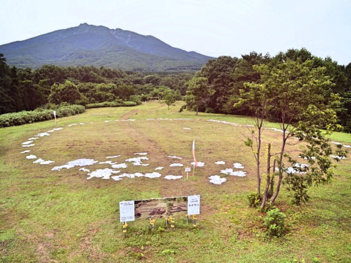


Ōmori Katsuyama Site
Monument and historic site · 8.2 km
Stone circle, settlement in Aomori, Japan

Parks, trails and playgrounds17

5 more on the map.
Restaurants and cafes10



History
The area around Itayanagi was controlled by the Tsugaru clan of Hirosaki Domain during the Edo period, and was the location of a daikansho. After the Meiji Restoration, it was formed into a village on April 1, 1889, with the establishment of the modern municipalities system. It was elevated to town status on April 1, 1920. On March 10, 1955, Itayanagi annexed the neighboring villages of Hataoka, Koami, and Arakawa.
From the History section of Itayanagi, Aomori on Wikipedia, under CC BY-SA 4.0.
Churches and places of worship2
Shopping3
Gas and EV charging5
Schools, colleges and libraries7
Healthcare2
Map of Itayanagi
49 places. The map loads OpenStreetMap tiles when you open it.
Getting there and nearby towns
Aomori Airport (AOJ) is the nearest airport with scheduled flights listed in OpenStreetMap, 20 km away.
- Fujisaki 6 km southeast, about 6 min by car
- Tsuruta 7 km north, about 7 min by car
- Hirosaki 11 km south, about 11 min by car
- Namioka 12 km east, about 12 min by car
- Aomori 27 km northeast, about 27 min by car
- Ōdate 48 km south, about 48 min by car
- Takanosu 53 km south, about 53 min by car
- Shichinohe 59 km east, about 59 min by car
- Noshiro 65 km southwest, about 1 h by car
- Misawa 79 km east, about 1 h 15 min by car
Drive times are estimates from straight-line distance, not routes.
Local news
Headlines from INDB.
Reviews, tips and questions
Loading what members have shared...
Sources and licences
- GeoNames (CC BY 4.0): population, coordinates, regions and time zone
- OpenStreetMap contributors (ODbL 1.0): places, airports, map data
- Wikidata (CC0 1.0): elevation, founding date, time zone, website, landmarks and historic places
- Wikimedia Commons (see each image): photos
- Wikipedia (CC BY-SA 4.0): overview and history text
Photo credits
- Itayanagi town hall, アラツク, CC BY-SA 4.0
- Kaido-jinja, Itayanagi 20190908b, 掬茶, CC BY-SA 4.0
- Kaido-jinja, Itayanagi 20190908a, 掬茶, CC BY-SA 4.0
- Kaido-jinja, Itayanagi 20190908c, 掬茶, CC BY-SA 4.0
- JR East Kiha 40 at Itayanagi Station 20190908, 掬茶, CC BY-SA 4.0
- Aomori Prefectural Itayanagi High School, 掬茶, CC BY-SA 4.0
- Itayanagi town Itayanagi-Minami elementary school, 掬茶, CC BY-SA 4.0
- Itayanagi town Itayanagi-Kita elementary school, 掬茶, CC BY-SA 4.0
- Omori-Katsuyama Stone Circle, MChew, CC BY-SA 4.0
- Mt. Iwaki, Aomori - Oct 26, 2012, Yuichi Kosio, CC BY 2.0
- Entrance of Shiwa SA for Tokyo - Jun 26, 2012, Ari Helminen, CC BY 2.0
- Tsugaru-Ringo-Ohashi Bridge 241013, Yauchi, CC0
- Hayashizaki Station platform 202607, Sashimiteishoku, CC0
- Hayashizaki Station 202607, Sashimiteishoku, CC0
- 藤田民次郎墓碑, 歯河長瀞夫, CC BY-SA 4.0
- Takamasu-Onsen 241013, Yauchi, CC0
- Kawabe Daishō, Tsuruta-machi, Kitatsugaru-gun, Aomori-ken 038-3525, Japan - panoramio, torakiti, CC BY 3.0
- Gōshikawara Fujisaki, Fujisaki-machi, Minamitsugaru-gun, Aomori-ken 038-3802, Japan - panoramio (1), torakiti, CC BY 3.0
- Gōshikawara Fujisaki, Fujisaki-machi, Minamitsugaru-gun, Aomori-ken 038-3802, Japan - panoramio (2), torakiti, CC BY 3.0
- Gōshikawara Fujisaki, Fujisaki-machi, Minamitsugaru-gun, Aomori-ken 038-3802, Japan - panoramio, torakiti, CC BY 3.0
- Karaito Gozen Historical Park 202607, Sashimiteishoku, CC0
- Roadside Station Tsuruta 20190908b, 掬茶, CC BY-SA 4.0
- Roadside Station Tsuruta 20190908a, 掬茶, CC BY-SA 4.0
- Roadside Station Tsuruta 20190908c, 掬茶, CC BY-SA 4.0
- Tsurudomari Station 20200621c, 掬茶, CC BY-SA 4.0
- Tsurudomari Station 20200621a, 掬茶, CC BY-SA 4.0
- Tsurudomari Station 20200621b, 掬茶, CC BY-SA 4.0
- Fujisaki town Fujisaki-Chuo elementary school, 掬茶, CC BY-SA 4.0


Page built November 4, 2026. Spotted a mistake? Tell us or suggest a place.