
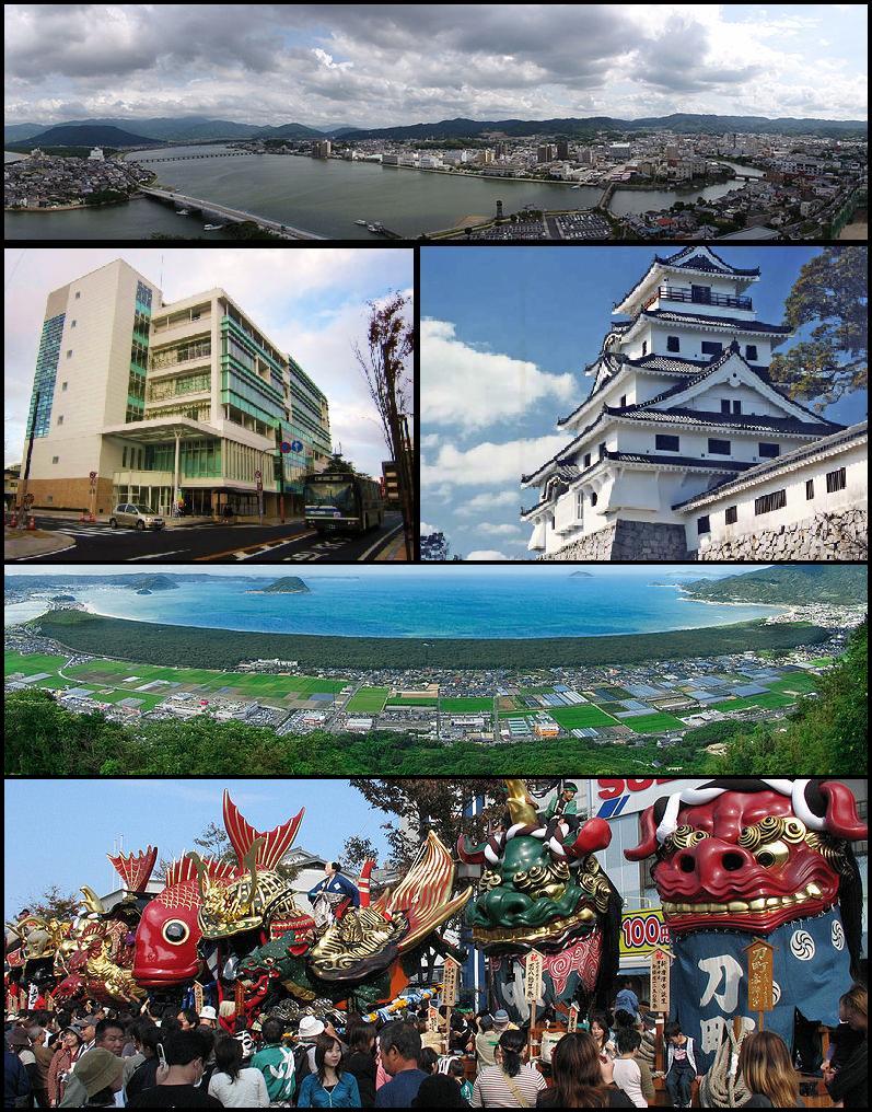


Karatsu, Japan
唐津市
Karatsu is a town of 117,663 people in Saga, Japan, founded in April 1, 1889.
Why visit Karatsu
Townapedia lists 86 museums and landmarks, 48 parks and trails, 66 places to eat, 31 places to stay and 42 attractions in and around town.
Highlights include Kan'non Falls, Mikaeri-no-taki Falls, Saga Prefectural Museum of Nagoya Castle and Karatsu Castle.
Weather in Karatsu
Forecast from MET Norway (CC BY 4.0). Full forecast
About Karatsu
Karatsu (唐津市, Karatsu-shi) is a city located in Saga Prefecture on the island of Kyushu, Japan. Its name, formed from the Japanese word roots 唐 kara (China, or continental East Asia in general), and 津 tsu (port), signifies its historical importance as an ancient trading port between Japan with China and Korea. As of 1 September 2026, the city had an estimated population of 111,413 in 51,678 households, and a population density of 228.5 persons per km2. The total area of the city is 487.58 km2 (188.26 sq mi).
From the Wikipedia article Karatsu, Saga (this version), under CC BY-SA 4.0.
Travel tips from other travellers: Karatsu on Wikivoyage (CC BY-SA 4.0).
Things to do42





30 more on the map.
Museums and landmarks86


Nabatake Site
Monument and historic site · 1.3 km
Archaeological site in Japan

Kawamura Art Museum
Museum · 1.2 km
Art museum in Saga Prefecture, Japan



74 more on the map.
Parks, trails and playgrounds48






36 more on the map.
Restaurants and cafes66


Esaki
Restaurant · Sushi · 0.6 km
Tu-Sa 17:00-22:00; Su 12:00-14:00; Mo off
TRATTORIA Legare
Restaurant · Italian · 1.2 km
Mo-Su 11:00-22:00
54 more on the map.
History
The area of Karatsu was part of ancient Hizen Province. In 1591, on the coast of the northern part of the city (formerly the town of Chinzei), Nagoya Castle was constructed. The following year, it became the location from which the Imjin War was launched by Toyotomi Hideyoshi. In the middle of 1593, Terazawa Hirotaka created Karatsu Domain. In 1602, replacing Nagoya Castle, Karatsu Castle was constructed in what is now the heart of Karatsu.
From the History section of Karatsu, Saga on Wikipedia, under CC BY-SA 4.0.
Where to stay31
Churches and places of worship31
Shopping19
Schools, colleges and libraries79
Healthcare32
Map of Karatsu
250 places. The map loads OpenStreetMap tiles when you open it.
Getting there and nearby towns
Iki Airport (IKI) is the nearest airport with scheduled flights listed in OpenStreetMap, 38 km away.
- Moroura 10 km west, about 10 min by car
- Sasebo 38 km southwest, about 38 min by car
- Fukuoka 45 km northeast, about 45 min by car
- Kasuga 47 km east, about 47 min by car
- Ōnojō 48 km east, about 48 min by car
- Chikushino-shi 51 km east, about 51 min by car
- Kurume 53 km east, about 53 min by car
- Ōmuta 64 km southeast, about 1 h by car
- Isahaya 67 km south, about 1 h by car
- Iizuka 70 km east, about 1 h 15 min by car
Drive times are estimates from straight-line distance, not routes.
Local news
Headlines from INDB.
Reviews, tips and questions
Loading what members have shared...
Sources and licences
- GeoNames (CC BY 4.0): population, coordinates, regions and time zone
- OpenStreetMap contributors (ODbL 1.0): places, airports, map data
- Wikidata (CC0 1.0): elevation, founding date, time zone, website, landmarks and historic places
- Wikimedia Commons (see each image): photos
- Wikipedia (CC BY-SA 4.0): overview and history text
Photo credits
- Karatsu Montage, Tatawidepine, CC BY-SA 3.0
- Karatsu sta south road, Katainaka, CC BY-SA 3.0
- KR-JP Karatsu Event 07, *Youngjin, CC BY-SA 4.0
- Karatsu City Library 260912 2, Aspere, CC BY-SA 4.0
- Karatsu Modern Library in front of the South Entrance of Karatsu Station, そらみみ, CC BY-SA 4.0
- 100228 the front of Karatsu City Library, Kkjap at Japanese Wikipedia, CC BY 3.0
- KR-JP Karatsu Event 09, *Youngjin, CC BY-SA 4.0
- Staircase of Karatsu City Library 260911, Aspere, CC BY-SA 4.0
- KR-JP Karatsu Event 08, *Youngjin, CC BY-SA 4.0
- Karatsu City Furusato Hall Arpino 정문, Twotwo2019, CC BY 4.0
- KR-JP Karatsu Event 05, *Youngjin, CC BY-SA 4.0
- KR-JP Karatsu Event 06, *Youngjin, CC BY-SA 4.0
- KR-JP Karatsu Event 04, *Youngjin, CC BY-SA 4.0
- KR-JP Karatsu Event 01, *Youngjin, CC BY-SA 4.0
- KR-JP Karatsu Event 02, *Youngjin, CC BY-SA 4.0
- Platform of Karatsu Station, そらみみ (Soramimi), CC BY-SA 4.0
- Platform of Karatsu Station 3, そらみみ (Soramimi), CC BY-SA 4.0
- Platform of Karatsu Station 4, そらみみ, CC BY-SA 4.0
- Electronic signage of Karatsu Station, そらみみ, CC BY-SA 4.0
- Nabatake Site rice field, Pekachu, CC BY-SA 4.0
- Nabatake Site Matsuro-kan Museum, Pekachu, CC BY-SA 4.0
- Karatsujo, Unknown author, Public domain
- NagoyaC museum, Aboshi at Japanese Wikipedia, CC BY-SA 3.0
- Yakataishi no Nanatsugama on the sea around, Yukiko Yamamoto from flickr, CC BY 2.0
- Mount Tomboyama and Himeshima Island from Hamasaki Beach 2, そらみみ, CC BY-SA 4.0
- Karatsu Shrine, user:Atsasebo, CC BY-SA 3.0
- Mount Kishidake from mountain path in Hieda, Kitahata, Pekachu, CC BY-SA 4.0
- 田島神社全景, sirousaghi, CC BY-SA 4.0
- View from Karatsu Castle(33707194761), Dime Gontar, CC BY 2.0
- Kagami-jinja Ichi-no-miya, STA3816, CC BY-SA 4.0
- Karatsu City Ouchi Library, Peka, CC BY-SA 4.0
- 旧唐津銀行本店, てるみー, CC BY-SA 4.0
- 田嶋神社社殿, Hority, CC BY-SA 4.0
- Nanatsukama 01, Unknown author, CC BY-SA 3.0
- 唐津城 - panoramio, mahlervv, CC BY 3.0
- Open space in Matsuura Riverside Park, Peka, CC BY-SA 4.0
- Karatsuminami High School, hyolee2, CC BY-SA 4.0
- Mount Sakurei from Takatori, Peka, CC BY-SA 4.0
- View from Tenshu of Karatsu Castle (Mount Kinuboshiyama), そらみみ, CC BY-SA 4.0
- Saga Prefectural Karatsu Technical High School, Ackeyyama, CC0
- KANNON waterfall Saga,JAPAN, Si-take. at Japanese Wikipedia, CC BY-SA 3.0
- Saiseikai Karatsu Hospital, Peka, CC BY-SA 4.0
- Waterfall of Mikaeri, アラツク, CC BY-SA 4.0
- Karatsu Red Cross Hospital, Peka, CC BY-SA 4.0
- Imari City Minamihata Elementary and Junior High School, Minamihata Kyogakukan, Ackeyyama, CC0
- Karatsu City Yobuko Elementary School, Ackeyyama, CC0
- Karatsu City Kaisei Junior High School, Ackeyyama, CC0
- View from Tenshu of Karatsu Castle (Nijino Matsubara and Mount Kagamiyama), そらみみ, CC BY-SA 4.0
- Imari hayatsu es, Sept23, CC BY-SA 4.0
- Karatsu City Onizuka Elementary School, Ackeyyama, CC0
- Karatsu City Minato Elementary School, Ackeyyama, CC0
- Karatsu City Hirabaru Elementary School, Ackeyyama, CC0
- Kawamura art museum, ハポニアラ, CC BY 4.0


Page built November 4, 2026. Spotted a mistake? Tell us or suggest a place.