


Ōnojō, Japan
大野城市
Ōnojō is a town of 102,085 people in Fukuoka, Japan, founded in April 1, 1972.
Why visit Ōnojō
Townapedia lists 53 museums and landmarks, 167 parks and trails, 142 places to eat, 8 places to stay and 13 attractions in and around town.
Highlights include Chikushi Jogakuen University, Daiichi University of Pharmacy, Antokudai Site and Dazaifu Gakkōin Site.
Weather in Ōnojō
Forecast from MET Norway (CC BY 4.0). Full forecast
About Ōnojō
Ōnojō (大野城市, Ōnojō-shi; Japanese pronunciation: [ò̞ó̞.nó̞.(ɟ̟͡)ʑò̞ò̞, -(ɟ̟͡)ʑó̞ò̞.ɕì, ó̞ó̞-]) is an area located in Fukuoka Prefecture, Japan. As of 31 March 2024, the city had an estimated population of 102,818 in 46689 households, and a population density of 3800 persons per km2. The total area of the city is 26.89 km2 (10.38 sq mi).
From the Wikipedia article Ōnojō (this version), under CC BY-SA 4.0.
Things to do13

Chikushi Jogakuen University
School · 6.0 km
Higher education institution in Fukuoka Prefecture, Japan
Daiichi University of Pharmacy
School · 6.3 km
Higher education institution in Fukuoka Prefecture, Japan
Fukuoka International University
School · 5.7 km
Higher education institution in Fukuoka Prefecture, Japan

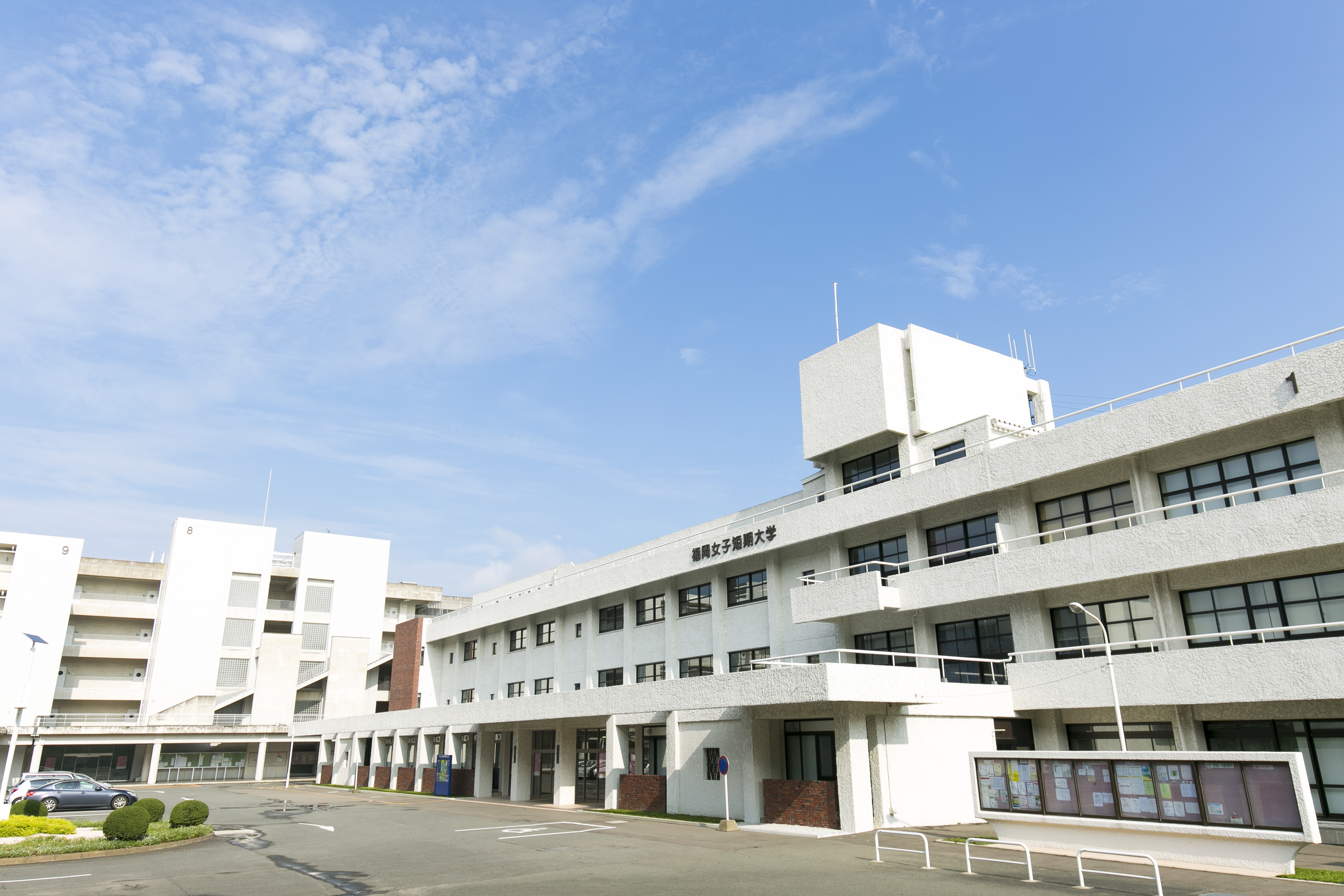
Fukuoka Jo Gakuin University
School · 3.5 km
Higher education institution in Fukuoka Prefecture, Japan

Fukuoka Social Medical Welfare University
School · 5.4 km
Higher education institution in Fukuoka Prefecture, Japan

Japan University of Economics
School · 5.6 km
Higher education institution in Fukuoka Prefecture, Japan
Kyushu Institute of Design
School · 5.3 km
Higher education institution in Fukuoka Prefecture, Japan

Kyushu Institute of Information Sciences
School · 5.9 km
Higher education institution in Fukuoka Prefecture, Japan


1 more on the map.
Museums and landmarks53

Antokudai Site
Monument and historic site · 6.9 km
Archaeological site in Japan

Dazaifu Gakkōin Site
Monument and historic site · 4.4 km
Historic university site in Fukuoka, Japan

Itazuke Site
Monument and historic site · 4.1 km
Archaeological site in Japan

Kanenokuma Site
Monument and historic site · 3.0 km
Archeological site in Hakata-ku, Fukuoka, Japan

Kokubu Tile Kiln ruins
Monument and historic site · 3.2 km
Archaeological site in Japan

Kyushu National Museum
Museum · 5.9 km
National museum in Fukuoka, Japan

Sugu-Okamoto Site
Monument and historic site · 2.6 km
Historic site in Kasuga, Fukuoka, Japan
Tōnobaru pagoda ruins
Monument and historic site · 5.3 km
Archeological site in Chikushino, Japan


41 more on the map.
Parks, trails and playgrounds167



155 more on the map.
Restaurants and cafes142





130 more on the map.
History
The area of Ōnojō is located in former Chikuzen Province and has had strong ties with Hakata and Dazaifu since ancient times. The city takes its name from Ōno Castlem which was built in the Asuka Period to protect Daizaifu against possible invasion by Silla and Tang China. Nearby Mizuki Castle also served the same purpose. The city area also has many other ruins, including the Ushikubi Sue Ware Kiln Site, from a time when this area was a major producer of Sue ware pottery. During the Edo Period, it was largely under the control of Fukuoka Domain.
After the Meiji restoration, the village of Ōno was established on May 1, 1889 with the creation of the modern municipalities system. It was raised to town status on October 10, 1951 and changed its name to Ōnojō on being raised to city status on April 1, 1972.
From the History section of Ōnojō on Wikipedia, under CC BY-SA 4.0.
Where to stay8
Churches and places of worship42
Shopping53
Gas and EV charging15
Schools, colleges and libraries60
Healthcare31
府川医院 Fukawa Clinic General Internal Medicine (English Speaking)
Clinic and pharmacy · 3.5 km
3 Chome-14-25 Ijiri, Minami Ward, Fukuoka
Map of Ōnojō
250 places. The map loads OpenStreetMap tiles when you open it.
Getting there and nearby towns
Fukuoka Airport (FUK) is the nearest airport with scheduled flights listed in OpenStreetMap, 6 km away.
- Kasuga 2 km southwest, about 2 min by car
- Chikushino-shi 6 km southeast, about 6 min by car
- Umi 5 km northeast, about 5 min by car
- Dazaifu 5 km southeast, about 5 min by car
- Katanawa 5 km west, about 5 min by car
- Fukuoka 9 km northwest, about 9 min by car
- Iizuka 22 km northeast, about 22 min by car
- Kurume 25 km south, about 25 min by car
- Kitakyushu 49 km northeast, about 49 min by car
- Ōmuta 56 km south, about 56 min by car
Drive times are estimates from straight-line distance, not routes.
Local news
Headlines from INDB.
Reviews, tips and questions
Loading what members have shared...
Sources and licences
- GeoNames (CC BY 4.0): population, coordinates, regions and time zone
- OpenStreetMap contributors (ODbL 1.0): places, airports, map data
- Wikidata (CC0 1.0): elevation, founding date, time zone, website, landmarks and historic places
- Wikimedia Commons (see each image): photos
- Wikipedia (CC BY-SA 4.0): overview and history text
Photo credits
- Confluence of Misaka and Ushikubi Rivers, STA3816, CC BY-SA 4.0
- Daiichi CPS01, Muyo, CC BY-SA 3.0
- Fukuoka Jo Gakuin University, Mattk1964, CC BY-SA 3.0
- 日本経済大学KOROKAN, Maria0402, CC BY-SA 4.0
- Dazaifu (government) gakko-in, Saigen Jiro, CC0
- Itazuke Ruins, Muyo, CC BY-SA 3.0
- Kokubu Kawaragama (Dazaifu), Saigen Jiro, CC0
- Kyushu National Museum 九州国立博物館 01, ノボホショコロトソ, CC BY 4.0
- Warehouses at the Suguokamoto Site, STA3816, CC BY-SA 4.0
- Fukuoka City Archaeology Center, Muyo, CC BY-SA 3.0
- Kasuga HS, 副会長, Public domain
- Chikuzen Kokubunji hondou-2, Saigen Jiro, CC0
- Fukuoka Tokushukai Hospital, R34SkylineGT-R V-SpecⅡNür, CC BY-SA 3.0
- 福岡女子短期大学, Katsutoshi Sakurai, CC BY-SA 4.0
- Chikushijogakuen University01, Muyo master at ja.wikipedia, CC BY-SA 3.0
- KIIS01, Muyo master at ja.wikipedia, CC BY-SA 3.0
- Kanenokuma jar coffins, MChew, CC BY-SA 4.0
- Onojo Ogi Elementary School 2006, Unknown author, CC BY-SA 3.0
- Onojo Shimoori Elementary School, hyolee2, CC BY-SA 4.0
- Onojo Ori Junior High Schoo, hyolee2, CC BY-SA 4.0
- Fukuoka Sanchiku Junior High School, hyolee2, CC BY-SA 4.0
- Fukuoka Sanchiku Elementary School, hyolee2, CC BY-SA 4.0
- Onojo Ori Elementary School, hyolee2, CC BY-SA 4.0
- ACROSS MALL Kasuga 2021, hyolee2, CC BY-SA 4.0
- Fukuoka Prefectural Kasuga Park Baseball Park 20170603, そらみみ, CC BY-SA 4.0
- Onojo Cocoro-no-furusato-kan City Museum, STA3816, CC BY-SA 4.0
- Daimonji Park 01, STA3816, CC BY-SA 4.0
- Daimonji Park 02, STA3816, CC BY-SA 4.0
- Platform of Kasugabaru Station, そらみみ (Soramimi), CC BY-SA 4.0
- Platform and overpass of Kasugabaru Station, そらみみ (Soramimi), CC BY-SA 4.0
- Train bounding for Daizenji Station arriving at Kasugabaru Station, そらみみ (Soramimi), CC BY-SA 4.0
- View from overpass of Kasugabaru Station, そらみみ (Soramimi), CC BY-SA 4.0
- View of Kasugabaru Station, そらみみ (Soramimi), CC BY-SA 4.0
- Kasugabaru Station 20160515, そらみみ (Soramimi), CC BY-SA 4.0
- 埋め立て龍神池, しだん, CC0
- Street view near Kasugabaru Station, そらみみ (Soramimi), CC BY-SA 4.0
- View in Fukuoka Prefectural Kasuga Park 12, そらみみ, CC BY-SA 4.0
- Kasuga Park East Entrance Crossroads 20170603, そらみみ, CC BY-SA 4.0
- Manhole cover of Kasuga, Fukuoka 2, そらみみ, CC BY-SA 4.0
- Kasuga City Office 20170603, そらみみ, CC BY-SA 4.0


Page built November 4, 2026. Spotted a mistake? Tell us or suggest a place.