


Kesennuma, Japan
気仙沼市
Kesennuma is a town of 61,147 people in Miyagi, Japan, founded in June 1, 1953.
Why visit Kesennuma
Townapedia lists 19 museums and landmarks, 50 parks and trails, 238 places to eat, 25 places to stay and 25 attractions in and around town.
Highlights include Ice Museum, 亀山, Rias Ark Museum of Art and シャークミュージアム.
Weather in Kesennuma
Forecast from MET Norway (CC BY 4.0). Full forecast
About Kesennuma
Kesennuma (気仙沼市, Kesennuma-shi) is a city in Miyagi Prefecture, Japan. As of 1 August 2020, the city had an estimated population of 59,803 and a population density of 190 inhabitants per square kilometre (490/sq mi) in 26,390 households. The total area of the city is 332.44 square kilometres (128.36 sq mi). Large sections of the city were destroyed by the 2011 Tōhoku earthquake and tsunami and major fires on March 11, 2011.
From the Wikipedia article Kesennuma (this version), under CC BY-SA 4.0.
Travel tips from other travellers: Kesennuma on Wikivoyage (CC BY-SA 4.0).
Things to do25

Ice Museum
Monument and historic site
Aquarium in Kesennuma, Miyagi Prefecture, Japan



13 more on the map.
Museums and landmarks19


Nakazawahama Shell Mound
Monument and historic site · 12.0 km
Archaeological site in Japan

7 more on the map.
Parks, trails and playgrounds50
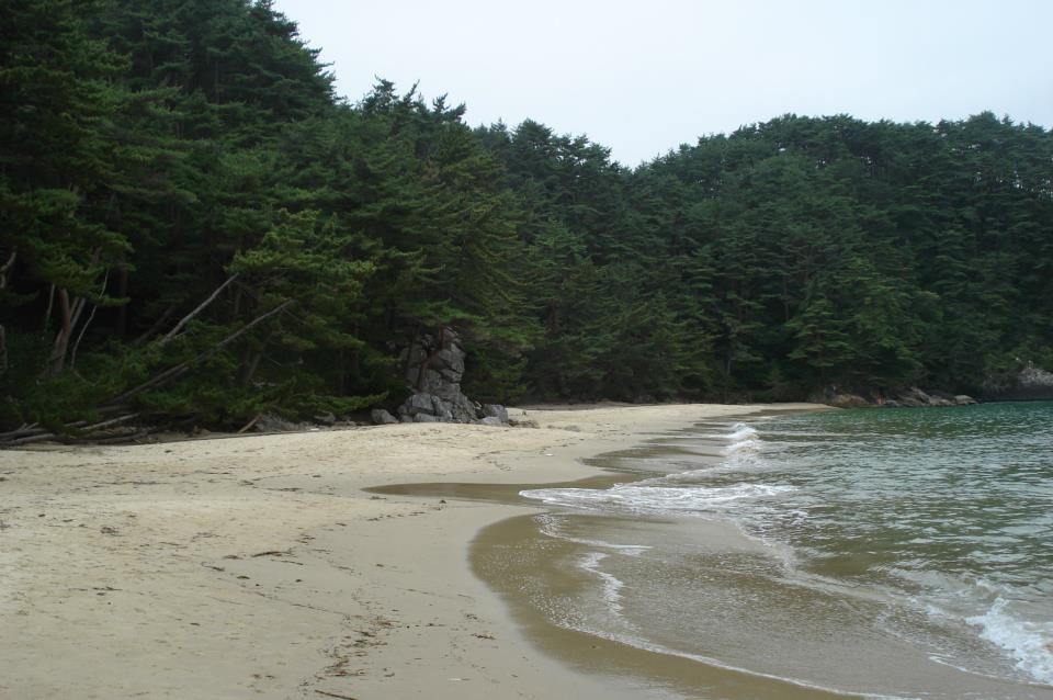





38 more on the map.
Restaurants and cafes238


226 more on the map.
History
The area of present-day Kesennuma was part of ancient Mutsu Province and has been settled since at least the Jōmon period by the Emishi people, as evidenced by numerous shell middens found in coastal areas. During the later portion of the Heian period, the area was ruled by the Northern Fujiwara. During the Sengoku period, the area was contested by various samurai clans before the area came under the control of the Date clan of Sendai Domain during the Edo period, under the Tokugawa shogunate. The town of Kesennuma was established on June 1, 1889 within Motoyoshi District, Miyagi with the establishment of the modern municipalities system.
Kesennuma City was formed on June 1, 1953, when the town of Kesennuma annexed the neighboring town of Shishiori and village of Matsuiwa. On April 1, 1955, the city annexed the villages of Niitsuki, Hashikami and Oshima. On March 31, 2006, the town of Karakuwa and on September 1, 2009 the town of Motoyoshi (both from Motoyoshi District) were likewise incorporated into Kesennuma.
From the History section of Kesennuma on Wikipedia, under CC BY-SA 4.0.
Where to stay25
Churches and places of worship61
Shopping48
Gas and EV charging15
Schools, colleges and libraries34
Healthcare42
Map of Kesennuma
250 places. The map loads OpenStreetMap tiles when you open it.
Getting there and nearby towns
Hanamaki Airport (HNA) is the nearest airport with scheduled flights listed in OpenStreetMap, 70 km away.
- Rikuzen-Takata 15 km northeast, about 15 min by car
- Ōfunato 22 km northeast, about 22 min by car
- Minamisanriku 27 km southwest, about 27 min by car
- Ichinoseki 38 km west, about 38 min by car
- Ōshū 44 km northwest, about 44 min by car
- Mizusawa 46 km northwest, about 46 min by car
- Tōno 46 km north, about 46 min by car
- Kamaishi 49 km northeast, about 49 min by car
- Kanegasaki 52 km northwest, about 52 min by car
- Ishinomaki 59 km southwest, about 59 min by car
Drive times are estimates from straight-line distance, not routes.
Local news
Headlines from INDB.
Reviews, tips and questions
Loading what members have shared...
Sources and licences
- GeoNames (CC BY 4.0): population, coordinates, regions and time zone
- OpenStreetMap contributors (ODbL 1.0): places, airports, map data
- Wikidata (CC0 1.0): elevation, founding date, time zone, website, landmarks and historic places
- Wikimedia Commons (see each image): photos
- Wikipedia (CC BY-SA 4.0): overview and history text
Photo credits
- 気仙沼湾kesennuma-wan - panoramio, Satoh Junpei, CC BY-SA 3.0
- 気仙沼魚町と安波山Kesennuma-Mt.Anba - panoramio, Satoh Junpei, CC BY-SA 3.0
- Kesennuma city Kesennuma elementary school 202509, とらもん192, CC BY 4.0
- 気仙沼プラザホテルKesennuma PlazaHotel - panoramio, Satoh Junpei, CC BY-SA 3.0
- Kesennuma fishing port, -3 Oct. 2007 a, Yuma Sugawara from Sendai, japan, CC BY 2.0
- Reconstruction Food Village Kesennuma alley of restaurant, Sakaori ( talk ), CC BY 3.0
- Reconstruction Food Village Kesennuma alley entrance, Sakaori ( talk ), CC BY 3.0
- Kesennuma bay 001 20130601, Opqr, CC BY-SA 4.0
- Kesennuma City Hall One-Ten Office, 2026, 石巻敎祖, CC BY-SA 4.0
- Oshima Kisen Fantasy at Kesennuma Port 202608a, とらもん192, CC BY 4.0
- Oshima Kisen Fantasy at Kesennuma Port 202608b, とらもん192, CC BY 4.0
- Minami-Kesennuma Station after tsunami, Christopher Johnson, CC BY-SA 2.0
- Kesennuma Girls' High School 2012, Miyuki Meinaka, CC BY-SA 3.0
- Inside of Kesennuma City Hall after tsunami, Daisuke TSUDA, CC BY-SA 2.0
- 気仙沼の様子 Kesennuma, Deeply Damaged Area by the Tsunami of Japan Quake, Hajime NAKANO, CC BY 2.0
- Kesennuma uminoiti, Ty19080914, CC BY-SA 4.0
- Miyagi Prefecture Kesennuma High School, Yasu ( talk ), CC BY-SA 3.0
- Miyagi Prefectural Kesennuma Support School 1, Ebiebi2, CC BY-SA 4.0
- Hayamajinja, Makusakura, CC BY-SA 3.0
- Kesennuma city Jonan junior high school 202405, とらもん192, CC BY 4.0
- Kesennuma City Hospital, Yasu ( talk ), CC BY-SA 3.0
- Hayamasan seen from the WSW - panoramio, Satoh Junpei, CC BY-SA 3.0
- Kameyama seen from Uranohama 202412, とらもん192, CC BY 4.0
- 十八鳴浜, Ubuhouse, CC BY-SA 3.0
- Hondo Hodaji,Kesennuma, Ty19080914, CC BY-SA 4.0
- Enunkan Garden,Kesennuma,Miyagi, Ty19080914, CC BY-SA 4.0
- Isuzujinjya syaden,Kesennuma, Ty19080914, CC BY-SA 4.0
- Riasu ark museum, Ty19080914, CC BY-SA 4.0
- Kesennuma city Shishiori elementary school 202405, とらもん192, CC BY 4.0
- Kesennuma city Karakuwa elementary school 202411, とらもん192, CC BY 4.0
- 東陵高等学校, 小室泰六, CC BY-SA 4.0
- Hayama-jinja, Makusakura, CC BY-SA 4.0
- Frozen fish in ice1, Sue Waters, CC BY-SA 2.0
- Rokkakudo Hodaji,Kesennuma, Ty19080914, CC BY-SA 4.0
- 魚市場前岸壁Uoichibamae ganpeki - panoramio, Satoh Junpei, CC BY-SA 3.0
- 海の市Uminoichi(鮮魚海産物売り場) - panoramio, Satoh Junpei, CC BY-SA 3.0
- 東北 2017-03 (33242291546), Hajime NAKANO, CC BY 2.0
- 魚市場屋上(見学者デッキ)Dekki of Uo-ichiba - panoramio, Satoh Junpei, CC BY-SA 3.0
- シャーク・ミュージアム駐車場Shark Museum P - panoramio, Satoh Junpei, CC BY-SA 3.0
- あたみ屋 2016-10-11 3季ぶり優勝 (30475847624), Cheng-en Cheng, CC BY-SA 2.0


Page built November 5, 2026. Spotted a mistake? Tell us or suggest a place.