


Kumamoto, Japan
熊本市
Kumamoto is a regional capital of 738,907 people in Kumamoto, Japan, founded in April 1, 1889.
Why visit Kumamoto
Townapedia lists 80 museums and landmarks, 56 parks and trails, 168 places to eat, 29 places to stay and 17 attractions in and around town.
Highlights include Kumamoto Gakuen University, Kumamoto Health Science University, Adaka-Kurobashi Shell Mounds and Futagoyama Stone Tool Production Site.
Weather in Kumamoto
Forecast from MET Norway (CC BY 4.0). Full forecast
About Kumamoto
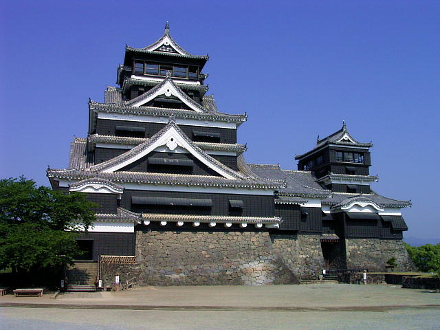
Kumamoto (熊本市, Kumamoto-shi; Japanese pronunciation: [kɯ̈̀.mä́.mó̞.tó̞(.ɕì)]) is the capital city of Kumamoto Prefecture on the island of Kyushu, Japan. As of June 1, 2019, the city had an estimated population of 738,907 and a population density of 1,893 people per km2. The total area is 390.32 km2.
From the Wikipedia article Kumamoto (this version), under CC BY-SA 4.0.
Travel tips from other travellers: Kumamoto on Wikivoyage (CC BY-SA 4.0).
Things to do17

Kumamoto Gakuen University
School · 3.4 km
Higher education institution in Kumamoto Prefecture, Japan

Kumamoto Health Science University
School · 5.3 km
Higher education institution in Kumamoto Prefecture, Japan

Kumamoto Prefectural Theater
Cinema and theater · 3.4 km
Theater in Kumamoto, Japan

Kumamoto University
School · 3.5 km
Higher education institution in Kumamoto Prefecture, Japan

Kyūshū Lutheran College
School · 3.3 km
Higher education institution in Kumamoto Prefecture, Japan

Kyushu Tokai University
School · 4.9 km
Higher education institution in Kumamoto Prefecture, Japan

Prefectural University of Kumamoto
School · 6.8 km
Higher education institution in Kumamoto Prefecture, Japan


Sojo University
School · 2.8 km
Private University in Nishi-ku, Kunamoto, Japan



5 more on the map.
Museums and landmarks80

Adaka-Kurobashi Shell Mounds
Monument and historic site · 12.0 km
Archaeological site(s) in Kumamoto, Kumamoto, Japan

Futagoyama Stone Tool Production Site
Monument and historic site · 12.1 km
Archaeological site in Japan





68 more on the map.
Parks, trails and playgrounds56


Kumamoto City Zoological and Botanical Gardens
Park · 6.3 km
Zoo in Kumamoto, Japan



44 more on the map.
Restaurants and cafes168


漁港直送 目利きの銀次
Restaurant · Seafood · 1.7 km
5:00から10:30まで朝食、11:00から15:00までランチのメニューあり
下通, 熊本市中央区
24/7
156 more on the map.
Where to stay29
Churches and places of worship54
Shopping50
Gas and EV charging4
Schools, colleges and libraries58
Healthcare43
Map of Kumamoto
250 places. The map loads OpenStreetMap tiles when you open it.
Getting there and nearby towns
Kumamoto Airport (KMJ) is the nearest airport with scheduled flights listed in OpenStreetMap, 15 km away.
- Kotō 6 km southeast, about 6 min by car
- Uejima 9 km southeast, about 9 min by car
- Uekimachi-mōno 10 km north, about 10 min by car
- Shimada 11 km southeast, about 11 min by car
- Okino 12 km northeast, about 12 min by car
- Ōmuta 34 km northwest, about 34 min by car
- Kurume 59 km north, about 59 min by car
- Chikushino-shi 79 km north, about 1 h 15 min by car
- Kasuga 83 km north, about 1 h 30 min by car
- Ōnojō 84 km north, about 1 h 30 min by car
Drive times are estimates from straight-line distance, not routes.
Local news
Headlines from INDB.
Reviews, tips and questions
Loading what members have shared...
Sources and licences
- GeoNames (CC BY 4.0): population, coordinates, regions and time zone
- OpenStreetMap contributors (ODbL 1.0): places, airports, map data
- Wikidata (CC0 1.0): elevation, founding date, time zone, website, landmarks and historic places
- Wikimedia Commons (see each image): photos
- Wikipedia (CC BY-SA 4.0): overview and history text
Photo credits
- Kumamoto Castle and Kyūshū Shinkansen 02, Hisagi, CC BY-SA 3.0
- Fujisakidai Baseball Stadium Kumamoto, Fabimaru, CC BY-SA 3.0
- Kumamoto shorituji, Motoki-jj, CC BY-SA 3.0
- Kumamoto Seizan Jr Highschool, Motoki-jj, CC BY-SA 3.0
- Aegithalos caudatus kiusiuensis, Kumamoto, Kyushu, Japan 1, tatsutomo, CC BY 4.0
- Aegithalos caudatus kiusiuensis, Kumamoto, Kyushu, Japan 2, tatsutomo, CC BY 4.0
- Aegithalos caudatus kiusiuensis, Kumamoto, Kyushu, Japan 3, tatsutomo, CC BY 4.0
- Kumamoto City Tram 9704 2015, 継之助, CC BY-SA 3.0
- Kumamoto City Tram 8501 20160728, 継之助, CC BY-SA 4.0
- Kumamoto City Tram 1353 20150804, 継之助, CC BY-SA 4.0
- Kumamoto City Tram 1096 20160728, 継之助, CC BY-SA 4.0
- Kumamoto City Tram 1081 20180727, 継之助, CC BY-SA 4.0
- Inside former Hosokawa Gyōbutei Kumamoto 01, Fabimaru, CC BY-SA 3.0
- Inside former Hosokawa Gyōbutei Kumamoto 02, Fabimaru, CC BY-SA 3.0
- Kumamoto Prefectural Art Museum, Drivephotographer, CC0
- National Hospital Organization Kumamoto Medical Center Fuzoku school, Motoki-jj, CC BY-SA 3.0
- Kumamoto Castle Hitsujisaruyagura and Mototaikoyagura, Muyo, CC BY-SA 4.0
- Kumamoto Gakuen University, Hykw-a4 at Japanese Wikipedia, CC BY-SA 3.0
- Kumamoto prefectural theater approach 1, MK Products, CC BY-SA 3.0
- KumamotoUniv IMG, 910MoLT at Japanese Wikipedia, CC BY-SA 3.0
- Kyushu Lutheran College, hyolee2, CC BY-SA 3.0
- Kumamotokenritsuuniv, Original uploader was Hykw-a4 at ja.wikipedia, CC BY-SA 3.0
- Jomon Kaimen, Nanj2783, CC BY-SA 4.0
- Kumamoto Church, Truth1974, CC BY-SA 4.0
- Kumamoto-Prefectural Museum of Art main 1, MK Products at Japanese Wikipedia, CC BY-SA 3.0
- Fujisakihachimanguu-shrine, MK Products, CC BY-SA 3.0
- Kumamotojo, Birdman at Japanese Wikipedia, CC BY-SA 3.0
- Honmyoji Temple Jochibyo, STA3816, CC BY-SA 3.0
- Kumamoto Shinto General Hospital 2017, hyolee2, CC BY-SA 4.0
- Bessho-konpira, Siwamura, CC BY-SA 3.0
- Kitaoka-shrine, Siwamura, CC BY-SA 3.0
- Hosokawa-Gyoubu house ogenkan 1, MK Products, CC BY-SA 3.0
- ANA Hotel Kumamoto NEWSKY building 1, MK Products, CC BY-SA 3.0
- Kumamoto-castle Inari shrine, Bakkai, CC BY-SA 3.0
- Kumadai Hospital, Motoki-jj, CC BY-SA 3.0
- Haiden of Kumamoto Grand Shrine, そらみみ, CC BY-SA 3.0
- Kumamoto city auditorium building 1, MK Products, CC BY-SA 3.0
- Bipuresu kumanichi-kaikan01s3200, 663highland, CC BY 2.5
- Keiryo Jr Highschool, Motoki-jj, CC BY-SA 3.0
- Kumamoto Jyousei E school, Motoki-jj, CC BY-SA 3.0
- Kumamoto City Museum, Motoki-jj, CC BY-SA 3.0
- National Hospital Organization Kumamoto Medical Center 20131021, Waka77, Public domain
- Shirakawa-kouen park (kumamoto) 1, MK Products at Japanese Wikipedia, CC BY-SA 3.0
- Kenmotsudai-arboretum-entrance 1, MK Products, CC BY-SA 3.0
- Mount Hanaoka-yama 1, MK Products, CC BY-SA 3.0
- SAKURA-MACHI-Kumamoto, MaedaAkihiko, CC0
- Q85883937, Gpwitteveen, CC BY-SA 3.0
- Kumamoto-Prefectural Museum of Art pavilion 1, MK Products, CC BY-SA 3.0
- Shanti Stupa, Michael Goodine, CC BY 2.0
- Sojouniv, MK Products, CC BY-SA 3.0
- Shokeiuniv, Original uploader was Hykw-a4 at ja.wikipedia, CC BY-SA 3.0
- Kumamoto health science univercity building 1, MK Products at Japanese Wikipedia, CC BY-SA 3.0
- Kyuusyuutokaiuniv, Original uploader was Hykw-a4 at ja.wikipedia, CC BY-SA 3.0
- Kumamoto Prefectural Daiichi High School, hyolee2, CC BY-SA 3.0
- Kumamoto Joto Elementary School and Kumamoto Toen Junior High School and Kumamoto Aoba Special School 2021, hyolee2, CC BY-SA 4.0
- Kumamoto Iseri Junior High School 2021, hyolee2, CC BY-SA 4.0
- Kumamoto Isshin Elementary School 2020, hyolee2, CC BY-SA 4.0
- Kumamoto Keitoku Elementary School 2020, hyolee2, CC BY-SA 4.0
- Kumamoto Gofuku Elementary School 2020, hyolee2, CC BY-SA 4.0
- Kumamoto Kasuga Elementary school, hyolee2, CC BY-SA 3.0
- Kumamoto Kozan Elementary School 2020, hyolee2, CC BY-SA 4.0
- Kumamoto Furumachi Elementary school, hyolee2, CC BY-SA 3.0
- Shimada gallery, Motoki-jj, CC BY-SA 3.0


Page built November 4, 2026. Spotted a mistake? Tell us or suggest a place.