


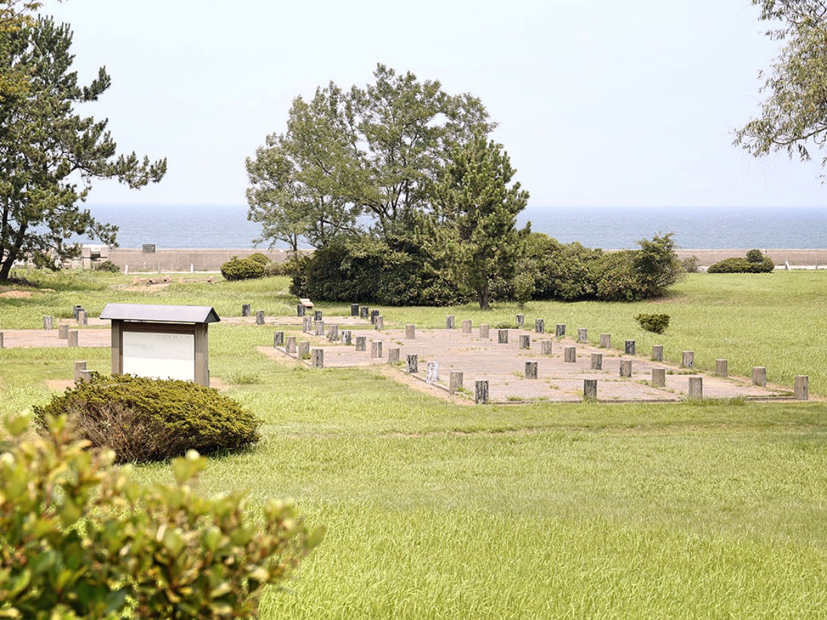


Kurobe-shi, Japan
黒部市
Kurobe-shi is a town of 41,564 people in Toyama, Japan, founded in March 31, 2006.
Why visit Kurobe-shi
Townapedia lists 22 museums and landmarks, 62 parks and trails, 126 places to eat, 28 places to stay and 7 attractions in and around town.
Highlights include Uozu Aquarium, 生地鼻灯台, Jōbenoma Site and Fudōdō Site.
Weather in Kurobe-shi
Forecast from MET Norway (CC BY 4.0). Full forecast
About Kurobe-shi
Kurobe (黒部市, Kurobe-shi) is a city in Toyama Prefecture, in the Chūbu region of Japan. As of 1 February 2018, the city had an estimated population of 41,564 in 15,387 households and a population density of 95.8 persons per km2. Its total area was 426.31 square kilometres (164.60 sq mi).
From the Wikipedia article Kurobe (this version), under CC BY-SA 4.0.
Travel tips from other travellers: Kurobe-shi on Wikivoyage (CC BY-SA 4.0).
Things to do7






Museums and landmarks22
Jōbenoma Site
Monument and historic site · 7.1 km
Archaeological site in Nyūzen, Toyama, Japan
Fudōdō Site
Monument and historic site · 9.5 km
Jōmon period archaeological site in Asahi, Hokuriku, Japan



10 more on the map.
Parks, trails and playgrounds62




50 more on the map.
Restaurants and cafes126


Trattoria Delphino
Restaurant · Italian, Noodle, Pizza · 8.0 km
11:30-14:30,17:30-21:00;Th off



114 more on the map.
History
The area is home to the Aimotohimesha Shrine and also shares its name with Kurobe River, both of which form a central element in the local legend of a powerful serpent of Kurobe River.
The area of present-day Kurobe was part of ancient Etchū Province. The towns of Ikuji and Mikkaichi were created on April 1, 1889 with the establishment of the municipalities system. On April 1, 1954, the town of Ikuji merged with the town of Sakurai to form the city of Kurobe.
On March 31, 2006 the town of Unazuki (from Shimoniikawa District) was merged into Kurobe.
From the History section of Kurobe on Wikipedia, under CC BY-SA 4.0.
Where to stay28
Churches and places of worship155
Shopping31
Gas and EV charging31
Schools, colleges and libraries52
Healthcare34
Map of Kurobe-shi
250 places. The map loads OpenStreetMap tiles when you open it.
Getting there and nearby towns
Toyama Airport (TOY) is the nearest airport with scheduled flights listed in OpenStreetMap, 36 km away.
- Nyūzen 6 km northeast, about 6 min by car
- Uozu 12 km south, about 12 min by car
- Kamiichi 24 km south, about 24 min by car
- Toyama 31 km southwest, about 31 min by car
- Itoigawa 38 km northeast, about 38 min by car
- Himimachi 41 km west, about 41 min by car
- Nanao 46 km west, about 46 min by car
- Ōmachi 58 km southeast, about 58 min by car
- Oyabe 59 km southwest, about 59 min by car
- Nanto-shi 61 km southwest, about 1 h by car
Drive times are estimates from straight-line distance, not routes.
Local news
Headlines from INDB.
Reviews, tips and questions
Loading what members have shared...
Sources and licences
- GeoNames (CC BY 4.0): population, coordinates, regions and time zone
- OpenStreetMap contributors (ODbL 1.0): places, airports, map data
- Wikidata (CC0 1.0): elevation, founding date, time zone, website, landmarks and historic places
- Wikimedia Commons (see each image): photos
- Wikipedia (CC BY-SA 4.0): overview and history text
Photo credits
- Kurobe City Hall, Fuseoyama, CC BY-SA 4.0
- UOZU AQUARIUM, 極地狐, CC BY-SA 2.0
- Jobenoma Site, MChew, CC BY-SA 4.0
- Uozu Momoyama Sports Park, 国土地理院, CC BY 4.0
- Fudodo Site, MChew, CC BY-SA 4.0
- Mirage Land, TTTNIS, CC0
- Yagokoro-Ooichihiko-Jinja005, えむかとー, Public domain
- Uozu-high-school toyama-pref 2018, XF10, CC BY-SA 4.0
- Kurobe Ikujibana Lighthouse ac, Asturio Cantabrio, CC BY-SA 4.0
- Unazuki, Roadside Station, Toyama, Japan, tail_furry, CC BY-SA 3.0
- Uozu Buried Forest Museum ac (1), Asturio Cantabrio, CC BY-SA 4.0
- Uozu-Jinja006, えむかとー, Public domain
- KurobeCity Hos, Own work, CC BY-SA 3.0
- Asahi-junior-high-school asahi-town 2018, XF10, CC BY-SA 4.0
- Asahi General Hospital, Asasa198, CC BY-SA 4.0
- Nyuzen High School, 禁樹なずな, CC BY-SA 3.0
- Tobu-junior-high-school uozu-city 2018, XF10, CC BY-SA 4.0
- Uozu City Library ac (1), Asturio Cantabrio, CC BY-SA 4.0
- Unazuki, Michi-no-Eki, Toyama, Japan, October 2020, Tail furry, CC BY-SA 4.0
- Nyuzen-nishi-junior-high-school nyuzen-town 2018, XF10, CC BY-SA 4.0
- Nyuzen-elem-school nyuzen-town 2018, XF10, CC BY-SA 4.0
- Shinsei-ji Temple in Uozu city, ブルーノ・プラス, CC BY 4.0
- Apple Hill (Uozu), Suikotei This photo was taken with Google Pixel 7a, CC BY 4.0
- 宮野球場 入口, クハ419-5, CC BY-SA 3.0
- Seisui-ji Temple in Asahi town, ブルーノ・プラス, CC BY 4.0
- R008 2-069, Puchi-masashi, CC BY-SA 4.0
- KUROBE YOSHIDA SCIENCE MUSEUM 2022-09, 京葉快速26, CC BY-SA 4.0
- Ikuji Station(5), 赤座, CC0
- Ikuji Station(3), 赤座, CC0
- Ikuji Station(6), 赤座, CC0
- Ikuji Station(4), 赤座, CC0
- Ikuji Station(2), 赤座, CC0
- Ikuji Station(1), 赤座, CC0
- Ikuji Station(7), 赤座, CC0
- 生地駅2017, キャンター, CC BY-SA 3.0
- Kurobe Post Office, Triglav, CC BY-SA 3.0
- Kokusei III power station, photo: Qurren ( talk ) Taken with Canon IXY 10S, CC BY-SA 3.0
- 東三日市駅 駅名票, MihailJP, CC0
- Ogyu Station 2026-05-16 (1), Oq10pass, CC0
- Ogyu Station 2026-07-05, Oq10pass, CC0


Page built November 5, 2026. Spotted a mistake? Tell us or suggest a place.