


Nyūzen, Japan
入善町
Nyūzen is a town of 25,007 people in Toyama, Japan, founded in April 1, 1889.
Why visit Nyūzen
Townapedia lists 11 museums and landmarks, 12 parks and trails, 85 places to eat, 8 places to stay and 1 attraction in and around town.
Highlights include Jōbenoma Site and Fudōdō Site.
Weather in Nyūzen
Forecast from MET Norway (CC BY 4.0). Full forecast
About Nyūzen
Nyūzen (入善町, Nyūzen-machi) is a town in Shimoniikawa District, Toyama Prefecture, Japan. As of 1 May 2018, the town had an estimated population of 25,007 in 8,970 households and a population density of 350 persons per km2. The total area of the town was 71.25 square kilometres (27.51 sq mi).
From the Wikipedia article Nyūzen (this version), under CC BY-SA 4.0.
Things to do1

Museums and landmarks11
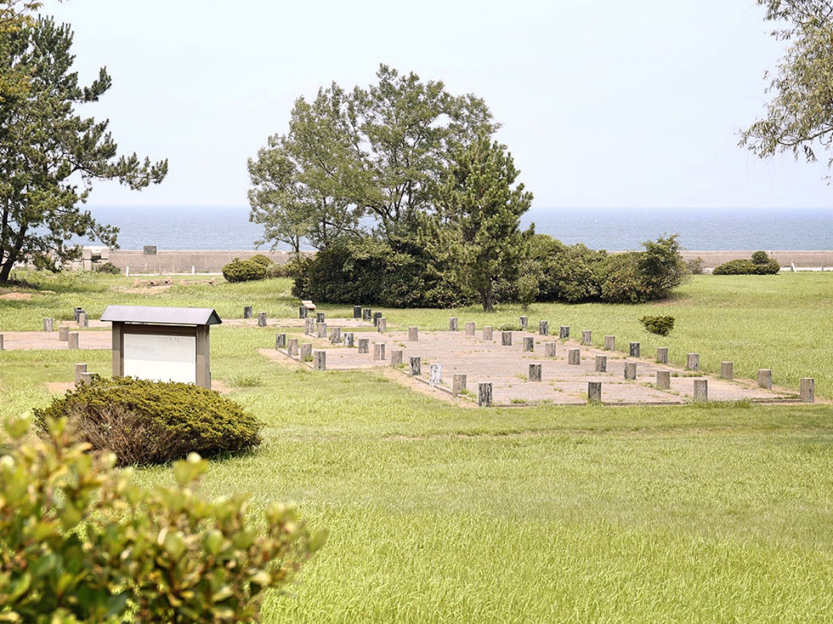
Jōbenoma Site
Monument and historic site · 1.9 km
Archaeological site in Nyūzen, Toyama, Japan


Fudōdō Site
Monument and historic site · 5.1 km
Jōmon period archaeological site in Asahi, Hokuriku, Japan


Parks, trails and playgrounds12


Restaurants and cafes85




73 more on the map.
History
The area of present-day Nyūzen was part of ancient Etchū Province. The area was organised as part of Shimoniikawa District, Toyama after the Meiji restoration. The town of Nyūzen was created with merger of seven villages in Shimoniikawa District on October 1, 1953.
From the History section of Nyūzen on Wikipedia, under CC BY-SA 4.0.
Where to stay8
Churches and places of worship81
Shopping12
Gas and EV charging19
Idemitsu SS / Yoneharashoji Energy Bu Kurobe Filling Station 出光SS/米原商事(株)エネルギー部 黒部給油所
Gas station · 6.3 km
Schools, colleges and libraries20
Healthcare17
Map of Nyūzen
250 places. The map loads OpenStreetMap tiles when you open it.
Getting there and nearby towns
Toyama Airport (TOY) is the nearest airport with scheduled flights listed in OpenStreetMap, 42 km away.
- Uozu 18 km southwest, about 18 min by car
- Itoigawa 33 km east, about 33 min by car
- Toyama 37 km southwest, about 37 min by car
- Nanao 49 km west, about 49 min by car
- Ōmachi 59 km southeast, about 59 min by car
- Suzu 59 km north, about 59 min by car
- Anamizu 63 km northwest, about 1 h by car
- Hakui 64 km west, about 1 h by car
- Jōetsu 69 km east, about 1 h 15 min by car
- Chikuma 70 km southeast, about 1 h 15 min by car
Drive times are estimates from straight-line distance, not routes.
Local news
Headlines from INDB.
Reviews, tips and questions
Loading what members have shared...
Sources and licences
- GeoNames (CC BY 4.0): population, coordinates, regions and time zone
- OpenStreetMap contributors (ODbL 1.0): places, airports, map data
- Wikidata (CC0 1.0): elevation, founding date, time zone, website, landmarks and historic places
- Wikimedia Commons (see each image): photos
- Wikipedia (CC BY-SA 4.0): overview and history text
Photo credits
- Nyuzen Town Office 201209, 禁樹なずな This photo was taken with Casio Exilim EX-Z88, CC BY-SA 3.0
- Nyūzen Station(1), 赤座, CC0
- Nyūzen Station(2), 赤座, CC0
- Nyūzen Station(4), 赤座, CC0
- Nyūzen Station(5), 赤座, CC0
- Nyūzen Station(6), 赤座, CC0
- Nyūzen Station(3), 赤座, CC0
- Nyūzen Station(8), 赤座, CC0
- Nyūzen Station(9), 赤座, CC0
- Nyūzen Station(7), 赤座, CC0
- Nyūzen Station(10), 赤座, CC0
- Nyūzen Station(12), 赤座, CC0
- Nyūzen Station(11), 赤座, CC0
- Jobenoma Site, MChew, CC BY-SA 4.0
- Fudodo Site, MChew, CC BY-SA 4.0
- Asahi-junior-high-school asahi-town 2018, XF10, CC BY-SA 4.0
- Asahi General Hospital, Asasa198, CC BY-SA 4.0
- Nyuzen High School, 禁樹なずな, CC BY-SA 3.0
- Nyuzen-nishi-junior-high-school nyuzen-town 2018, XF10, CC BY-SA 4.0
- Nyuzen-elem-school nyuzen-town 2018, XF10, CC BY-SA 4.0
- Seisui-ji Temple in Asahi town, ブルーノ・プラス, CC BY 4.0
- Nyuzen Town Office, Hirorinmasa This photo was taken with Canon Digital IXUS 95 IS, CC BY-SA 3.0
- JA minaho, ナイトキャビン, CC BY 4.0
- JA minaho aisai hiroba, ナイトキャビン, CC BY 4.0
- Nyuzen Town Hall 2026-05-16, Oq10pass, CC0
- Aoki shrine, Aoki, Nyuzen, Toyama - May 20, 2006, Sistak, CC BY-SA 2.0
- Doichi to Aoki, Fuseoyama, CC0
- 杉沢の沢スギの池, Ruess1, CC BY-SA 4.0
- Ushirotateyama 1, Koji-Matsukura, CC BY-SA 3.0
- 舟川の桜 - panoramio (3), くろふね, CC BY 3.0
- 舟川の桜 - panoramio (1), くろふね, CC BY 3.0
- 舟川の桜 - panoramio, くろふね, CC BY 3.0
- 舟川の桜 - panoramio (8), くろふね, CC BY 3.0
- 舟川べり09, くろふね, CC BY-SA 4.0
- 舟川べり 01, くろふね, CC BY-SA 4.0
- 舟川べり 02, くろふね, CC BY-SA 4.0
- 舟川の桜 - panoramio (7), くろふね, CC BY 3.0
- 舟川べり08, くろふね, CC BY-SA 4.0
- 舟川の桜 - panoramio (5), くろふね, CC BY 3.0
- 舟川べり07, くろふね, CC BY-SA 4.0


Page built November 5, 2026. Spotted a mistake? Tell us or suggest a place.