


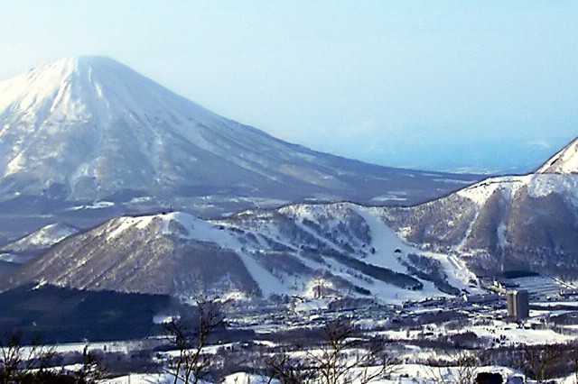


Makkari, Japan
真狩村
Makkari is a town of 2,045 people in Hokkaido, Japan, founded in April 1, 1922.
Why visit Makkari
Townapedia lists 1 museum or landmark, 6 parks and trails, 16 places to eat, 14 places to stay and 9 attractions in and around town.
Highlights include Rusutsu Resort and ルスツリゾート遊園地.
Weather in Makkari
Forecast from MET Norway (CC BY 4.0). Full forecast
About Makkari
Makkari (真狩村, Makkari-mura) is a village located in Shiribeshi Subprefecture, Hokkaido, Japan.
From the Wikipedia article Makkari, Hokkaido (this version), under CC BY-SA 4.0.
Things to do9
Rusutsu Resort
Ski area · 8.3 km
Resort in Rusutsu, Hokkaido Prefecture, Japan

Museums and landmarks1

Parks, trails and playgrounds6



Restaurants and cafes16


ルスツ酒場
Bar and pub · Japanese · 8.3 km
188 泉川, 留寿都村
Mo-Su 11:00-13:30,18:00-21:30
Ishimame
Restaurant · German, Soba, Noodles · 2.8 km
Tu, Th-Su 11:30-14:45
Natural Yeast Ripe Rusutsu Pizza
Restaurant · Pizza · 7.0 km
Mo-Su 10:00-18:00
Doraibuim miyuki
Restaurant · Japanese, Noodles, Curry · 6.6 km
Mo-Su 10:00-21:00

4 more on the map.
History
1897: Makkari Village split off from Abuta Village (now Toyako Town).
1901: Kaributo Village (now Niseko Town) was split off from Makkari Village.
1910: Makkari Village was transferred from Muroran Subprefecture (now Iburi Subprefecture) to Shiribeshi Subprefecture.
1917: Kimobetsu Village (now town) was split off from Makkari Village.
1922: Makkaribetsu Village (now Makkari Village) was split off from Makkari Village.
1941: Makkaribetsu Village changed its name to Makkari Village.
From the History section of Makkari, Hokkaido on Wikipedia, under CC BY-SA 4.0.
Where to stay14
Churches and places of worship8
Shopping1
Gas and EV charging3
Schools, colleges and libraries8
Healthcare3
Map of Makkari
69 places. The map loads OpenStreetMap tiles when you open it.
Getting there and nearby towns
Sapporo Okadama Airport (OKD) is the nearest airport with scheduled flights listed in OpenStreetMap, 62 km away.
- Rusutsu 6 km southeast, about 6 min by car
- Kutchan 17 km north, about 17 min by car
- Rankoshimachi 22 km west, about 22 min by car
- Date 33 km south, about 33 min by car
- Niki 44 km north, about 44 min by car
- Oshamambe 44 km southwest, about 44 min by car
- Noboribetsu 46 km southeast, about 46 min by car
- Yoichi 50 km north, about 50 min by car
- Muroran 51 km south, about 51 min by car
- Sapporo 56 km northeast, about 56 min by car
Drive times are estimates from straight-line distance, not routes.
Local news
Headlines from INDB.
Reviews, tips and questions
Loading what members have shared...
Sources and licences
- GeoNames (CC BY 4.0): population, coordinates, regions and time zone
- OpenStreetMap contributors (ODbL 1.0): places, airports, map data
- Wikidata (CC0 1.0): elevation, founding date, time zone, website, landmarks and historic places
- Wikimedia Commons (see each image): photos
- Wikipedia (CC BY-SA 4.0): overview and history text
Photo credits
- Makkari village hall, アラツク, CC BY-SA 4.0
- Michinoeki Makkari Flower Center, Him56, CC BY-SA 3.0
- Rusutsu WestMt(200703), E-190, CC BY-SA 3.0
- Makkari YH 2011, Soica2001 ( talk ), Public domain
- 20181106 ToyakoHwy 5098 (48429912442), Ray Swi-hymn from Sijhih-Taipei, Taiwan, CC BY-SA 2.0
- 20181106 ToyakoHwy 5097 (48429771231), Ray Swi-hymn from Sijhih-Taipei, Taiwan, CC BY-SA 2.0
- 20181106 ToyakoHwy 5096 (48429772501), Ray Swi-hymn from Sijhih-Taipei, Taiwan, CC BY-SA 2.0
- 20181106 ToyakoHwy 5095 (48429773721), Ray Swi-hymn from Sijhih-Taipei, Taiwan, CC BY-SA 2.0
- 20181106 ToyakoHwy 5094 (48429917062), Ray Swi-hymn from Sijhih-Taipei, Taiwan, CC BY-SA 2.0
- 20181106 ToyakoHwy 5100 (48429766956), Ray Swi-hymn from Sijhih-Taipei, Taiwan, CC BY-SA 2.0
- 20181106 ToyakoHwy 5101 (48429908217), Ray Swi-hymn from Sijhih-Taipei, Taiwan, CC BY-SA 2.0
- 20181106 ToyakoHwy 5102 (48429763931), Ray Swi-hymn from Sijhih-Taipei, Taiwan, CC BY-SA 2.0
- 20181106 ToyakoHwy 5104 (48429903227), Ray Swi-hymn from Sijhih-Taipei, Taiwan, CC BY-SA 2.0
- 20181106 ToyakoHwy 5103 (48429905082), Ray Swi-hymn from Sijhih-Taipei, Taiwan, CC BY-SA 2.0
- 20181106 ToyakoHwy 5105 (48429901997), Ray Swi-hymn from Sijhih-Taipei, Taiwan, CC BY-SA 2.0
- 20181106 ToyakoHwy 5106 (48429757951), Ray Swi-hymn from Sijhih-Taipei, Taiwan, CC BY-SA 2.0
- 20181106 ToyakoHwy 5107 (48429756771), Ray Swi-hymn from Sijhih-Taipei, Taiwan, CC BY-SA 2.0
- 20181106 ToyakoHwy 5108 (48429755696), Ray Swi-hymn from Sijhih-Taipei, Taiwan, CC BY-SA 2.0
- 20181106 ToyakoHwy 5109 (48429754636), Ray Swi-hymn from Sijhih-Taipei, Taiwan, CC BY-SA 2.0
- 20181106 ToyakoHwy 5110 (48429896317), Ray Swi-hymn from Sijhih-Taipei, Taiwan, CC BY-SA 2.0
- 20181106 ToyakoHwy 5111 (48429751936), Ray Swi-hymn from Sijhih-Taipei, Taiwan, CC BY-SA 2.0
- 20181106 ToyakoHwy 5112 (48429750576), Ray Swi-hymn from Sijhih-Taipei, Taiwan, CC BY-SA 2.0
- 20181106 ToyakoHwy 5113 (48429749146), Ray Swi-hymn from Sijhih-Taipei, Taiwan, CC BY-SA 2.0
- 20181106 ToyakoHwy 5114 (48429747756), Ray Swi-hymn from Sijhih-Taipei, Taiwan, CC BY-SA 2.0
- 20181106 ToyakoHwy 5093 (48429776911), Ray Swi-hymn from Sijhih-Taipei, Taiwan, CC BY-SA 2.0
- 20181106 ToyakoHwy 5092 (48429778626), Ray Swi-hymn from Sijhih-Taipei, Taiwan, CC BY-SA 2.0
- 20181106 ToyakoHwy 5115 (48429746421), Ray Swi-hymn from Sijhih-Taipei, Taiwan, CC BY-SA 2.0
- 20181106 ToyakoHwy 5091 (48429780206), Ray Swi-hymn from Sijhih-Taipei, Taiwan, CC BY-SA 2.0
- 20181106 ToyakoHwy 5116 (48429888307), Ray Swi-hymn from Sijhih-Taipei, Taiwan, CC BY-SA 2.0
- 20181106 ToyakoHwy 5117 (48429743776), Ray Swi-hymn from Sijhih-Taipei, Taiwan, CC BY-SA 2.0
- 20181106 ToyakoHwy 5118 (48429734007), Ray Swi-hymn from Sijhih-Taipei, Taiwan, CC BY-SA 2.0
- 20181106 ToyakoHwy 5119 (48429742491), Ray Swi-hymn from Sijhih-Taipei, Taiwan, CC BY-SA 2.0
- 20181106 ToyakoHwy 5121 (48429741381), Ray Swi-hymn from Sijhih-Taipei, Taiwan, CC BY-SA 2.0
- Mt. Yotei in snow (53370261284), Raita Futo from Tokyo, Japan, CC BY 2.0
- 20181106 ToyakoHwy 5122 (48429740346), Ray Swi-hymn from Sijhih-Taipei, Taiwan, CC BY-SA 2.0
- 20181106 ToyakoHwy 5090 (48429781216), Ray Swi-hymn from Sijhih-Taipei, Taiwan, CC BY-SA 2.0
- 20181106 ToyakoHwy 5123 (48429882297), Ray Swi-hymn from Sijhih-Taipei, Taiwan, CC BY-SA 2.0
- 20181106 ToyakoHwy 5124 (48429737901), Ray Swi-hymn from Sijhih-Taipei, Taiwan, CC BY-SA 2.0
- 20181106 ToyakoHwy 5125 (48429736781), Ray Swi-hymn from Sijhih-Taipei, Taiwan, CC BY-SA 2.0
- 20181106 ToyakoHwy 5126 (48429878462), Ray Swi-hymn from Sijhih-Taipei, Taiwan, CC BY-SA 2.0


Page built November 5, 2026. Spotted a mistake? Tell us or suggest a place.