


Rankoshimachi, Japan
蘭越町
Rankoshimachi is a town of 4,893 people in Hokkaido, Japan, founded in December 1, 1954.
Why visit Rankoshimachi
Townapedia lists 2 museums and landmarks, 5 parks and trails, 124 places to eat, 153 places to stay and 24 attractions in and around town.
Highlights include Niseko Moiwa Ski Resort, Niseko Tokyu Grand HIRAFU and 有島記念館.
Weather in Rankoshimachi
Forecast from MET Norway (CC BY 4.0). Full forecast
About Rankoshimachi
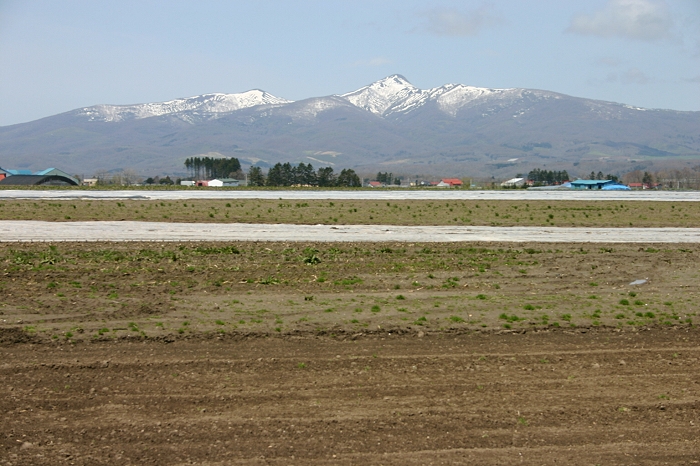
Rankoshi (蘭越町, Rankoshi-chō) is a town located in Shiribeshi Subprefecture, Hokkaido, Japan.
From the Wikipedia article Rankoshi, Hokkaido (this version), under CC BY-SA 4.0.
Things to do24


Niseko Tokyu Grand HIRAFU
Ski area · 14.3 km
Building in Kutchan, Hokkaido Prefecture, Japan

Niseko United
Ski area · 9.8 km
Ski resort complex on Mount Annupuri, Hokkaidō, Japan





12 more on the map.
Museums and landmarks2



Parks, trails and playgrounds5


Restaurants and cafes124


Honda Coffee shop
Cafe · Coffee Shop · 12.2 km
Coffee + Food
Mo-Su 08:00-15:00
Matsuri
Restaurant · Japanese · 8.4 km
Japanese"Izakaya" restaurant
Mo-Su 15:30-23:00

Farmer's kitchen PONPON
Restaurant · Pasta, Ramen, Pizza, Fish And Chips, Curry, Local, Friture · 11.9 km
1, ニセコ町
Mo-Su 11:30-14:00, 17:00-22:00
112 more on the map.
Where to stay153
Niseko Annupuri Guest House
Motel and hotel · 9.4 km
479-4, Niseko Town, Iwata-gun, Hokkaido Niseko 479-4
Churches and places of worship20
Shopping24
Gas and EV charging4
Schools, colleges and libraries9
Healthcare5
Map of Rankoshimachi
250 places. The map loads OpenStreetMap tiles when you open it.
Getting there and nearby towns
Sapporo Okadama Airport (OKD) is the nearest airport with scheduled flights listed in OpenStreetMap, 77 km away.
- Kutchan 19 km northeast, about 19 min by car
- Suttsu 26 km west, about 26 min by car
- Rusutsu 28 km east, about 28 min by car
- Date 46 km southeast, about 46 min by car
- Yoichi 48 km northeast, about 48 min by car
- Muroran 66 km southeast, about 1 h by car
- Noboribetsu 66 km southeast, about 1 h by car
- Yakumo 66 km south, about 1 h by car
- Sapporo 72 km northeast, about 1 h 15 min by car
- Shiraoi 72 km southeast, about 1 h 15 min by car
Drive times are estimates from straight-line distance, not routes.
Local news
Headlines from INDB.
Reviews, tips and questions
Loading what members have shared...
Sources and licences
- GeoNames (CC BY 4.0): population, coordinates, regions and time zone
- OpenStreetMap contributors (ODbL 1.0): places, airports, map data
- Wikidata (CC0 1.0): elevation, founding date, time zone, website, landmarks and historic places
- Wikimedia Commons (see each image): photos
- Wikipedia (CC BY-SA 4.0): overview and history text
Photo credits
- RankoshiTownOffice, Asasa198, CC BY-SA 3.0
- ニセコひらふ2, Wakimasa, CC BY-SA 3.0
- Mt RAIDEN 1, Highten31, CC BY-SA 3.0
- Mt CHISE 2, Highten31, CC BY-SA 3.0
- Mt-nisekoannupuri-summer, No machine-readable author provided. Oga~commonswiki assumed (based on copyright claims)., Public domain
- ニセコモイワ3, Wakimasa, CC BY-SA 3.0
- Mt NITO 1, Highten31, CC BY-SA 3.0
- Mt MEKUNNAI, Highten31, CC BY-SA 3.0
- Mt KONBU 2, Highten31, CC BY-SA 3.0
- Arishima Takeo Memorial Museum - Aug 25, 2016 (4), pinboke_planet, CC BY 2.0
- Niseko United Ski Resort in Hokkaido Japan, Alisterio1010, CC BY-SA 4.0
- RankoshiHS, 投稿者, CC BY-SA 3.0
- ニセコ東山スキー場2, Wakimasa, CC BY-SA 3.0
- Niseko-Annupuri YH 2011, Soica2001 ( talk ), Public domain
- Local station - panoramio, tsushima, CC BY 3.0
- Rankoshi 20231229203324 (53497777306), inunami, CC BY 2.0
- ISS048-E-50349 - View of Earth, Earth Science and Remote Sensing Unit , Lyndon B. Johnson Space Center, Public domain
- ISS054-E-62687 - View of Earth, Earth Science and Remote Sensing Unit, NASA Johnson Space Center, Public domain
- ISS033-E-19544 - View of Earth, Earth Science and Remote Sensing Unit , Lyndon B. Johnson Space Center, Public domain
- Niseko Yakushi spa roten, Soica2001 ( talk ), Public domain
- 薬師温泉神社 - panoramio, pakku, CC BY 3.0
- Niseko-Kogane spa 2011, Soica2001 ( talk ), Public domain
- Niseko-Kogane spa roten, Soica2001 ( talk ), Public domain
- Niseko-Kogane spa uchiyu, Soica2001 ( talk ), Public domain
- Michinoeki Rankoshi Furusato no Oka, Him56, CC BY-SA 3.0
- 鯉川温泉宿(Koikawa spa hotels) - panoramio, pakku, CC BY 3.0
- 鯉川の池 - panoramio, pakku, CC BY 3.0
- 甘露泉(Delicious water) - panoramio, pakku, CC BY 3.0
- さかもと公園③(Sakimoto Park③) - panoramio, pakku, CC BY 3.0
- さかもと公園②(Sakimoto Park②) - panoramio, pakku, CC BY 3.0
- さかもと公園①(Sakimoto Park①) - panoramio, pakku, CC BY 3.0
- Niimi Onsengai 2011, Soica2001 ( talk ), Public domain
- Hôtel room at one niseko resort towers in 2018, Lasthib, CC BY-SA 4.0
- One Niseko resort towers by night in 2018, Lasthib, CC BY-SA 3.0
- 煮えたぎる泥の沼(Mud springs) - panoramio, pakku, CC BY 3.0
- 大湯沼の秋景色 - panoramio, pakku, CC BY 3.0
- すすきと大湯沼 - panoramio, pakku, CC BY 3.0
- YugokoroTei roten, Soica2001 ( talk ), Public domain
- Niseko Kogen YH, Soica2001 ( talk ), Public domain
- O mapa da montanha! (6969763545), Cesar I. Martins from Jundiai, Brazil, CC BY 2.0


Page built November 5, 2026. Spotted a mistake? Tell us or suggest a place.