


Why visit Minato
Townapedia lists 37 museums and landmarks, 18 parks and trails, 80 places to eat, 3 places to stay and 5 attractions in and around town.
Highlights include Wakayama Medical University, Wakayama Castle Park Zoo, Wakayama Castle and Wakayama City Museum.
Weather in Minato
Forecast from MET Norway (CC BY 4.0). Full forecast
Things to do5
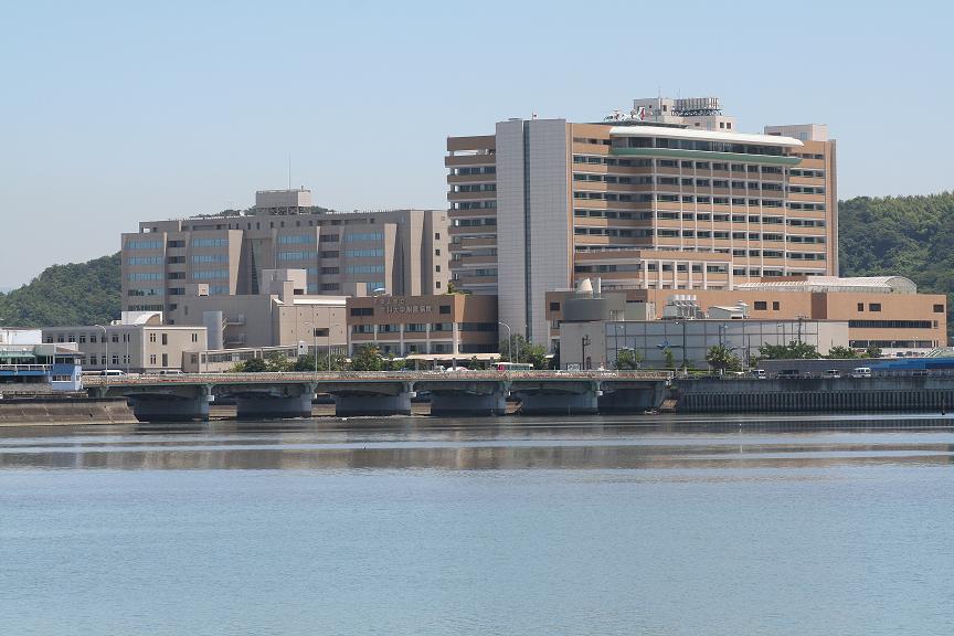
Wakayama Medical University
School · 4.1 km
Higher education institution in Wakayama Prefecture, Japan




Museums and landmarks37


The Museum of Modern Art Wakayama
Museum · 2.2 km
営業時間 9:30~17:00常設展の観覧料 一般:340円 大学生:230円車いす、授乳室、ベビーカー利用可能特別展なども開催されている。
4‐14, 和歌山市吹上



25 more on the map.
Parks, trails and playgrounds18



6 more on the map.
Restaurants and cafes80

幸龍創房
Restaurant · Noodle · 2.2 km
味噌ラーメン店。特に「とんこつ味噌ラーメン」と「海老味噌ラーメン」が看板メニューのお店です。
64, 和歌山市
11:00-20:00
サイカ屋マチカフェ29 Withフォレスト・ガン・プラ
Restaurant · Steak House · 2.2 km
ステーキ&カフェ ガンプラ
62 2階, 和歌山市


68 more on the map.
Where to stay3
Churches and places of worship27
Shopping13
Gas and EV charging5
Schools, colleges and libraries24
Healthcare20
Map of Minato
232 places. The map loads OpenStreetMap tiles when you open it.
Getting there and nearby towns
Kansai International Airport (KIX) is the nearest airport with scheduled flights listed in OpenStreetMap, 26 km away.
- Izumisano 27 km northeast, about 27 min by car
- Kishiwada 34 km northeast, about 34 min by car
- Kawachi-Nagano 47 km northeast, about 47 min by car
- Akashi 51 km north, about 51 min by car
- Kobe 53 km north, about 53 min by car
- Matsubara 54 km northeast, about 54 min by car
- Habikino 55 km northeast, about 55 min by car
- Amagasaki 61 km northeast, about 1 h by car
- Osaka 62 km northeast, about 1 h by car
- Kakogawachō-honmachi 68 km northwest, about 1 h 15 min by car
Drive times are estimates from straight-line distance, not routes.
Local news
Headlines from INDB.
Reviews, tips and questions
Loading what members have shared...
Sources and licences
- GeoNames (CC BY 4.0): population, coordinates, regions and time zone
- OpenStreetMap contributors (ODbL 1.0): places, airports, map data
- Wikidata (CC0 1.0): elevation, founding date, time zone, website, landmarks and historic places
- Wikimedia Commons (see each image): photos
Photo credits
- 121013 The museum of modern art, wakayama01s3, 663highland, CC BY-SA 4.0
- Wakayama Castle 2011 Kuruwa, Wak89, CC BY-SA 3.0
- 121013 Wakayama Prefectural Museum01s5, 663highland, CC BY-SA 4.0
- Wakayama Prefectural library, KishujiRapid, CC BY-SA 4.0
- Sankoji Temple, KishujiRapid, CC BY-SA 4.0
- Wakayama Park Zoo, KishujiRapid, CC BY-SA 4.0
- Wakayama Castle Nishinomaru Garden05st3200, 663highland, CC BY 2.5
- Wakayama University Special Support School, KishujiRapid, CC BY-SA 4.0
- Wakayama City Museum1, KENPEI, CC BY-SA 3.0
- Wakayama City Seiwa junior high school, KishujiRapid, CC BY-SA 4.0
- Wakayama Prefectural Hearing Special Support School, KishujiRapid, CC BY-SA 4.0
- Wakayama Prefectural Wakayama Commercial High School, KishujiRapid, CC BY-SA 4.0
- WakayamaTechnicalHighSchool, どんどん, CC BY-SA 3.0
- Hoonji (Wakayama, Wakayama) hondo, KENPEI, CC BY-SA 3.0
- Okayama-no-jishodo Wakayama01n4272, 663highland, CC BY 2.5
- Red Cross Wakayama Medical Center, アラツク, CC BY-SA 4.0
- Muryokoji Wakayama05n3200, 663highland, CC BY 2.5
- Sangoji, ふじろっく, CC BY 3.0
- Yanomiya jinja, Jerry fish tkc, CC BY-SA 3.0
- Honko-ji, Wakayama, 運動会プロテインパワー, CC BY-SA 4.0
- Wakayama-Medical-University, kinowaka, CC BY-SA 3.0
- 和歌山県立博物館, Mont Blank rich, CC0
- 和歌山城 天守閣(2024年), Mont Blank rich, CC0
- Wakayama prefectural Seirin high school, ja:user:Koutei, CC BY-SA 3.0
- Wakayama Saika Elementary School, hyolee2, CC BY-SA 4.0
- Muryokoji Wakayama01n3200, 663highland, CC BY 2.5
- 081204 The Museum of Modern Art, Wakayama, Japan01s3, 663highland, CC BY-SA 4.0
- Wakayama Park, Wakayama, Wakayama, Japan - panoramio, commando lando, CC BY-SA 3.0


Page built November 4, 2026. Spotted a mistake? Tell us or suggest a place.