


Mino, Japan
美濃市
Mino is a town of 20,749 people in Gifu, Japan, founded in April 1, 1954.
Why visit Mino
Townapedia lists 22 museums and landmarks, 69 parks and trails, 73 places to eat, 9 places to stay and 32 attractions in and around town.
Highlights include Chubu Gakuin University, Gifu University of Medical Science, Seki Sword Smith Museum and 三浦勝治美術館.
Weather in Mino
Forecast from MET Norway (CC BY 4.0). Full forecast
About Mino
Mino (美濃市, Mino-shi; Japanese pronunciation: [mʲí.nò̞, mʲì.nó̞(.ɕì)]) is a city located in Gifu, Japan. As of 31 December 2018, the city had an estimated population of 20,749 in 8149 households, and a population density of 180 persons per km2. The total area of the city was 117.01 square kilometres (45.18 sq mi). The city is renowned for traditional Japanese Mino washi paper and its streets, which are in the style of the early Edo period (1603–1868).
From the Wikipedia article Mino, Gifu (this version), under CC BY-SA 4.0.
Travel tips from other travellers: Mino on Wikivoyage (CC BY-SA 4.0).
Things to do32

Chubu Gakuin University
School · 8.5 km
Private university in Seki, Japan

Gifu University of Medical Science
School · 5.6 km
Higher education institution in Gifu Prefecture, Japan
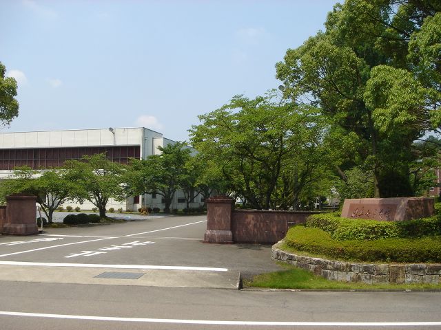
Gifu Women's University
School · 10.5 km
Private university in Gifu Prefecture, Japan



20 more on the map.
Museums and landmarks22


Mirokuji kanga ruins
Monument and historic site · 3.7 km
Archaeological site in Japan

Oibora-Asakura Sue Ware Kiln Site
Monument and historic site · 11.6 km
Archaeological site in Japan



10 more on the map.
Parks, trails and playgrounds69





57 more on the map.
Restaurants and cafes73



61 more on the map.
History
The area around Mino was part of the traditional Mino Province. During the Edo period, Kanamori Nagachika, the founder of Takayama Domain was granted permission by Tokugawa Ieyasu to build Oguriyama Castle on the Nagara River. Due to floods, the castle town was relocated in 1605 to higher ground. The area later became part of the holdings of Owari Domain under the Tokugawa shogunate. In the post-Meiji restoration cadastral reforms, Mugi District in Gifu Prefecture was created, and with the establishment of the modern municipalities system on July 1, 1889, the town of Kozuchi was created. In July 1909 Kozuchi was the site of a meteorite impact. The meteorite, which massed about 13.5 kg (30 lb), broke into pieces and fell across an area 13 miles (21 km) long and 5 miles (8.0 km) wide. The largest piece, about 4 kg (8.8 lb), fell in the village of Gokurakuji.
On April 1, 1911, Kozuchi was renamed Mino. Mino was raised to city status on April 1, 1954, with the merger of the town of Mino with the villages of Suhara, Shimomaki, Kamimaki, Oyada, Aimi, and Nakauchi.
From the History section of Mino, Gifu on Wikipedia, under CC BY-SA 4.0.
Where to stay9
Churches and places of worship80
Shopping30
Gas and EV charging12
Schools, colleges and libraries51
Healthcare16
Map of Mino
250 places. The map loads OpenStreetMap tiles when you open it.
Getting there and nearby towns
Gifu Airbase (QGU) is the nearest airport with scheduled flights listed in OpenStreetMap, 16 km away.
- Kakamigahara 14 km south, about 14 min by car
- Gifu 19 km southwest, about 19 min by car
- Kani 19 km southeast, about 19 min by car
- Ōguchi 21 km south, about 21 min by car
- Kōnan 23 km south, about 23 min by car
- Yaotsu 22 km east, about 22 min by car
- Mitake 24 km southeast, about 24 min by car
- Ichinomiya 28 km south, about 28 min by car
- Komaki 28 km south, about 28 min by car
- Iwakura 28 km south, about 28 min by car
Drive times are estimates from straight-line distance, not routes.
Local news
Headlines from INDB.
Reviews, tips and questions
Loading what members have shared...
Sources and licences
- GeoNames (CC BY 4.0): population, coordinates, regions and time zone
- OpenStreetMap contributors (ODbL 1.0): places, airports, map data
- Wikidata (CC0 1.0): elevation, founding date, time zone, website, landmarks and historic places
- Wikimedia Commons (see each image): photos
- Wikipedia (CC BY-SA 4.0): overview and history text
Photo credits
- (Other), Mino, Gifu Prefecture 501-3701, Japan - panoramio, blue.reaf, CC BY 3.0
- Bus stop in Mino Chiune 2017-02-8, さかきばらたいら, CC BY-SA 4.0
- Chiune bridge in Chiune-cho, Mino-city 2017-02-08, さかきばらたいら, CC BY-SA 4.0
- Meitetsu Mino Station Ruins 20131227, Rsa, CC BY-SA 3.0
- (Other), Mino, Gifu Prefecture 501-3701, Japan - panoramio - blue.reaf, blue.reaf, CC BY 3.0
- Nobuki Sugihara in Mino, Gifu-Prefecuture 20181013, 榊原平, CC BY-SA 4.0
- Machiya in Mino-machi, T.Kiya, CC BY-SA 2.0
- (Other), Mino, Gifu Prefecture 501-3701, Japan - panoramio (1), Fumihiko Ueno, CC BY 3.0
- (Other), Mino, Gifu Prefecture 501-3701, Japan - panoramio (2), Fumihiko Ueno, CC BY 3.0
- Mino Bridge, Yobito KAYANUMA, CC BY-SA 3.0
- Maeno, Mino, Gifu Prefecture 501-3716, Japan - panoramio, Fumihiko Ueno, CC BY 3.0
- Drone park and museum Mino, Mino, 2022, 大野 一将, CC BY-SA 4.0
- Ryushō-ji temple, Mino, 2023, 大野 一将, CC0
- Chubugakuin University Seki2007-1, Monami, CC BY-SA 3.0
- Gifu University of Medical Science02, Monami, CC BY-SA 3.0
- Gifu Womans Univ2, Monami at ja.wikipedia, CC BY-SA 3.0
- 弥勒寺官衙遺跡, Opqr, CC BY-SA 4.0
- Asakura Sue Ware Kiln Site, Gifu, 2019, 大野一将, CC BY-SA 4.0
- Enku Museum 4, Hide-sp, CC BY-SA 3.0
- Shogen Junior Collage ac (1), Asturio Cantabrio, CC BY-SA 4.0
- Aeon town mino, Opqr, CC BY-SA 4.0
- Feather Museum 1, Hide-sp, CC BY-SA 3.0
- Mago main building ac (2), Asturio Cantabrio, CC BY-SA 4.0
- Sakuta jinja, Opqr, CC BY-SA 4.0
- Gifu Family Park Adventure 01, Hide-sp, CC BY-SA 3.0
- Gifu Prefectural Museum 1, Hide-sp, CC BY-SA 3.0
- Gifu Prefectural Sekiuchi High School01, Monami, CC BY-SA 3.0
- Gifu Prefectural Seki High School01, Monami, CC BY-SA 3.0
- Shin-Chokokuji 1, Hide-sp, CC BY-SA 3.0
- Kasuga Shrine 01, Hide-sp, CC BY-SA 3.0
- Raisyoji hondo, Opqr, CC BY-SA 4.0
- Eisyoji, Opqr, CC BY-SA 4.0
- No-shu Sekisho Rest House 02, Hide-sp, CC BY-SA 3.0
- Mino Washi Akari Art Hall ac (1), Asturio Cantabrio, CC BY-SA 4.0
- Mino Municipal Hospital from Mount Kojo, Alpsdake, CC BY-SA 4.0
- Minami Roadside Stn2008-1, Monami, CC BY-SA 3.0
- Seki City Culture Hall 2, Hide-sp, CC BY-SA 3.0
- Seki Sword Tradition Museum 1, Hide-sp, CC BY-SA 3.0
- Seitai-ji temple, Mino, 2018, 大野 一将, CC BY-SA 4.0
- Hōshō-in temple, Mino, 2016, 大野 一将, CC BY-SA 4.0
- Bairyū-ji temple, Seki, 2017, 大野 一将, CC BY-SA 4.0
- Eri-ji temple, Seki, 2017, 大野 一将, CC BY-SA 4.0
- Mino City Nakauchi Elementary School, Alpsdake, CC BY-SA 4.0
- Daiun-ji temple, Seki, 2017, 大野 一将, CC BY-SA 4.0
- Seki City Shimouchi Junior high school, Alpsdake, CC BY-SA 4.0
- Jōin-ji temple, Gifu, 2018, 大野 一将, CC BY-SA 4.0
- Former Imai House and Mino Museum ac (1), Asturio Cantabrio, CC BY-SA 4.0
- Igi-jinja ac (1), Asturio Cantabrio, CC BY-SA 4.0
- Gifu academy, 森林文化アカデミー, CC BY-SA 4.0
- Gifu City Miwa Junior high school, Alpsdake, CC BY-SA 4.0
- Minokamo City Ibuka Elementary School ac, Asturio Cantabrio, CC BY-SA 4.0
- Gifu Miwakita Elementary School, hyolee2, CC BY-SA 4.0
- 三浦勝治美術館, へぼ飯, CC0


Page built November 4, 2026. Spotted a mistake? Tell us or suggest a place.