



Nagawa, Japan
長和町
Nagawa is a town of 6,088 people in Nagano, Japan, founded in October 1, 2005.
Why visit Nagawa
Townapedia lists 35 museums and landmarks, 20 parks and trails, 31 places to eat, 24 places to stay and 10 attractions in and around town.
Highlights include 独鈷山, Tobayama Cave, 佐久市立天来記念館 and Tōmi Tyūō Park.
Weather in Nagawa
Forecast from MET Norway (CC BY 4.0). Full forecast
About Nagawa
Nagawa (長和町, Nagawa-machi) is a town located in Nagano Prefecture, Japan. As of 1 April 2019, the town had an estimated population of 6,088 in 2,650 households, and a population density of 32.6 persons per km2. The total area of the town is 183.86 square kilometres (70.99 sq mi).
From the Wikipedia article Nagawa, Nagano (this version), under CC BY-SA 4.0.
Things to do10




Museums and landmarks35

Tobayama Cave
Monument and historic site · 1.9 km
Archaeological site




23 more on the map.
Parks, trails and playgrounds20




8 more on the map.
Restaurants and cafes31


19 more on the map.
History
The area of present-day Nagawa was part of ancient Shinano Province. The area was part of the holdings of Ueda Domain during the Edo period, and had two stations on the Nakasendō highway connecting Edo with Kyoto: Nagakubo-shuku and Wada-shuku. The modern town of Nagakubo-shinmachi was established on April 1, 1889, by the establishment of the municipalities system and was renamed Nagato on September 1, 1956. The town of Nagawa was formed by the merger of Nagato with the village of Wada (also from Chiisagata District).
From the History section of Nagawa, Nagano on Wikipedia, under CC BY-SA 4.0.
Where to stay24
Churches and places of worship17
Shopping9
Gas and EV charging9
Schools, colleges and libraries23
Healthcare16
Map of Nagawa
194 places. The map loads OpenStreetMap tiles when you open it.
Getting there and nearby towns
Shinshu-Matsumoto Airport (MMJ) is the nearest airport with scheduled flights listed in OpenStreetMap, 32 km away.
- Ueda 14 km north, about 14 min by car
- Tōmi 13 km northeast, about 13 min by car
- Aoki 14 km northwest, about 14 min by car
- Komoro 17 km east, about 17 min by car
- Sakaki 21 km north, about 21 min by car
- Saku 22 km east, about 22 min by car
- Miyota 24 km east, about 24 min by car
- Matsumoto 26 km west, about 26 min by car
- Shimosuwa 28 km southwest, about 28 min by car
- Suwa 30 km southwest, about 30 min by car
Drive times are estimates from straight-line distance, not routes.
Local news
Headlines from INDB.
Reviews, tips and questions
Loading what members have shared...
Sources and licences
- GeoNames (CC BY 4.0): population, coordinates, regions and time zone
- OpenStreetMap contributors (ODbL 1.0): places, airports, map data
- Wikidata (CC0 1.0): elevation, founding date, time zone, website, landmarks and historic places
- Wikimedia Commons (see each image): photos
- Wikipedia (CC BY-SA 4.0): overview and history text
Photo credits
- Nagawa town Nagato branch office, photo: Qurren ( talk ) Taken with Canon IXY 10S (Digital IXUS 210), CC BY-SA 3.0
- Tobayama Cave, MChew, CC BY-SA 3.0
- 東御中央公園20220522 03, Komoro no kaze, CC BY-SA 4.0
- 黄葉の前山寺 A Pagoda and Autumn Leaves (8172177740), Yuya Sekiguchi, CC BY 2.0
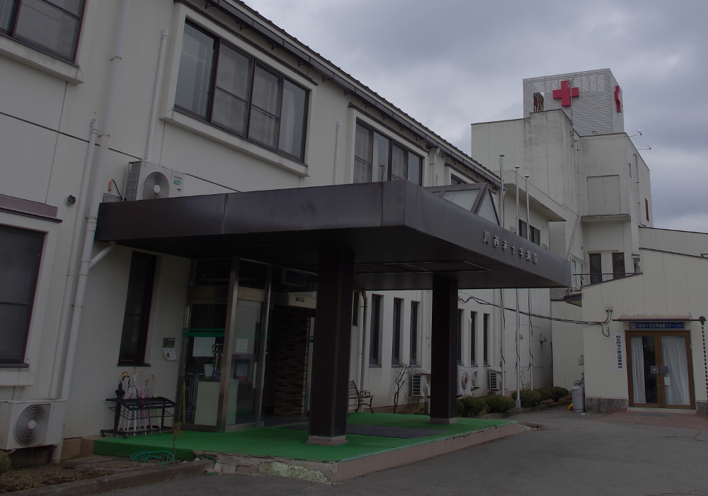
- Kawanishi Red Cross Hospital, ぷんすけ, CC BY-SA 4.0
- 260828 Mugonkan Ueda Nagano pref Japan01o, 663highland, CC BY-SA 4.0
- Ikushimatarushima-jinja keidai, Saigen Jiro, CC0
- Chuzen-ji, Ueda, ぷんすけ, CC BY-SA 4.0
- Tenrai Museum, photo: Qurren ( talk ) Taken with Canon IXY 10S (Digital IXUS 210), CC BY-SA 3.0
- Ueda Women's Junior College, Abasaa, Public domain
- Sakura International High School, Abasaa, Public domain
- Mt.Tokko, Yama0904, CC BY-SA 4.0
- R152-052, Puchi-masashi, CC BY-SA 4.0
- Takeshi Public Hall, photo: Qurren ( talk ) Taken with Canon IXY 430F (Digital IXUS 245 HS), CC BY-SA 3.0
- Ueda city Takeshi regional autonomy center, photo: Qurren ( talk ) Taken with Canon IXY 430F (Digital IXUS 245 HS), CC BY-SA 3.0
- Takeshi Tomoshibi Museum 1, photo: Qurren ( talk ) Taken with Canon IXY 430F (Digital IXUS 245 HS), CC BY-SA 3.0
- Takeshi Tomoshibi Museum 7, photo: Qurren ( talk ) Taken with Canon IXY 430F (Digital IXUS 245 HS), CC BY-SA 3.0
- Takeshi Tomoshibi Museum 8, photo: Qurren ( talk ) Taken with Canon IXY 430F (Digital IXUS 245 HS), CC BY-SA 3.0
- Takeshi Tomoshibi Museum 6, photo: Qurren ( talk ) Taken with Canon IXY 430F (Digital IXUS 245 HS), CC BY-SA 3.0
- Takeshi Tomoshibi Museum 3, photo: Qurren ( talk ) Taken with Canon IXY 430F (Digital IXUS 245 HS), CC BY-SA 3.0
- Takeshi Tomoshibi Museum 2, photo: Qurren ( talk ) Taken with Canon IXY 430F (Digital IXUS 245 HS), CC BY-SA 3.0
- Takeshi Tomoshibi Museum 4, photo: Qurren ( talk ) Taken with Canon IXY 430F (Digital IXUS 245 HS), CC BY-SA 3.0
- Takeshi Tomoshibi Museum 5, photo: Qurren ( talk ) Taken with Canon IXY 430F (Digital IXUS 245 HS), CC BY-SA 3.0
- Higashiuchi no Shidare Enoki. of the Maruko Folk Museum. E, さかおり, CC BY-SA 4.0
- Higashiuchi no Shidare Enoki. of the Maruko Folk Museum. B, さかおり, CC BY-SA 4.0
- Higashiuchi no Shidare Enoki. of the Maruko Folk Museum. D, さかおり, CC BY-SA 4.0
- Higashiuchi no Shidare Enoki. of the Maruko Folk Museum. A, さかおり, CC BY-SA 4.0
- Higashiuchi no Shidare Enoki. of the Maruko Folk Museum. C, さかおり, CC BY-SA 4.0
- Higashiuchi no Shidare Enoki. of the Enomi no Ie community center. Southern side, さかおり, CC BY-SA 4.0
- Higashiuchi no Shidare Enoki. of the Enomi no Ie community center. Northern side, さかおり, CC BY-SA 4.0
- 立科町蟹窪バス停 - panoramio, w-kei, CC BY 3.0
- 上田市下和子の二十三夜尊, Komoro no kaze, CC BY-SA 4.0
- NagakuboJuku-NakasendoRoadView, Bryanmackinnon, CC BY 4.0
- NagakuboJuku-HonjinGate, Bryanmackinnon, CC BY 4.0
- Watchtower at Maruko Castle, Tmv, CC BY-SA 4.0
- R142-190, Puchi-masashi, CC BY-SA 4.0
- ISS045-E-174584 - View of Earth, Earth Science and Remote Sensing Unit , Lyndon B. Johnson Space Center, Public domain
- ISS045-E-174582 - View of Earth, Earth Science and Remote Sensing Unit , Lyndon B. Johnson Space Center, Public domain
- ISS045-E-77423 - View of Earth, Earth Science and Remote Sensing Unit , Lyndon B. Johnson Space Center, Public domain
- ISS045-E-174586 - View of Earth, Earth Science and Remote Sensing Unit , Lyndon B. Johnson Space Center, Public domain


Page built November 5, 2026. Spotted a mistake? Tell us or suggest a place.