


Miyota, Japan
御代田町
Miyota is a town of 15,562 people in Nagano, Japan, founded in September 30, 1956.
Why visit Miyota
Townapedia lists 31 museums and landmarks, 13 parks and trails, 30 places to eat, 12 places to stay and 7 attractions in and around town.
Highlights include Saku Ski Garden Parada, Saku University, Saku Children's Science Dome for the Future and Sezon Museum of Modern Art.
Weather in Miyota
Forecast from MET Norway (CC BY 4.0). Full forecast
About Miyota
Miyota (御代田町, Miyota-machi) is a town located in Nagano Prefecture, Japan. As of 1 April 2019, the town had an estimated population of 15,562 in 6897 households, and a population density of 260 persons per km2. The total area of the town is 58.79 square kilometres (22.70 sq mi).
From the Wikipedia article Miyota, Nagano (this version), under CC BY-SA 4.0.
Things to do7


Saku University
School · 9.0 km
Higher education institution in Nagano Prefecture, Japan



Museums and landmarks31

Saku Children's Science Dome for the Future
Museum · 7.9 km
Science museum in Nagano, Japan

Sezon Museum of Modern Art
Museum · 7.1 km
Art museum in Karuizawa, Nagano, Japan




19 more on the map.
Parks, trails and playgrounds13






1 more on the map.
Restaurants and cafes30


海山亭いっちょう
Restaurant · Japanese · 6.4 km
Mo-Th,Su 11:00-22:00; PH -1 day,Fr-Sa 11:00-23:00
麺賊 夢我夢中
Restaurant · Ramen, Noodle · 5.9 km
Tu-Sa 11:00-15:00,17:00-21:00; Su 11:00-15:00
18 more on the map.
History
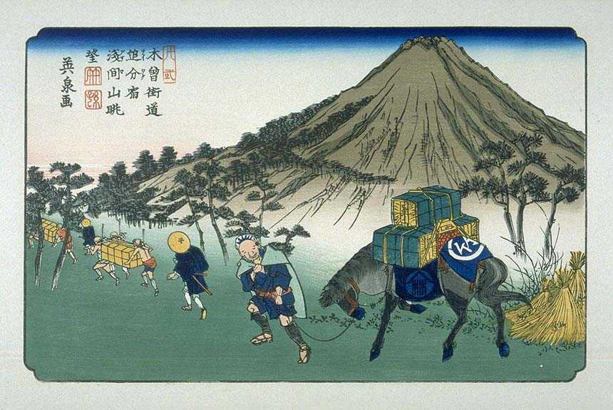
The area of present-day Miyota was part of ancient Shinano Province, and was the site of the Battle of Odaihara during the Sengoku period. As Otai-shuku, it developed as a post station on the Nakasendo highway connecting Edo with Kyoto during the Edo period. The village of Miyota was created with the establishment of the modern municipalities system on April 1, 1889. It merged with the villages of Onuma and Goka to form the town of Miyota on September 30, 1956.
From the History section of Miyota, Nagano on Wikipedia, under CC BY-SA 4.0.
Where to stay12
Churches and places of worship8
Shopping11
Gas and EV charging2
Schools, colleges and libraries8
Healthcare5
Map of Miyota
127 places. The map loads OpenStreetMap tiles when you open it.
Getting there and nearby towns
Shinshu-Matsumoto Airport (MMJ) is the nearest airport with scheduled flights listed in OpenStreetMap, 56 km away.
- Komoro 7 km west, about 7 min by car
- Karuizawa 11 km east, about 11 min by car
- Saku 14 km south, about 14 min by car
- Tōmi 14 km west, about 14 min by car
- Ueda 22 km west, about 22 min by car
- Sakaki 33 km northwest, about 33 min by car
- Annaka 34 km east, about 34 min by car
- Tomioka 36 km east, about 36 min by car
- Suzaka 39 km northwest, about 39 min by car
- Takasaki 45 km east, about 45 min by car
Drive times are estimates from straight-line distance, not routes.
Local news
Headlines from INDB.
Reviews, tips and questions
Loading what members have shared...
Sources and licences
- GeoNames (CC BY 4.0): population, coordinates, regions and time zone
- OpenStreetMap contributors (ODbL 1.0): places, airports, map data
- Wikidata (CC0 1.0): elevation, founding date, time zone, website, landmarks and historic places
- Wikimedia Commons (see each image): photos
- Wikipedia (CC BY-SA 4.0): overview and history text
Photo credits
- Miyota town office 2019-03, photo: Qurren ( talk ) Taken with Canon PowerShot G9 X, CC BY-SA 4.0
- Miyota town office pot still monument 1, photo: Qurren ( talk ) Taken with Canon PowerShot G9 X, CC BY-SA 4.0
- Miyota town office pot still monument 2, photo: Qurren ( talk ) Taken with Canon PowerShot G9 X, CC BY-SA 4.0
- Miyota town office 1, photo: Qurren ( talk ) Taken with Canon IXY 10S (Digital IXUS 210), CC BY-SA 3.0
- Shinano-railway-Miyota-station-building-20110908-064844, LERK, CC BY-SA 4.0
- Saku University, Abasaa, Public domain
- Saku Children's Science Dome, 妖精書士, CC BY-SA 3.0
- 220930 Sezon Museum of Modern Art Karuizawa Nagano pref Japan04s3, 663highland, CC BY-SA 4.0
- Kisokaido20 Oiwake, Keisai Eisen, Public domain
- PARADA Minami, 苗場山, CC BY-SA 3.0
- Shinraku-ji (Miyota, Nagano) hondo, photo: Qurren ( talk ) Taken with Canon PowerShot G9 X, CC BY-SA 4.0
- 160730 Tatsuo Hori literature Memorial Karuizawa Nagano pref Japan01n, 663highland, CC BY 2.5
- 160729 Le Vent Museum of Contemporary Art Karuizawa Nagano pref Japan02s3, 663highland, CC BY-SA 4.0
- Sesso Park ground, photo: Qurren ( talk ) Taken with Panasonic Lumix DMC-FX35, CC BY-SA 4.0
- 追分郷土館, Komoro no kaze, CC BY-SA 4.0
- Ecole Miyota exterior ac (2), Asturio Cantabrio, CC BY-SA 4.0
- 160730 Oiwake-shuku Karuizawa Nagano pref Japan01n, 663highland, CC BY 2.5
- Miyota Town Library childrens corner ac (1), Asturio Cantabrio, CC BY-SA 4.0
- Nigori River (Mitsuishi, Oiwake, Karuizawa), photo: Qurren ( talk ) Taken with Canon IXY 10S, CC BY-SA 3.0
- 三ツ石公民館, Komoro no kaze, CC BY-SA 4.0
- 三ツ石公民館敷地内の警鐘楼, Komoro no kaze, CC BY-SA 4.0
- 三ツ石公民館敷地内の牛頭観世音, Komoro no kaze, CC BY-SA 4.0
- 県営千ヶ滝農業水利改良事業竣工記念碑, Komoro no kaze, CC BY-SA 4.0
- 千ヶ滝湯川用水温水路(御影用水温水路) 01, Komoro no kaze, CC BY-SA 4.0
- 浅間山 - panoramio (1), Yobito KAYANUMA, CC BY-SA 3.0
- 御代田町役場庁舎 20190222, Komoro no kaze, CC BY-SA 4.0
- 八加倉神社, Komoro no kaze, CC BY-SA 4.0
- 旧メルシャンウイスキー蒸留所の初代ポットスチル(蒸留器), Komoro no kaze, CC BY-SA 4.0
- Former Musée d'art Mercian Karuizawa 2019-03, photo: Qurren ( talk ) Taken with Canon PowerShot G9 X, CC BY-SA 4.0
- まなびの館エコールみよた, Komoro no kaze, CC BY-SA 4.0
- CKT7513-C2-6 Mikage Canal warming channel, Geospatial Information Authority of Japan Retouch: Qurren ( talk ), CC BY 4.0
- 160730 Wakasare-no-hi Oiwakejuku Karuizawa Japan03s3, 663highland, CC BY 2.5
- 160730 Wakasare-no-hi Oiwakejuku Karuizawa Japan04s3, 663highland, CC BY 2.5
- 160730 Wakasare-no-hi Oiwakejuku Karuizawa Japan02s3, 663highland, CC BY 2.5
- 160730 Wakasare-no-hi Oiwakejuku Karuizawa Japan01s3, 663highland, CC BY 2.5
- 分去れの碑 - panoramio, Yobito KAYANUMA, CC BY-SA 3.0
- 160730 Nakasendo Oiwake Community Center Karuizawa Japan02s3, 663highland, CC BY 2.5
- 160730 Nakasendo Oiwake Community Center Karuizawa Japan01s3, 663highland, CC BY 2.5
- 160730 Oiwake-chuo Park and Suwa-jinja Karuizawa Japan02s3, 663highland, CC BY 2.5
- 160730 Oiwake-chuo Park and Suwa-jinja Karuizawa Japan03s3, 663highland, CC BY 2.5


Page built November 5, 2026. Spotted a mistake? Tell us or suggest a place.