


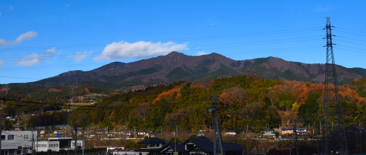
Nakanojō, Japan
中之条町
Nakanojō is a town of 15,571 people in Gunma, Japan, founded in April 1, 1889.
Why visit Nakanojō
Townapedia lists 41 museums and landmarks, 44 parks and trails, 84 places to eat, 55 places to stay and 36 attractions in and around town.
Highlights include Ikaho Green Bokujō, Mount Komochi, Lock Heart Castle and Kuroimine Site.
Weather in Nakanojō
Forecast from MET Norway (CC BY 4.0). Full forecast
About Nakanojō
Nakanojō (中之条町, Nakanojō-machi) is a town located in Gunma Prefecture, Japan. As of 1 August 2020, the town had an estimated population of 15,571 in 6,737 households, and a population density of 35 persons per km2. The total area of the town is 439.28 square kilometres (169.61 sq mi).
From the Wikipedia article Nakanojō, Gunma (this version), under CC BY-SA 4.0.
Travel tips from other travellers: Nakanojō on Wikivoyage (CC BY-SA 4.0).
Things to do36




農産物直売所てんぐ
Farm and orchard · 9.6 km
Apr-Nov: 09:00-18:00; Dec-Mar: 09:00-17:00

24 more on the map.
Museums and landmarks41

Kuroimine Site
Monument and historic site · 15.8 km
Archaeological site in Japan

Yaze Site
Monument and historic site · 17.5 km
Archaeological site in Minakami, Gunma, Japan




Bokusui Poetry Monument “Travel in the Wilderness”
Monument and historic site · 14.1 km
29 more on the map.
Parks, trails and playgrounds44



32 more on the map.
Restaurants and cafes84


Kashiwaya Cafe
Cafe · Cake, Coffee Shop, Curry, Japanese · 12.2 km
Th-Tu 10:00-05:00
72 more on the map.
History
During the Edo period, the area around Nakanojō was part of the hatamoto-administered territory within Kōzuke Province.
With the creation of the modern municipalities system after the Meiji Restoration on April 1, 1889, the town of Nakanojō was created within Agatsuma District of Gunma Prefecture. The villages of Isama, Sawada and Nakuta merged into Nakanojō on April 15, 1955.
On March 28, 2010, the village of Kuni, also from Agatsuma District, merged into Nakanojō.
From the History section of Nakanojō, Gunma on Wikipedia, under CC BY-SA 4.0.
Where to stay55
Churches and places of worship17
Shopping14
Gas and EV charging13
Schools, colleges and libraries31
Healthcare8
Map of Nakanojō
250 places. The map loads OpenStreetMap tiles when you open it.
Getting there and nearby towns
Shinshu-Matsumoto Airport (MMJ) is the nearest airport with scheduled flights listed in OpenStreetMap, 95 km away.
- Numata 19 km east, about 19 min by car
- Takasaki 32 km southeast, about 32 min by car
- Tomioka 37 km south, about 37 min by car
- Yoshii 40 km south, about 40 min by car
- Ōmamachō-ōmama 43 km southeast, about 43 min by car
- Kiryū 49 km southeast, about 49 min by car
- Ueda 54 km west, about 54 min by car
- Ōta 57 km southeast, about 57 min by car
- Ashikaga 61 km southeast, about 1 h by car
- Kumagaya 70 km southeast, about 1 h 15 min by car
Drive times are estimates from straight-line distance, not routes.
Local news
Headlines from INDB.
Reviews, tips and questions
Loading what members have shared...
Sources and licences
- GeoNames (CC BY 4.0): population, coordinates, regions and time zone
- OpenStreetMap contributors (ODbL 1.0): places, airports, map data
- Wikidata (CC0 1.0): elevation, founding date, time zone, website, landmarks and historic places
- Wikimedia Commons (see each image): photos
- Wikipedia (CC BY-SA 4.0): overview and history text
Photo credits
- Nakanojo town-office, Bakkai at Japanese Wikipedia, CC BY-SA 3.0
- Kuroimine Site, MChew, CC BY-SA 4.0
- Yaze site reconstructed pit dwelling, MChew, CC BY-SA 4.0
- Haruna Honden, Unkei6hokusai4, CC BY-SA 3.0
- Marble Village Lockheart Castle, Lockheart Castle front exterior, Mukasora ( talk ), CC BY-SA 3.0
- Komochiyama-gunma-1200, 㭍月例祭, CC BY-SA 3.0
- Mount Iwabitsu 2018-09 2, photo: Qurren ( talk ) Taken with Canon PowerShot G9 X, CC BY-SA 4.0
- Ikaho-jinja 01, matsukaz, CC BY 2.1 jp
- Michinoeki Agatsuma-kyo, アラツク, CC BY-SA 4.0
- Takehisa Yumeji Ikaho Art Museum, Abasaa, Public domain
- 伊香保グリーン牧場 - panoramio, ger531, CC BY 3.0
- Haramuseumarc, Sss g00, CC BY-SA 4.0
- Gunma Prefectural Agatsuma Chuo HS, Nyao148, CC BY-SA 4.0
- Kawashima-kawasukune-jinja, Taisuke.Kasuya, CC BY-SA 4.0
- Hakojima-kawasukune-jinja, Taisuke.Kasuya, CC BY-SA 4.0
- Nakanojo town Nakanojo elem-sch, Bakkai, CC BY-SA 3.0
- Ikaho Onsen 03, Yones, Public domain
- Nakanojo Museum of Folk and History 2, photo: Qurren ( talk ) Taken with Canon PowerShot G9 X, CC BY-SA 4.0
- Agatsuma-jinja (Nakanojo, Gunma) otorii, photo: Qurren ( talk ) Taken with Canon PowerShot G9 X, CC BY-SA 4.0
- つむじ 中之条伊勢町 2013 (9996398524), Kentaro Ohno from Tokyo, Japan, CC BY 2.0
- Nakanojo Summary Court, Suikotei, CC BY 4.0
- Shiroiya, Suikotei, CC BY 4.0
- Nakanojo Museum of Folk and History 1, photo: Qurren ( talk ) Taken with Canon PowerShot G9 X, CC BY-SA 4.0
- Nakanojo Museum of Folk and History 3, photo: Qurren ( talk ) Taken with Canon PowerShot G9 X, CC BY-SA 4.0
- Nakanojo Museum of Folk and History 20250927, Suikotei, CC BY 4.0
- 近藤公園 中之条伊勢町エリア 2013 (9995896414), Kentaro Ohno from Tokyo, Japan, CC BY 2.0
- Machida-ke Jutaku Shuoku, Suikotei, CC BY 4.0
- Toukee Ishi Volcanic rock, さかおり, CC BY-SA 4.0
- 忠霊塔(中之条町), Komoro no kaze, CC BY-SA 4.0
- Rinsho-ji (Nakanojo, Gunma) Orokamono-no-hi, photo: Qurren ( talk ) Taken with Canon PowerShot G9 X, CC BY-SA 4.0
- Rinsho-ji (Nakanojo, Gunma) sanmon hengaku, photo: Qurren ( talk ) Taken with Canon PowerShot G9 X, CC BY-SA 4.0
- Rinsho-ji (Nakanojo, Gunma) sanmon, photo: Qurren ( talk ) Taken with Canon PowerShot G9 X, CC BY-SA 4.0
- Rinsho-ji (Nakanojo, Gunma) hondo 2, photo: Qurren ( talk ) Taken with Canon PowerShot G9 X, CC BY-SA 4.0
- Rinsho-ji (Nakanojo, Gunma) kannondo, photo: Qurren ( talk ) Taken with Canon PowerShot G9 X, CC BY-SA 4.0
- Rinsho-ji (Nakanojo, Gunma) hondo 1, photo: Qurren ( talk ) Taken with Canon PowerShot G9 X, CC BY-SA 4.0
- 林昌寺 中之条伊勢町エリア 2013(9992034766), Kentaro Ohno from Tokyo, Japan, CC BY 2.0
- 中之条伊勢町エリア 2013 (9996538476), Kentaro Ohno from Tokyo, Japan, CC BY 2.0
- 中之条駅 - panoramio (2), くろふね, CC BY 3.0
- ほづみとんかつ店 - panoramio, くろふね, CC BY 3.0
- 中之条駅 - panoramio (4), くろふね, CC BY 3.0


Page built November 4, 2026. Spotted a mistake? Tell us or suggest a place.