


Namie, Japan
浪江町
Namie is a town of 21,866 people in Fukushima, Japan, founded in April 1, 1889.
Why visit Namie
Townapedia lists 76 museums and landmarks, 13 parks and trails, 54 places to eat, 8 places to stay and 7 attractions in and around town.
Highlights include Kiyotosaku Cave Tombs and The Great East Japan Earthquake and Nuclear Disaster Memorial Museum.
Weather in Namie
Forecast from MET Norway (CC BY 4.0). Full forecast
About Namie
Namie (浪江町, Namie-machi) is a town located in Fukushima Prefecture, Japan. As of 29 February 2020 the town has a population of 1,238 in 794 households, although the official registered population was 17,114 in 6853 households. The total area of the town is 223.14 square kilometres (86.15 sq mi).
From the Wikipedia article Namie, Fukushima (this version), under CC BY-SA 4.0.
Things to do7


Museums and landmarks76
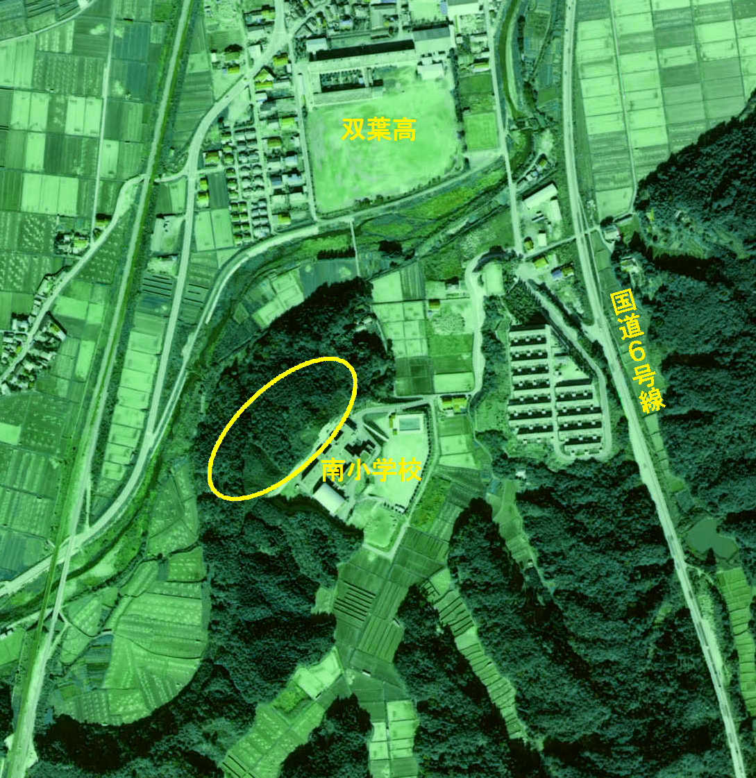
Kiyotosaku Cave Tombs
Monument and historic site · 4.6 km
Archaeological site in Futaba, Japan

The Great East Japan Earthquake and Nuclear Disaster Memorial Museum
Museum · 3.7 km
09:00-17:00; Tu off; Dec 29-Jan 03 off

Urajiri Shell Mound
Monument and historic site · 4.7 km
Archaeological site in Minamisōma, Japan
Yokodaidō Steel Production Site
Monument and historic site · 9.3 km
Archaeological site in Minamisōma, Japan

Site of Fukushima nuclear disaster
Monument and historic site · 7.4 km


Fukushima March 11 Memorial Park National Memorial Hall
Monument and historic site · 3.6 km
A monument in remembrance and mourning of those who were lost in the Great East Japan Earthquake of 2011-03-11.

64 more on the map.
Parks, trails and playgrounds13



1 more on the map.
Restaurants and cafes54






キッチン Grandma
Restaurant · 1.2 km
Mo-Tu, Th-Fr 11:00-14:30; We, Sa, Su off
42 more on the map.
History
The area of present-day Namie was part of Mutsu Province. The remains of Kofun period burial mounds have been found in the area. During the Nara period, it was the center of ancient Futaba District within Iwaki Province During the Edo period, it was part of Sōma Domain, which was ruled by the Sōma clan until the Meiji restoration. On April 1, 1889, the village of Namie was created within Naraha District, Fukushima with the establishment of the modern municipalities system. Naraha District became Futaba District in April 1896. Namie was raised to town status on March 1, 1900. The town expanded on May 1, 1956 by annexing the neighboring villages of Obori, Karino and Tsushima.
From the History section of Namie, Fukushima on Wikipedia, under CC BY-SA 4.0.
Where to stay8
Churches and places of worship26
Shopping16
Gas and EV charging8
Schools, colleges and libraries13
Healthcare2
Map of Namie
223 places. The map loads OpenStreetMap tiles when you open it.
Getting there and nearby towns
Fukushima Airport (FKS) is the nearest airport with scheduled flights listed in OpenStreetMap, 58 km away.
- Kumamachi 11 km south, about 11 min by car
- Minami-Sōma 16 km north, about 16 min by car
- Yanagawamachi-saiwaichō 54 km northwest, about 54 min by car
- Kōriyama 55 km west, about 55 min by car
- Fukushima 56 km northwest, about 56 min by car
- Sukagawa 59 km west, about 59 min by car
- Yabuki 68 km southwest, about 1 h 15 min by car
- Tanagura 74 km southwest, about 1 h 15 min by car
- Sendai 88 km north, about 1 h 30 min by car
- Takahagi 89 km south, about 1 h 30 min by car
Drive times are estimates from straight-line distance, not routes.
Local news
Headlines from INDB.
Reviews, tips and questions
Loading what members have shared...
Sources and licences
- GeoNames (CC BY 4.0): population, coordinates, regions and time zone
- OpenStreetMap contributors (ODbL 1.0): places, airports, map data
- Wikidata (CC0 1.0): elevation, founding date, time zone, website, landmarks and historic places
- Wikimedia Commons (see each image): photos
- Wikipedia (CC BY-SA 4.0): overview and history text
Photo credits
- Namietownoffice, Kuha455405, CC BY-SA 3.0
- Potato namie branch 01, Higa4, CC0
- AEON Namie branch 01, Higa4, CC0
- Unagi Daibō (Namie, Fukushima) 01, Higa4, CC0
- Shōfuku (Namie, Fukushima) 01, Higa4, CC0
- Ajikura Namie branch 01, Higa4, CC0
- Futaba police station Namie branch 03, Higa4, CC0
- Futaba police station Namie branch 02, Higa4, CC0
- Futaba police station Namie branch 01, Higa4, CC0
- Hotel Namie (Namie, Fukushima) 01, Higa4, CC0
- Hotel Namie (Namie, Fukushima) 02, Higa4, CC0
- Namie fire station 02, Higa4, CC0
- Namie fire station 03, Higa4, CC0
- Namie-machi town office 04, Higa4, CC0
- Namie fire station 01, Higa4, CC0
- Namie-machi town office 03, Higa4, CC0
- Machizukuri Namie 01, Higa4, CC0
- Namie-machi town office 02, Higa4, CC0
- Namie-machi town office 01, Higa4, CC0
- Namie-machi town office 08, Higa4, CC0
- Sunshine Namie 01, Higa4, CC0
- Potato namie branch 02, Higa4, CC0
- Sunshine Namie 02, Higa4, CC0
- Namie Municipal Namie Sosei Elementary and Junior High School, Yasu ( talk ), CC BY-SA 3.0
- Tōhō bank namie branch 01, Higa4, CC0
- Tōhō bank namie branch 02, Higa4, CC0
- Namie-machi town office 05, Higa4, CC0
- Unagi Daibō (Namie, Fukushima) 02, Higa4, CC0
- Namie-machi town office 06, Higa4, CC0
- Namie Post Office, Kuha455405, CC BY-SA 3.0
- Namie-machi town office 07, Higa4, CC0
- Namie Clinic 01, Higa4, CC0
- Appearance of Fukushima I Nuclear Power Plant Unit 3 after the explosion 20110315, 資源エネルギー庁, CC BY 4.0
- Haiden of Hiwashi-jinja shrine in Minamisouma city, Bachstelze, CC BY-SA 3.0
- Shōsai-ji (Namie, Fukushima) 01, Higa4, CC0
- Yamazumi-jinja shrine, Bachstelze, CC BY-SA 3.0
- 東日本大震災・原子力災害伝承館, 特急スカイツリートレイン, CC BY-SA 4.0
- Jōfuku-ji (Namie, Fukushima) 02, Higa4, CC0
- Hotel Futabanomori (Namie, Fukushima) 03, Higa4, CC0
- Yakiniku Bar DON (Namie, Fukushima) 02, Higa4, CC0
- Tonkatsu Shiga (Namie, Fukushima) 01, Higa4, CC0
- Namie Niku Shokudō 01, Higa4, CC0
- Joyeuxstro Namie 01, Higa4, CC0
- Namie-jinja (Fukushima) 03, Higa4, CC0
- Kunitama-jinja (Namie, Fukushima) 01, Higa4, CC0
- Shohatsu-jinja (Namie, Fukushima) 01, Higa4, CC0
- Atago-dō (Namie, Fukushima) 01, Higa4, CC0
- Kiyotosaku aero 1975, 国土交通省, Attribution
- Daihizan Sekibutsu, MChew, CC BY-SA 4.0


Page built November 4, 2026. Spotted a mistake? Tell us or suggest a place.