




Natori-shi, Japan
名取市
Natori-shi is a town of 78,718 people in Miyagi, Japan, founded in April 1, 1955.
Why visit Natori-shi
Townapedia lists 14 museums and landmarks, 115 parks and trails, 229 places to eat, 4 places to stay and 8 attractions in and around town.
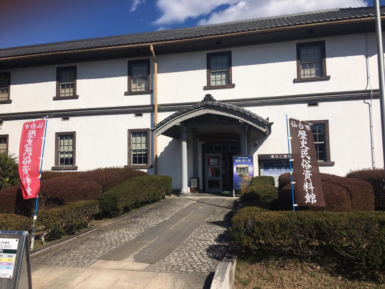
Highlights include Shokei Gakuin University, Tohoku Gakuin University, Miyagi Museum of Art and Sendai City Museum of History and Folklore.
Weather in Natori-shi
Forecast from MET Norway (CC BY 4.0). Full forecast
About Natori-shi
Natori (名取市, Natori-shi) is a city located in Miyagi Prefecture, Japan. As of 31 May 2020, the city had an estimated population of 79,459 in 31,748 households, and a population density of 810 persons per km2. The total area of the city is 98.17 square kilometres (37.90 sq mi).
From the Wikipedia article Natori, Miyagi (this version), under CC BY-SA 4.0.
Things to do8

Shokei Gakuin University
School · 5.7 km
A private university in Natori, Miyagi, Japan
Tohoku Gakuin University
School · 9.2 km
Higher education institution in Miyagi Prefecture, Japan

Tohoku University
School · 9.8 km
Higher education institution in Miyagi Prefecture, Japan


Museums and landmarks14

Miyagi Museum of Art
Museum · 11.1 km
Art museum in Sendai, Miyagi Prefecture, Japan
Sendai City Museum of History and Folklore
Museum · 10.6 km
Museum in Sendai, Miyagi, Japan

Sendai City Tomizawa Site Museum
Museum · 6.3 km
Museum in Sendai, Japan

Tohoku Gakuin University Museum
Museum · 9.1 km
Museum in Sendai, Miyagi, Japan

Tohoku University Museum
Museum · 10.9 km
Museum in Sendai, Miyagi, Japan



2 more on the map.
Parks, trails and playgrounds115


103 more on the map.
Restaurants and cafes229





217 more on the map.
History
The area of present-day Natori was part of ancient Mutsu Province, and was under control of the Date clan of Sendai Domain during the Edo period, under the Tokugawa shogunate. In 1867, Natori came within the borders of the new Rikuzen Province, which later became part of Miyagi Prefecture. With the establishment of the modern municipalities system on April 1, 1889 Natori District was formed with six villages: Masuda, Higashi-Taga, Shimo-Masuda, Tatekoshi, Aishiwa and Takadate. On April 1, 1896, Masuda was elevated to town status as was Higashi-Taga on April 1, 1928. On April 1, 1955, the towns of Masuda and Yuriage, and the villages of Shimo-Masuda, Tatekoshi, Aishiwa and Takadate were merged to create the town of Natori, which was elevated to city status on October 1, 1958. The official boundaries of Natori City have changed since 1958, as Sendai City redefines its area to include districts to the north and west of Natori.
From the History section of Natori, Miyagi on Wikipedia, under CC BY-SA 4.0.
Where to stay4
Churches and places of worship41
Shopping47
Gas and EV charging14
Schools, colleges and libraries27
Healthcare96
Map of Natori-shi
250 places. The map loads OpenStreetMap tiles when you open it.
Getting there and nearby towns
Sendai Airport (SDJ) is the nearest airport with scheduled flights listed in OpenStreetMap, 4 km away.
- Sendai 11 km north, about 11 min by car
- Murata 15 km west, about 15 min by car
- Tagajō-shi 18 km northeast, about 18 min by car
- Ōkawara 18 km southwest, about 18 min by car
- Rifu 20 km northeast, about 20 min by car
- Shiogama 21 km northeast, about 21 min by car
- Tomiya 25 km north, about 25 min by car
- Shiroishi 29 km southwest, about 29 min by car
- Yamoto 41 km northeast, about 41 min by car
- Sōma 42 km south, about 42 min by car
Drive times are estimates from straight-line distance, not routes.
Local news
Headlines from INDB.
Reviews, tips and questions
Loading what members have shared...
Sources and licences
- GeoNames (CC BY 4.0): population, coordinates, regions and time zone
- OpenStreetMap contributors (ODbL 1.0): places, airports, map data
- Wikidata (CC0 1.0): elevation, founding date, time zone, website, landmarks and historic places
- Wikimedia Commons (see each image): photos
- Wikipedia (CC BY-SA 4.0): overview and history text
Photo credits
- TohokugakuinDaigaku2005-4, No machine-readable author provided. Kinori assumed (based on copyright claims)., Public domain
- Kawauchi campus of Tohoku University 20220910a, 掬茶, CC BY-SA 4.0
- The miyagi museum of art01s3872, 663highland, CC BY 2.5
- Сендайский городской музей истории и быта 1, Kyotohippie, CC BY-SA 4.0
- Sendai City Tomizawa Site Museum1, Asenas10 at Japanese Wikipedia, CC BY 3.0
- Tohoku University Museum, 2025, 石巻敎祖, CC BY 4.0
- Sendai - Sendai6192, lumoplank, CC0
- Donguriann, Hide0326, CC BY-SA 3.0
- Natori Daiichi JHS, 国土地理院, CC BY 4.0
- Miyagi Prefecture Natori support school 1, Ebiebi2, CC BY-SA 4.0
- Haiden of Taga-jinja shrine at Natori city, Bachstelze, CC BY-SA 3.0
- Tohoku Gakuin University Main Building, 石巻敎祖, CC BY-SA 4.0
- Raijin-yama-kofun zenkei, Saigen Jiro, CC0
- Saizeriya Yoshikawa factory, Ebiebi2, CC BY-SA 3.0
- AEON MALL Natori 20261015, Rarisan, CC0
- Natori City Masuda Junior High School, Miyuki Meinaka, CC BY-SA 3.0
- Natori City Library 20250615, Suikotei, CC BY 4.0
- Dairokuten jinjya (Natori, Miyagi) 05, Thirteen-fri, CC BY-SA 4.0
- Dairokuten jinjya (Natori, Miyagi) 04, Thirteen-fri, CC BY-SA 4.0
- Dairokuten jinjya (Natori, Miyagi) 13, Thirteen-fri, CC BY-SA 4.0
- Dairokuten jinjya (Natori, Miyagi) 09, Thirteen-fri, CC BY-SA 4.0
- Dairokuten jinjya (Natori, Miyagi) 11, Thirteen-fri, CC BY-SA 4.0
- Dairokuten jinjya (Natori, Miyagi) 06, Thirteen-fri, CC BY-SA 4.0
- Dairokuten jinjya (Natori, Miyagi) 10, Thirteen-fri, CC BY-SA 4.0
- Dairokuten jinjya (Natori, Miyagi) 08, Thirteen-fri, CC BY-SA 4.0
- Dairokuten jinjya (Natori, Miyagi) 07, Thirteen-fri, CC BY-SA 4.0
- Dairokuten jinjya (Natori, Miyagi) 12, Thirteen-fri, CC BY-SA 4.0
- Natori City Library, Miyuki Meinaka, CC BY-SA 3.0
- 衣笠の松01, カルガモコロッケ, CC0
- Joban line 20220101171820 (52268544835), inunami, CC BY 2.0
- Miyagi prefectural route 128 Natori Station Line, Miyuki Meinaka, CC BY-SA 3.0
- 名取駅 - panoramio, クハ419-5, CC BY-SA 3.0
- Sapporo breweries sendai 01, Asacyan, CC BY-SA 3.0
- Stroad in Natori (Japan National Route 4, southbound), Benlisquare, CC BY-SA 4.0
- AEON TOWN Natori, Miura1115, CC0
- Nodayama in 2011-11, Kinori, CC0
- 77 Bank Morisekinoshita branch & Yuriage branch, Suikotei, CC BY 4.0
- Sendai-airport-transit-morisekinoshita-station-trucks, 掬茶, CC BY-SA 4.0
- Sendai-airport-transit-morisekinoshita-station-platform2, 掬茶, CC BY-SA 4.0
- McDonald's drive thru in Iinozaka, Natori, Benlisquare, CC BY-SA 4.0


Page built November 5, 2026. Spotted a mistake? Tell us or suggest a place.