


Tomiya, Japan
富谷市
Tomiya is a town of 52,433 people in Miyagi, Japan, founded in April 1, 1889.
Why visit Tomiya
Townapedia lists 14 museums and landmarks, 120 parks and trails, 210 places to eat, 9 places to stay and 12 attractions in and around town.
Highlights include Miyagi University, Sendai Shirayuri Women's College, Hara Asao Kinenkan and Shinmachi Park.
Weather in Tomiya
Forecast from MET Norway (CC BY 4.0). Full forecast
About Tomiya
Tomiya (富谷市, Tomiya-shi) is a city located in central Miyagi Prefecture, Japan. As of 31 May 2020, the city had an estimated population of 52,433, and a population density of 1,100 persons per km2 in 19,535 households. The total area of the city is 49.18 square kilometres (18.99 sq mi).
From the Wikipedia article Tomiya, Miyagi (this version), under CC BY-SA 4.0.
Things to do12
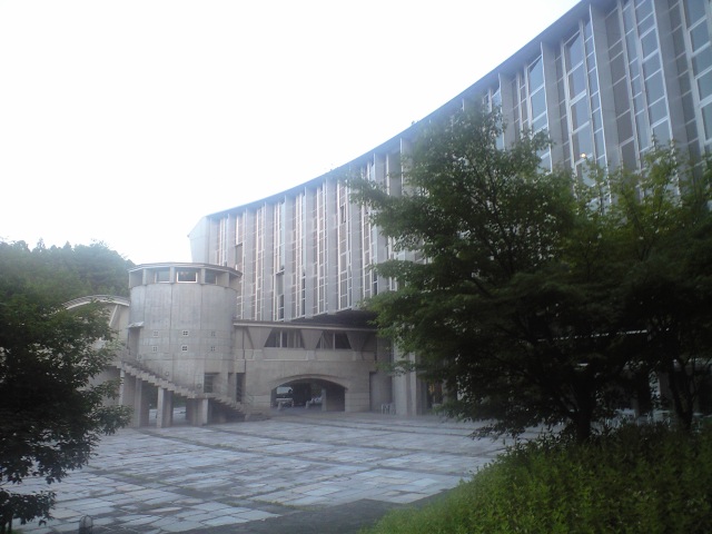
Miyagi University
School · 6.4 km
Higher education institution in Miyagi Prefecture, Japan

Sendai Shirayuri Women's College
School · 8.1 km
Catholic women's college in Sendai, Japan


Museums and landmarks14



Poké Lids (Lapras, Foongus, Torterra);Poké Lids (Lapras and Foongus and Torterra)
Monument and historic site · 4.9 km
2 more on the map.
Parks, trails and playgrounds120



108 more on the map.
Restaurants and cafes210


198 more on the map.
History
The area of present-day Tomiya was part of ancient Mutsu Province, and has been settled since at least the Jōmon period by the Emishi people. During later portion of the Heian period, the area was ruled by the Northern Fujiwara. During the Sengoku period, the area was contested by various samurai clans before the area came under the control of the Date clan of Sendai Domain during the Edo period, under the Tokugawa shogunate. During the Edo period, Tomiya was a post town on the Ōshū Kaidō highway connecting Edo with northern Japan.
The village of Tomiya was created on April 1, 1889 with the post-Meiji restoration establishment of the modern municipalities system. It was raised to town status on April 1, 1963 and raised to city status on October 10, 2016.
From the History section of Tomiya, Miyagi on Wikipedia, under CC BY-SA 4.0.
Where to stay9
Churches and places of worship59
Shopping43
Gas and EV charging21
Schools, colleges and libraries36
Healthcare63
Map of Tomiya
250 places. The map loads OpenStreetMap tiles when you open it.
Getting there and nearby towns
Sendai Airport (SDJ) is the nearest airport with scheduled flights listed in OpenStreetMap, 28 km away.
- Sendai 14 km south, about 14 min by car
- Ōsaki 23 km north, about 23 min by car
- Yamoto 29 km east, about 29 min by car
- Ishinomaki 36 km east, about 36 min by car
- Ichinoseki 62 km north, about 1 h by car
- Yanagawamachi-saiwaichō 65 km southwest, about 1 h by car
- Sōma 67 km south, about 1 h by car
- Hobaramachi 71 km southwest, about 1 h 15 min by car
- Koori 70 km southwest, about 1 h 15 min by car
- Fukushima 80 km southwest, about 1 h 15 min by car
Drive times are estimates from straight-line distance, not routes.
Local news
Headlines from INDB.
Reviews, tips and questions
Loading what members have shared...
Sources and licences
- GeoNames (CC BY 4.0): population, coordinates, regions and time zone
- OpenStreetMap contributors (ODbL 1.0): places, airports, map data
- Wikidata (CC0 1.0): elevation, founding date, time zone, website, landmarks and historic places
- Wikimedia Commons (see each image): photos
- Wikipedia (CC BY-SA 4.0): overview and history text
Photo credits
- Tomiya Kurokawa Miyagi - panoramio, cora_cola 茶々丸, CC BY-SA 3.0
- 富谷町 西友付近の交差点 Tomiya - panoramio, cora_cola 茶々丸, CC BY-SA 3.0
- 富谷中学校 通学路 Tomiya - panoramio, cora_cola 茶々丸, CC BY-SA 3.0
- 富谷町役場から 七ツ森 Tomiya - panoramio, cora_cola 茶々丸, CC BY-SA 3.0
- Tomiya Miyagi Japan - panoramio, cora_cola 茶々丸, CC BY-SA 3.0
- 富谷町運動公園前 国道 Tomiya - panoramio, cora_cola 茶々丸, CC BY-SA 3.0
- 富谷町役場 TOMIYA - panoramio, cora_cola 茶々丸, CC BY-SA 3.0
- 杜のまち Tomiya - panoramio, cora_cola 茶々丸, CC BY-SA 3.0
- 富谷町スポーツセンター Tomiya Sport Center - panoramio, cora_cola 茶々丸, CC BY-SA 3.0
- 杜の丘団地 入り口 Tomiya - panoramio, cora_cola 茶々丸, CC BY-SA 3.0
- Myu2008, The original uploader was Maquazy at Japanese Wikipedia ., Public domain
- Sendai shirayuri auditorium, マスール, CC BY-SA 4.0
- AEON MALL Tomiya, ToshiJapon, CC BY-SA 4.0
- 宮床中学校, ToshiJapon, CC BY-SA 4.0
- Tennouji, ToshiJapon, CC0
- KurokawaHighschool, Asasa198, CC BY-SA 3.0
- Narita chu, ToshiJapon, CC BY-SA 4.0
- 日吉台中学校, ToshiJapon, CC BY-SA 4.0
- Kingyoku, ToshiJapon, CC BY-SA 4.0
- Kuhonji1, ToshiJapon, CC BY-SA 4.0
- 大和町立 小野小学校 - panoramio, cora_cola 茶々丸, CC BY-SA 3.0
- Akaishidai ele, ToshiJapon, CC BY-SA 4.0
- Higashikoyodaisho, ToshiJapon, CC BY-SA 4.0
- Narita sho, ToshiJapon, CC BY-SA 4.0
- Narita higashi sho, ToshiJapon, CC BY-SA 4.0
- Yuki shrine, ToshiJapon, CC BY-SA 4.0
- Kumano, ToshiJapon, CC BY-SA 4.0
- Hara Asao Memorial Hall, 七厩拓, CC BY-SA 4.0
- Izumigaokasho Sendai, ToshiJapon, CC BY-SA 4.0
- Shinmachi Park, ToshiJapon, CC BY-SA 4.0
- Tomigaoka Park2, ToshiJapon, CC BY-SA 4.0
- 残された緑地 - panoramio, cora_cola 茶々丸, CC BY-SA 3.0
- 熊野神社 - panoramio, 浅野ます道, CC BY 3.0
- 身近に感じる秋 - panoramio, cora_cola 茶々丸, CC BY-SA 3.0
- 大木の紅葉 - panoramio, cora_cola 茶々丸, CC BY-SA 3.0
- 秋の日差し - panoramio, cora_cola 茶々丸, CC BY-SA 3.0
- 見事な枝ぶり - panoramio, cora_cola 茶々丸, CC BY-SA 3.0
- サニータウン 入り口 Sunny Town - panoramio, cora_cola 茶々丸, CC BY-SA 3.0
- 秋の大木 2本 - panoramio, cora_cola 茶々丸, CC BY-SA 3.0
- 4号線地下道 - panoramio, cora_cola 茶々丸, CC BY-SA 3.0


Page built November 5, 2026. Spotted a mistake? Tell us or suggest a place.