


Ninohe, Japan
二戸市
Ninohe is a town of 25,513 people in Iwate, Japan, founded in April 1, 1972.
Why visit Ninohe
Townapedia lists 52 museums and landmarks, 18 parks and trails, 49 places to eat, 14 places to stay and 13 attractions in and around town.
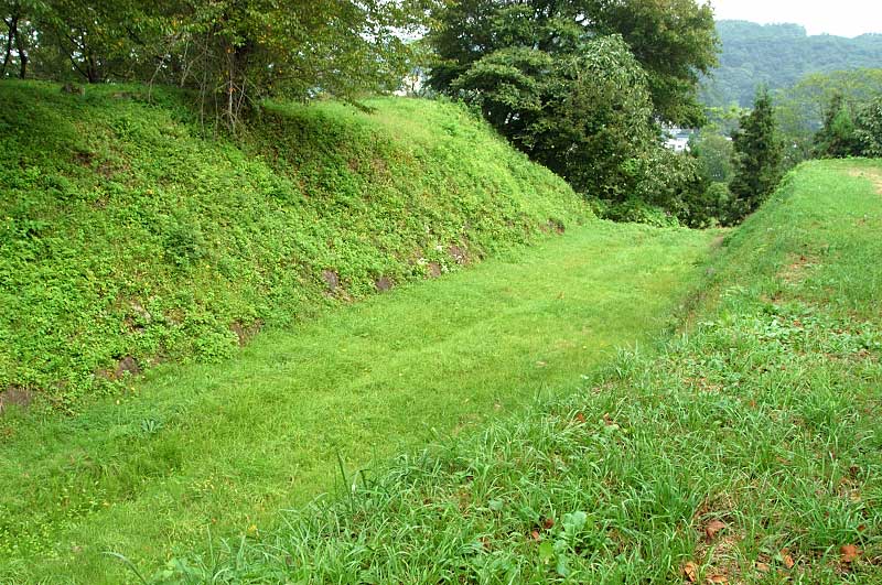
Highlights include Mt. Nakui, Mt. Oritsume, Goshono Site and 九戸城.
Weather in Ninohe
Forecast from MET Norway (CC BY 4.0). Full forecast
About Ninohe
Ninohe (二戸市, Ninohe-shi) is a city located in Iwate Prefecture, Japan. As of 31 March 2020, the city had an estimated population of 26,344, and a population density of 63 persons per km2 in 11,803 households. The total area of the city is 420.42 square kilometres (162.33 sq mi).
From the Wikipedia article Ninohe, Iwate (this version), under CC BY-SA 4.0.
Travel tips from other travellers: Ninohe on Wikivoyage (CC BY-SA 4.0).
Things to do13




1 more on the map.
Museums and landmarks52

Goshono Site
Monument and historic site · 10.4 km
Archaeological type site



Sannohe Town History Museum
Museum · 10.9 km
34-29 大字梅内字城ノ下, 三戸町

40 more on the map.
Parks, trails and playgrounds18



6 more on the map.
Restaurants and cafes49

COUNTRY ROAD;えんや
Restaurant · Japanese, Coffee Shop · 12.2 km
Mo,Su 10:00-22:00; Tu-Th 10:00-23:00; Fr-Sa 10:00-24:00

37 more on the map.
History
The area of present-day Ninohe was part of ancient Mutsu Province, and has been settled since at least the Jōmon period. Many Jōmon and Kofun period remains have been found. Inhabited by the Emishi tribes, the Nihon Shoki describes the penetration of the area by forces of the imperial dynasty in the late Nara period; however, it was not under effective control of the central government until the mid-Heian period. The area was dominated by the Nanbu clan from the early Muromachi period, and was named for one of the nine numbered stockades, or fortified ranches, that established to secure this frontier area. During the Edo period, the area was under the control of Morioka Domain.
In the early Meiji period, the town of Fukuoka and the villages of Jōbōji, Kindaichi, Gohenchi, Tomai, Ishikiridokoro, and Nisattai were established within Ninohe District on April 1, 1889 with the establishment of the modern municipalities system. Jōbōji was elevated to town status on December 25, 1940. Gohenchi, Tomai, Ishikiridokoro, and Nisattai merged with Fukuoka on March 10, 1955. The modern city was founded on April 1, 1972, with the merger of the town of Fukuoka with the village of Kindaichi. On January 1, 2006, the city of Ninohe annexed the town of Jōbōji.
From the History section of Ninohe, Iwate on Wikipedia, under CC BY-SA 4.0.
Where to stay14
Churches and places of worship49
Shopping21
Gas and EV charging12
Schools, colleges and libraries25
Healthcare22
Map of Ninohe
250 places. The map loads OpenStreetMap tiles when you open it.
Getting there and nearby towns
JMSDF Hachinohe Air Base (HHE) is the nearest airport with scheduled flights listed in OpenStreetMap, 32 km away.
- Ichinohe 8 km south, about 8 min by car
- Towada 38 km north, about 38 min by car
- Kuji 40 km east, about 40 min by car
- Misawa 45 km north, about 45 min by car
- Hanawa 46 km west, about 46 min by car
- Shichinohe 46 km north, about 46 min by car
- Ōdate 64 km west, about 1 h by car
- Morioka 67 km south, about 1 h by car
- Hirakawa 71 km northwest, about 1 h 15 min by car
- Aomori 76 km northwest, about 1 h 15 min by car
Drive times are estimates from straight-line distance, not routes.
Local news
Headlines from INDB.
Reviews, tips and questions
Loading what members have shared...
Sources and licences
- GeoNames (CC BY 4.0): population, coordinates, regions and time zone
- OpenStreetMap contributors (ODbL 1.0): places, airports, map data
- Wikidata (CC0 1.0): elevation, founding date, time zone, website, landmarks and historic places
- Wikimedia Commons (see each image): photos
- Wikipedia (CC BY-SA 4.0): overview and history text
Photo credits
- NinoheCityOffice, Wakkubox, CC BY-SA 3.0
- Iwate Prefectural Ninohe Hospital, Yasu ( talk ), CC BY-SA 3.0
- Nisatai Elementary School, Ninohe 250628, Yauchi, CC0
- Ninohe Police Station, Yauchi, CC BY-SA 4.0
- Ninohe Fire Department 160716, Yauchi, CC BY-SA 4.0
- Iwate Prefectural Government Ninohe district Joint Government Building, Suikotei, CC BY 4.0
- JREast-Ninohe-station-building-east-20110718-145412, LERK, CC BY-SA 4.0
- JREast-Ninohe-station-building-west-20110718-145812, LERK, CC BY-SA 4.0
- IGR-Iwate-galaxy-railway-Ninohe-station-platform-20110718-145002, LERK, CC BY-SA 4.0
- 御所野遺跡の復元竪穴建物, 小池 隆, CC BY 3.0
- Kunohejou001, Satoshin at Japanese Wikipedia, CC BY-SA 3.0
- Sannohe Town Library, 遊仙, CC BY 2.1 jp
- 御所野縄文博物館, 小池 隆, CC BY 3.0
- Fukuoka HighScool Iwate Main Gate 160716, Yauchi, CC BY-SA 4.0
- Fukuoka-Technical HighScool Iwate 160716, Yauchi, CC BY-SA 4.0
- ISS065-E-213877 - View of Earth, Earth Science and Remote Sensing Unit , Lyndon B. Johnson Space Center, Public domain
- ISS065-E-213878 - View of Earth, Earth Science and Remote Sensing Unit , Lyndon B. Johnson Space Center, Public domain
- ISS064-E-48032 - View of Earth, Earth Science and Remote Sensing Unit , Lyndon B. Johnson Space Center, Public domain
- Nanbu Bijin headquarters, Yasu ( talk ), CC BY-SA 3.0
- IGR Iwate Galaxy Railway Kintaichi-Onsen Station, Yasu ( talk ), CC BY-SA 3.0
- Iwate Prefectural Road No244 250628, Yauchi, CC0
- Cassiopeia-FM studio 160716, Yauchi, CC BY-SA 4.0
- Nanyato Observation Tower 160716, Yauchi, CC BY-SA 4.0
- 岩手川口駅 新駅舎, On-neko, CC BY-SA 4.0
- Fukuoka Technical-HighSchool Main Gate 160716, Yauchi, CC BY-SA 4.0
- Ishikiridokoro Elementary School, Yauchi, CC BY-SA 4.0
- Cross-bedding of Namiuchi Pass. Partial enlargement. A, さかおり, CC BY-SA 4.0
- Cross-bedding of Namiuchi Pass. B, さかおり, CC BY-SA 4.0
- Cross-bedding of Namiuchi Pass. Partial enlargement. E, さかおり, CC BY-SA 4.0
- Cross-bedding of Namiuchi Pass. Partial enlargement. D, さかおり, CC BY-SA 4.0
- Cross-bedding of Namiuchi Pass. Partial enlargement. C, さかおり, CC BY-SA 4.0
- Cross-bedding of Namiuchi Pass. C, さかおり, CC BY-SA 4.0
- Cross-bedding of Namiuchi Pass. D, さかおり, CC BY-SA 4.0
- Cross-bedding of Namiuchi Pass. A, さかおり, CC BY-SA 4.0
- Cross-bedding of Namiuchi Pass. Partial enlargement. G, さかおり, CC BY-SA 4.0
- Cross-bedding of Namiuchi Pass. Partial enlargement. B, さかおり, CC BY-SA 4.0
- Cross-bedding of Namiuchi Pass. F, さかおり, CC BY-SA 4.0
- Cross-bedding of Namiuchi Pass. Partial enlargement. H, さかおり, CC BY-SA 4.0
- Cross-bedding of Namiuchi Pass. Partial enlargement. F, さかおり, CC BY-SA 4.0
- Cross-bedding of Namiuchi Pass. E, さかおり, CC BY-SA 4.0


Page built November 5, 2026. Spotted a mistake? Tell us or suggest a place.