


Oyama, Japan
小山市
Oyama is a town of 167,647 people in Tochigi, Japan, founded in March 31, 1954.
Why visit Oyama
Townapedia lists 24 museums and landmarks, 99 parks and trails, 179 places to eat, 9 places to stay and 4 attractions in and around town.
Highlights include Hakuoh University, Jichi Medical University, Teranohigashi Site and The Site of Shimotsuke Provincial Government.
Weather in Oyama
Forecast from MET Norway (CC BY 4.0). Full forecast
About Oyama
Oyama (小山市, Oyama-shi; Japanese pronunciation: [ó̞.jä̀.mä̀, ò̞.jä́.mä́.ɕì]) is a city located in Tochigi Prefecture, Japan. As of 1 August 2020, the city had an estimated population of 167,647 in 70,928 households, and a population density of 980 persons per km2. The total area of the city is 171.76 square kilometres (66.32 sq mi). In 2006, Oyama became the second most populous city in Tochigi Prefecture, with the capital Utsunomiya retaining the number one spot.
From the Wikipedia article Oyama, Tochigi (this version), under CC BY-SA 4.0.
Travel tips from other travellers: Oyama on Wikivoyage (CC BY-SA 4.0).
Things to do4

Hakuoh University
School · 1.8 km
Higher education institution in Tochigi Prefecture, Japan

Jichi Medical University
School · 12.3 km
Higher education institution in Tochigi Prefecture, Japan


Museums and landmarks24
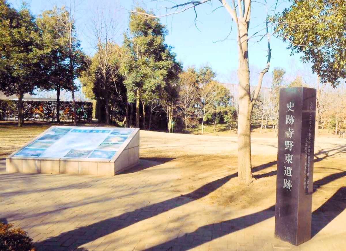
Teranohigashi Site
Monument and historic site · 7.9 km
Archaeological site in Oyama, Tochigi, Japan

The Site of Shimotsuke Provincial Government
Monument and historic site · 9.0 km
Historic site in Tochigi, Japan

Yūki temple ruins
Monument and historic site · 8.5 km
Archaeological site in Japan


寺野東遺跡 国指定遺跡
Monument and historic site · 7.8 km
旧石器時代から近世までの複合遺跡 環状盛土遺構、水場遺構、木組み遺構

12 more on the map.
Parks, trails and playgrounds99

Kanakubo Athletic Park Baseball Field
Sports field and stadium · 7.2 km


87 more on the map.
Restaurants and cafes179




167 more on the map.
History
Oyama-shuku was a post station on the Nikkō Kaidō connecting Edo with the shrines at Nikkō, and was controlled by Utsunomiya Domain during the Edo period. Oyama town was established within Shimotsuga District, Tochigi with the establishment of the modern municipalities system on April 1, 1889. Oyama merged with the neighboring village of Otani on March 31, 1954 and was elevated to city status. On April 18, 1963, Oyama annexed the town of Mamada and village of Mita, both from Shimotsuga District. This was followed by the town of Kuwakinu on September 30, 1965.
From the History section of Oyama, Tochigi on Wikipedia, under CC BY-SA 4.0.
Where to stay9
Churches and places of worship42
Shopping67
Gas and EV charging14
Schools, colleges and libraries69
Ibaraki Prefectural Yuki Special Needs Education School
School · 7.8 km
Healthcare54
Map of Oyama
250 places. The map loads OpenStreetMap tiles when you open it.
Getting there and nearby towns
Ibaraki Airport (IBR) is the nearest airport with scheduled flights listed in OpenStreetMap, 57 km away.
- Tochigi 11 km northwest, about 11 min by car
- Koga 15 km southwest, about 15 min by car
- Chikusei 16 km east, about 16 min by car
- Sano 20 km west, about 20 min by car
- Tsukuba 37 km southeast, about 37 min by car
- Ōta 39 km west, about 39 min by car
- Tsuchiura 44 km southeast, about 44 min by car
- Kiryū 43 km west, about 43 min by car
- Nagareyama 50 km south, about 50 min by car
- Kashiwa 51 km south, about 51 min by car
Drive times are estimates from straight-line distance, not routes.
Local news
Headlines from INDB.
Reviews, tips and questions
Loading what members have shared...
Sources and licences
- GeoNames (CC BY 4.0): population, coordinates, regions and time zone
- OpenStreetMap contributors (ODbL 1.0): places, airports, map data
- Wikidata (CC0 1.0): elevation, founding date, time zone, website, landmarks and historic places
- Wikimedia Commons (see each image): photos
- Wikipedia (CC BY-SA 4.0): overview and history text
Photo credits
- Oyama-jo.4, Yoichi123, Public domain
- Oyama National College of Technology main gate, ほぶ, CC0
- Japanese National Highway no.50 on Oyama city Tochigi Japan2, Ebiebi2, CC BY-SA 3.0
- Japanese National Highway no.50 on Oyama city Tochigi Japan, Ebiebi2, Public domain
- Oyama City Central Citizen’s Hall, Miyuki Meinaka, CC BY-SA 4.0
- Oyama City Hall view from Pedestrian bridge, Miyuki Meinaka, CC BY-SA 4.0
- JOYHON Oyama Station Shop, Miyuki Meinaka, CC BY-SA 4.0
- Oyama City Hall Nov. 2022, Miyuki Meinaka, CC BY-SA 4.0
- Chuo Labour Bank Oyama Branch, Suikotei, CC BY 4.0
- Oyama Works, Furukawa Industrial Machinery Systems 1, Miyuki Meinaka, CC BY-SA 4.0
- Oyama city Oyama junior high school, Miyuki Meinaka, CC BY-SA 4.0
- Oyama Works, Furukawa Industrial Machinery Systems 2, Miyuki Meinaka, CC BY-SA 4.0
- Oyama Shinkansen Rolling Stock Center-2, まも, Public domain
- Terahigashi Site, MChew, CC BY-SA 4.0
- Oyama City Museum 01, Abasaa, Public domain
- Takedasuga Jinja, Abasaa, Public domain
- Kurumaya Museum of Art, Abasaa, Public domain
- Yuki 2nd High School, Abasaa, Public domain
- Ten'nouin-oyama, Tatsundo h, Public domain
- Yuki city Yuki junior high school Aerial view (2021-05), 国土地理院, CC BY 4.0
- Jichi Med. Univ. Education & Research Center, Miyuki Meinaka, CC BY-SA 4.0
- Shimotsuke Kokucho Ruins maedono, Saigen Jiro, CC0
- Tochigi pref. Kokubunji special school, Miyuki Meinaka, CC BY-SA 4.0
- Oyama High school, M yanagisawa, CC BY 3.0
- Tochigi Korean Elementary and Junior High School, Abasaa, Public domain
- Kakubo Sports Park Baseball Stadium 01, 小石川人晃, CC BY-SA 4.0
- Joko-ji (Oyama), Abasaa, Public domain
- ISS026-E-16524 - View of Japan, Earth Science and Remote Sensing Unit , Lyndon B. Johnson Space Center, Public domain
- 小山聖泉キリスト教会 - panoramio, officeshema, CC BY 3.0
- 国道50号 栃木県小山市神鳥谷一丁目 20180318 093953, Puchi-masashi This photo was taken with Canon PowerShot G9 X Mark II, CC BY-SA 4.0
- アキュア メイド (48752564076), bob walker from London, UK, CC BY-SA 2.0
- JRE 415Kei Moha414-1535, 芹丘智美, CC BY 3.0
- 小山駅15・16番線発車標(英語版), Taikokazu, CC BY-SA 4.0
- 小山駅15・16番線発車標, Taikokazu, CC BY-SA 4.0
- JNR SL C50123, tatsundo_h This photo was taken with Canon HF11, CC BY-SA 3.0
- Japanese-national-railways-C50-123-20230325-151656, LERK, CC BY-SA 4.0
- Japanese-national-railways-C50-123-20230325-151908, LERK, CC BY-SA 4.0
- Japanese-national-railways-C50-123-20230325-151415, LERK, CC BY-SA 4.0
- 宇都宮 宇味家 (55139022710), nagi usano from Tokyo, Japan, CC BY 4.0
- 宇都宮 宇味家 (55138870909), nagi usano from Tokyo, Japan, CC BY 4.0


Page built November 4, 2026. Spotted a mistake? Tell us or suggest a place.