


Tochigi, Japan
栃木市
Tochigi is a town of 159,056 people in Tochigi, Japan, founded in April 1, 1937.
Why visit Tochigi
Townapedia lists 42 museums and landmarks, 74 parks and trails, 140 places to eat, 8 places to stay and 16 attractions in and around town.
Highlights include Dokkyo Medical University, Hakuoh University, Kamikōnushi-Mobara Kanga ruins and Teranohigashi Site.
Weather in Tochigi
Forecast from MET Norway (CC BY 4.0). Full forecast
About Tochigi
Tochigi (栃木市, Tochigi-shi) is a city located in Tochigi Prefecture, in the northern Kantō region of Japan. As of 1 June 2023, the city had an estimated population of 151,842 in 66,018 households, and a population density of 458 persons per km2. The total area of the city is 331.50 square kilometres (127.99 sq mi). Because the city escaped war damage during World War II, many historical temples, traditional shops and kura (Japanese traditional storehouses) remain in the city center.
From the Wikipedia article Tochigi (city) (this version), under CC BY-SA 4.0.
Travel tips from other travellers: Tochigi on Wikivoyage (CC BY-SA 4.0).
Things to do16

Dokkyo Medical University
School · 12.8 km
Higher education institution in Tochigi Prefecture, Japan

Hakuoh University
School · 9.3 km
Higher education institution in Tochigi Prefecture, Japan

Jichi Medical University
School · 11.5 km
Higher education institution in Tochigi Prefecture, Japan

Cosmos Hall
Cinema and theater · 9.6 km
栃木市岩舟町静2303 佐野バイパス
Tu-Su 08:00-17:30



Grapes farm & Agricultural direct sale place “Tachibanaen ”
Scenic view · 7.4 km

4 more on the map.
Museums and landmarks42

Kamikōnushi-Mobara Kanga ruins
Monument and historic site · 16.2 km
Ancient ruins in Utsunomiya, Kantō, Japan
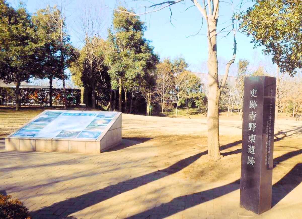
Teranohigashi Site
Monument and historic site · 14.7 km
Archaeological site in Oyama, Tochigi, Japan

The Site of Shimotsuke Provincial Government
Monument and historic site · 4.6 km
Historic site in Tochigi, Japan




30 more on the map.
Parks, trails and playgrounds74




62 more on the map.
Restaurants and cafes140



128 more on the map.
History
In the Edo period, Tochigi prospered from its location on the Uzumagawa River, which connected with the Tone River to Edo. Envoys using the Reiheishi Way sent from the Imperial Court going to Shrines and Temples of Nikkō stayed at the lodging area in the city. Most of the area was formerly tenryō territory controlled directly by the Tokugawa shogunate; however, the minor feudal domain of Fukiake Domain was located within the borders of modern city of Tochigi.
Following the Meiji Restoration and the creation of Tochigi Prefecture, Tochigi Town was the prefectural capital from 1871 until its relocation to Utsunomiya in 1884. On April 1, 1937, Tochigi was elevated to city status.
On September 30, 1954, Tochigi absorbed the villages of Ōmiya, Minagawa, Fukiage, and Terao (all from Shimotsuga District). This was followed by the village of Kōō (from Shimotsuga District) on March 31, 1957.
Tochigi hosted its first film festival, the Kuranomachikado, or, "Eizo Film Festival" from October 5, 2007, to October 8, 2007.
On March 29, 2010, Tochigi absorbed the towns of Fujioka, Ōhira and Tsuga (Shimotsuga District). This was followed by the town of Nishikata (from Kamitsuga District) on October 1, 2011, and the town of Iwafune (from Shimotsuga District) on April 5, 2014.
From the History section of Tochigi (city) on Wikipedia, under CC BY-SA 4.0.
Where to stay8
Churches and places of worship69
Shopping67
Gas and EV charging5
Schools, colleges and libraries71
Healthcare65
Map of Tochigi
250 places. The map loads OpenStreetMap tiles when you open it.
Getting there and nearby towns
Ibaraki Airport (IBR) is the nearest airport with scheduled flights listed in OpenStreetMap, 65 km away.
- Koga 22 km south, about 22 min by car
- Chikusei 24 km east, about 24 min by car
- Ōta 34 km west, about 34 min by car
- Kiryū 36 km west, about 36 min by car
- Tsukuba 48 km southeast, about 48 min by car
- Tsuchiura 54 km southeast, about 54 min by car
- Kashiwa 62 km south, about 1 h by car
- Nagareyama 61 km south, about 1 h by car
- Takasaki 64 km west, about 1 h by car
- Tokyo 77 km south, about 1 h 15 min by car
Drive times are estimates from straight-line distance, not routes.
Local news
Headlines from INDB.
Reviews, tips and questions
Loading what members have shared...
Sources and licences
- GeoNames (CC BY 4.0): population, coordinates, regions and time zone
- OpenStreetMap contributors (ODbL 1.0): places, airports, map data
- Wikidata (CC0 1.0): elevation, founding date, time zone, website, landmarks and historic places
- Wikimedia Commons (see each image): photos
- Wikipedia (CC BY-SA 4.0): overview and history text
Photo credits
- Tochigi City Montage, Uraniwa, CC BY-SA 4.0
- Tochigi Float Museum, Miyuki Meinaka, CC BY-SA 4.0
- Tobu Department Store & Tochigi City Hall, Miyuki Meinaka, CC BY-SA 4.0
- Tochigi Grand Hotel, Mar. 2025, Miyuki Meinaka, CC BY-SA 4.0
- Tochigi - panoramio, kcomiida, CC BY-SA 3.0
- Tochigi - panoramio - kcomiida, kcomiida, CC BY-SA 3.0
- Tochigi - panoramio - kcomiida (8), kcomiida, CC BY-SA 3.0
- The last Tochigi Town Assembly meeting, Unknown author Unknown author, Public domain
- Coffered Ceiling, Tochigi City Literature Museum, うらにわ, CC BY-SA 4.0
- Tochigi City Literature Museum November 2021, うらにわ, CC BY-SA 4.0
- Tochigi Salon, Tochigi City Literature Museum, うらにわ, CC BY-SA 4.0
- New and Old Wood Used for the Ceiling, Tochigi City Literature Museum, うらにわ, CC BY-SA 4.0
- Exhibition Room, Tochigi City Literature Museum, うらにわ, CC BY-SA 4.0
- Multipurpose Room, Tochigi City Literature Museum, うらにわ, CC BY-SA 4.0
- Model of the Building Frame, Tochigi City Literature Museum, うらにわ, CC BY-SA 4.0
- Stairway Landing, Tochigi City Literature Museum, うらにわ, CC BY-SA 4.0
- Tochigi City Art Museum as seen from the second floor of Tochigi City Literature Museum, うらにわ, CC BY-SA 4.0
- Tochigi Salon, Tochigi City Literature Museum 2, うらにわ, CC BY-SA 4.0
- After Demolition of Extension, Tochigi City Literature Museum, うらにわ, CC BY-SA 4.0
- Entrance, Tochigi City Literature Museum, うらにわ, CC BY-SA 4.0
- Tochigi - panoramio - kcomiida (9), kcomiida, CC BY-SA 3.0
- Spring of Carp, Tochigi city, Miyuki Meinaka, CC BY-SA 4.0
- Municipal Establishment Ceremony of Tochigi City, Unknown author Unknown author, Public domain
- Tobu Tochigi cityhall, うらにわ This photo was taken with iPhone 6 Plus, CC BY-SA 4.0
- Tobu Tochigi cityhall 2, うらにわ This photo was taken with iPhone 6 Plus, CC BY-SA 4.0
- Site of Hatakeyama Jinya, Tochigi, Miyuki Meinaka, CC BY-SA 4.0
- Tochigi-Shimmeigu-Otorii, Shin-Nippori, CC0
- Tochigi - panoramio - kcomiida (2), kcomiida, CC BY-SA 3.0
- Dokkyo Medical University2009, Miyuki Meinaka, Public domain
- Historical Government Buildings Site of Kamikonushi & Mobara 02, Miyuki Meinaka, CC BY-SA 4.0
- Terahigashi Site, MChew, CC BY-SA 4.0
- Shimotsuke-kokubunji hondou, Saigen Jiro, CC0
- Tochigi Shingyoji temple, うらにわ, CC BY-SA 4.0
- Fuji Sengen Shrine on the summit of Mt. Ohira, Miyuki Meinaka, CC BY-SA 4.0
- Ohirasan shrine-haiden,tochigi-city,japan, katorisi, CC BY-SA 3.0
- 麓の果樹園から見た晃石山, Koda6029, CC BY-SA 4.0
- Tochigi Cultural Hall, Miyuki Meinaka, CC BY-SA 4.0
- Tochigi Prefectural Gakuyukan High School, M yanagisawa This photo was taken with Canon EOS 400D, CC BY 3.0
- Tochigi Shounan High School, M yanagisawa, CC BY 3.0
- 栃木県立栃木高等学校, ポプラ並木 This photo was taken with Sony DSC-T1, CC BY-SA 3.0
- New Ginger Museum, Miyuki Meinaka, CC BY-SA 4.0
- Koganei Ichirizuka, Tochigi, ニンジンシチュー, CC0
- City Football Station-5, Waka77, CC0
- Jigen-ji temple, Shimotsuke, Miyuki Meinaka, CC BY-SA 4.0
- Jichi Med. Univ. Education & Research Center, Miyuki Meinaka, CC BY-SA 4.0
- Shimotsuke Kokucho Ruins maedono, Saigen Jiro, CC0
- Oyama High school, M yanagisawa, CC BY 3.0
- Tochigi Technical High School, M yanagisawa, CC BY 3.0
- Saizeriya Yoshikawa factory, Ebiebi2, CC BY-SA 3.0
- Tochigi city Iwafune junior high school-2, うらにわ This photo was taken with iPhone 6 Plus, CC BY-SA 4.0
- Tochigi Minami Junior High School, Miyuki Meinaka, CC BY-SA 4.0
- Tochigi city Kou-Kita Elementary School, 国鉄115系湘南色, Public domain
- Tochigi city Tochigi central elementary school, うらにわ, CC BY-SA 4.0
- Ohira Junior High School, Tochigi, Miyuki Meinaka, CC BY-SA 4.0
- 下野国分寺跡 伽藍, Saigen Jiro, Public domain
- Tochigi-Medical-Center-Shimotsuga 1, Ebiebi2, CC BY-SA 4.0
- Mibu Junior High School, Miyuki Meinaka, CC BY-SA 4.0
- Cosmos Hall, Tochigi, March 2024 (from west), Uraniwa, CC BY 4.0


Page built November 4, 2026. Spotted a mistake? Tell us or suggest a place.