
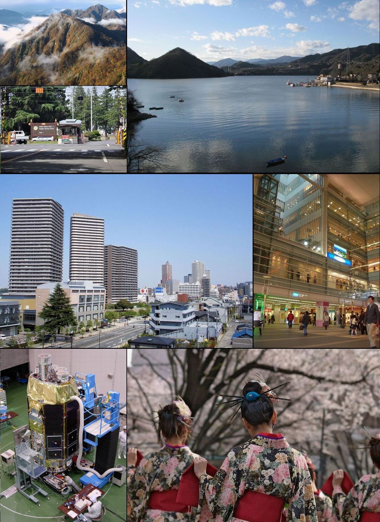


Sagamihara, Japan
相模原市
Sagamihara is a town of 720,780 people in Kanagawa, Japan, founded in April 29, 1941.
Why visit Sagamihara
Townapedia lists 108 museums and landmarks, 75 parks and trails, 133 places to eat, 17 places to stay and 72 attractions in and around town.
Highlights include Azabu University, Hayato Great Falls, Takao 599 Museum and Funada Stone Age Site.
Weather in Sagamihara
Forecast from MET Norway (CC BY 4.0). Full forecast
About Sagamihara
Sagamihara (相模原市, Sagamihara-shi) is a city in Kanagawa Prefecture, Japan. As of May 1, 2021, the city has an estimated population of 723,470, with 334,812 households, and a population density of 1,220 persons per km2. The total area of the city is 328.91 square kilometres (126.99 sq mi). Sagamihara is the third-most-populous city in the prefecture, after Yokohama and Kawasaki, and the fifth most populous suburb of the Greater Tokyo Area.
From the Wikipedia article Sagamihara (this version), under CC BY-SA 4.0.
Travel tips from other travellers: Sagamihara on Wikivoyage (CC BY-SA 4.0).
Things to do72

Azabu University
School · 13.3 km
Higher education institution in Kanagawa Prefecture, Japan


Joshibi University of Art and Design
School · 14.0 km
Higher education institution in Kanagawa Prefecture, Japan

Kanagawa Institute of Technology
School · 12.8 km
Higher education institution in Kanagawa Prefecture, Japan

Nihon Bunka University
School · 11.7 km
Private university in Tokyo, Japan


Sagami Women's University
School · 17.2 km
Private college in Sagamihara, Japan
Shoin University
School · 15.4 km
Higher education institution in Kanagawa Prefecture, Japan


Tama Tech
Monument and historic site · 15.9 km
Former Japanese amusement park
Tokyo Junshin University
School · 16.4 km
Japan private women's college
60 more on the map.
Museums and landmarks108


Funada Stone Age Site
Monument and historic site · 11.3 km
Archaeological site in Japan

Katsusaka Site
Monument and historic site · 14.8 km
Archaeological site of the Jomon period in Sagamihara City, Kanagawa Prefecture.

Kawajiri Stone Age Site
Monument and historic site · 5.9 km
Archaeological site in Japan

Suwarashi Stone Age Site
Monument and historic site · 3.9 km
Archaeological site in Japan

Tabata Site
Monument and historic site · 11.7 km
Archaeological site in Machida, Tokyo, Japan Japan
Tanamukaihara Site
Monument and historic site · 11.1 km
Ruins in Sagamihara, Japan



96 more on the map.
Parks, trails and playgrounds75




63 more on the map.
Restaurants and cafes133

Gusto
Restaurant · Western, Japanese · 6.7 km
Family restaurant chain
Mo-Fr 09:00-22:00; Sa-Su,PH 08:00-22:00

ZEBRA 津久井本店
Cafe · Coffee Shop, Croissant · 2.4 km
Mo-Fr 09:00-17:00; Sa-Su,PH 09:00-18:00

121 more on the map.
History
The area of modern Sagamihara has been settled since ancient times, and has a number of remains from the Japanese Paleolithic period and Kofun period have been found. It was home to the Yokoyama clan, one of the seven warrior clans of the Musashi region during the early Kamakura period. During the Edo period, the lands around Sagamihara were tenryō territory theoretically administered directly by the Tokugawa Shogunate in Edo; however, in reality, the area was a patchwork of small fiefs held by various hatamoto, as well as exclaves under the control of the Ogino-Yamanaka Domain and Karasuyama Domain.
After the Meiji Restoration, the eastern portion was part of Kōza District, and the western portion was part of Tsukui District. The Kōza District portion was administratively divided into six villages on April 1, 1889 with the creation of the modern municipalities system. The area was the location of extensive training facilities and arsenals of the Imperial Japanese Army during the 1930s. These villages were merged on April 29, 1941, together with neighboring Zama Town to create Sagamihara Town. At the time of its formation, it was the largest town in Japan in terms of area.
From the History section of Sagamihara on Wikipedia, under CC BY-SA 4.0.
Where to stay17
Churches and places of worship83
Takao-san Yakuo-in Yuki-ji Temple
Place of worship · Shingon Shu · 6.6 km
Shopping20
Gas and EV charging16
Schools, colleges and libraries42
Healthcare24
Map of Sagamihara
250 places. The map loads OpenStreetMap tiles when you open it.
Getting there and nearby towns
Yokota Air Base (OKO) is the nearest airport with scheduled flights listed in OpenStreetMap, 22 km away.
- Aihara 8 km northeast, about 8 min by car
- Zama 16 km southeast, about 16 min by car
- Atsugi 18 km southeast, about 18 min by car
- Isehara 20 km south, about 20 min by car
- Yamato 22 km southeast, about 22 min by car
- Hadano 22 km south, about 22 min by car
- Ebina 25 km southeast, about 25 min by car
- Hiratsuka 28 km south, about 28 min by car
- Chigasaki 30 km southeast, about 30 min by car
- Fujisawa 32 km southeast, about 32 min by car
Drive times are estimates from straight-line distance, not routes.
Local news
Headlines from INDB.
Reviews, tips and questions
Loading what members have shared...
Sources and licences
- GeoNames (CC BY 4.0): population, coordinates, regions and time zone
- OpenStreetMap contributors (ODbL 1.0): places, airports, map data
- Wikidata (CC0 1.0): elevation, founding date, time zone, website, landmarks and historic places
- Wikimedia Commons (see each image): photos
- Wikipedia (CC BY-SA 4.0): overview and history text
Photo credits
- Sagamihara montage, File:Usugatake-hirugatake.JPG by User:Σ64 File:Gate 1 of Sagami Genaral Depot in 2011.jpg by User:Nikm File:Sagamiko -01.jpg by User:Aimaimyi File:Hashimoto, Sagamihara.jpg by User:Phronimoi..., CC BY-SA 3.0
- Aoyama, Midori Ward, Sagamihara, Kanagawa Prefecture 252-0156, Japan - panoramio (2), 運転太郎, CC BY 3.0
- Aoyama, Midori Ward, Sagamihara, Kanagawa Prefecture 252-0156, Japan - panoramio (1), 運転太郎, CC BY 3.0
- Aoyama, Midori Ward, Sagamihara, Kanagawa Prefecture 252-0156, Japan - panoramio (5), 運転太郎, CC BY 3.0
- Aoyama, Midori Ward, Sagamihara, Kanagawa Prefecture 252-0156, Japan - panoramio (9), 運転太郎, CC BY 3.0
- Aoyama, Midori Ward, Sagamihara, Kanagawa Prefecture 252-0156, Japan - panoramio (7), 運転太郎, CC BY 3.0
- Aoyama, Midori Ward, Sagamihara, Kanagawa Prefecture 252-0156, Japan - panoramio, 運転太郎, CC BY 3.0
- Aoyama, Midori Ward, Sagamihara, Kanagawa Prefecture 252-0156, Japan - panoramio (3), 運転太郎, CC BY 3.0
- Aoyama, Midori Ward, Sagamihara, Kanagawa Prefecture 252-0156, Japan - panoramio (6), 運転太郎, CC BY 3.0
- Aoyama, Midori Ward, Sagamihara, Kanagawa Prefecture 252-0156, Japan - panoramio (4), 運転太郎, CC BY 3.0
- Aonohara, Midori Ward, Sagamihara, Kanagawa Prefecture 252-0161, Japan - panoramio (25), 運転太郎, CC BY 3.0
- Aoyama, Midori Ward, Sagamihara, Kanagawa Prefecture 252-0156, Japan - panoramio (8), 運転太郎, CC BY 3.0
- Aonohara, Midori Ward, Sagamihara, Kanagawa Prefecture 252-0161, Japan - panoramio (23), 運転太郎, CC BY 3.0
- Mikage, Midori Ward, Sagamihara, Kanagawa Prefecture 252-0159, Japan - panoramio (3), 運転太郎, CC BY 3.0
- Aonohara, Midori Ward, Sagamihara, Kanagawa Prefecture 252-0161, Japan - panoramio (26), 運転太郎, CC BY 3.0
- Mikage, Midori Ward, Sagamihara, Kanagawa Prefecture 252-0159, Japan - panoramio (9), 運転太郎, CC BY 3.0
- Nakano, Midori Ward, Sagamihara, Kanagawa Prefecture 252-0157, Japan - panoramio (1), 運転太郎, CC BY 3.0
- Nakano, Midori Ward, Sagamihara, Kanagawa Prefecture 252-0157, Japan - panoramio, 運転太郎, CC BY 3.0
- Nakano, Midori Ward, Sagamihara, Kanagawa Prefecture 252-0157, Japan - panoramio (4), 運転太郎, CC BY 3.0
- Mikage, Midori Ward, Sagamihara, Kanagawa Prefecture 252-0159, Japan - panoramio (6), 運転太郎, CC BY 3.0
- Nakano, Midori Ward, Sagamihara, Kanagawa Prefecture 252-0157, Japan - panoramio (2), 運転太郎, CC BY 3.0
- Nakano, Midori Ward, Sagamihara, Kanagawa Prefecture 252-0157, Japan - panoramio (3), 運転太郎, CC BY 3.0
- Mikage, Midori Ward, Sagamihara, Kanagawa Prefecture 252-0159, Japan - panoramio (10), 運転太郎, CC BY 3.0
- Mikage, Midori Ward, Sagamihara, Kanagawa Prefecture 252-0159, Japan - panoramio (4), 運転太郎, CC BY 3.0
- Mikage, Midori Ward, Sagamihara, Kanagawa Prefecture 252-0159, Japan - panoramio (5), 運転太郎, CC BY 3.0
- Mikage, Midori Ward, Sagamihara, Kanagawa Prefecture 252-0159, Japan - panoramio (1), 運転太郎, CC BY 3.0
- Mikage, Midori Ward, Sagamihara, Kanagawa Prefecture 252-0159, Japan - panoramio (8), 運転太郎, CC BY 3.0
- Mikage, Midori Ward, Sagamihara, Kanagawa Prefecture 252-0159, Japan - panoramio (2), 運転太郎, CC BY 3.0
- Azabu University, Abasaa, Public domain
- Hayato-ootaki, Citrinitas, CC BY-SA 3.0
- Kanagawa Institute of Technology, Catto at Japanese Wikipedia, CC BY-SA 3.0
- Nihon Bunka University, Abasaa, Public domain
- 崇貞館入口付近, faso, CC BY-SA 3.0
- Soka University Founders Hall, Beyond My Ken, CC BY-SA 4.0
- Tama Art University Library2, Wiiii, CC BY-SA 4.0
- Tama-tech,Kur-garden,Entrance, 妖精書士 ( talk ), Public domain
- Reconstructed Buildings at Katsusaka Site Park - panoramio, 小林俊通, CC BY-SA 3.0
- 川尻遺跡(縄文遺跡), Hot amigo, CC BY 4.0
- 田端遺跡, 多摩に暇人, CC BY 3.0
- TokyoFujiArtMuseum2, Tanuki32, CC BY-SA 4.0
- Naganuma Park, 多摩に暇人 が撮影, CC BY 3.0
- Tama-zoo, Dddeco at Japanese Wikipedia, CC BY-SA 3.0
- Fujiexpress T1708, ja:User:江戸前鰻, CC BY 3.0
- Takaosan Yakuouin hondo, KENPEI, CC BY-SA 4.0
- Japan Red Cross Tsukui Hospital, Waka77, CC0
- Aikawa park center, Qurren, CC BY-SA 3.0
- Oto-ryokuchi, machiro, CC BY-SA 3.0
- Takao 599 Museum-1, 江戸村のとくぞう, CC BY-SA 4.0
- Fumon-ji Temple in Sagamihara city, ブルーノ・プラス, CC BY 4.0
- Shoraku-ji Temple in Aikawa town, ブルーノ・プラス, CC BY 4.0
- Vietnam Temple, ブルーノ・プラス, CC BY 4.0
- Sagajo, Wikikanamori at Japanese Wikipedia, CC BY-SA 3.0
- Suara Site exterior, MChew, CC BY-SA 4.0
- 神奈川県立相模湖公園 - panoramio (8), hideki higano, CC BY-SA 3.0
- 寸沢嵐石器時代遺跡 内部, Wakkist, CC BY-SA 4.0
- Kiyokawa Miyagase junior high school 2024 July 28 04-20PM, Nesnad, CC BY 4.0


Page built November 4, 2026. Spotted a mistake? Tell us or suggest a place.