


Zama, Japan
座間市
Zama is a town of 132,325 people in Kanagawa, Japan, founded in September 1, 1948.
Why visit Zama
Townapedia lists 78 museums and landmarks, 172 parks and trails, 126 places to eat, 1 place to stay and 7 attractions in and around town.
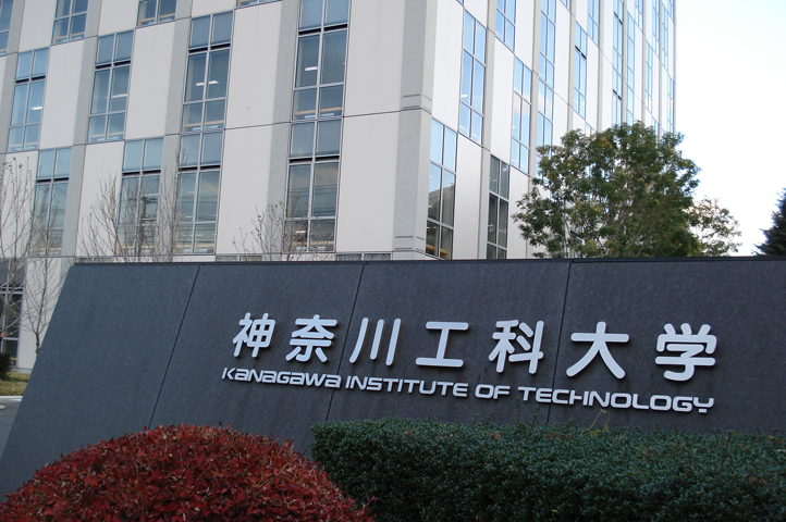
Highlights include Joshibi University of Art and Design, Kanagawa Institute of Technology, Katsusaka Site and Tanamukaihara Site.
Weather in Zama
Forecast from MET Norway (CC BY 4.0). Full forecast
About Zama
Zama (座間市, Zama-shi) is a city located in Kanagawa Prefecture, Japan. As of 1 June 2021, it had an estimated population of 130,667 and a population density of 7,400 persons per km2. The total area is 17.58 square kilometres (6.79 sq mi). The city hosts the United States Army Camp Zama base.
From the Wikipedia article Zama, Kanagawa (this version), under CC BY-SA 4.0.
Things to do7

Joshibi University of Art and Design
School · 4.5 km
Higher education institution in Kanagawa Prefecture, Japan
Kanagawa Institute of Technology
School · 4.5 km
Higher education institution in Kanagawa Prefecture, Japan

Sagami Women's University
School · 6.2 km
Private college in Sagamihara, Japan
Tokyo Jogakkan College
School · 7.0 km
College in Machida, Tokyo, Japan



Museums and landmarks78

Katsusaka Site
Monument and historic site · 2.3 km
Archaeological site of the Jomon period in Sagamihara City, Kanagawa Prefecture.

Tanamukaihara Site
Monument and historic site · 5.6 km
Ruins in Sagamihara, Japan



66 more on the map.
Parks, trails and playgrounds172






160 more on the map.
Restaurants and cafes126

114 more on the map.
History
The area around Zama has been settled since prehistoric times, and Jōmon period remains have been found. The hamlet of "Izama" was a post station on the ancient Tōkaidō road connecting Kyoto with the provinces in the Kantō region, and the area was part of the tenryō territory within Sagami Province during the Edo period administered directly by the Tokugawa shogunate through a number of hatamoto-class administrators. During the cadastral reforms after the Meiji Restoration in 1889, the area of present-day Zama consisted of five hamlets in Kōza District, Kanagawa Prefecture.
The area remained very rural until the coming of the Odakyu Electric Railway in 1927 and the Sagami Railway in 1935, which spurred development, but the area was mostly farmland when the Imperial Japanese Army Academy was relocated to the Zama area in 1937. The increase in population led Zama Village to be promoted to Zama town the same year. However, in 1941, Zama Town and surrounding villages were merged into Sagamihara. In 1944, the Kōza Naval Arsenal of the Imperial Japanese Navy was established in the area. It was closed with the end of World War II, and the Imperial Japanese Army Academy was turned over to the United States Army to become Camp Zama.
From the History section of Zama, Kanagawa on Wikipedia, under CC BY-SA 4.0.
Where to stay1
Churches and places of worship81
Shopping32
Gas and EV charging13
Schools, colleges and libraries34
Healthcare29
Map of Zama
250 places. The map loads OpenStreetMap tiles when you open it.
Getting there and nearby towns
United States Naval Air Facility Atsugi (NJA) is the nearest airport with scheduled flights listed in OpenStreetMap, 6 km away.
- Atsugi 5 km south, about 5 min by car
- Yokohama 24 km east, about 24 min by car
- Kawasaki 30 km east, about 30 min by car
- Tokyo 35 km northeast, about 35 min by car
- Kisarazu 50 km east, about 50 min by car
- Matsudo 56 km northeast, about 56 min by car
- Nagareyama 62 km northeast, about 1 h by car
- Narashino 63 km east, about 1 h by car
- Chiba 67 km east, about 1 h by car
- Kashiwa 67 km northeast, about 1 h by car
Drive times are estimates from straight-line distance, not routes.
Local news
Headlines from INDB.
Reviews, tips and questions
Loading what members have shared...
Sources and licences
- GeoNames (CC BY 4.0): population, coordinates, regions and time zone
- OpenStreetMap contributors (ODbL 1.0): places, airports, map data
- Wikidata (CC0 1.0): elevation, founding date, time zone, website, landmarks and historic places
- Wikimedia Commons (see each image): photos
- Wikipedia (CC BY-SA 4.0): overview and history text
Photo credits
- Zama City Hall, (KANAGAWA Pref. Japan), Mj-bird, CC BY-SA 3.0
- Ryugen-in Temple in Zama city, ブルーノ・プラス, CC BY 4.0
- Zama Shrine in Zama city, ブルーノ・プラス, CC BY 4.0
- Enkyouji Temple in Zama city, ブルーノ・プラス, CC BY 4.0
- Zamakamijuku intersection -01, Aimaimyi, CC BY-SA 3.0
- Kanagawa Institute of Technology, Catto at Japanese Wikipedia, CC BY-SA 3.0
- Reconstructed Buildings at Katsusaka Site Park - panoramio, 小林俊通, CC BY-SA 3.0
- Izuminomori Park 01, 椎林 隆夫, CC BY-SA 3.0
- Pond in Yatoyama, Necco128, CC BY-SA 3.0
- Shingan-ji, Necco, CC BY-SA 3.0
- Bando 08 Shokoku-ji 02, tak1701d, CC BY-SA 3.0
- Sagami Sansen Koen 1, Oos ( talk ), CC BY-SA 3.0
- Sagamikokubunzi-hondou, のりまき, CC BY-SA 3.0
- Ryuhoji, Ebina, Oos ( talk ), CC BY-SA 3.0
- Kurihara Shrine in Zama city, ブルーノ・プラス, CC BY 4.0
- 海老名マスジド(正面), Haya4, CC BY 4.0
- Katsusaka Arukayato Site, gaikan, Saigen Jiro, CC0
- Choshoji Temple in Sagamihara city, ブルーノ・プラス, CC BY 4.0
- Yayoi jinja -01, Aimaimyi, CC BY-SA 3.0
- Sagajo, Wikikanamori at Japanese Wikipedia, CC BY-SA 3.0
- 座間高校, CtNF, CC BY-SA 4.0
- Akibayama-1gou, のりまき at Japanese Wikipedia, CC BY-SA 3.0
- Sagami-kokubunji hondou, Saigen Jiro, CC0
- Shingan-ji Temple in Zama city, ブルーノ・プラス, CC BY 4.0
- Zama Suzuka Shrine, 五虎将軍, CC BY-SA 4.0
- Tokyo-Honganzi-Kenseihi-1, のりまき, CC BY 3.0
- Kanigazawa park, Zama 202412-1, 運動会プロテインパワー, CC BY-SA 4.0
- Zama General Hospital 202412, 運動会プロテインパワー, CC BY-SA 4.0
- Suzuka-myojinjya 5a, Thirteen-fri, CC BY-SA 4.0
- 座間市「木いちご野いちご」のケーキ (54689024172), Nori Norisa, CC BY 4.0
- Suzuka no Izumi, Thirteen-fri, CC BY-SA 4.0
- Suzuka-myojinjya 3c, Thirteen-fri, CC BY-SA 4.0
- Suzuka-myojinjya 5b, Thirteen-fri, CC BY-SA 4.0
- Suzuka-myojinjya 4b-2, Thirteen-fri, CC BY-SA 4.0
- Suzuka-myojinjya 3b, Thirteen-fri, CC BY-SA 4.0
- Suzuka-myojinjya 7b, Thirteen-fri, CC BY-SA 4.0
- Suzuka-myojinjya 4b, Thirteen-fri, CC BY-SA 4.0
- Suzuka-myojinjya 8a, Thirteen-fri, CC BY-SA 4.0
- Suzuka-myojinjya 5c, Thirteen-fri, CC BY-SA 4.0
- KANAGAWA 509, MASA KUROFUNE, CC BY-SA 4.0


Page built November 4, 2026. Spotted a mistake? Tell us or suggest a place.