


Shimoda, Japan
下田市
Shimoda is a town of 21,402 people in Shizuoka, Japan, founded in April 1, 1889.
Why visit Shimoda
Townapedia lists 27 museums and landmarks, 18 parks and trails, 45 places to eat, 46 places to stay and 21 attractions in and around town.
Highlights include Shimoda Sea Aquarium, Experience Zoo iZoo, Shimoda Ropeway and Uehara Museum of Modern Art.
Weather in Shimoda
Forecast from MET Norway (CC BY 4.0). Full forecast
About Shimoda
Shimoda (下田市, Shimoda-shi) is a city and port located in Shizuoka Prefecture, Japan. As of 1 February 2024, the city had an estimated population of 19,670 in 10,436 households, and a population density of 188 persons per square kilometre (490 persons/mi2). The total area of the city is 104.71 square kilometres (40.43 sq mi). In the 1850s, Japan was in political crisis over its increasing inability to maintain its national seclusion policy and the issue of what relations, if any, it should have with foreign powers.
From the Wikipedia article Shimoda, Shizuoka (this version), under CC BY-SA 4.0.
Travel tips from other travellers: Shimoda on Wikivoyage (CC BY-SA 4.0).
Things to do21

Shimoda Sea Aquarium
Zoo and aquarium · 1.2 km
Aquarium with jellyfish, dolphin show and more.
22-31 三丁目, 下田市
Mo-Su 09:00-16:00


9 more on the map.
Museums and landmarks27





15 more on the map.
Parks, trails and playgrounds18




6 more on the map.
Restaurants and cafes45


FermenCo. Pizza
Restaurant · Pizza · 2.7 km
Su-Mo 11:00-15:00, Tu closed, We-Fr 11:00-15:00, Sa 11:00-20:30

33 more on the map.
History
Shimoda has been settled since prehistoric times, with numerous Jōmon period remains found within city limits. It is mentioned in Nara period documents as the location to which Prince Ōtsu was exiled in 686 after his failed rebellion, and in Heian period documents in reference to its iron ore deposits. During the Sengoku period it was controlled by the Odawara Hōjō clan, who built a castle (later destroyed by Toyotomi Hideyoshi). Under the Tokugawa shogunate, Shimoda was tenryō territory directly administered by the shōgun. During the Edo period, Shimoda prospered as a seaport, and was a major port of call for coastal vessels travelling between Osaka and Edo. Until 1721, as a security measure, all vessels were obligated to call at Shimoda before proceeding on to Edo.
From the History section of Shimoda, Shizuoka on Wikipedia, under CC BY-SA 4.0.
Where to stay46
Churches and places of worship43
Shopping8
Gas and EV charging12
Schools, colleges and libraries20
Healthcare12
Map of Shimoda
250 places. The map loads OpenStreetMap tiles when you open it.
Getting there and nearby towns
Oshima Airport (OIM) is the nearest airport with scheduled flights listed in OpenStreetMap, 40 km away.
- Shuzenji 33 km north, about 33 min by car
- Numazu 48 km north, about 48 min by car
- Mishima 49 km north, about 49 min by car
- Yugawara 54 km north, about 54 min by car
- Hakone 58 km north, about 58 min by car
- Fuji 59 km northwest, about 59 min by car
- Yaizu 61 km west, about 1 h by car
- Fujieda 65 km west, about 1 h by car
- Odawara 67 km north, about 1 h by car
- Fujinomiya 67 km northwest, about 1 h by car
Drive times are estimates from straight-line distance, not routes.
Local news
Headlines from INDB.
Reviews, tips and questions
Loading what members have shared...
Sources and licences
- GeoNames (CC BY 4.0): population, coordinates, regions and time zone
- OpenStreetMap contributors (ODbL 1.0): places, airports, map data
- Wikidata (CC0 1.0): elevation, founding date, time zone, website, landmarks and historic places
- Wikimedia Commons (see each image): photos
- Wikipedia (CC BY-SA 4.0): overview and history text
Photo credits
- Shimoda Port Shimodau Shizuoka pref Japan02s, 663highland, CC BY 2.5
- Various views in Shimoda Shizuoka 2024 Nov 3 various 22 57 19 386000, Nesnad, CC BY 4.0
- 1 Chome, Shimoda, Shizuoka Prefecture 415-0021, Japan - panoramio (1), Fumihiko Ueno, CC BY 3.0
- 1 Chome, Shimoda, Shizuoka Prefecture 415-0021, Japan - panoramio, Fumihiko Ueno, CC BY 3.0
- Shimoda center townscape 9, Syced, CC0
- Shimoda center townscape 10, Syced, CC0
- Pine tree(Shimoda), Drivephotographer, CC0
- Sailors from USS Mustin enjoy the Shimoda Black Ship Festival. (34845113395), Official U.S. Navy Page from United States of America Daniel A. Taylor/U.S. Navy, Public domain
- 1 Chome, Shimoda, Shizuoka Prefecture 415-0021, Japan - panoramio (2), Fumihiko Ueno, CC BY 3.0
- 2 Chome, Shimoda, Shizuoka Prefecture 415-0022, Japan - panoramio (1), Fumihiko Ueno, CC BY 3.0
- Izukyu Shimoda station 2024 Nov 3 various 22 46 39 375000, Nesnad, CC BY 4.0
- Various views in Shimoda Shizuoka 2024 Nov 3 various 22 57 09 741000, Nesnad, CC BY 4.0
- Izukyu Shimoda station 2024 Nov 3 various 22 46 25 415000, Nesnad, CC BY 4.0
- USS Susquehanna model in Shimoda station square, Shizuoka, woinary, CC BY-SA 2.0
- Izukyu Shimoda station 2024 Nov 3 various 22 47 36 739000, Nesnad, CC BY 4.0
- Izukyu Shimoda station 2024 Nov 3 various 22 48 03 008000, Nesnad, CC BY 4.0
- Izukyu Shimoda station 2024 Nov 3 various 22 47 10 855000, Nesnad, CC BY 4.0
- Shimoda station 伊豆急下田駅 (2639972633), Yamaguchi Yoshiaki from Japan, CC BY-SA 2.0
- Izukyu Shimoda station 2024 Nov 3 various 22 46 51 980000, Nesnad, CC BY 4.0
- Shimoda footbath, Drivephotographer, CC0
- Izukyū Shimoda station front square - Dec 26, 2018, inunami, CC BY 2.0
- Izukyu Shimoda station 2024 Nov 3 various 22 48 28 929000, Nesnad, CC BY 4.0
- Shimoda Cultural Hall, Drivephotographer, CC0
- Shin Shimoda station, Drivephotographer, CC0
- August 2022 in Shimoda and around 5, Syced, CC0
- Izukyu Shimoda station 2024 Nov 3 various 22 48 55 213000, Nesnad, CC BY 4.0
- 2 Chome, Shimoda, Shizuoka Prefecture 415-0022, Japan - panoramio, Fumihiko Ueno, CC BY 3.0
- Various views in Shimoda Shizuoka 2024 Nov 3 various 22 56 56 780000, Nesnad, CC BY 4.0
- Izukyu Shimoda station 2024 Nov 3 various 22 45 56 610000, Nesnad, CC BY 4.0
- Shimoda station, Drivephotographer, CC0
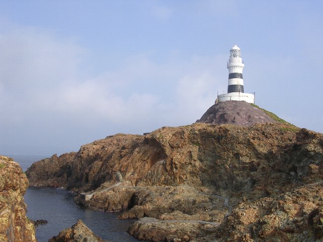
- Mikomotojima-todai, E-190, CC BY-SA 3.0
- Fujisan from Motohakone, Unknown author, CC BY-SA 3.0
- Gyokusenji temple shimoda 2007-02-24, No machine-readable author provided. Geomr~commonswiki assumed (based on copyright claims)., CC BY-SA 3.0
- Ryosenji temple shimoda 2007-02-24, No machine-readable author provided. Geomr~commonswiki assumed (based on copyright claims)., CC BY-SA 3.0
- Gondola to the Nesugata-yama Park, Shimoda, Shizuoka, Japan, User: (WT-shared) Shoestring at wts wikivoyage, CC BY-SA 4.0
- 体感型動物園 iZoo 外観, Izoo-izoo4321, CC BY-SA 3.0
- Shimoda-Kaichu-Suizokukan, キッコーマソ, Public domain
- Ikonahime no mikoto-jinja haiden, Saigen Jiro, CC0
- 下田大和館 - panoramio, alonfloc, CC BY 3.0
- Shimoda Asahi Elementary School-2017, Asasa198, CC BY-SA 4.0
- Shimoda City Library 01, Yaritsusozai, CC BY-SA 4.0
- Shimoda Medical Center, Abasaa, Public domain
- Senda Site, enkei, Saigen Jiro, CC0
- Ryugu Sea Cave 20121010 a, Batholith, Public domain


Page built November 5, 2026. Spotted a mistake? Tell us or suggest a place.