


Suga-inadazutsumi, Japan
Suga-inadazutsumi is a town of 5,842 people in Kanagawa, Japan.
Why visit Suga-inadazutsumi
Townapedia lists 16 museums and landmarks, 59 parks and trails, 337 places to eat, 8 places to stay and 15 attractions in and around town.
Highlights include Den-en Chofu University, Japan Institute of the Moving Image, 調布市郷土博物館 and Fujiko·F·Fujio Museum.
Weather in Suga-inadazutsumi
Forecast from MET Norway (CC BY 4.0). Full forecast
Things to do15

Den-en Chofu University
School · 4.6 km
Higher education institution in Kanagawa Prefecture, Japan

Japan Institute of the Moving Image
School · 5.4 km
Japanese film school and university

Sengawa Theater
Cinema and theater · 5.2 km
Municipal theatre in Japan

Shirayuri University
School · 5.3 km
Education organization in Tokyo, Japan

St. Marianna University School of Medicine
School · 3.9 km
Japanese private medical university


Tokyo University of Foreign Studies
School · 4.7 km
Universities and colleges in Tokyo

University of Electro-Communications
School · 2.3 km
Japanese University



3 more on the map.
Museums and landmarks16



Shimofuda Site
Monument and historic site · 1.3 km
Archaeological site in Chōfu, Japan

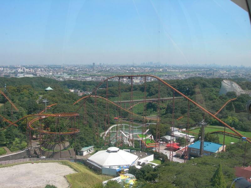

4 more on the map.
Parks, trails and playgrounds59



Higashitakane Site
Park · 5.4 km
Yayoi period settlement trace in Kawasaki, Kanagawa, Japan





47 more on the map.
Restaurants and cafes337




Doutor Coffee Shop
Cafe · Coffee Shop · 2.2 km
Mo-Fr 07:00-21:00; Sa-Su 08:00-20:00
Giglio Rosso
Restaurant · Italian · 2.1 km
11:30-14:00, 18:00-22:00; Tu off
325 more on the map.
Where to stay8
Churches and places of worship24
Shopping57
Gas and EV charging7
Schools, colleges and libraries36
Healthcare37
Map of Suga-inadazutsumi
250 places. The map loads OpenStreetMap tiles when you open it.
Getting there and nearby towns
Yokota Air Base (OKO) is the nearest airport with scheduled flights listed in OpenStreetMap, 21 km away.
- Noborito 2 km southeast, about 2 min by car
- Komae 3 km east, about 3 min by car
- Inagi 4 km west, about 4 min by car
- Fuchū 7 km northwest, about 7 min by car
- Koganei 8 km north, about 8 min by car
- Musashino 8 km north, about 8 min by car
- Azamino 7 km south, about 7 min by car
- Kichijōji-honchō 9 km northeast, about 9 min by car
- Kokubunji 9 km northwest, about 9 min by car
- Nishi-Tokyo-shi 10 km north, about 10 min by car
Drive times are estimates from straight-line distance, not routes.
Local news
Headlines from INDB.
Reviews, tips and questions
Loading what members have shared...
Sources and licences
- GeoNames (CC BY 4.0): population, coordinates, regions and time zone
- OpenStreetMap contributors (ODbL 1.0): places, airports, map data
- Wikidata (CC0 1.0): elevation, founding date, time zone, website, landmarks and historic places
- Wikimedia Commons (see each image): photos
Photo credits
- Den-en Chofu University, Abasaa, Public domain
- 白山校舎外観 1, Yagi kouhou, CC BY-SA 4.0
- Sengawa theater, 運動会プロテインパワー, CC BY-SA 4.0
- Shirayuriwomensuniv, The original uploader was Hykw-a4 at Japanese Wikipedia ., CC BY-SA 3.0
- Showa University of Music, Unknown author, CC BY-SA 3.0
- Seimariannaikauniv, The original uploader was Hykw-a4 at Japanese Wikipedia ., CC BY-SA 3.0
- Toho Gakuen, Nyao148, CC BY-SA 3.0
- 東京外国語大学 - panoramio (16), kanesue, CC BY 3.0
- Uec koudou, The original uploader was Kaoruitoh at Japanese Wikipedia ., Public domain
- Komazawa Women's University in 2009, Nikm, Public domain
- Fujiko・F・Fujio Museum -01, Aimaimyi, CC BY-SA 3.0
- Shimofuda Site, gaikan, Saigen Jiro, CC0
- Taro Okamoto Museum5, 江戸村のとくぞう (Edomura no Tokuzo), CC BY-SA 4.0
- Yomiuriland-20100411, Rsa, CC BY-SA 3.0
- 東高根森林公園、川崎市 - panoramio, Toshihiro Matsui, CC BY-SA 3.0
- Jindai Plants Park 2, ITA-ATU, CC BY-SA 3.0
- 世田谷区 きたみふれあい広場 201504021007 - panoramio, Mitsuyoshi Kondo, CC BY 3.0
- Musashinonomori Park 2, っ, CC BY-SA 3.0
- Bandit Coaster Yomiuriland Overview, thecrypt from UK, CC BY-SA 2.0
- Keiokaku Velodrome, Abasaa, Public domain
- Anazawatenjin, No machine-readable author provided. Waka moana assumed (based on copyright claims)., Public domain
- Nakanoshima Elementary school, Suikotei, CC BY-SA 4.0
- Josho-ji (Chofu), Abasaa, Public domain
- 威光寺 - panoramio (2), 珈琲牛乳, CC BY 3.0
- 長念寺 本堂, Tomo123Ace, CC0
- 藤子・F・不二雄ミュージアム - panoramio, 珈琲牛乳, CC BY 3.0
- Bandit nightview, Sakura Torch, CC BY-SA 4.0
- Chofu-Sta-C-202608, Nyao148, CC BY-SA 4.0
- Inadazutsumi Station platforms 20170630, DAJF This photo was taken with Sony SLT-A77, CC BY-SA 4.0
- 稲田公園 - panoramio, インターネット川崎ガイド, CC BY 3.0
- 多摩川上河原堰稲田取水所 - panoramio, インターネット川崎ガイド, CC BY 3.0
- 多摩川海岸より26km・菅稲田堤3丁目・京王相模原線を望む - panoramio, インターネット川崎ガイド, CC BY 3.0
- Inadazutsumi Station 2025 May 3 various 01, Nesnad, CC BY 4.0
- Inadazutsumi Station 2025 May 3 various 02, Nesnad, CC BY 4.0
- Inadazutsumi Station 2025 May 3 various 03, Nesnad, CC BY 4.0
- Inadazutsumi Station entrance 20170630, DAJF This photo was taken with Sony SLT-A77, CC BY-SA 4.0
- JR Nambu-Line Inadazutsumi Station Platform, Mister0124 This photo was taken with Sony NEX-3, CC BY-SA 4.0
- Inadadutsumi-Station-2006-07-11 2, Syohei Arai This photo was taken with Panasonic Lumix DMC-FX7, CC BY-SA 4.0
- JREast-Nambu-line-JN16-Inadazutsumi-station-platform-20240203-111214, LERK, CC BY-SA 4.0
- JREast-Nambu-line-Inadazutsumi-station-platform, LERK, CC BY 3.0
- Ikuta Ryokuchi Park 9, Syced, CC0


Page built November 5, 2026. Spotted a mistake? Tell us or suggest a place.