


Fuchū, Japan
府中市
Fuchū is a town of 262,790 people in Tokyo, Japan, founded in April 1, 1954.
Why visit Fuchū
Townapedia lists 52 museums and landmarks, 68 parks and trails, 291 places to eat, 15 places to stay and 23 attractions in and around town.
Highlights include Asia University, Fuchu-no-Mori Theater, Fuchu Art Museum and Fuchu City Local Forest Museum.
Weather in Fuchū
Forecast from MET Norway (CC BY 4.0). Full forecast
About Fuchū
Fuchū (府中市, Fuchū-shi) is a city located in the western portion of the Tokyo Metropolis, Japan. Fuchū serves as a regional commercial center and a commuter town for workers in central Tokyo. The city hosts large scale manufacturing facilities for Toshiba, NEC and Suntory, as well as the Bank of Japan's main computer operations center. Local sporting attractions include the Tokyo Racecourse and the training grounds of Top League rugby teams Toshiba Brave Lupus and Suntory Sungoliath.
From the Wikipedia article Fuchū, Tokyo (this version), under CC BY-SA 4.0.
Travel tips from other travellers: Fuchū on Wikivoyage (CC BY-SA 4.0).
Things to do23


Hitotsubashi University
School · 4.0 km
National university in Kunitachi, Tokyo, Japan

International Christian University
School · 4.5 km
University in Tokyo

Japan Lutheran College
School · 5.0 km
Private university in Tokyo, Japan


Musashino Art University
School · 6.5 km
University in Kodaira, western Tokyo

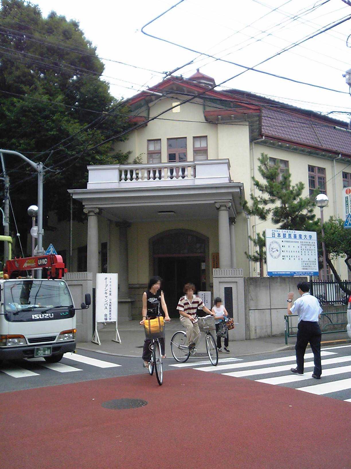
Nippon Veterinary and Life Science University
School · 6.6 km
Private university in Tokyo


Sugino Fashion College
School · 6.0 km
Private college in Shinagawa, Tokyo, Japan

11 more on the map.
Museums and landmarks52


Kodaira Hirakushi Denchu Art Museum
Museum · 4.9 km
Art museum in Tokyo, Japan
Kyōdo-no-Mori
Museum · 2.2 km
Open-air folk museum in Fuchū, Tokyo, Japan

National Institute of Polar Research
Museum · 7.8 km
Japanese research institute for Antarctica

Shimofuda Site
Monument and historic site · 6.9 km
Archaeological site in Chōfu, Japan

Suzuki Site
Monument and historic site · 5.1 km
Archaeological site in Kodaira, Japan


40 more on the map.
Parks, trails and playgrounds68




56 more on the map.
Restaurants and cafes291


COFFEA EXLIBRIS kettle
Cafe · Coffee Shop · 1.1 km
Mo-Fr 12:00-19:00, Sa,Su,PH 11:00-19:00, Tu off
279 more on the map.
History
The government of ancient Musashi Province was established in Fuchū by the Taika Reform, and the city prospered as the local center of politics, economy, and culture. It prospered as a post town on the Kōshū Kaidō highway in the Edo period, and the Kita Tama District public office was placed here after the start of the Meiji era.
645: With the Taika Reforms of the government of Musashi Province was established in Fuchū.
1602: The Fuchū post-town was established with the upgrading of the Kōshū-dochu road (Kōshū Highway).
1868: Nirayama Prefecture was established, and the southwest part of the city region becomes part of it. The remainder was under the jurisdiction of the Musashi prefectural governor.
1869: Shinagawa Prefecture was established, and except for the southwest part, the city becomes part of the prefecture.
1871: Establishment of the prefectural system. Parts of the city were transferred to Kanagawa Prefecture by the next year step by step.
1878: Tama District of Kanagawa Prefecture was divided into three districts: North Tama, South Tama, West Tama, and one district in Tokyo Prefecture: East Tama. The city region became part of North Tama District, whose district offices were established in the city.
1880: Four towns and one village of the central area of the city region merged into Fuchū-eki.
From the History section of Fuchū, Tokyo on Wikipedia, under CC BY-SA 4.0.
Where to stay15
Churches and places of worship27
Shopping40
Gas and EV charging11
Schools, colleges and libraries40
Healthcare38
Map of Fuchū
250 places. The map loads OpenStreetMap tiles when you open it.
Getting there and nearby towns
Yokota Air Base (OKO) is the nearest airport with scheduled flights listed in OpenStreetMap, 14 km away.
- Kokubunji 3 km north, about 3 min by car
- Tachikawa 7 km northwest, about 7 min by car
- Nishi-Tokyo-shi 8 km northeast, about 8 min by car
- Musashino 8 km northeast, about 8 min by car
- Higashimurayama 9 km north, about 9 min by car
- Higashikurume 9 km north, about 9 min by car
- Akishima 11 km northwest, about 11 min by car
- Tokorozawa 14 km north, about 14 min by car
- Hachiōji 14 km west, about 14 min by car
- Machida 15 km south, about 15 min by car
Drive times are estimates from straight-line distance, not routes.
Local news
Headlines from INDB.
Reviews, tips and questions
Loading what members have shared...
Sources and licences
- GeoNames (CC BY 4.0): population, coordinates, regions and time zone
- OpenStreetMap contributors (ODbL 1.0): places, airports, map data
- Wikidata (CC0 1.0): elevation, founding date, time zone, website, landmarks and historic places
- Wikimedia Commons (see each image): photos
- Wikipedia (CC BY-SA 4.0): overview and history text
Photo credits
- FuchuCityHall2023091, Fuchu, CC BY 4.0
- 武蔵府中郵便局 Musashi-Fuchū Post Office 2013.5.17 - panoramio, Nankou Oronain (as36…, CC BY-SA 3.0
- 1 Chome Miyamachi, Fuchū-shi, Tōkyō-to 183-0023, Japan - panoramio, 六九六九緑町, CC BY 3.0
- Asia-University-Japan, The original uploader was Itasan at Japanese Wikipedia ., CC BY-SA 3.0
- Kanematsu auditorium, Wiiii, CC BY-SA 3.0
- ルーテル学院チャペル外観, ルーテル学院大学, CC BY-SA 3.0
- Musashino Art University, The original uploader was Hykw-a4 at Japanese Wikipedia ., CC BY-SA 3.0
- Ariake Campus, Musashino University, Kakidai, CC BY-SA 4.0
- Jyuuitikusanuniv, The original uploader was Hykw-a4 at Japanese Wikipedia ., CC BY-SA 3.0
- Tama University in April 2009, Nikm, Public domain
- Entrance of the Edo-Tokyo Open Air Architectural Museum, Fumiya Fujihara, CC BY 2.0
- Kodaira Hirakushi Denchu Art Museum front, Calton, CC BY-SA 4.0
- National Institute of Japanese Literature, Tamago915 ( talk ), CC BY-SA 3.0
- Shimofuda Site, gaikan, Saigen Jiro, CC0
- Suzuki Remains Museum, Nyao148, CC BY-SA 3.0
- Jindai Plants Park 2, ITA-ATU, CC BY-SA 3.0
- Koganei-Park, Itasan, CC BY 3.0
- Musashinonomori Park 2, っ, CC BY-SA 3.0
- Tama-zoo, Dddeco at Japanese Wikipedia, CC BY-SA 3.0
- Tonogayato1, Irina Gelbukh, CC BY-SA 3.0
- Kyodo no Mori Historic Buildings, Bryanmackinnon, Public domain
- Fuchunomorikoen, っ, CC BY-SA 3.0
- Ōkunitama Shrine, Fuchu, CC BY-SA 4.0
- Tokyo Racecourse Fuji view stand 20070422, Goki, CC BY-SA 3.0
- Tokyo University of Agriculture and Technology Main Hall, Wiiii, CC BY-SA 3.0
- Fuchunomorigeijutugekijo, っ, CC BY-SA 3.0
- Fuchu.no.mori.kouen 02, Fuchu, CC BY-SA 4.0
- Jikeiin temple fuchu tokyo 2009, User:Kentin, CC BY-SA 3.0
- Tokyo Metropolitan Nogyo High School, Hykw-a4, CC BY-SA 3.0
- Togoji.fuchu001, Keyaki, CC BY-SA 4.0
- Syoumyo-ji 01, Fuchu, CC BY-SA 4.0
- Koanji-outside-jan2015, Nesnad, CC BY-SA 3.0
- JRA-RACING MUSEUM, Rsa, CC BY-SA 3.0
- Musashinokokufu-hachimangu 20120715, Saigen Jiro, Public domain
- Fuchu.kyodo.no.mori.kouen18, Fuchu, CC BY-SA 4.0
- 善明寺本堂, カノーサンポ, CC BY-SA 4.0
- Hachiman Jinja (Shiraitodai 1-chome, Fuchu, Tokyo) 01, Abasaa, Public domain
- Chofuku-ji, Fuchu 202502-1, 運動会プロテインパワー, CC BY-SA 4.0
- 東京競馬場 - panoramio (4), くろふね, CC BY 3.0
- Tokyo University of Agriculture and Technology, Wiiii, CC0
- Meisei University Hino Campus, Abasaa, Public domain
- Sugino Fashion College, Shinagawa, Tokyo, Japan, Hykw-a4 at ja.wikipedia., CC BY-SA 3.0
- Siraumegakuen, The original uploader was Hykw-a4 at Japanese Wikipedia ., CC BY-SA 3.0


Page built November 4, 2026. Spotted a mistake? Tell us or suggest a place.