


Suzu, Japan
珠洲市
Suzu is a town of 12,929 people in Ishikawa, Japan, founded in July 15, 1954.
Why visit Suzu
Townapedia lists 17 museums and landmarks, 8 parks and trails, 28 places to eat, 12 places to stay and 10 attractions in and around town.
Highlights include Rokkōsaki Lighthouse, La Porto Suzu, Mawaki Site and Site of Matsunami Castle Garden.
Weather in Suzu
Forecast from MET Norway (CC BY 4.0). Full forecast
About Suzu
Suzu (珠洲市, Suzu-shi) is a city located in northern Ishikawa Prefecture, Japan. As of 31 March 2021, the city had an estimated population of 13,531 in 6013 households, and a population density of 54.6 persons per km2. The total area of the city was 247.20 square kilometres (95.44 sq mi).
From the Wikipedia article Suzu, Ishikawa (this version), under CC BY-SA 4.0.
Things to do10



Museums and landmarks17
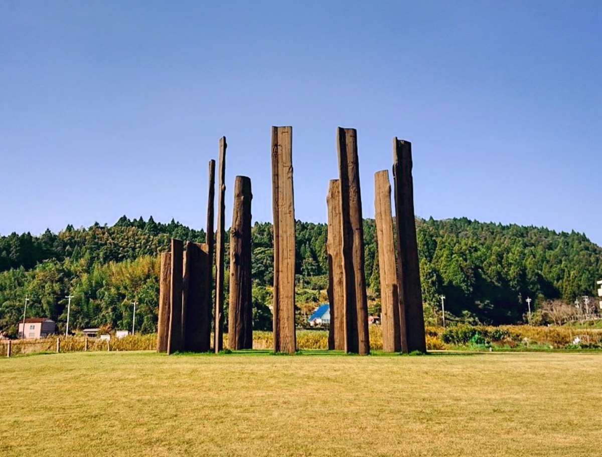
Mawaki Site
Monument and historic site · 15.1 km
Archaeological site in Japan




5 more on the map.
Parks, trails and playgrounds8

Restaurants and cafes28

16 more on the map.
History
In ancient times, Suzu prospered as a gateway for trade by sea, establishing connections with places such as Izumo, Sado and Ezo. In turn, Suzu was introduced to ironware culture from a considerably early period in the Izumo era, and even gained crucial agricultural influence and knowledge to develop an agricultural society. In fact, it is thought that such ancient Noto culture originated and spread outwards from the tip of the Noto Peninsula.
In the second year of the Yōrō (718), Noto Province consisting of the 4 districts of Suzu, Fugeshi, Hakui and Noto was established. For a short period of time, the land was claimed as part of Etchū Province. During this period the famous Ōtomo no Yakamochi recited a poem about the picturesque scenery of Suzu Bay, which would later be included in the famous poetry anthology Man'yōshū.
Later in the Kōji period (1143), Noto Provincial Governor Minamoto no Toshikane established Wakayama shōen which grew to become the largest estate in Noto, expanding territory to take over the majority of land in Suzu. Around this time, production of Suzu ware began, which was exported as far as Hokkaido. The area was also noted from ancient times for the production of salt.
From the History section of Suzu, Ishikawa on Wikipedia, under CC BY-SA 4.0.
Where to stay12
Churches and places of worship14
Shopping7
Gas and EV charging5
Schools, colleges and libraries17
Ishikawa Prefectural Nanao Special Needs Support School Suzu Branch School
School · 3.9 km
Healthcare3
Map of Suzu
121 places. The map loads OpenStreetMap tiles when you open it.
Getting there and nearby towns
Noto Airport (NTQ) is the nearest airport with scheduled flights listed in OpenStreetMap, 30 km away.
- Ushitsu 17 km southwest, about 17 min by car
- Wajima 32 km west, about 32 min by car
- Anamizu 39 km southwest, about 39 min by car
- Nanao 50 km southwest, about 50 min by car
- Nyūzen 59 km south, about 59 min by car
- Hitoto 59 km southwest, about 59 min by car
- Kurobe-shi 62 km south, about 1 h by car
- Hakui 74 km southwest, about 1 h 15 min by car
- Toyama 82 km south, about 1 h 15 min by car
- Kahoku 90 km southwest, about 1 h 30 min by car
Drive times are estimates from straight-line distance, not routes.
Local news
Headlines from INDB.
Reviews, tips and questions
Loading what members have shared...
Sources and licences
- GeoNames (CC BY 4.0): population, coordinates, regions and time zone
- OpenStreetMap contributors (ODbL 1.0): places, airports, map data
- Wikidata (CC0 1.0): elevation, founding date, time zone, website, landmarks and historic places
- Wikimedia Commons (see each image): photos
- Wikipedia (CC BY-SA 4.0): overview and history text
Photo credits
- Suzu City Hall, Hirorinmasa, CC BY-SA 3.0
- Noetsu Cablenet Suzu, ナイトキャビン, CC BY 4.0
- Iida-machi in Suzu, Miyuki Meinaka, CC BY-SA 3.0
- R6 noto earthquake suzu la-porte-suzu 2024-02-16 1, Hurohukidaikon, CC BY 4.0
- R6 noto earthquake suzu iida-area 2024-02-16 1, Hurohukidaikon, CC BY 4.0
- R6 noto earthquake suzu iida-area 2024-02-16 2, Hurohukidaikon, CC BY 4.0
- R6 noto earthquake suzu shopping plaza seaside 2024-02-16 1, Hurohukidaikon, CC BY 4.0
- R6 noto earthquake suzu iida-area 2024-02-16 3, Hurohukidaikon, CC BY 4.0
- R6 noto earthquake suzu iida-area 2024-02-16 5, Hurohukidaikon, CC BY 4.0
- R6 noto earthquake suzu iida-area 2024-02-16 4, Hurohukidaikon, CC BY 4.0
- 1-chōme Iidamachi, Suzu-shi, Ishikawa-ken 927-1214, Japan - panoramio (16), kiwa dokokano, CC BY-SA 3.0
- 1-chōme Iidamachi, Suzu-shi, Ishikawa-ken 927-1214, Japan - panoramio (3), kiwa dokokano, CC BY-SA 3.0
- R6 noto earthquake suzu iida-area 2024-02-16 6, Hurohukidaikon, CC BY 4.0
- 1-chōme Iidamachi, Suzu-shi, Ishikawa-ken 927-1214, Japan - panoramio (7), kiwa dokokano, CC BY-SA 3.0
- 1-chōme Iidamachi, Suzu-shi, Ishikawa-ken 927-1214, Japan - panoramio (15), kiwa dokokano, CC BY-SA 3.0
- 1-chōme Iidamachi, Suzu-shi, Ishikawa-ken 927-1214, Japan - panoramio (17), kiwa dokokano, CC BY-SA 3.0
- 1-chōme Iidamachi, Suzu-shi, Ishikawa-ken 927-1214, Japan - panoramio (8), kiwa dokokano, CC BY-SA 3.0
- 1-chōme Iidamachi, Suzu-shi, Ishikawa-ken 927-1214, Japan - panoramio (10), kiwa dokokano, CC BY-SA 3.0
- 1-chōme Iidamachi, Suzu-shi, Ishikawa-ken 927-1214, Japan - panoramio (11), kiwa dokokano, CC BY-SA 3.0
- 1-chōme Iidamachi, Suzu-shi, Ishikawa-ken 927-1214, Japan - panoramio (19), kiwa dokokano, CC BY-SA 3.0
- 1-chōme Iidamachi, Suzu-shi, Ishikawa-ken 927-1214, Japan - panoramio (12), kiwa dokokano, CC BY-SA 3.0
- 1-chōme Iidamachi, Suzu-shi, Ishikawa-ken 927-1214, Japan - panoramio (9), kiwa dokokano, CC BY-SA 3.0
- 1-chōme Iidamachi, Suzu-shi, Ishikawa-ken 927-1214, Japan - panoramio (13), kiwa dokokano, CC BY-SA 3.0
- 1-chōme Iidamachi, Suzu-shi, Ishikawa-ken 927-1214, Japan - panoramio (14), kiwa dokokano, CC BY-SA 3.0
- 1-chōme Iidamachi, Suzu-shi, Ishikawa-ken 927-1214, Japan - panoramio (5), kiwa dokokano, CC BY-SA 3.0
- 1-chōme-1-13 Iidamachi, Suzu-shi, Ishikawa-ken 927-1214, Japan - panoramio (13), kiwa dokokano, CC BY-SA 3.0
- 1-chōme Iidamachi, Suzu-shi, Ishikawa-ken 927-1214, Japan - panoramio (18), kiwa dokokano, CC BY-SA 3.0
- 1-chōme-1-13 Iidamachi, Suzu-shi, Ishikawa-ken 927-1214, Japan - panoramio (2), kiwa dokokano, CC BY-SA 3.0
- 1-chōme-1-13 Iidamachi, Suzu-shi, Ishikawa-ken 927-1214, Japan - panoramio (14), kiwa dokokano, CC BY-SA 3.0
- 1-chōme Iidamachi, Suzu-shi, Ishikawa-ken 927-1214, Japan - panoramio (1), kiwa dokokano, CC BY-SA 3.0
- 1-chōme Iidamachi, Suzu-shi, Ishikawa-ken 927-1214, Japan - panoramio, kiwa dokokano, CC BY-SA 3.0
- 1-chōme Iidamachi, Suzu-shi, Ishikawa-ken 927-1214, Japan - panoramio (4), kiwa dokokano, CC BY-SA 3.0
- 1-chōme Iidamachi, Suzu-shi, Ishikawa-ken 927-1214, Japan - panoramio (6), kiwa dokokano, CC BY-SA 3.0
- 1-chōme Iidamachi, Suzu-shi, Ishikawa-ken 927-1214, Japan - panoramio (2), kiwa dokokano, CC BY-SA 3.0
- 1-chōme-1-13 Iidamachi, Suzu-shi, Ishikawa-ken 927-1214, Japan - panoramio (15), kiwa dokokano, CC BY-SA 3.0
- 1-chōme-1-13 Iidamachi, Suzu-shi, Ishikawa-ken 927-1214, Japan - panoramio (3), kiwa dokokano, CC BY-SA 3.0
- 1-chōme-1-13 Iidamachi, Suzu-shi, Ishikawa-ken 927-1214, Japan - panoramio (7), kiwa dokokano, CC BY-SA 3.0
- Mawaki Site, MChew, CC BY-SA 4.0
- Rokkosaki Lighthouse 4, photo: Qurren ( talk ) Taken with Canon IXY 430F (Digital IXUS 245 HS), CC BY-SA 3.0
- 20120812lapolte suzu, Ds3wrc no1, CC BY-SA 3.0
- Matsunamijou honmaruato, コヲダ, CC BY-SA 4.0
- Suzu Municipal Misaki Junior High School, Yasu ( talk ), CC BY-SA 3.0
- Kasuga-jinja, Suzu - Haiden, 運動会プロテインパワー, CC BY-SA 4.0
- Ishikawa pref. Iida High School Entrance, Miyuki Meinaka, CC BY-SA 3.0
- Suzu general hospital, 運動会プロテインパワー, CC BY-SA 4.0


Page built November 5, 2026. Spotted a mistake? Tell us or suggest a place.