


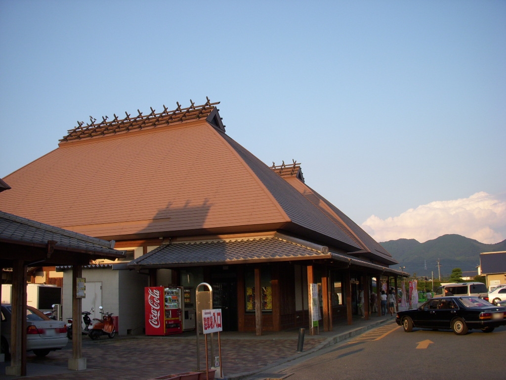


Ukiha, Japan
うきは市
Ukiha is a town of 27,981 people in Fukuoka, Japan, founded in March 20, 2005.
Why visit Ukiha
Townapedia lists 17 museums and landmarks, 11 parks and trails, 18 places to eat, 10 places to stay and 6 attractions in and around town.
Highlights include Mt. Takatori, Hiratsuka Kawazoe Site and 春光園 觀光果園.
Weather in Ukiha
Forecast from MET Norway (CC BY 4.0). Full forecast
About Ukiha
Ukiha (うきは市, Ukiha-shi; Japanese pronunciation: [ɯ̈́.k̟ʲi̥.hä̀, ɯ̈̀.k̟ʲi̥.hä́(.ɕì)]) is a city located in Fukuoka Prefecture, Japan. As of 31 January 2024, the city had an estimated population of 27,723 in 11449 households, and a population density of 240 persons per km2. The total area of the city is 117.46 km2 (45.35 sq mi).
From the Wikipedia article Ukiha, Fukuoka (this version), under CC BY-SA 4.0.
Things to do6


Museums and landmarks17


Hiratsuka Kawazoe Site
Monument and historic site · 10.1 km
Archaeological site in Asakura, Fukuoka Prefecture, Japan

春光園 觀光果園
Monument and historic site · 7.9 km
MAPCODE:166595751*22
Mo-Su 09:00-17:00
5 more on the map.
Parks, trails and playgrounds11


Restaurants and cafes18


6 more on the map.
History
The area of Ukiha was part of ancient Chikugo Province. During the Edo Period the area was under the control of Kurume Domain. After the Meiji restoration, the village of Ukiha was established on May 1, 1889 with the creation of the modern municipalities system. Ukima merged with the village of Tsubago on April 1, 1929 to form the village of Miyuki, which was raised to town status on January 1, 1951. Three months later, Miyuki merged with the villages of Oishi, Himeji and Yamaharu to form the town of Ukiha. Ukiha absorbed the town of Yoshii and was raised to city status on March 20, 2005.
From the History section of Ukiha, Fukuoka on Wikipedia, under CC BY-SA 4.0.
Where to stay10
Churches and places of worship5
Shopping7
Gas and EV charging12
Schools, colleges and libraries39
Healthcare11
Map of Ukiha
136 places. The map loads OpenStreetMap tiles when you open it.
Getting there and nearby towns
Fukuoka Airport (FUK) is the nearest airport with scheduled flights listed in OpenStreetMap, 38 km away.
- Amagi 11 km northwest, about 11 min by car
- Tachiarai 13 km west, about 13 min by car
- Kurume 22 km west, about 22 min by car
- Chikushino-shi 27 km northwest, about 27 min by car
- Dazaifu 27 km northwest, about 27 min by car
- Iizuka 32 km north, about 32 min by car
- Ōnojō 32 km northwest, about 32 min by car
- Kasuga 33 km northwest, about 33 min by car
- Umi 32 km northwest, about 32 min by car
- Fukuoka 41 km northwest, about 41 min by car
Drive times are estimates from straight-line distance, not routes.
Local news
Headlines from INDB.
Reviews, tips and questions
Loading what members have shared...
Sources and licences
- GeoNames (CC BY 4.0): population, coordinates, regions and time zone
- OpenStreetMap contributors (ODbL 1.0): places, airports, map data
- Wikidata (CC0 1.0): elevation, founding date, time zone, website, landmarks and historic places
- Wikimedia Commons (see each image): photos
- Wikipedia (CC BY-SA 4.0): overview and history text
Photo credits
- Ukiha City Hall, Waka77, CC0
- Hirazuka Kawazoe Archaeological Park 05, 水だらけのプール, CC BY-SA 4.0
- Michi no eki Ukiha, みんと at Japanese Wikipedia, Public domain
- Ukiha Chitose Elementary School 2022, hyolee2, CC BY-SA 4.0
- Ukiha Junior High School, hyolee2, CC BY-SA 4.0
- Asakura Haki Junior High School, hyolee2, CC BY-SA 4.0
- 水神社 うきは市吉井町, あじさか, CC BY-SA 4.0
- Chikugogawa River from Esonoshukubashi Bridge 3, そらみみ, CC BY-SA 4.0
- Chikugogawa River from Esonoshukubashi Bridge 2, そらみみ, CC BY-SA 4.0
- Mount Maderayama and grand camphor tree "Kakurega no mori" from Esonoshukubashi Bridge, そらみみ, CC BY-SA 4.0
- Chikugogawa River from Esonoshukubashi Bridge, そらみみ, CC BY-SA 4.0
- うきは市役所 20261007, あじさか, CC BY-SA 4.0
- Street view on north side of Esonoshukubashi Bridge, そらみみ, CC BY-SA 4.0
- Esonoshukubashi Bridge on Chikugogawa River, そらみみ, CC BY-SA 4.0
- Chikugogawa River near Esonoshukubashi Bridge 3, そらみみ, CC BY-SA 4.0
- Horikawa Aqueduct near Esonoshukubashi Bridge, そらみみ, CC BY-SA 4.0
- 郵便ポスト うきは市吉井町 901316, あじさか, CC BY-SA 4.0
- Chikugogawa River near Esonoshukubashi Bridge 2, そらみみ, CC BY-SA 4.0
- Chikugogawa River near Esonoshukubashi Bridge, そらみみ, CC BY-SA 4.0
- Horikawa Aqueduct from Kakureganomoribashi Bridge, そらみみ, CC BY-SA 4.0
- Horikawa Aqueduct from Kakureganomoribashi Bridge 2, そらみみ, CC BY-SA 4.0
- View of Esonoshukubashi Bridge on Chikugogawa River, そらみみ, CC BY-SA 4.0
- 徳光堂水位局, あじさか, CC BY-SA 4.0
- Mino Mountains and Esonoshukubashi Bridge, そらみみ, CC BY-SA 4.0
- Horikawa Aqueducts near Yamada Weir 3, そらみみ, CC BY-SA 4.0
- Chikugogawa River near Yamada Weir, そらみみ, CC BY-SA 4.0
- View of Esonoshukubashi Bridge on Chikugogawa River 2, そらみみ, CC BY-SA 4.0
- View of Yamada Weir on Chikugogawa River, そらみみ, CC BY-SA 4.0
- Fukuoka Prefectural Road No.14 on south side of Esonoshuku Crossroads, そらみみ, CC BY-SA 4.0
- View of Yamada Weir on Chikugogawa River 2, そらみみ, CC BY-SA 4.0
- View of Yamada Weir, そらみみ, CC BY-SA 4.0
- View of Mount Maderayama near Esonoshuku Crossroads, そらみみ, CC BY-SA 4.0
- Esonoshuku Crossroads 20170326, そらみみ, CC BY-SA 4.0
- Esonoshuku Crossroads 20170326-2, そらみみ, CC BY-SA 4.0
- Horikawa Aqueducts near Yamada Weir, そらみみ, CC BY-SA 4.0
- Yamada Weir on Chikugogawa River 4, そらみみ, CC BY-SA 4.0
- 山田の堰の下流は絶好のポイント - panoramio, UltraH, CC BY-SA 3.0
- Yamada Weir on Chikugogawa River 5, そらみみ, CC BY-SA 4.0
- Toriis of Eso Hachiman Shrine, そらみみ, CC BY-SA 4.0
- Horikawa Aqueducts near Yamada Weir 2, そらみみ, CC BY-SA 4.0


Page built November 5, 2026. Spotted a mistake? Tell us or suggest a place.