


Keasbey, New Jersey
Keasbey is a community of 2,252 people in Middlesex County, New Jersey.
Why visit Keasbey
Townapedia lists 15 museums and landmarks, 10 parks and trails, 9 places to eat, 4 places to stay and 5 attractions in and around town.
Highlights include Driscoll Bridge, Edison Bridge, Conference House and Kearny Cottage.
July is the warmest month, with average highs of 86°F; January lows average 23°F, and about 29 inches of snow fall in a normal year.
Weather in Keasbey
Forecast from the National Weather Service. Full forecast
About Keasbey
Keasbey (pronounced "KAYS-bee") is a census-designated place (CDP) and unincorporated community in Woodbridge Township, Middlesex County, New Jersey, United States. It is located in the western outskirts of adjacent Perth Amboy. As of the 2020 census, the CDP's population was 3,027. Many Hispanic / Latino families have relocated from Perth Amboy to Keasbey.
From the Wikipedia article Keasbey, New Jersey (this version), under CC BY-SA 4.0.
Things to do5

Driscoll Bridge
Bridge · 0.7 mi
Toll bridge in New Jersey carrying the Garden State Parkway


Raritan Bay Drawbridge
Bridge · 2.1 mi
Bridge in United States of America

Stephen J. Capestro Theatre
Cinema and theater · 2.4 mi
Outdoor theater in Edison, New Jersey

Museums and landmarks15
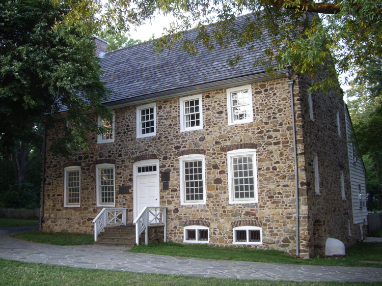
Conference House
Monument and historic site · National Register of Historic Places · 3.1 mi
Staten Island, New York location listed on National Register of Historic Places

Kearny Cottage
Monument and historic site · National Register of Historic Places · 2.5 mi
Historic house in New Jersey, United States

Mary Wilkins Freeman House
Monument and historic site · National Register of Historic Places · 3.1 mi
Historic house in Middlesex County, New Jersey

Metuchen Borough Hall
Monument and historic site · National Register of Historic Places · 3.4 mi
City hall of Metuchen, New Jersey

Metuchen Post Office
Monument and historic site · National Register of Historic Places · 3.1 mi
Historic building in Metuchen, New Jersey

Middlesex Avenue–Woodwild Park Historic District
Monument and historic site · National Register of Historic Places · 3.3 mi
Historic district in Metuchen, New Jersey

Perth Amboy
Monument and historic site · National Register of Historic Places · 2.0 mi
NJ Transit railway station
Perth Amboy City Hall and Surveyor General's Office
Monument and historic site · National Register of Historic Places · 2.5 mi
Historic buildings in Perth Amboy, New Jersey

Perth Amboy Public Library
Monument and historic site · National Register of Historic Places · 2.2 mi
Public library in Perth Amboy, New Jersey

Proprietary House
Monument and historic site · National Register of Historic Places · 2.4 mi
Historic building in Perth Amboy, New Jersey

Roosevelt Hospital
Monument and historic site · National Register of Historic Places · 2.9 mi
Historic building in Edison, New Jersey


Ward's Point
Monument and historic site · National Register of Historic Places · 3.3 mi
Southernmost point in the State of New York
3 more on the map.
Parks, trails and playgrounds10

Conference House Park
Park · 3.2 mi
Park in the United States of America

Restaurants and cafes9

Rosevelt's Deli
Restaurant · Sandwich · 1.2 mi
684 King Georges Post Road, Woodbridge Township
Mo-Fr 06:00-22:00; Sa 07:00-22:00; Su 08:00-15:00

Burger King
Fast food · Burger · 1.0 mi
147 New Brunswick Avenue, Hopelawn
Mo-Sa 06:00-23:00; Su 07:00-23:00
History
Keasbey was originally known as "Florida Grove" due to its picnic areas and beaches on the Raritan River.
The community is named after the Keasbey family, whose home in Morristown is now Macculloch Hall, a museum. One of the brick manufacturers established in Keasbey was owned by the Keasbey family.
Arizona Beverage Company, the makers of AriZona Iced Tea, opened AriZonaLand at its 70-acre (28 ha) facility, offering visitors a "Willy-Wonka-esque" tour of its factory, complete with a gift shop and museum.
Major sections of Smith Street, a critical artery connecting Keasbey to Perth Amboy has been closed since September 2025, when a quarter-mile-long crack split the roadway, leading to months of anticipated repairs and significant traffic detours related to reconstruction of the road.
From the History section of Keasbey, New Jersey on Wikipedia, under CC BY-SA 4.0.
Where to stay4
Churches and places of worship12
Simpson United Methodist Church
Church · National Register of Historic Places · 2.5 mi
St. Peter's Episcopal Church
Church · National Register of Historic Places · 2.6 mi
Faith Deliverance Family Worship Center
Place of worship · 1.5 mi
337 Herbert Street, Perth Amboy
Shopping3
Gas and EV charging4
Schools, colleges and libraries44
Academy For Urban Leadership Charter School
School · 1.9 mi
612 Amboy Ave, Perth Amboy
Benjamin Franklin Elementary School
School · 3.7 mi
2485 Woodbridge Avenue, Edison
Edmund Hmieleski Early Childhood Center
School · 2.3 mi
925 Amboy Avenue, Perth Amboy
Edward J. Patten Elementary School
School · 2.3 mi
500 Charles Street, Perth Amboy
Healthcare1
Map of Keasbey
107 places. The map loads OpenStreetMap tiles when you open it.
Climate by month
Monthly table
| Month | High | Low | Rain | Snow |
|---|---|---|---|---|
| Jan | 40°F | 23°F | 3.7 in | 8.3 in |
| Feb | 43°F | 24°F | 3.0 in | 9.3 in |
| Mar | 51°F | 31°F | 4.4 in | 5.2 in |
| Apr | 62°F | 41°F | 3.9 in | 0.6 in |
| May | 72°F | 51°F | 4.0 in | 0.0 in |
| Jun | 81°F | 60°F | 4.8 in | 0.0 in |
| Jul | 86°F | 66°F | 4.8 in | 0.0 in |
| Aug | 85°F | 64°F | 4.7 in | 0.0 in |
| Sep | 78°F | 56°F | 4.2 in | 0.0 in |
| Oct | 66°F | 44°F | 4.1 in | 0.2 in |
| Nov | 56°F | 35°F | 3.4 in | 0.5 in |
| Dec | 45°F | 28°F | 4.5 in | 4.9 in |
U.S. Climate Normals 1991-2020 for New Brunswick 3 Se Hcn (7 mi away), NOAA NCEI.
People and cost of living
American Community Survey 5-year estimates, 2020-2024, U.S. Census Bureau. Estimates have margins of error, larger for small towns.
Disaster history
Middlesex County has had 17 federal disaster declarations since 2000, most often for hurricanes.
- 2021-09-05: Remnants Of Hurricane Ida (Hurricane)
- 2021-09-02: Remnants Of Hurricane Ida (Hurricane)
- 2020-03-25: Covid-19 Pandemic (Biological)
- 2020-03-13: Covid-19 (Biological)
- 2016-03-14: Severe Winter Storm And Snowstorm (Severe Storm)
- 2012-10-30: Hurricane Sandy (Hurricane)
OpenFEMA disaster declarations summaries.
Getting there and nearby towns
Linden Airport (LDJ) is the nearest airport with scheduled flights listed in OpenStreetMap, 8 miles away.
- Hopelawn 1 mi northeast, about 2 min by car
- Fords 1 mi north, about 2 min by car
- Perth Amboy 2 mi east, about 3 min by car
- Woodbridge 3 mi northeast, about 5 min by car
- Sayreville 3 mi south, about 5 min by car
- Metuchen 3 mi northwest, about 5 min by car
- Iselin 4 mi north, about 6 min by car
- Colonia 5 mi north, about 8 min by car
- Avenel 5 mi northeast, about 8 min by car
- South River 6 mi southwest, about 10 min by car
Drive times are estimates from straight-line distance, not routes.
Local news
Headlines from INDB, the NEMICO news database.
Reviews, tips and questions
Loading what members have shared...
Sources and licences
- NCES EDGE (Public domain): public schools
- NOAA NCEI U.S. Climate Normals 1991-2020 (Public domain): climate by month
- OpenFEMA (Public domain): disaster declarations
- OpenStreetMap contributors (ODbL 1.0): places, airports, map data
- U.S. Census Bureau (Public domain): population, income, housing, education, commute
- Wikidata (CC0 1.0): elevation, founding date, time zone, website, landmarks and historic places
- Wikimedia Commons (see each image): photos
- Wikipedia (CC BY-SA 4.0): overview and history text
Photo credits
- 300 Middlesex Avenue, Metuchen, NJ - Corbin House, Zeete, CC BY-SA 4.0
- Roosevelt Hospital, Edison, NJ - north view, Zeete, CC BY-SA 3.0
- Perth Amboy Station - April 2015, Adam Moss, CC BY-SA 2.0
- South Pole SI jeh, Jim.henderson, Public domain
- Perth Amboy Public Library, NJ - 2025, Zeete, CC BY-SA 4.0
- Conference-house-staten-island, Dmadeo, CC BY-SA 3.0
- ProprietaryHousePerthAmboy, Rafaelgarcia, Public domain
- StPetersPerthAmboy, KForce, CC BY-SA 3.0
- Simpson United Methodist Church, PeterMac13, CC BY-SA 3.0
- MetuchenNJ MaryWilkinsFreemanHouse, Magicpiano, CC BY-SA 4.0
- MetuchenPostOffice, KForce, CC BY-SA 3.0
- LawrenceKearnyHouse, KForce, CC BY-SA 3.0
- PerthAmboyFerrySlip, KForce at en.wikipedia, CC BY-SA 3.0
- Raritan Bay Bridge, Lithium6ion, Public domain
- Driscoll-vieser-edison bridges 2002, Lamune, CC BY 3.0
- Victory Bridge from US 9, O, Public domain
- 2020-07-13 17 05 34 View north along New Jersey State Route 440 (Middlesex Freeway) at the exit for U.S. Route 9 SOUTH in Woodbridge Township, Middlesex County, New Jersey, Famartin, CC BY-SA 4.0
- 2021-08-24 12 30 26 View south along New Jersey State Route 440 (Middlesex Freeway) from the overpass for the ramps to Middlesex County Route 656 (Riverside Drive) in Woodbridge Township, Middlesex..., Famartin, CC BY-SA 4.0
- 2021-08-24 12 33 52 View north along New Jersey State Route 440 (Middlesex Freeway) from the overpass for the ramps to Middlesex County Route 656 (Riverside Drive) in Woodbridge Township, Middlesex..., Famartin, CC BY-SA 4.0
- 2021-08-24 12 37 50 View north along New Jersey State Route 440 (Middlesex Freeway) from the overpass for the rail line just north of the ramps to Middlesex County Route 656 (Riverside Drive) in..., Famartin, CC BY-SA 4.0
- 2021-08-24 12 37 38 View south along New Jersey State Route 440 (Middlesex Freeway) from the overpass for the rail line just north of the ramps to Middlesex County Route 656 (Riverside Drive) in..., Famartin, CC BY-SA 4.0
- 2020-07-13 17 09 05 View north along New Jersey State Route 440 (Middlesex Freeway) at the exit for Garden State Parkway SOUTH in Woodbridge Township, Middlesex County, New Jersey, Famartin, CC BY-SA 4.0
- 2018-05-20 14 43 38 View south along New Jersey Route 440 (Middlesex Freeway) just south of the interchange with the Garden State Parkway and U.S. Route 9 in Woodbridge Township, Middlesex County..., Famartin, CC BY-SA 4.0
- 2021-08-24 12 21 06 View north along New Jersey State Route 440 (Middlesex Freeway) from the overpass for Middlesex County Route 629 (Industrial Avenue) in Woodbridge Township, Middlesex County, New..., Famartin, CC BY-SA 4.0
- 2021-08-24 12 20 17 View south along New Jersey State Route 440 (Middlesex Freeway) from the overpass for Middlesex County Route 629 (Industrial Avenue) in Woodbridge Township, Middlesex County, New..., Famartin, CC BY-SA 4.0
- 2020-07-14 10 39 56 View south along New Jersey State Route 440 (Middlesex Freeway) at the exit for U.S. Route 9 SOUTH-Garden State Parkway SOUTH in Woodbridge Township, Middlesex County, New Jersey, Famartin, CC BY-SA 4.0
- 2021-05-28 10 06 06 View north along New Jersey State Route 444 (Garden State Parkway) from the overpass for New Jersey State Route 440 (Middlesex Freeway) in Woodbridge Township, Middlesex County..., Famartin, CC BY-SA 4.0
- 2020-08-22 13 17 47 View north along U.S. Route 9 at the exit for New Jersey State Route 440-Interstate 287 (Raritan Center, Perth Amboy, Staten Island) in Woodbridge Township, Middlesex County, New..., Famartin, CC BY-SA 4.0
- 2021-05-28 09 50 10 View south along New Jersey State Route 444 (Garden State Parkway) from the overpass for New Jersey State Route 440 (Middlesex Freeway) in Woodbridge Township, Middlesex County..., Famartin, CC BY-SA 4.0
- 2021-07-22 15 15 17 View north along the southbound lanes of U.S. Route 9 from the overpass for New Jersey State Route 440 (Middlesex Freeway) in Woodbridge Township, Middlesex County, New Jersey, Famartin, CC BY-SA 4.0
- 2021-07-22 15 06 07 View south along U.S. Route 9 from the overpass for New Jersey State Route 440 (Middlesex Freeway) in Woodbridge Township, Middlesex County, New Jersey, Famartin, CC BY-SA 4.0
- 2021-07-22 15 14 42 View north along the northbound lanes of U.S. Route 9 from the overpass for New Jersey State Route 440 (Middlesex Freeway) in Woodbridge Township, Middlesex County, New Jersey, Famartin, CC BY-SA 4.0
- 2020-07-13 17 13 29 View north along New Jersey State Route 440 (Middlesex Freeway) at the exit for U.S. Route 9 NORTH-Garden State Parkway NORTH-Smith Street-Perth Amboy in Woodbridge Township..., Famartin, CC BY-SA 4.0
- 2020-07-13 17 01 35 View north along New Jersey State Route 440 (Middlesex Freeway) at the exit for Smith Street-Riverside Drive-Fords in Woodbridge Township, Middlesex County, New Jersey, Famartin, CC BY-SA 4.0
- 2021-07-22 15 30 44 View south along the southbound lanes of U.S. Route 9 from the overpass for the ramp to New Jersey State Route 440 (Middlesex Freeway) in Woodbridge Township, Middlesex County..., Famartin, CC BY-SA 4.0
- 2021-05-28 10 24 00 Sodium-vapor street light lit during the day above U.S. Route 9 just north of New Jersey State Route 440 (Middlesex Freeway) in Woodbridge Township, Middlesex County, New Jersey, Famartin, CC BY-SA 4.0
- 2021-07-22 15 37 51 View north along the southbound lanes of U.S. Route 9 from the overpass for the ramp to New Jersey State Route 440 (Middlesex Freeway) in Woodbridge Township, Middlesex County..., Famartin, CC BY-SA 4.0
- 2021-05-28 10 34 46 View south along New Jersey State Route 444 (Garden State Parkway) from the overpass for ramp to New Jersey State Route 440 (Middlesex Freeway) in Woodbridge Township, Middlesex..., Famartin, CC BY-SA 4.0
- 2021-07-22 15 31 31 View south along the northbound lanes of U.S. Route 9 from the overpass for the ramp to New Jersey State Route 440 (Middlesex Freeway) in Woodbridge Township, Middlesex County..., Famartin, CC BY-SA 4.0
- 2021-05-28 10 37 18 View north along New Jersey State Route 444 (Garden State Parkway) from the overpass for rail line just north of the ramp to New Jersey State Route 440 (Middlesex Freeway) in..., Famartin, CC BY-SA 4.0


Page built October 30, 2026. Spotted a mistake? Tell us or suggest a place.