


Lenox, Massachusetts
Lenox is a community of 1,866 people in Berkshire County, Massachusetts.
Why visit Lenox
Townapedia lists 20 museums and landmarks, 14 parks and trails, 16 places to eat, 8 places to stay and 7 attractions in and around town.
Highlights include Elm Court, Frelinghuysen Morris House and Studio, Kennedy Park and Tanglewood.
July is the warmest month, with average highs of 82°F; January lows average 13°F.
Weather in Lenox
Forecast from the National Weather Service. Full forecast
About Lenox
Lenox, also known as Lenox Center, is a census-designated place (CDP) in the town of Lenox in Berkshire County, Massachusetts, United States. The population was 1,675 at the 2010 census, out of 5,025 in the entire town of Lenox.
From the Wikipedia article Lenox (CDP), Massachusetts (this version), under CC BY-SA 4.0.
Things to do7


Museums and landmarks20

Elm Court
Monument and historic site · National Register of Historic Places · 1.6 mi
Historic house in Massachusetts, United States

Frelinghuysen Morris House and Studio
Museum · National Register of Historic Places · 1.1 mi
House museum and studio in Stockbridge and Lennox, Massachusetts

Lenox Academy
Monument and historic site · National Register of Historic Places
Historic school building in Lenox, Massachusetts, United States

Lenox High School
Monument and historic site · National Register of Historic Places
High school in Massachusetts, United States

Lenox Railroad Station
Monument and historic site · National Register of Historic Places · 2.2 mi
Railway station in Lenox, the United States of America

Lenox Village Historic District
Monument and historic site · National Register of Historic Places
Historic district in Lenox, Massachusetts
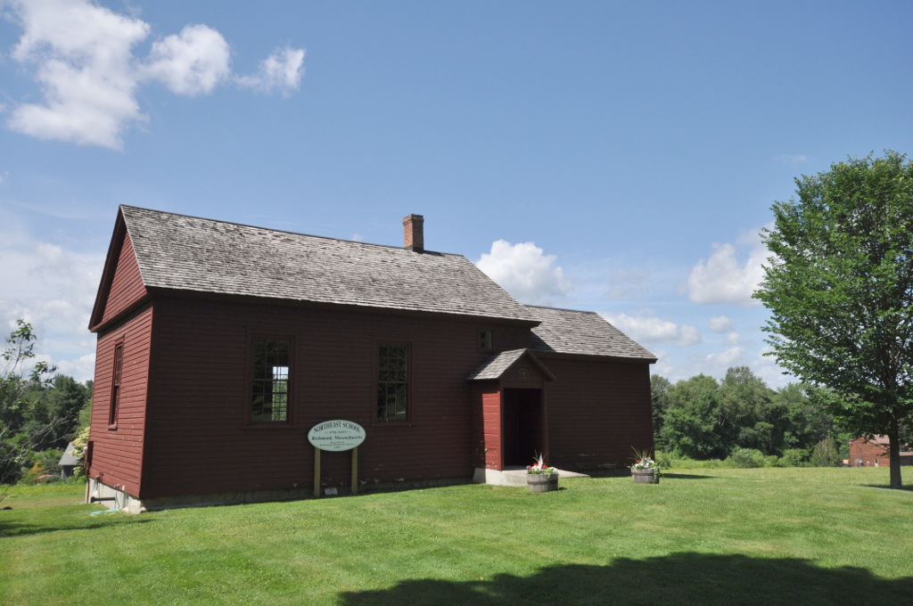
Northeast School
Monument and historic site · National Register of Historic Places · 3.5 mi
Historic school building in Richmond, Massachusetts, United States

Shadow Brook Farm Historic District
Monument and historic site · National Register of Historic Places · 2.3 mi
Historic district in Massachusetts, United States
The Mount
Monument and historic site · National Register of Historic Places · 2.1 mi
Country house in Lenox, Massachusetts

Ventfort Hall Mansion and Gilded Age Museum
Monument and historic site · National Register of Historic Places · 0.7 mi
Building in Massachusetts, United States


Wheatleigh
Monument and historic site · National Register of Historic Places · 1.6 mi
Historic country estate in Stockbridge, Massachusetts, United States

8 more on the map.
Parks, trails and playgrounds14


Roche Reserve, Berkshire Natural Resource Council (BNRC)
Hiking and trails · 0.7 mi
2 more on the map.
Restaurants and cafes16





4 more on the map.
Where to stay8
Churches and places of worship3
Church on the Hill
Church · United Church Of Christ · National Register of Historic Places
55 Main Street, Lenox
Trinity Episcopal Church
Church · Anglican · National Register of Historic Places · 0.5 mi
88 Walker Street, Lenox
Shopping3
Gas and EV charging1
Schools, colleges and libraries17
Healthcare1
Map of Lenox
90 places. The map loads OpenStreetMap tiles when you open it.
Climate by month
Monthly table
| Month | High | Low | Rain |
|---|---|---|---|
| Jan | 32°F | 13°F | 3.5 in |
| Feb | 35°F | 14°F | 3.1 in |
| Mar | 43°F | 21°F | 3.7 in |
| Apr | 56°F | 32°F | 3.8 in |
| May | 69°F | 43°F | 4.2 in |
| Jun | 77°F | 52°F | 4.8 in |
| Jul | 82°F | 57°F | 4.5 in |
| Aug | 81°F | 55°F | 4.2 in |
| Sep | 72°F | 48°F | 4.5 in |
| Oct | 59°F | 37°F | 4.8 in |
| Nov | 47°F | 28°F | 3.6 in |
| Dec | 36°F | 19°F | 4.5 in |
U.S. Climate Normals 1991-2020 for Lenox Dale (3 mi away), NOAA NCEI.
People and cost of living
American Community Survey 5-year estimates, 2020-2024, U.S. Census Bureau. Estimates have margins of error, larger for small towns.
Disaster history
Berkshire County has had 19 federal disaster declarations since 2000, most often for severe storms.
- 2023-09-15: Hurricane Lee (Hurricane)
- 2020-03-27: Covid-19 Pandemic (Biological)
- 2020-03-13: Covid-19 (Biological)
- 2013-04-19: Severe Winter Storm, Snowstorm, And Flooding (Severe Storm)
- 2012-10-28: Hurricane Sandy (Hurricane)
- 2012-01-06: Severe Storm And Snowstorm (Severe Storm)
OpenFEMA disaster declarations summaries.
Getting there and nearby towns
Pittsfield Municipal Airport (PSF) is the nearest airport with scheduled flights listed in OpenStreetMap, 4 miles away.
- Lee 4 mi southeast, about 7 min by car
- Pittsfield 6 mi north, about 10 min by car
- Housatonic 9 mi southwest, about 14 min by car
- Great Barrington 12 mi south, about 20 min by car
- North Adams 23 mi north, about 38 min by car
- Westfield 31 mi southeast, about 50 min by car
- Northampton 31 mi east, about 50 min by car
- Easthampton 32 mi east, about 52 min by car
- Albany 33 mi northwest, about 54 min by car
- Troy 33 mi northwest, about 52 min by car
Drive times are estimates from straight-line distance, not routes.
Local news
Headlines from INDB, the NEMICO news database.
Reviews, tips and questions
Loading what members have shared...
Sources and licences
- NCES EDGE (Public domain): public schools
- NOAA NCEI U.S. Climate Normals 1991-2020 (Public domain): climate by month
- OpenFEMA (Public domain): disaster declarations
- OpenStreetMap contributors (ODbL 1.0): places, airports, map data
- U.S. Census Bureau (Public domain): population, income, housing, education, commute
- Wikidata (CC0 1.0): elevation, founding date, time zone, website, landmarks and historic places
- Wikimedia Commons (see each image): photos
- Wikipedia (CC BY-SA 4.0): overview and history text
Photo credits
- Kemble Street, Lenox, MA, Unknown author Unknown author, Public domain
- Lenox, Massachusetts, Quintin Soloviev, CC BY 4.0
- The Olde Heritage Tavern, Lenox, Doug Kerr from Albany, NY, United States, CC BY-SA 2.0
- Street Railway Terminal, Lenox, Massachusetts - postcard, Unknown author Unknown author, Public domain
- Lenox MA 7-31-26, Ascended Dreamer, CC BY-SA 4.0
- Morris-elementary-in-lenox 25717165816 o, Eric Haynes for the Office of the Governor of Massachusetts, Public domain
- Koussevitzky Music Shed at Tanglewood in Lenox, Massachusetts, Chamberednautilus, CC BY-SA 4.0
- Lenox Library, Lenox MA, John Phelan, CC BY-SA 3.0
- Church on the Hill, Lenox, Massachusetts, Daderot., CC BY-SA 3.0
- Trinity Episcopal Church, Lenox MA, John Phelan, CC BY-SA 3.0
- Shadowbrook, Lenox, MA, Unknown author Unknown author, Public domain
- Lenox Academy, Lenox MA, John Phelan, CC BY-SA 3.0
- Frelinghuysen Morris House and Studio, Vlad b, CC BY-SA 4.0
- Ventforthall, Chrissypan at en.wikipedia, Public domain
- Elm Court, Lenox MA, John Phelan, CC BY-SA 3.0
- Berkshire Scenic Railway Museum, Ham549 at English Wikipedia, CC BY 3.0
- Wheatleigh, Lenox MA, John Phelan, CC BY-SA 3.0
- Lenox High School, Lenox MA, John Phelan, CC BY-SA 3.0
- RichmondMA NortheastSchool, Magicpiano, CC BY-SA 3.0
- Channing Gibson, Jackgibbz, CC BY-SA 4.0
- Peziza domiciliana 159777593, Claire Nish, CC BY 4.0
- Tanglewood OzawaHall July 2009, Titus.jon, CC BY-SA 2.0
- WaitWaitPanel, Pacamah, CC BY 4.0
- WaitWaitTanglewoodTaping, Pacamah, CC BY 4.0
- WaitWaitDontTellMeStage, Pacamah, CC BY 4.0
- WaitWaitDontTellMeStaffandSupport, Pacamah, CC BY 4.0
- BillAndPeterWaitWaitTanglewood, Pacamah, CC BY 4.0
- JoyelleNicoleJohnsonAtTanglewood, Pacamah, CC BY 4.0
- WaitWaitWithPaulGiamatti, Pacamah, CC BY 4.0
- MoRoccaTanglewood, Pacamah, CC BY 4.0
- BostonPopsAtTanglewood, UpstateNYer, CC BY-SA 3.0
- Koussevitzky Music Shed at Tanglewood Music Center, Chamberednautilus, CC BY-SA 4.0
- 20241004 black capped chickadee and american goldfinch pleasant valley PD207710, Paul Danese, CC BY-SA 4.0
- 20241004 black capped chickadee and american goldfinch pleasant valley PD207702, Paul Danese, CC BY-SA 4.0
- 20241004 american goldfinch pleasant valley PD207727, Paul Danese, CC BY-SA 4.0
- 20241004 black capped chickadee pleasant valley PD207705, Paul Danese, CC BY-SA 4.0
- 20260519 chestnut sided warbler pleasant valley ws PD02471, Paul Danese, CC BY-SA 4.0
- 20260831 chestnut sided warbler pleasant valley wildlife sanctuary PD06723, Paul Danese, CC BY-SA 4.0
- 20260831 chestnut sided warbler pleasant valley wildlife sanctuary PD06725 1, Paul Danese, CC BY-SA 4.0
- 20260831 red eyed vireo pleasant valley wildlife sanctuary PD06789, Paul Danese, CC BY-SA 4.0


Page built October 30, 2026. Spotted a mistake? Tell us or suggest a place.