




Little Silver, New Jersey
Little Silver is a borough of 6,105 people in Monmouth County, New Jersey, founded in April 28, 1923.
Why visit Little Silver
Townapedia lists 15 museums and landmarks, 16 parks and trails, 19 places to eat and 4 attractions in and around town.
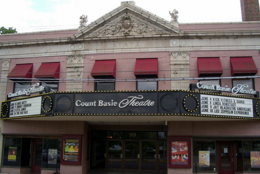
Highlights include Count Basie Theatre, Marion Huber Theater, Allen House and Anthony Reckless Estate.
July is the warmest month, with average highs of 84°F; January lows average 25°F.
Weather in Little Silver
Forecast from the National Weather Service. Full forecast
About Little Silver
Little Silver is a borough in Monmouth County, in the U.S. state of New Jersey. As of the 2020 United States census, the borough's population was 6,131, an increase of 181 (+3.0%) from the 2010 census count of 5,950, which in turn reflected a drop of 220 (−3.6%) from the 6,170 counted in the 2000 census.
From the Wikipedia article Little Silver, New Jersey (this version), under CC BY-SA 4.0.
Things to do4
Count Basie Theatre
Cinema and theater · National Register of Historic Places · 2.0 mi
Theater in Red Bank, New Jersey, United States

Marion Huber Theater
Cinema and theater · 1.9 mi
Smaller stage of the Two River Theater in Red Bank, New Jersey


Two River Theater
Cinema and theater · 2.3 mi
Theater in Red Bank, New Jersey
Museums and landmarks15

Allen House
Monument and historic site · National Register of Historic Places · 1.7 mi
Historic house in Shrewsbury, New Jersey

Anthony Reckless Estate
Monument and historic site · National Register of Historic Places · 1.8 mi
Historic house in Monmouth County, New Jersey

Little Silver
Monument and historic site · National Register of Historic Places · 0.8 mi
NJ Transit rail station

North Long Branch School-Primary No. 3
Monument and historic site · National Register of Historic Places · 3.1 mi
School building in New Jersey, United States of America

Parker Homestead
Monument and historic site · National Register of Historic Places · 1.3 mi
Building in New Jersey, United States

Red Bank
Monument and historic site · National Register of Historic Places · 2.2 mi
New Jersey Transit rail station in Red Bank, New Jersey, United States
T. Thomas Fortune House
Monument and historic site · National Register of Historic Places · 2.1 mi
Historic house in New Jersey, United States

Wardell House
Monument and historic site · National Register of Historic Places · 1.8 mi
Historic house in New Jersey, United States


Seabright Lawn Tennis and Cricket Club
Monument and historic site · National Register of Historic Places · 3.4 mi

Shore Institute for Contemporary Art
Museum · 3.4 mi
Non-profit arts center in Asbury Park, New Jersey
Fort Monmouth Historic District
Monument and historic site · 1.4 mi
National Register of Historic Places ID: 13000764
3 more on the map.
Parks, trails and playgrounds16


4 more on the map.
Restaurants and cafes19

Round Dough With a Hole
Restaurant · Bagel, Sandwich · 1.2 mi
700 Oceanport Avenue, Oceanport
Mo-Su 06:00-14:00




7 more on the map.
History
Prior to the settlement of Europeans, the area that is now Little Silver was inhabited by the Navesink Native Americans.
There are several tales of how Little Silver received its name. In one, brothers Joseph and Peter Parker, who settled in this area in 1667 and owned land bounded by Parker's Creek on the south and Little Silver Creek on the north, named their holdings "Little Silver" after their father's (George Parker) estate in Portsmouth, Rhode Island. The original Parker Homestead, dating to 1725 and one of the state's oldest, was acquired by the borough and is undergoing renovation.
Other explanations for the derivation of the name are the payment to Native Americans for purchase of the land and the placid appearance of the water.
The borough's earliest European residents were primarily farmers, fishermen and merchants.
Parkers – Joseph and Peter Parker originally settled the area, and their original homestead at 235 Rumson Road has been declared a state historic site.
Sickles – Harold and Elsie Sickles acquired land and opened a wholesale truck farm in 1908. The land was acquired from Harold's mother who was related to the Parkers. Transitioning from seasonal to year-round in 1998, Sickles Market became a specialty garden and food market until it closed in March 2024 after 116 years.
From the History section of Little Silver, New Jersey on Wikipedia, under CC BY-SA 4.0.
Churches and places of worship18
Christ Church (Episcopal), Shrewsbury
Church · National Register of Historic Places · 1.7 mi
First Presbyterian Church of Rumson
Church · National Register of Historic Places · 3.0 mi
St. George's-by-the-River Episcopal Church
Church · National Register of Historic Places · 3.5 mi
St. James Memorial Church of Eatontown
Church · National Register of Historic Places · 2.4 mi
St. John's Episcopal Church
Church · National Register of Historic Places
Shopping6
Gas and EV charging3
Schools, colleges and libraries49
Atlantic Highlands Elementary School
School · 5.1 mi
140 First Avenue, Atlantic Highlands
Joseph M. Ferraina Early Childhood Learning Center
School · 3.1 mi
80 Avenel Boulevard, Long Branch
Healthcare2
The Kaga Academy of Aesthetic and Concierge Medicine
Clinic and pharmacy · 1.7 mi
830 Broad Street, Shrewsbury
Map of Little Silver
132 places. The map loads OpenStreetMap tiles when you open it.
Climate by month
Monthly table
| Month | High | Low | Rain |
|---|---|---|---|
| Jan | 42°F | 25°F | 4.2 in |
| Feb | 43°F | 26°F | 3.3 in |
| Mar | 49°F | 32°F | 4.3 in |
| Apr | 59°F | 41°F | 3.9 in |
| May | 68°F | 51°F | 4.1 in |
| Jun | 78°F | 61°F | 4.3 in |
| Jul | 84°F | 67°F | 4.4 in |
| Aug | 82°F | 65°F | 6.3 in |
| Sep | 76°F | 59°F | 4.3 in |
| Oct | 66°F | 47°F | 4.7 in |
| Nov | 56°F | 37°F | 3.8 in |
| Dec | 47°F | 30°F | 4.8 in |
U.S. Climate Normals 1991-2020 for Long Branch-Oakhurst Hcn (3 mi away), NOAA NCEI.
People and cost of living
American Community Survey 5-year estimates, 2020-2024, U.S. Census Bureau. Estimates have margins of error, larger for small towns.
Disaster history
Monmouth County has had 16 federal disaster declarations since 2000, most often for hurricanes.
- 2021-09-05: Remnants Of Hurricane Ida (Hurricane)
- 2021-09-02: Remnants Of Hurricane Ida (Hurricane)
- 2020-12-11: Tropical Storm Isaias (Hurricane)
- 2020-03-25: Covid-19 Pandemic (Biological)
- 2020-03-13: Covid-19 (Biological)
- 2016-03-14: Severe Winter Storm And Snowstorm (Severe Storm)
OpenFEMA disaster declarations summaries.
Getting there and nearby towns
Monmouth Executive Airport (BLM) is the nearest airport with scheduled flights listed in OpenStreetMap, 11 miles away.
- Fair Haven 2 mi north, about 3 min by car
- Red Bank 2 mi northwest, about 3 min by car
- Eatontown 3 mi south, about 5 min by car
- Fairview 3 mi northwest, about 5 min by car
- Long Branch 4 mi southeast, about 6 min by car
- Highlands 5 mi northeast, about 8 min by car
- Atlantic Highlands 5 mi north, about 9 min by car
- Tinton Falls 6 mi southwest, about 9 min by car
- Leonardo 6 mi north, about 9 min by car
- Belford 7 mi north, about 11 min by car
Drive times are estimates from straight-line distance, not routes.
Local news
Headlines from INDB, the NEMICO news database.
Reviews, tips and questions
Loading what members have shared...
Sources and licences
- NCES EDGE (Public domain): public schools
- NOAA NCEI U.S. Climate Normals 1991-2020 (Public domain): climate by month
- OpenFEMA (Public domain): disaster declarations
- OpenStreetMap contributors (ODbL 1.0): places, airports, map data
- U.S. Census Bureau (Public domain): population, income, housing, education, commute
- Wikidata (CC0 1.0): elevation, founding date, time zone, website, landmarks and historic places
- Wikimedia Commons (see each image): photos
- Wikipedia (CC BY-SA 4.0): overview and history text
Photo credits
- Parker Homestead (1), Apc106, CC BY-SA 3.0
- AllenHouseShrewsburyNJ, ClassicLady, CC BY-SA 3.0
- Fisk Chapel (7), Apc106, CC BY-SA 3.0
- Basie theatre, Wikijazz at English Wikipedia, Public domain
- St. James Memorial Church of Eatontown, akaBuddy, CC BY-SA 3.0
- Episcopalian church in Shrewsbury New Jersey on Route 35, Tomwsulcer, CC0
- First Presbyterian Church of Rumson (5), Apc106, CC BY-SA 3.0
- LSticketbooth, Wikijazz at English Wikipedia, Public domain
- Anthony Reckless Estate, Red Bank, New Jersey (3969287329), Jazz Guy from New Jersey, United States, CC BY 2.0
- LongBranch NJ North Long Branch School Primary No3, Josconklin, CC BY-SA 3.0
- St. George's-by-the-River Episcopal Church (5), Apc106, CC BY-SA 3.0
- 7.9.12RedBankRailStationByLuigiNovi4, Nightscream, CC BY 3.0
- Wardell House, Ashley Blalock, CC BY-SA 3.0
- St. John's Episcopal Church (2), Apc106, CC BY-SA 3.0
- Seabright-tennis-club, Dmadeo, CC BY-SA 3.0
- TRTCExterior 30 compress, Jkamouh, Public domain


Page built October 30, 2026. Spotted a mistake? Tell us or suggest a place.