


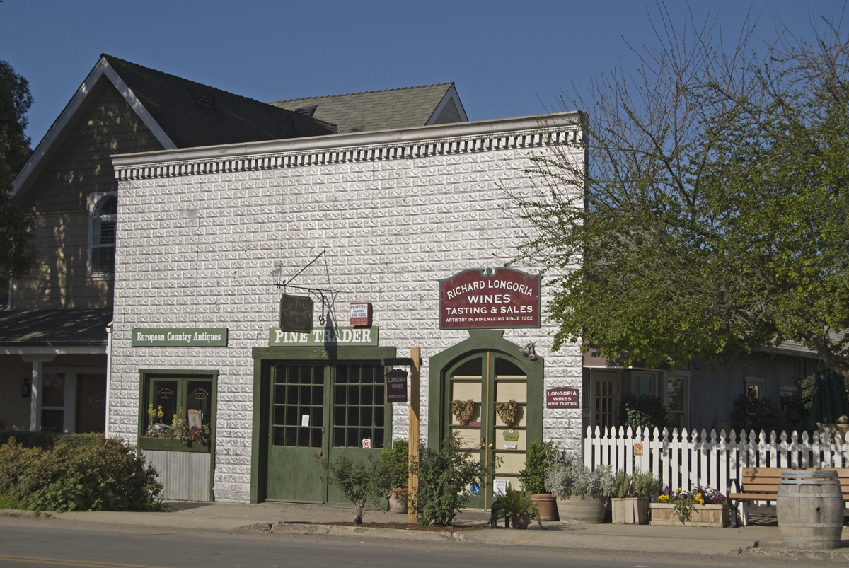


Los Olivos, California
Los Olivos is a community of 1,038 people in Santa Barbara County, California.
Why visit Los Olivos
Townapedia lists 1 park or trail, 16 places to eat and 2 places to stay in and around town.
August is the warmest month, with average highs of 93°F; December lows average 33°F.
Weather in Los Olivos
Forecast from the National Weather Service. Full forecast
About Los Olivos
Los Olivos (; Spanish for "the olive trees") is an unincorporated community in the Santa Ynez Valley of Santa Barbara County, California, United States. Tourism is popular in this rural area which is an agricultural region with an emphasis on wine grapes. For statistical purposes, the United States Census Bureau has defined Los Olivos as a census-designated place (CDP). The population was 1,202 at the 2020 census.
From the Wikipedia article Los Olivos, California (this version), under CC BY-SA 4.0.
Parks, trails and playgrounds1

Restaurants and cafes16


Artiste Winery & Tasting Studio
Brewery and winery · 0.4 mi
2948 Grand Avenue, Los Olivos
Bien Nacido & Solomon Hills Estates Tasting Room
Brewery and winery · 0.4 mi
2963 Grand Avenue, Los Olivos

Bob's Well Bread at the Ballard Store
Bakery · 1.8 mi
2449 Baseline Avenue, Ballard
Figueroa Mountain Brewery Company
Brewery and winery
2363 Alamo Pintado Avenue, Los Olivos
Los Olivos Tasting Room & Wine Shop
Brewery and winery
The original wine tasting bar in Los Olivos featuring wines from small wineries around the central coast.
Refugio Ranch Vineyards - Los Olivos Tasting Room
Brewery and winery · 0.4 mi
2990 Grand Avenue, Los Olivos
Roblar Winery and Vineyards
Brewery and winery · 1.5 mi
3010 Roblar Avenue, Santa Ynez
4 more on the map.
Where to stay2

Ballard Inn & Gathering Table
Motel and hotel · 1.8 mi
2436 Baseline Avenue, Ballard
Shopping4

History
Sometime around 1880, on a bluff overlooking Alamo Pintado Creek, just north of the town of Ballard, a two-story house was built, with a wide, covered front porch and neatly symmetrical arched windows in the center gable, situated on prime farmland. It became the property of twenty-two-year-old Alden March Boyd, of Albany, New York, when he paid $8,000 for "157 acres, more or less, together with the dwelling house," in 1885. He planted five thousand olive trees, and called it Rancho De Los Olivos. The 1880s were a boom time for California. On November 16, 1887, the Pacific Coast Railway line extension from Los Alamos was completed. The developers of the narrow-gauge railway first named their town El Olivar, then El Olivos, and finally Los Olivos, after Boyd's nearby ranch.
Los Olivos was connected by the narrow gauge railroad to points north as far as San Luis Obispo until the train made its last run in 1934. The southern terminus of the railroad was in front of Mattei's Tavern, where a stagecoach line continued over San Marcos Pass into Santa Barbara.
From the History section of Los Olivos, California on Wikipedia, under CC BY-SA 4.0.
Gas and EV charging1
Schools, colleges and libraries15
Map of Los Olivos
39 places. The map loads OpenStreetMap tiles when you open it.
Climate by month
Monthly table
| Month | High | Low | Rain | Snow |
|---|---|---|---|---|
| Jan | 67°F | 34°F | 4.9 in | 0.0 in |
| Feb | 68°F | 35°F | 5.3 in | 0.0 in |
| Mar | 71°F | 38°F | 3.6 in | 0.0 in |
| Apr | 76°F | 39°F | 1.3 in | 0.0 in |
| May | 80°F | 43°F | 0.5 in | 0.0 in |
| Jun | 86°F | 45°F | 0.1 in | 0.0 in |
| Jul | 92°F | 48°F | 0.0 in | 0.0 in |
| Aug | 93°F | 48°F | 0.0 in | 0.0 in |
| Sep | 91°F | 47°F | 0.1 in | 0.0 in |
| Oct | 84°F | 43°F | 0.8 in | 0.0 in |
| Nov | 75°F | 38°F | 1.2 in | 0.0 in |
| Dec | 67°F | 33°F | 3.3 in | 0.0 in |
U.S. Climate Normals 1991-2020 for Cachuma Lake (9 mi away), NOAA NCEI.
People and cost of living
American Community Survey 5-year estimates, 2020-2024, U.S. Census Bureau. Estimates have margins of error, larger for small towns.
Disaster history
Santa Barbara County has had 29 federal disaster declarations since 2000, most often for fires.
- 2024-04-13: Severe Winter Storms, Tornadoes, Flooding, Landslides, And Mudslides (Severe Storm)
- 2023-04-03: Severe Winter Storms, Straight-Line Winds, Flooding, Landslides, And Mudslides (Severe Storm)
- 2023-03-10: Severe Winter Storms, Flooding, Landslides, And Mudslides (Flood)
- 2023-01-14: Severe Winter Storms, Flooding, Landslides, And Mudslides (Flood)
- 2023-01-09: Severe Winter Storms, Flooding, And Mudslides (Flood)
- 2021-10-13: Alisal Fire (Fire)
OpenFEMA disaster declarations summaries.
Getting there and nearby towns
Santa Ynez Airport (SQA) is the nearest airport with scheduled flights listed in OpenStreetMap, 4 miles away.
- Lompoc 20 mi west, about 32 min by car
- Goleta 21 mi southeast, about 35 min by car
- Orcutt 22 mi northwest, about 36 min by car
- Isla Vista 23 mi southeast, about 36 min by car
- University of California-Santa Barbara 23 mi southeast, about 37 min by car
- Eastern Goleta Valley 24 mi southeast, about 39 min by car
- Santa Maria 26 mi northwest, about 42 min by car
- Santa Barbara 29 mi southeast, about 47 min by car
- Nipomo 33 mi northwest, about 54 min by car
- Carpinteria 40 mi southeast, about 1 h by car
Drive times are estimates from straight-line distance, not routes.
Local news
Headlines from INDB, the NEMICO news database.
Reviews, tips and questions
Loading what members have shared...
Sources and licences
- NCES EDGE (Public domain): public schools
- NOAA NCEI U.S. Climate Normals 1991-2020 (Public domain): climate by month
- OpenFEMA (Public domain): disaster declarations
- OpenStreetMap contributors (ODbL 1.0): places, airports, map data
- U.S. Census Bureau (Public domain): population, income, housing, education, commute
- Wikidata (CC0 1.0): elevation, founding date, time zone, website
- Wikimedia Commons (see each image): photos
- Wikipedia (CC BY-SA 4.0): overview and history text
Photo credits
- Los olivos street, Taken by Antandrus, Public domain
- Los Olivos CA, Damian Gadal, CC BY 2.0
- Pine Trader, Los Olivos, Damian Gadal, CC BY 2.0
- 1886 Guest Book from Mattei's Tavern, Los Olivos, California, Collette14713, CC BY-SA 4.0
- The Bear and Star - Feb 2018 - Sarah Stierch 02, Missvain, CC BY 4.0
- The Bear and Star - Feb 2018 - Sarah Stierch 03, Missvain, CC BY 4.0
- The Bear and Star - Feb 2018 - Sarah Stierch 04, Missvain, CC BY 4.0
- The Bubble Shack - Feb 2018 - Sarah Stierch 03, Missvain, CC BY 4.0
- Lemonade Stand - panoramio, Jon_York, CC BY-SA 3.0


Page built October 30, 2026. Spotted a mistake? Tell us or suggest a place.