
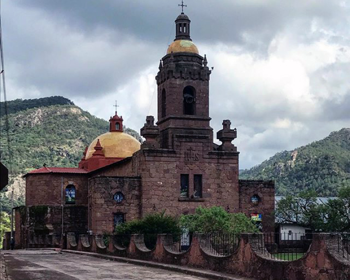

Cerocahui, Mexico
Cerocahui is a town of 1,556 people in Chihuahua, Mexico, founded in November 23, 1680.
Why visit Cerocahui
Townapedia lists 3 museums and landmarks, 2 places to stay and 1 attraction in and around town.
Weather in Cerocahui
Forecast from MET Norway (CC BY 4.0). Full forecast
About Cerocahui
Cerocahui is a town in the Urique Municipality of Chihuahua, Mexico.
From the Wikipedia article Cerocahui (this version), under CC BY-SA 4.0.
Things to do1

Museums and landmarks3

Where to stay2

Churches and places of worship1

History
It is well known for its local Jesuit church. In June 2022 gunmen invaded the church after a local man tried to seek refuge inside the building. The assailants murdered a civilian man as well as two Jesuit priests.
From the History section of Cerocahui on Wikipedia, under CC BY-SA 4.0.
Schools, colleges and libraries1
Map of Cerocahui
8 places. The map loads OpenStreetMap tiles when you open it.
Getting there and nearby towns
Aereopuerto de Alamos (XAL) is the nearest airport with scheduled flights listed in OpenStreetMap, 93 km away.
- Urique 17 km southeast, about 17 min by car
- Guapalayna 21 km southeast, about 21 min by car
- Témoris 22 km west, about 22 min by car
- San Rafael 27 km northeast, about 27 min by car
- Batopilas de Manuel Gómez Morín 43 km southeast, about 43 min by car
- Chínipas de Almada 49 km west, about 49 min by car
- Samachique 51 km east, about 51 min by car
- Milpillas 59 km west, about 59 min by car
- Yoquivo 60 km southeast, about 1 h by car
- Creel 65 km northeast, about 1 h by car
Drive times are estimates from straight-line distance, not routes.
Local news
Headlines from INDB.
Reviews, tips and questions
Loading what members have shared...
Sources and licences
- GeoNames (CC BY 4.0): population, coordinates, regions and time zone
- OpenStreetMap contributors (ODbL 1.0): places, airports, map data
- Wikidata (CC0 1.0): elevation, founding date, time zone, website
- Wikimedia Commons (see each image): photos
- Wikipedia (CC BY-SA 4.0): overview and history text
Photo credits
- Templo de la Misión de Cerocahui, MikSed, CC BY 4.0
Page built November 4, 2026. Spotted a mistake? Tell us or suggest a place.