


San Nicolás de los Garza, Mexico
San Nicolás de los Garza is a town of 412,199 people in Nuevo León, Mexico, founded in February 5, 1597.
Why visit San Nicolás de los Garza
Townapedia lists 13 museums and landmarks, 72 parks and trails, 152 places to eat, 15 places to stay and 12 attractions in and around town.
Highlights include Auditorio Banamex, Mirador del Obispado, Faro del Comercio and Government Palace Museum.
Weather in San Nicolás de los Garza
Forecast from MET Norway (CC BY 4.0). Full forecast
About San Nicolás de los Garza
San Nicolás de los Garza , sometimes known only as San Nicolás, is a city and coextensive municipality in the Mexican state of Nuevo León that is part of the Monterrey metropolitan area. It has become primarily a city for residences and family houses, although it still has several factories that tend to relocate to the periphery of the metropolitan area. It is the fifth-largest city in the state, behind Monterrey, Guadalupe, Ciudad Apodaca and General Escobedo.
From the Wikipedia article San Nicolás de los Garza (this version), under CC BY-SA 4.0.
Travel tips from other travellers: San Nicolás de los Garza on Wikivoyage (CC BY-SA 4.0).
Things to do12

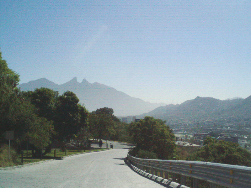
Mirador del Obispado
Monument and historic site · 8.5 km
Hill and lookout in Monterrey, Mexico

Universidad Autónoma Nuevo León
School · 1.8 km
Public university in the state Nuevo León in Mexico

Universidad de la vida, la casa de los famosos
School · 8.1 km
Institution of higher education in Monterrey, México
Universidad Metropolitana de Monterrey
School · 7.7 km
Mexican university

Museums and landmarks13

Faro del Comercio
Monument and historic site · 8.4 km
Monument in Mexico

Government Palace Museum
Museum · 7.7 km
State government building in Monterrey, Mexico
Museo de Arte Contemporáneo de Monterrey
Museum · 8.1 km
Museum of Contemporary Art in Monterrey, Mexico

Museum of Steel
Museum · 7.3 km
Museum in Monterrey, Nuevo León, Mexico

Palacio del Obispado
Museum · 8.6 km
History Museum in Nuevo Leon, MX


1 more on the map.
Parks, trails and playgrounds72





Cancha de futbol
Park · 0.7 km
Calle Universidad Labastida, san nicolas de los garza
Gran Parque San Nicolás
Park · 1.2 km
Parque con pista para caminar/trotar/correr. Tiene aparatos para hacer ejercicio y juegos para los niños. Hay patos en su interior y un...
60 more on the map.
Restaurants and cafes152

Ninjato Sushi
Restaurant · Asian, Sushi · 2.7 km
101 Avenida República Mexicana
Su-Mo, We-Th 12:00-22:00; Fr-Sa 12:00-23:00

Boyak Club
Bar and pub · 2.7 km
Restaurante bar en Plaza Andenes, está dirigido a personas de entre 18 y 30 años. Hay karaoke entre semana y DJ los fines de semana.
1250 Avenida Universidad, San Nicolás de los Garza
Tu-Su 18:00-2:00

Mi Pueblo
Restaurant · Mexican · 1.3 km
100 Cristina Larralde de Treviño, San Nicolas de los Garza
Tu-Su 12:00-23:00
El Sazón Veracruzano
Restaurant · Mexican · 2.0 km
Mo-Fr 08:00-18:00; Sa 10:00-15:00; PH unknown
Foodology san nicolas
Restaurant · Saludable · 4.2 km
4614 plan de san luis, san nicolas de los garza
Hui Xin
Restaurant · Chinese · 2.0 km
Mo-Sa 11:00-21:00; Su 12:00-19:00; PH unknown
140 more on the map.
History
San Nicolás de los Garza was founded on 5 February 1597 and given the name of Estancia de Pedro de la Garza (Pedro de la Garza's Estate), then Estancia de San Nicolás (Saint Nicholas' Estate), and finally Estancia de San Nicolás de los Garza (Saint Nicholas of the Garzas' Estate). The first people that inhabited the terrain were Amerindian, mostly nomads. They were the Alazapas, the Ayalas and the Alincheños.
San Nicolás was founded right after Monterrey, when Diego de Montemayor granted permission to inhabit the area to his secretary, Diego Díaz de Berlanga; Pedro de Iñigo; Domingo Manuel; and D. Pedro de la Garza. The members of these families are considered the first settlers of the city.
Diego Díaz de Berlanga was the person that redacted Monterrey's Foundation Act, and authorized the first land permissions to its first settlers.
In 1830 the area was declared to the category of village, with the name of San Nicolás de los Garza, in honor of the patron saint of the town. On 12 May 1970 it was declared a city.
From the History section of San Nicolás de los Garza on Wikipedia, under CC BY-SA 4.0.
Where to stay15
Churches and places of worship21
Iglesia Evangelica Crsitiana Espiritual
Church · Evangelical · 4.3 km
1475 Calle Pericles, San Nicolás de los Garza
Iglesia Pentecostés Nuevo Testamento (ICC Monterrey)
Church · Pentecostal · 4.3 km
1953 Avenida Alfonso Reyes, Monterrey
Parroquia Santa María de Guadalupe
Church · Catholic · 4.1 km
305 Calle Bochica, San Nicolás de los Garza
Shopping55
Gm super carnes
Grocery · 3.2 km
Avenida Diego Díaz de Berlanga, san nicolas de los garza
Plaza Metro Sendero
Shopping center · 3.2 km
113 Carretera a Colombia, General Escobedo
Gas and EV charging72
Schools, colleges and libraries76
Colegio Club de Leones No. 1
School · Catholic · 4.2 km
3751 Avenida General Bernardo Reyes
Biblioteca pública Anastacio Villarreal
Library · 2.7 km
Las Puentes, San Nicolás
Escuela Primaria General Santiago F. Xicotencatl
School · 3.2 km
5100 Calle Luis Moreno
Escuela Primaria Pablo Livas
School · 1.8 km
S/N Privada Rubén Darío, San Nicolás de los Garza
Healthcare69
Farmacia Universitaria
Clinic and pharmacy · 2.3 km
s/n Avenida Pedro de Alba, San Nicolás de los Garza
Hospital Metropolitano Torre de Hospitalizacion
Clinic and pharmacy · 4.1 km
4600 Adolfo López Mateos, Monterrey
Unidad de Medicina Familiar No. 43
Clinic and pharmacy · 4.0 km
S/N Calle Guanajuato, General Escobedo
Centro Médico ROA
Clinic and pharmacy · 3.2 km
101 Avenida Sendero Norte, Escobedo
Map of San Nicolás de los Garza
250 places. The map loads OpenStreetMap tiles when you open it.
Getting there and nearby towns
Del Norte International Airport (NTR) is the nearest airport with scheduled flights listed in OpenStreetMap, 15 km away.
- Monterrey 7 km south, about 7 min by car
- Ciudad General Escobedo 6 km north, about 6 min by car
- Guadalupe 8 km southeast, about 8 min by car
- Fraccionamiento Cosmópolis Octavo Sector 11 km northeast, about 11 min by car
- Ciudad Apodaca 12 km east, about 12 min by car
- San Pedro Garza García 13 km southwest, about 13 min by car
- Santa Rosa 12 km northeast, about 12 min by car
- Mitras Poniente 13 km west, about 13 min by car
- Santa Catarina 17 km southwest, about 17 min by car
- Saltillo 76 km southwest, about 1 h 15 min by car
Drive times are estimates from straight-line distance, not routes.
Local news
Headlines from INDB.
Reviews, tips and questions
Loading what members have shared...
Sources and licences
- GeoNames (CC BY 4.0): population, coordinates, regions and time zone
- OpenStreetMap contributors (ODbL 1.0): places, airports, map data
- Wikidata (CC0 1.0): elevation, founding date, time zone, website, landmarks and historic places
- Wikimedia Commons (see each image): photos
- Wikipedia (CC BY-SA 4.0): overview and history text
Photo credits
- Universidad Station, Omaaar, Public domain
- Auditorio Banamex, Tavoman666, CC BY-SA 3.0
- Torre Rectoria UANL (2023), Davidmejoradas, CC BY-SA 4.0
- Farodelcomercio, Cvmontuy, CC BY-SA 3.0
- PALACIO DE GOB, LABNL Lab Cultural Ciudadano, CC BY-SA 2.0
- Fachada MARCO, Limbo@MX C, CC BY 2.5
- Antiguo Obispado o Museo Regional de Nuevo León, Brendablue77, CC BY-SA 3.0
- Parque Fundidora, Monterrey1, México en Fotos, CC BY-SA 2.0
- Basilica de Guadalupe Monterrey 17, Valdez Lopez, CC BY-SA 3.0
- Monterrey - Catedral de la Inmaculada Concepción - 4, This illustration was made by Peter Potrowl . Please credit this with : © Peter Potrowl in the immediate vicinity of the image. A link to my website sitemai.eu would be much appreciated but isn't..., CC BY-SA 4.0
- Monterrey - Antigua basilica de Guadalupe - 2, This illustration was made by Peter Potrowl . Please credit this with : © Peter Potrowl in the immediate vicinity of the image. A link to my website sitemai.eu would be much appreciated but isn't..., CC BY-SA 4.0
- Mexico monterrey San Nicolás de los Garza Estadio Universitario 1, Arne Müseler, CC BY-SA 3.0 de
- Mirador Obispado 3, Unknown author, CC BY-SA 2.5
- Pabellón Sopladores del Museo del Acero en el Parque Fundidora, Rick González, CC BY 2.0
- Colorido cielo sobre estadio Universitario, Jdanielrmz11, CC BY-SA 4.0
- Ampelis Chinito - panoramio, panza.rayada, CC BY-SA 3.0
- Paloma de Alas Blancas - panoramio, panza.rayada, CC BY-SA 3.0
- Carpintero Cheje - panoramio, panza-rayada, CC BY-SA 3.0
- Pericos en el nogal - panoramio, panza.rayada, CC BY-SA 3.0
- Loros Cachete Amarillo en Monterrey - panoramio, panza-rayada, CC BY-SA 3.0
- Chipe Corona Naranja - panoramio, panza-rayada, CC BY-SA 3.0
- Flor de Granado - panoramio, panza-rayada, CC BY-SA 3.0
- Paloma Ala Blanca - panoramio, panza-rayada, CC BY-SA 3.0
- Carpintero Cheje, Roberto González, CC BY 2.0
- Loros Cachete Amarillo, Roberto González, CC BY 2.0
- Chipe Corona Naranja, Roberto González, CC BY 2.0
- Mirlo Pardo, Roberto González, CC BY 2.0
- Flor de Granado, Roberto González, CC BY 2.0
- Mirlo Pardo - panoramio, panza-rayada, CC BY-SA 3.0
- Anas platyrhynchos 168039641, Susana De la Torre Zavala, CC BY 4.0
- Colibrí Pico Ancho, Roberto González, CC BY 2.0
- Colibrí Pico Ancho - panoramio, panza-rayada, CC BY-SA 3.0
- Rectoría UANL, Gjuarezm, CC BY-SA 4.0
- Templo de San Nicolás Tolentino, Brenda A. Cerda Zarazua, CC BY-SA 4.0
- Panoramica Ciudad Universitaria, Gustavo de León, CC BY-SA 4.0
- Rodolfo Salinas Villarreal UANL, Rodolfosalinas, CC BY 4.0
- Sierra Madre Occidental desde el volcan - panoramio, Wiper México, CC BY-SA 3.0
- Volcan casa de los Tigres - panoramio, Wiper México, CC BY-SA 3.0
- La mejor afición - panoramio, Hari Seldon, CC BY-SA 3.0
- Pierre Oriola, Tefita228, CC BY-SA 4.0


Page built November 4, 2026. Spotted a mistake? Tell us or suggest a place.