

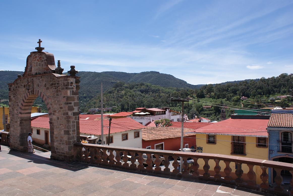


Tlalpujahua de Rayón, Mexico
Tlalpujahua de Rayón is a town of 3,530 people in Michoacán, Mexico, founded in 1560.
Why visit Tlalpujahua de Rayón
Townapedia lists 6 parks and trails, 5 places to eat, 4 places to stay and 1 attraction in and around town.
Weather in Tlalpujahua de Rayón
Forecast from MET Norway (CC BY 4.0). Full forecast
About Tlalpujahua de Rayón
Tlalpujahua (Spanish pronunciation: [tlalpuˈxawa]; formally Tlalpujahua de Rayón) is a town and municipality located in the far northeast of the state of Michoacán in central Mexico. It is a former mining town, home of the Dos Estrellas Mine, which was the leading producer of gold in the early 20th century. A major landslide of mud and mining debris damaged this mine and buried about one-third of the town in 1937. Mining continued until 1959, but nationalization of the mine by President Cardenas in the 1930s led to the demise of the mine and impoverishment of the town.
From the Wikipedia article Tlalpujahua (this version), under CC BY-SA 4.0.
Travel tips from other travellers: Tlalpujahua de Rayón on Wikivoyage (CC BY-SA 4.0).
Things to do1

Parks, trails and playgrounds6





Restaurants and cafes5

Vagón Express Minero Restaurant & Cafetería
Restaurant · Regional · 4.5 km
Avenida Ferrocarril, El Oro de Hidalgo
Mo-Su 09:00-18:00

SANTADALE
Bar and pub · 4.5 km
12 Calle 5 de Mayo, El Oro de Hidalgo
Mo-Su 09:00-22:00
Centro Botanero y Cervecero "El Gato Pérez"
Bar and pub · 4.4 km
Avenida Prolongación Constitución, El Oro de Hidalgo


Where to stay4

Hotel Posada "Colin"
Motel and hotel · 6.6 km
27 Av. Lazaro Cardenas 27, Centro, 61070 San Francisco de los Reyes, Mich.
History
In pre-Hispanic times, the area was initially dominated by the Mazahuas, with Tlalpujahuac as its original name. This comes from Nahuatl and means spongy or flabby land. The Purépecha took over the area in 1460, but the Aztecs invaded under Axayacatl. The area remained a point of contention between the Aztec Empire and Purépecha Empire until the Spanish conquest of both empires.
From the History section of Tlalpujahua on Wikipedia, under CC BY-SA 4.0.
Churches and places of worship3
Parroquia de Nuestra Señora del Carmen
Church · Catholic
s/n Calle 2 de Abril, Tlalpujahua De Rayón
Parroquia de Santa María de Guadalupe El Oro Méx
Church · Catholic · 4.7 km
S/N Callejon del Socorro, El Oro de Hidalgo
Schools, colleges and libraries4
Healthcare1
Map of Tlalpujahua de Rayón
24 places. The map loads OpenStreetMap tiles when you open it.
Getting there and nearby towns
Toluca International Airport (TLC) is the nearest airport with scheduled flights listed in OpenStreetMap, 82 km away.
- El Oro de Hidalgo 5 km east, about 5 min by car
- Heróica Zitácuaro 45 km southwest, about 45 min by car
- San Juan del Río 68 km north, about 1 h 15 min by car
- Valle de Bravo 68 km south, about 1 h 15 min by car
- Jilotepec de Molina Enríquez 69 km east, about 1 h 15 min by car
- San Miguel Zinacantepec 74 km southeast, about 1 h 15 min by car
- Toluca 79 km southeast, about 1 h 15 min by car
- Xonacatlán 81 km southeast, about 1 h 15 min by car
- El Pueblito 86 km north, about 1 h 30 min by car
- Santiago de Querétaro 90 km north, about 1 h 30 min by car
Drive times are estimates from straight-line distance, not routes.
Local news
Headlines from INDB.
Reviews, tips and questions
Loading what members have shared...
Sources and licences
- GeoNames (CC BY 4.0): population, coordinates, regions and time zone
- OpenStreetMap contributors (ODbL 1.0): places, airports, map data
- Wikidata (CC0 1.0): elevation, founding date, time zone, website
- Wikimedia Commons (see each image): photos
- Wikipedia (CC BY-SA 4.0): overview and history text
Photo credits
- KioskTlalpujahua, AlejandroLinaresGarcia, CC BY-SA 4.0
- Tlalpujahua de Rayón - panoramio, Wiper México, CC BY-SA 3.0
- SnPedroSnPabloTlalpu2, AlejandroLinaresGarcia, CC BY-SA 4.0
- StreetTlalpu1, AlejandroLinaresGarcia, CC BY-SA 4.0
- Parroquia de la Virgen del Carmen - panoramio, Wiper México, CC BY-SA 3.0
- La Plaza de Tlalpujahua - panoramio, Octavio Alonso Maya …, CC BY-SA 3.0
- Bella Iglesia - panoramio - Wiper México (1), Wiper México, CC BY-SA 3.0
- Tlalpujahua's Remasters - panoramio (16), Octavio Alonso Maya …, CC BY-SA 3.0
- Tlalpujahua's Remasters - panoramio (18), Octavio Alonso Maya …, CC BY-SA 3.0
- SnPedroSnPabloTlalpu, AlejandroLinaresGarcia, CC BY-SA 4.0
- Tlalpujahua's Remasters - panoramio (14) (cropped), Octavio Alonso Maya …, CC BY-SA 3.0
- Tlalpujahua's Remasters - panoramio (14), Octavio Alonso Maya …, CC BY-SA 3.0
- Portals - panoramio, Octavio Alonso Maya …, CC BY-SA 3.0
- FranAgPerezTlal, AlejandroLinaresGarcia, CC BY-SA 4.0
- AtriumCrossSPSPTlalpu, AlejandroLinaresGarcia, CC BY-SA 4.0
- Tlalpujahua's Remasters - panoramio (12), Octavio Alonso Maya …, CC BY-SA 3.0
- Barroco - panoramio, Wiper México, CC BY-SA 3.0
- El pueblo - panoramio, Wiper México, CC BY-SA 3.0
- Facada de la Fortaleza - panoramio, Octavio Alonso Maya …, CC BY-SA 3.0
- Tlalpujahua's Remasters - panoramio (13), Octavio Alonso Maya …, CC BY-SA 3.0
- Detail's on the stronghold's facade - panoramio, Octavio Alonso Maya …, CC BY-SA 3.0
- Tlalpujahua's Remasters - panoramio (17), Octavio Alonso Maya …, CC BY-SA 3.0
- FacadePedroPabloTlalpu, AlejandroLinaresGarcia, CC BY-SA 4.0
- PortalPedroPabloTlal, AlejandroLinaresGarcia, CC BY-SA 4.0
- Tlalpujahua's Remasters - panoramio (8), Octavio Alonso Maya …, CC BY-SA 3.0
- The Stronghold - panoramio, Octavio Alonso Maya …, CC BY-SA 3.0
- Tlalpujahua's Remasters - panoramio (20), Octavio Alonso Maya …, CC BY-SA 3.0
- StatueonStairsSSTlalpujahua, AlejandroLinaresGarcia, CC BY-SA 4.0
- SideEntranceSnPedroSnPabloTlalpu, AlejandroLinaresGarcia, CC BY-SA 4.0
- Torre de la Parroquia - panoramio, Wiper México, CC BY-SA 3.0
- Tlalpujahua's Remasters - panoramio (24), Octavio Alonso Maya …, CC BY-SA 3.0
- Tlalpujahua's Remasters - panoramio (11), Octavio Alonso Maya …, CC BY-SA 3.0
- Una Plaza en la iglesia - panoramio, Octavio Alonso Maya …, CC BY-SA 3.0
- Iglesia de Tlalpujahua - panoramio, Octavio Alonso Maya …, CC BY-SA 3.0
- Entrada Lateral, Octavio Alonso Maya Castro, CC BY-SA 3.0
- Tlalpujahua, Armando Pineda Ortiz, CC BY-SA 3.0
- Torre de la sacristía, Macintario, CC BY-SA 3.0
- Fachada Principal Santuario del Carmen, Macintario, CC BY-SA 3.0
- Tlalpujahua's Remasters - panoramio (15), Octavio Alonso Maya …, CC BY-SA 3.0
- Templo La Cofradía, Macintario, CC BY-SA 3.0
- El Teatro Juarez, Octavio Alonso Maya Castro, CC BY-SA 3.0
- Perfil del Tiro Norte, Jorge Armando López Reyes, CC BY-SA 3.0


Page built November 4, 2026. Spotted a mistake? Tell us or suggest a place.