


New Hempstead, New York
New Hempstead is a village of 5,472 people in Rockland County, New York, founded in 1983.
Why visit New Hempstead
Townapedia lists 11 museums and landmarks, 9 parks and trails, 4 places to eat and 2 attractions in and around town.
Highlights include Yeshiva Zichron Yaakov, Blauvelt House, Contempora House and Clover Stadium.
Weather in New Hempstead
Forecast from the National Weather Service. Full forecast
About New Hempstead
New Hempstead is a village in the town of Ramapo, Rockland County, New York, United States. It is located north of New Square, east of Wesley Hills, south of Pomona, and west of New City. As of July 2023, the United States Census Bureau estimated the population as 5,419. Residents utilize the Spring Valley and New City post offices.
From the Wikipedia article New Hempstead, New York (this version), under CC BY-SA 4.0.
Things to do2

Yeshiva Zichron Yaakov
School · 0.4 mi
All-male Jewish Orthodox high school located in New Hempstead, New York

Museums and landmarks11

Blauvelt House
Monument and historic site · National Register of Historic Places · 3.7 mi
Historic house in New York, United States

Contempora House
Monument and historic site · National Register of Historic Places · 3.0 mi
Historic house in New York, United States

Gurnee–Sherwood House
Monument and historic site · National Register of Historic Places · 2.6 mi
House in Wesley Hills, New York

Henry Varnum Poor House
Monument and historic site · National Register of Historic Places · 3.1 mi
Historic house in New York, United States

Houser-Conklin House
Monument and historic site · National Register of Historic Places · 1.2 mi
Historic house in New York, United States

North Main Street School
Monument and historic site · National Register of Historic Places · 1.8 mi
School building in New York, United States of America

Richard Pousette-Dart House and Studio
Monument and historic site · National Register of Historic Places · 2.6 mi
Historic house in New York, United States
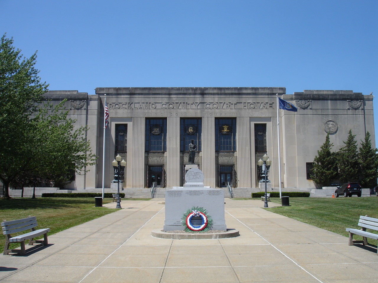
Rockland County Courthouse and Dutch Gardens
Monument and historic site · National Register of Historic Places · 3.1 mi
Historic district in New York, United States of America

Seaman–Knapp House
Monument and historic site · National Register of Historic Places · 2.7 mi
Historic house in Pomona, New York, United States

United States Post Office
Monument and historic site · National Register of Historic Places · 2.4 mi
Government building in Spring Valley, New York

John A. DeBaun Mill
Monument and historic site · National Register of Historic Places · 3.7 mi
Parks, trails and playgrounds9




Restaurants and cafes4





History
New Hempstead was incorporated on March 21, 1983. Joseph Berger of the New York Times said in a 1997 article that New Hempstead was one of several villages formed in Ramapo by non-Jews and more secular Jews "to preserve the sparse Better Homes and Garden [sic] ambiance that attracted them to Rockland County."
From the History section of New Hempstead, New York on Wikipedia, under CC BY-SA 4.0.
Churches and places of worship26
Brick Church Complex
Church · National Register of Historic Places · 0.9 mi
Ladentown United Methodist Church
Church · National Register of Historic Places · 2.8 mi
New Hempstead Presbyterian Church
Church · National Register of Historic Places · 1.0 mi
St. Paul's Episcopal Church
Church · National Register of Historic Places · 2.6 mi
Shopping3
Gas and EV charging3
Schools, colleges and libraries48
Clarkstown South Senior High School
School · 4.7 mi
31 Demarest Mill Rd, West Nyack
Healthcare1
Map of New Hempstead
107 places. The map loads OpenStreetMap tiles when you open it.
People and cost of living
American Community Survey 5-year estimates, 2020-2024, U.S. Census Bureau. Estimates have margins of error, larger for small towns.
Disaster history
Rockland County has had 20 federal disaster declarations since 2000, most often for hurricanes.
- 2023-07-22: Severe Storms And Flooding (Severe Storm)
- 2021-09-05: Remnants Of Hurricane Ida (Hurricane)
- 2021-09-02: Remnants Of Hurricane Ida (Hurricane)
- 2021-08-22: Hurricane Henri (Hurricane)
- 2020-10-02: Tropical Storm Isaias (Hurricane)
- 2020-03-20: Covid-19 Pandemic (Biological)
OpenFEMA disaster declarations summaries.
Getting there and nearby towns
Westchester County Airport (HPN) is the nearest airport with scheduled flights listed in OpenStreetMap, 19 miles away.
- Hillcrest 1 mi southeast, about 2 min by car
- Kaser 2 mi southwest, about 3 min by car
- Spring Valley 2 mi south, about 4 min by car
- Monsey 3 mi southwest, about 5 min by car
- New City 3 mi east, about 5 min by car
- Mount Ivy 3 mi north, about 5 min by car
- Montebello 3 mi west, about 5 min by car
- Nanuet 4 mi southeast, about 6 min by car
- Airmont 4 mi southwest, about 7 min by car
- Chestnut Ridge 4 mi south, about 7 min by car
Drive times are estimates from straight-line distance, not routes.
Local news
Headlines from INDB, the NEMICO news database.
Reviews, tips and questions
Loading what members have shared...
Sources and licences
- NCES EDGE (Public domain): public schools
- OpenFEMA (Public domain): disaster declarations
- OpenStreetMap contributors (ODbL 1.0): places, airports, map data
- U.S. Census Bureau (Public domain): population, income, housing, education, commute
- Wikidata (CC0 1.0): landmarks and historic places
- Wikimedia Commons (see each image): photos
- Wikipedia (CC BY-SA 4.0): overview and history text
Photo credits
- NY Route 45 nb entering New Hempstead, Jan. 2025, Mr. Matté (if there is an issue with this image, contact me using this image's Commons talk page , my Commons user talk page , or my English Wikipedia user talk page ; I'll know about it a lot faster), CC BY-SA 4.0
- Richard Pousette-Dart House, Pousette-dartfoundation, CC BY-SA 4.0
- New Hempstead Presbyterian Church, New City, NY, Daniel Case, CC BY-SA 3.0
- ST. PAUL'S EPISCOPAL CHURCH, Spring Valley, New York, JERRYE AND ROY KLOTZ, M.D., CC BY-SA 4.0
- LADENTOWN UNITED METHODIST CHURCH, ROCKLAND COUNTY NY, JERRYE & ROY KLOTZ. M.D., CC BY-SA 4.0
- HENRY VARNUM POOR HOUSE, NEW CITY, ROCKLAND COUNTY, NY, JERRYE & ROY KLOTZ, M.D., CC BY-SA 4.0
- North Main Street School, Spring Valley, NY, Daniel Case, CC BY-SA 3.0
- SEAMAN-KNAPP HOUSE, POMONA, ROCKLAND COUNTY MY, JERRYE & ROY KLOTZ, M.D., CC BY-SA 4.0
- CONTEMPORA HOUSE, NEW CITY, ROCKLAND COUNTY NY, JERRYE & ROY KLOTZ, M.D., CC BY-SA 4.0
- Jacob Blauvelt House, Alexisrael, CC BY-SA 3.0
- GURNEEY SHERWOOD HOUSE, WESLEY HILLS, ROCKLAND COUNTY, NY, JERRYE & ROY KLOTZ, M.D., CC BY-SA 4.0
- Spring Valley, NY, post office, Daniel Case, CC BY-SA 3.0
- RocklandCountyCourthouse, KForce, CC BY-SA 3.0
- JOHN A. DEBAUN MILL, ROCKLAND COUNTY, NY, JERRYE & ROY KLOTZ, M.D., CC BY-SA 4.0
- Church at Novo-Diveevo, Violette79 from Brooklyn, NY, USA, CC BY-SA 2.0
- New Hope Christian Church, Pwdennis2, CC BY-SA 3.0
- BRICK CHURCH COMPLEX, ROCKLAND COUNTY, NY, JERRYE & ROY KLOTZ, M.D., CC BY-SA 4.0
- Brick Church, Jimstu8, CC BY-SA 3.0
- Rabbi Chaim Yehoshua Halberstam Satmar Monsey Rav With Woodridge Rebbe, Shimon2519, CC0
- Entrance to Spring Valley, NY, Sije, CC BY-SA 4.0
- Hillcrest Fire Company No. 1, Hillcrest, NY, Jan. 2025, Mr. Matté (if there is an issue with this image, contact me using this image's Commons talk page , my Commons user talk page , or my English Wikipedia user talk page ; I'll know about it a lot faster), CC BY-SA 4.0
- HOUSER-CONKLIN HOUSE, MONSEY, ROCKLAND COUNTY, NY, JERRYE & ROY KLOTZ. M.D., CC BY-SA 4.0
- NY 306 sb at Lime Kiln Road, Wesley Hills, May 2025, Mr. Matté (if there is an issue with this image, contact me using this image's Commons talk page , my Commons user talk page , or my English Wikipedia user talk page ; I'll know about it a lot faster), CC BY-SA 4.0
- Sen. Eugene Levy Memorial Park, Ramapo, NY, Jan. 2025, Mr. Matté (if there is an issue with this image, contact me using this image's Commons talk page , my Commons user talk page , or my English Wikipedia user talk page ; I'll know about it a lot faster), CC BY-SA 4.0
- St. Joseph Church, Spring Valley, NY, Jan. 2025, Mr. Matté (if there is an issue with this image, contact me using this image's Commons talk page , my Commons user talk page , or my English Wikipedia user talk page ; I'll know about it a lot faster), CC BY-SA 4.0
- Hanukkah lighting of Zvhiller Rebbe of Monsey 2, Adamreinman, CC BY-SA 4.0
- Hanukkah lighting of Zvhiller Rebbe of Monsey, Adamreinman, CC BY-SA 4.0
- Mom and Habiscus, Canucha, CC BY-SA 4.0
- Spring Valley, NY shopping center and village offices, Jan. 2025, Mr. Matté (if there is an issue with this image, contact me using this image's Commons talk page , my Commons user talk page , or my English Wikipedia user talk page ; I'll know about it a lot faster), CC BY-SA 4.0
- New York National Guard Hurricane Sandy Response (Image 5 of 5) (8157922021), DVIDSHUB, CC BY 2.0


Page built October 30, 2026. Spotted a mistake? Tell us or suggest a place.