


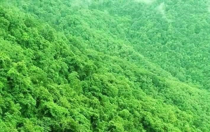

Why visit Iwo
Townapedia lists 3 museums and landmarks, 1 park or trail, 3 places to eat, 6 places to stay and 2 attractions in and around town.
Highlights include Bowen University, Westland University, Iwo and Oba Hills Forest Reserve.
Weather in Iwo
Forecast from MET Norway (CC BY 4.0). Full forecast
About Iwo
Iwo () is a city in Osun State, Nigeria. The Iwo people, like all other people of the Yoruba kingdom, are believed to have originated from Ile-Ife, where they migrated sometime in the 11th century according to Alademomi Kenyon and Prince Adelegan Adegbola (2009). The only predicted land with the symbol of the parrots (which signifies the location of the promised land) is the Iwo kingdom. The city was formerly part of old Oyo state and was later separated and became one of the major townships in Osun State, Nigeria.
From the Wikipedia article Iwo, Osun State (this version), under CC BY-SA 4.0.
Travel tips from other travellers: Iwo on Wikivoyage (CC BY-SA 4.0).
Things to do2


Bowen University
School · 1.5 km
Private Baptist University in Nigeria
Olupona - Iwo Road

Westland University, Iwo
School · 1.6 km
University in Iwo, Osun State, Nigeria
Museums and landmarks3

Parks, trails and playgrounds1
Restaurants and cafes3



Where to stay6
Churches and places of worship4
Shopping2
Gas and EV charging7
Schools, colleges and libraries10
Healthcare4
Map of Iwo
42 places. The map loads OpenStreetMap tiles when you open it.
Getting there and nearby towns
Ibadan Airport (IBA) is the nearest airport with scheduled flights listed in OpenStreetMap, 37 km away.
- Olupona 4 km south, about 4 min by car
- Lalupon 23 km southwest, about 23 min by car
- Gbongan 26 km southeast, about 26 min by car
- Inisa 29 km northeast, about 29 min by car
- Ikire 30 km south, about 30 min by car
- Modakeke 29 km south, about 29 min by car
- Ede 30 km east, about 30 min by car
- Fiditi 30 km west, about 30 min by car
- Ibadan 42 km southwest, about 42 min by car
- Osogbo 44 km east, about 44 min by car
Drive times are estimates from straight-line distance, not routes.
Local news
Headlines from INDB.
Reviews, tips and questions
Loading what members have shared...
Sources and licences
- GeoNames (CC BY 4.0): population, coordinates, regions and time zone
- OpenStreetMap contributors (ODbL 1.0): places, airports, map data
- Wikidata (CC0 1.0): elevation, founding date, time zone, website, landmarks and historic places
- Wikimedia Commons (see each image): photos
- Wikipedia (CC BY-SA 4.0): overview and history text
Photo credits
- King of Iwo, The National Archives UK, No restrictions
- King's palace in Iwo, The National Archives UK, No restrictions
- Old bridge of River Osun along Gbongan - Iwo Road, Osun State, Oderanti Moses, CC BY-SA 4.0
- Bowen Worship Centre, MercyAkande, CC BY-SA 4.0
- ObA HiLls Forest Reserve, Ekwoike, CC BY-SA 4.0
- ISS067-E-156860 - View of Earth, Earth Science and Remote Sensing Unit , Lyndon B. Johnson Space Center, Public domain
- ISS067-E-156859 - View of Earth, Earth Science and Remote Sensing Unit , Lyndon B. Johnson Space Center, Public domain
- ISS034-E-37485 - View of Earth, Earth Science and Remote Sensing Unit , Lyndon B. Johnson Space Center, Public domain
- Nigeria 20131023-DSC 3438, jbdodane, CC BY 2.0
- Eid congregation prayer, Fatimah Bello, CC BY-SA 4.0
- ISS067-E-156858 - View of Earth, Earth Science and Remote Sensing Unit , Lyndon B. Johnson Space Center, Public domain
- ISS067-E-156857 - View of Earth, Earth Science and Remote Sensing Unit , Lyndon B. Johnson Space Center, Public domain


Page built November 3, 2026. Spotted a mistake? Tell us or suggest a place.