


Why visit Obalende
Townapedia lists 13 museums and landmarks, 12 parks and trails, 74 places to eat, 24 places to stay and 9 attractions in and around town.
Highlights include Silverbird Cinemas Galleria, Apapa Amusement Park, African Artists' Foundation and Centre For Black And African Arts And Civilization.
Weather in Obalende
Forecast from MET Norway (CC BY 4.0). Full forecast
About Obalende
Obálendé, a contraction of the Yoruba saying Ibi ti Oba le wa de, meaning "Where the king chased us to", is a neighbourhood of Lagos, Nigeria, located in Eti-Osa LGA, close to Lagos Island. Eti-Osa was split by the Lagos State Government into Local Community Development Areas (LCDA) of which Ikoyi–Obalende is one. It contains many schools, including Holy Child College Obalende, St Gregory's College, Aunty Ayo International School and Girls Secondary Grammar School. It is bordered by the police barracks and Army barracks.
From the Wikipedia article Obalende (this version), under CC BY-SA 4.0.
Things to do9

Apapa Amusement Park
Monument and historic site · 5.4 km
Theme park in Lagos, Nigeria




Lagos Business School
School · 1.7 km
School for intending business professionals established in Lagos State


Museums and landmarks13

Centre For Black And African Arts And Civilization
Museum · 2.4 km
CBAAC is a parastatal under the Federal Ministry of Culture and Information which is statutorily charged with the responsibility of...
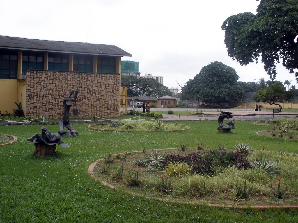
Nigerian National Museum, Lagos
Museum · 1.4 km
National museum in Nigeria


Rio de la plata
Monument and historic site · 3.5 km
Official residence of Oba of Lagos, Lagos Nigeria

Tafawa Balewa Square
Monument and historic site · 1.5 km
Ceremonial ground in Lagos, Nigeria

Tinubu Square
Monument and historic site · 3.0 km
Landmark in Lagos, Nigeria
TCA Gallery
Museum · 2.3 km
Suite 418 Block B10 Crescent B, Victoria Island
Tu-Su 11-5
1 more on the map.
Parks, trails and playgrounds12

Freedom Park
Park · 2.1 km
Park in Nigeria
1 Hospital Road, Broad Street, Lagos



Lagos Jet Ski Riders Club
Marina and boat launch · 0.7 km
12 Ademola Street, Lagos
Paradise Boat Club
Marina and boat launch · 1.0 km
8 Walter Carrington Crescent, Lagos


Restaurants and cafes74

Leila Restaurant
Restaurant · Lebanese · 2.3 km
864B Bishop Aboyade Cole Street, Eti-Osa
Mo-Su 09:00-23:00
The Greenhouse Lagos
Restaurant · Burger, Pizza, Coffee Shop, American, Italian, Ice Cream, Sandwich, Seafood, Fish And Chips · 2.0 km
15 Oba Adeyinka Oyekan Avenue, Lagos
Mo-Su 10:00-23:00


Ghana High
Restaurant · Jollof Rice, Ewa Aganyin, Moi Moi, Nigerian, Ponmo · 1.1 km
34 McCarthy Street, Lagos
Mo-Fr 08:00-17:00

62 more on the map.
History
The Royal West African Frontier Force (RWAFF) made up of predominantly Hausa men were initially camped on the land where King's College, Lagos is situated. Then, a need arose for the use of the land and the Oba of Lagos pressured the Governor of Lagos to resettle the RWAFF men, and sold virgin land in what is now Obalende to the British Colonial Government.
After resettlement in the purchased land, the RWAFF men named the place Ibi ti Ọba lé wà dé, which translated from Yoruba means "the place where the king drove us to".
From the History section of Obalende on Wikipedia, under CC BY-SA 4.0.
Where to stay24
Radisson Blu Anchorage Hotel Lagos
Motel and hotel · 1.1 km
1A Ozumba Mbadiwe Road, Lagos
B.B.Q. 'R' US Hotel (aka Moonways Hotel Ltd.)
Motel and hotel · 1.9 km
6 Akin-Olugbade Street
Churches and places of worship3
Holy Cross Cathedral
Church · Catholic · 2.1 km
19 Catholic Mission Street, Lagos
Shopping14
Gas and EV charging11
Schools, colleges and libraries14
American International School Lagos
School · 2.4 km
1004 Federal Housing Complex Road, Lagos
National Open University of Nigeria
School · 1.5 km
14/16 Ahmadu Bello Way, Lagos
Government Junior College Victoria Island
School · 1.5 km
11 Waziri Ibrahim Crescent, Lagos
Netherlands International School Lagos
School · 1.3 km
13A/B Walter Carrington Crescent, Lagos
Healthcare15
Map of Obalende
189 places. The map loads OpenStreetMap tiles when you open it.
Getting there and nearby towns
Murtala Mohammed International Airport (LOS) is the nearest airport with scheduled flights listed in OpenStreetMap, 18 km away.
- Lagos 2 km west, about 2 min by car
- Lekki 7 km east, about 7 min by car
- Surulere 9 km northwest, about 9 min by car
- Aiyetoro 8 km west, about 8 min by car
- Ajegunle 9 km west, about 9 min by car
- Aliayabiagba 9 km west, about 9 min by car
- Shomolu 11 km northwest, about 11 min by car
- Mushin 11 km northwest, about 11 min by car
- Ikeja 18 km northwest, about 18 min by car
- Ijebu Ode 69 km northeast, about 1 h 15 min by car
Drive times are estimates from straight-line distance, not routes.
Local news
Headlines from INDB.
Reviews, tips and questions
Loading what members have shared...
Sources and licences
- GeoNames (CC BY 4.0): population, coordinates, regions and time zone
- OpenStreetMap contributors (ODbL 1.0): places, airports, map data
- Wikidata (CC0 1.0): elevation, founding date, time zone, website, landmarks and historic places
- Wikimedia Commons (see each image): photos
- Wikipedia (CC BY-SA 4.0): overview and history text
Photo credits
- Obalende, Yufifalato722, CC BY-SA 4.0
- Super Star, Freak Out and KMG Booster, night, Unknown author, CC BY-SA 2.0
- 2013 Bar Beach Lagos Nigeria 12997530443, T. Obi, CC BY 2.0
- Carter Brdge 001, Solasly, CC BY-SA 4.0
- Eko cater bridge in Lagos State-Nigeria, Omoeko Media, CC BY-SA 4.0
- Lekki Ikoyi Link Bridge, Chippla, CC BY-SA 3.0
- Exhibition 2015, Tundehundeyin, CC BY-SA 4.0
- Iga iduganran, Yeniajayiii, CC BY-SA 4.0
- Tafawa Balewa Square Image, Sidhant Bendre, CC BY-SA 4.0
- 2014 Tinubu Square Lagos Nigeria 14640600637, Jeremy Weate from Abuja, Nigeria, CC BY 2.0
- Muri Okunola Park Lagos 2026-08 view-from-South, FrankvEck, CC BY-SA 4.0
- Garden in front of museum (6349971557), crashdburnd, CC BY-SA 2.0
- Holy Cross Cathedral Lagos, Kelechinaba, CC BY-SA 4.0
- Onikan Stadium, Comradeayobami, CC BY-SA 4.0
- View of NOUN Media centre, Fawaz.tairou, CC BY-SA 4.0
- St. Nicholas Hospital, Lagos, User:Kaizenify, Public domain
- Radisson Blue hotel, Taiwo Ayanleye, CC BY-SA 4.0
- Silverbird cinema building, Lagos, Kaizenify, CC BY-SA 4.0
- Federal palace hotel,Victoria island,Lagos, Godmyhelper, CC BY-SA 4.0
- Lagos-National-Museum-Front-IMG 6520cut, FrankvEck, CC BY-SA 4.0
- Lagos Island General Hospital with it's red roofs, Juganutt, CC BY-SA 4.0
- KFC Nigeria in Lagos 01, Qasamaan, CC BY 3.0
- Sunset at Landmark Beach, Kwadoskii, CC BY-SA 4.0


Page built November 3, 2026. Spotted a mistake? Tell us or suggest a place.