


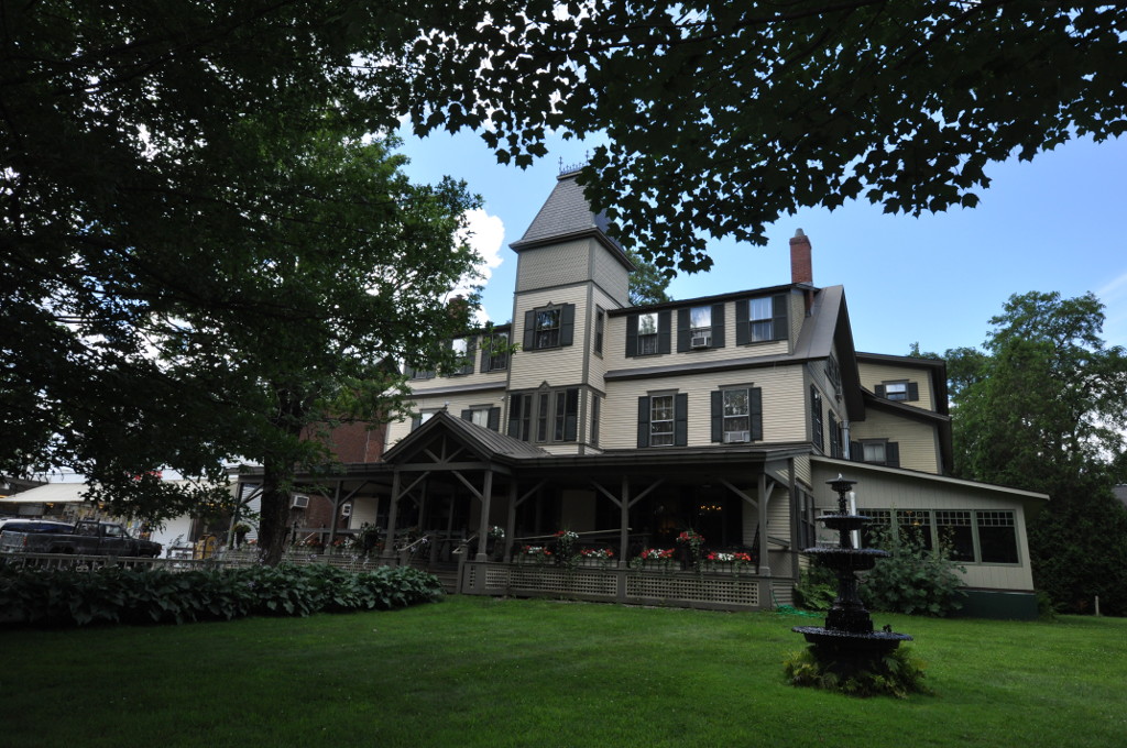


Why visit Norwich
Townapedia lists 15 museums and landmarks, 18 parks and trails, 35 places to eat, 3 places to stay and 11 attractions in and around town.
Highlights include Nugget Theater, Thayer School of Engineering, Hood Museum of Art and Montshire Museum of Science.
July is the warmest month, with average highs of 83°F; January lows average 13°F, and about 61 inches of snow fall in a normal year.
Weather in Norwich
Forecast from the National Weather Service. Full forecast
About Norwich
Norwich is a census-designated place (CDP) that comprises the central village of the town of Norwich, Windsor County, Vermont, United States. As of the 2010 census, the population of the CDP was 878, compared to 3,414 for the entire town of Norwich.
From the Wikipedia article Norwich (CDP), Vermont (this version), under CC BY-SA 4.0.
Things to do11


Thayer School of Engineering
School · 1.1 mi
Engineering school of Dartmouth College
Dartmouth College
School · 1.3 mi
Private university in Hanover, New Hampshire, US



Bema
Cinema and theater · 1.4 mi
"big empty meeting area" used for ceremonies, speakers, outdoor art installations
Observatory Road, Hanover
Museums and landmarks15

Hood Museum of Art
Museum · 1.4 mi
Art museum in Hanover, New Hampshire
6 East Wheelock Street, Hanover
We 11:00-17:00; Th,Fr 11:00-20:00; Sa 13:00-17:00

Montshire Museum of Science
Museum · 1.2 mi
Science museum in Norwich, Vermont
35 Montshire Road, Norwich
Mo-Su 10:00-17:00

Norwich Village Historic District
Monument and historic site · National Register of Historic Places
Historic district in Vermont, United States
Brigham Hill Historic District
Monument and historic site · National Register of Historic Places · 1.3 mi
Historic district in Vermont, United States

Christian Street Rural Historic District
Monument and historic site · National Register of Historic Places · 2.0 mi
Historic district in Vermont, United States
Goodrich Four Corners Historic District
Monument and historic site · National Register of Historic Places · 2.9 mi
Historic district in Norwich, Vermont

Norwich Mid-Century Modern Historic District
Monument and historic site · National Register of Historic Places · 0.7 mi
Historic district in Norwich, Vermont

Root School
Monument and historic site · National Register of Historic Places · 3.0 mi
Building in Vermont, United States

The Epic of American Civilization
Monument and historic site · National Register of Historic Places · 1.2 mi
Mural by José Clemente Orozco


Wilder
Monument and historic site · National Register of Historic Places · 3.0 mi
Census-designated place in Vermont, USA
Meeting House Farm
Monument and historic site · National Register of Historic Places · 0.7 mi
3 more on the map.
Parks, trails and playgrounds18


The Green
Park · 1.3 mi
Grass-covered field and common space at the center of Dartmouth College
Nathan's Garden
Park · 1.3 mi
Nathan's Garden is a beautiful forest enclave to read, meditate, or observe wildlife. The garden was created to honor Nathan Hall, who...
sunrise-sunset

Mink Brook Swimming Area
Beach · 1.3 mi
Excellent spot to enjoy the CT river! Please carry out all trash.

6 more on the map.
Restaurants and cafes35




Ramunto's Brick and Brew Pizzeria
Restaurant · Pizza · 1.5 mi
9 South Street, Hanover
Mo-Th,Sa 11:00-09:00, Su 12:00-21:00, Fr 11:00-22:00
Tacos Y Tequila
Restaurant · Mexican · 1.5 mi
3 Lebanon Street, Hanover
Mo-Th 11:00-22:00; Fr-Sa 11:00-23:00; Su 10:00-14:00,15:00-21:00
Tuk Tuk Thai Cuisine
Restaurant · Thai · 1.4 mi
5 South Main Street, Hanover
Mo-Th 11:00-22:00; Fr-Sa 11:00-22:30; Su 11:30-21:00
Dirt Cowboy Cafe
Cafe · 1.4 mi
7 South Main Street, Hanover
Mo-Sa 07:30-11:30, Mo-Su 12:00-16:00, Su 09:00-11:30,12:00-16:00
23 more on the map.
Where to stay3
Churches and places of worship11
The Church of Christ at Dartmouth College
Church · United Church Of Christ · 1.2 mi
40 College Street, Hanover
Shopping11
Gas and EV charging6
Schools, colleges and libraries21
Hartford Area Career & Technology Center
School · 4.2 mi
1 Gifford Road, White River Junction
Healthcare3
Map of Norwich
134 places. The map loads OpenStreetMap tiles when you open it.
Climate by month
Monthly table
| Month | High | Low | Rain | Snow |
|---|---|---|---|---|
| Jan | 30°F | 13°F | 2.7 in | 16.4 in |
| Feb | 34°F | 14°F | 2.4 in | 13.1 in |
| Mar | 44°F | 24°F | 3.0 in | 13.5 in |
| Apr | 58°F | 35°F | 3.2 in | 1.9 in |
| May | 71°F | 46°F | 3.3 in | 0.0 in |
| Jun | 79°F | 55°F | 3.7 in | 0.0 in |
| Jul | 83°F | 61°F | 4.5 in | 0.0 in |
| Aug | 82°F | 59°F | 3.5 in | 0.0 in |
| Sep | 74°F | 52°F | 3.3 in | 0.0 in |
| Oct | 60°F | 40°F | 4.0 in | 0.1 in |
| Nov | 47°F | 31°F | 3.0 in | 2.2 in |
| Dec | 36°F | 20°F | 3.4 in | 13.4 in |
U.S. Climate Normals 1991-2020 for Hanover Hcn (1 mi away), NOAA NCEI.
People and cost of living
American Community Survey 5-year estimates, 2020-2024, U.S. Census Bureau. Estimates have margins of error, larger for small towns.
Disaster history
Windsor County has had 19 federal disaster declarations since 2000, most often for severe storms.
- 2024-08-08: Tropical Depression Debby (Tropical Storm)
- 2024-03-02: Severe Storm And Flooding (Severe Storm)
- 2023-07-14: Severe Storms, Flooding, Landslides, And Mudslides (Flood)
- 2023-07-10: Flooding (Flood)
- 2021-08-22: Tropical Storm Henri (Hurricane)
- 2020-04-08: Covid-19 Pandemic (Biological)
OpenFEMA disaster declarations summaries.
Getting there and nearby towns
Lebanon Municipal Airport (LEB) is the nearest airport with scheduled flights listed in OpenStreetMap, 7 miles away.
- Hanover 2 mi east, about 3 min by car
- Lebanon 6 mi southeast, about 10 min by car
- Enfield 9 mi southeast, about 15 min by car
- Bradford 21 mi northeast, about 34 min by car
- Claremont 23 mi south, about 37 min by car
- Newport 25 mi south, about 41 min by car
- New London 26 mi southeast, about 42 min by car
- Plymouth 30 mi east, about 49 min by car
- Bristol 30 mi east, about 48 min by car
- Rutland 34 mi west, about 55 min by car
Drive times are estimates from straight-line distance, not routes.
Local news
Headlines from INDB, the NEMICO news database.
Reviews, tips and questions
Loading what members have shared...
Sources and licences
- NCES EDGE (Public domain): public schools
- NOAA NCEI U.S. Climate Normals 1991-2020 (Public domain): climate by month
- OpenFEMA (Public domain): disaster declarations
- OpenStreetMap contributors (ODbL 1.0): places, airports, map data
- U.S. Census Bureau (Public domain): population, income, housing, education, commute
- Wikidata (CC0 1.0): elevation, founding date, time zone, website, landmarks and historic places
- Wikimedia Commons (see each image): photos
- Wikipedia (CC BY-SA 4.0): overview and history text
Photo credits
- Dan & Whits General Store Main Street downtown Norwich VT October 2017, Artaxerxes, CC BY-SA 4.0
- Congregational church, Norwich, Vermont, Unknown author Unknown author, Public domain
- NorwichVT Library, Magicpiano, CC BY-SA 3.0
- NorwichVT NorwichInn, Magicpiano, CC BY-SA 3.0
- NorwichVT CongregationalChurch, Magicpiano, CC BY-SA 3.0
- Norwich, Vermont Town Office, Kenneth C. Zirkel, CC BY 4.0
- Norwich Congregational Church, Vermont-facade, Kenneth C. Zirkel, CC BY 4.0
- Norwich Public School, Vermont, Kenneth C. Zirkel, CC BY 4.0
- Tracy Hall , Norwich, Vermont - Church Street facade, Kenneth C. Zirkel, CC BY 4.0
- Norwich Congregational Church, Vermont, Kenneth C. Zirkel, CC BY 4.0
- Tracy Hall , Norwich, Vermont - Main Street facade, Kenneth C. Zirkel, CC BY 4.0
- Norwich, Vermont Historical Society, Kenneth C. Zirkel, CC BY 4.0
- Norwich Historical Society, Vermont, Kenneth C. Zirkel, CC BY 4.0
- Theta Chi Fraternity, Norwich, Vermont, Kenneth C. Zirkel, CC BY 4.0
- St. Barnabas Episcopal Church, Norwich Vermont, Kenneth C. Zirkel, CC BY 4.0
- Norwich VT 11-04-25, Ascended Dreamer, CC BY-SA 4.0
- NorwichVT MidCenturyModernHD 3, Magicpiano, CC BY-SA 4.0
- NorwichVT MidCenturyModernHD 2, Magicpiano, CC BY-SA 4.0
- NorwichVT MidCenturyModernHD 4, Magicpiano, CC BY-SA 4.0
- NorwichVT MidCenturyModernHD 1, Magicpiano, CC BY-SA 4.0
- King Arthur Baking Company store Norwich, Kenneth C. Zirkel, CC BY-SA 4.0
- King Arthur Baking store in Norwich, Vermont, Kenneth C. Zirkel, CC BY 4.0
- Montshire Museum of Science in Norwich, Vermont, Jared and Corin, CC BY-SA 2.0
- Hood Museum of Art - Dartmouth College - DSC04673, Daderot, CC0
- Orozco - Dartmouth c, Daderot ( original image ), CC BY-SA 3.0
- NorwichVT RootSchool, Magicpiano, CC BY-SA 3.0
- HartfordVT ChristianStreetHD 1, Magicpiano, CC BY-SA 3.0
- Wilder Station, Wilder, Vt (83548), Tichnor Brothers, Publisher, Public domain
- Occom Pond in Hanover, NH (4519062753), Šarūnas Burdulis from USA, CC BY-SA 2.0
- Fish in Occom Pond (4526571404), Šarūnas Burdulis from USA, CC BY-SA 2.0
- Atrium of the Arthur L. Irving Institute for Energy and Society, Dartmouth College, Kenneth C. Zirkel, CC BY 4.0
- Arthur L. Irving Institute lobby, Dartmouth College, Kenneth C. Zirkel, CC BY 4.0
- Tuck Hall, Dartmouth College, Kenneth C. Zirkel, CC BY 4.0
- Arthur L. Irving Institute, Dartmouth College, Kenneth C. Zirkel, CC BY 4.0
- Its spring, for real... (7210473946), Šarūnas Burdulis from USA, CC BY-SA 2.0
- Its spring, for real... (7210473268), Šarūnas Burdulis from USA, CC BY-SA 2.0
- Its spring, for real... (7210474554), Šarūnas Burdulis from USA, CC BY-SA 2.0
- Buchanan Hall, Tuck School of Business at Dartmouth College, Kenneth C. Zirkel, CC BY 4.0
- King Arthur Baking Company store interior, Kenneth C. Zirkel, CC BY-SA 4.0
- Inside the King Arthur Baking Company store, Kenneth C. Zirkel, CC BY 4.0


Page built October 30, 2026. Spotted a mistake? Tell us or suggest a place.