
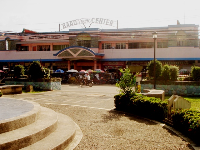


Why visit Baao
Townapedia lists 7 museums and landmarks, 10 parks and trails, 105 places to eat and 15 places to stay in and around town.
Weather in Baao
Forecast from MET Norway (CC BY 4.0). Full forecast
About Baao
Baao, officially the Municipality of Baao (Rinconada Bikol: Banwāan ka Baao; Tagalog: Bayan ng Baao) is municipality in the province of Camarines Sur, Philippines. According to the 2024 census, it has a population of 61,357 people. The 1818 Spanish census recorded the area as having 1,538 native families and 57 Spanish-Filipino families.
From the Wikipedia article Baao (this version), under CC BY-SA 4.0.
Travel tips from other travellers: Baao on Wikivoyage (CC BY-SA 4.0).
Museums and landmarks7

Parks, trails and playgrounds10




Tinagba Park
Park · 6.4 km
Tinagba Park includes the tower of the martyr soldiers who have fought for the country.

Restaurants and cafes105


Prinz and Paul Store & Eatery
Restaurant · Regional, Asian · 2.6 km
Maharlika Highway, Baao

93 more on the map.
Where to stay15

3 more on the map.
Churches and places of worship60
Iglesia ni Cristo Agdangan
Church · Iglesia Ni Cristo · 6.0 km
Maharlika Highway, Baao
Church of God - Iriga City
Church · Pentecostal · 5.8 km
Baao-Iriga City-Nabua Road
Iglesia ni Cristo - Lokal ng Baao
Church · Iglesia Ni Cristo · 2.1 km
Maharlika Highway
Iglesia ni Cristo - Lokal ng Iriga City
Church · Iglesia Ni Cristo · 5.5 km
Baao-Iriga City-Nabua Road, Iriga
Locale of Maharlika
Church · Iglesia Ni Cristo · 2.9 km
Baao-Iriga City-Nabua Road, Baao
St. John of the Cross Parish
Church · Roman Catholic · 6.3 km
Maharlika Highway, Baao
St. Michael the Archangel Chapel
Church · Roman Catholic · 5.8 km
Maharlika Highway, Nabua
Shopping22
Jurassic Construction and Supplies
Hardware store · 3.2 km
Maharlika Highway, Baao
Gas and EV charging37
Schools, colleges and libraries105
Healthcare25
Map of Baao
250 places. The map loads OpenStreetMap tiles when you open it.
Getting there and nearby towns
Naga Airport (WNP) is the nearest airport with scheduled flights listed in OpenStreetMap, 18 km away.
- Iriga City 6 km southeast, about 6 min by car
- Nabua 5 km south, about 5 min by car
- Bula 10 km west, about 10 min by car
- Bato 11 km south, about 11 min by car
- Buhi 17 km east, about 17 min by car
- Libon 19 km southeast, about 19 min by car
- Polangui 22 km southeast, about 22 min by car
- Tigaon 24 km northeast, about 24 min by car
- Oas 26 km southeast, about 26 min by car
- Naga 27 km northwest, about 27 min by car
Drive times are estimates from straight-line distance, not routes.
Local news
Headlines from INDB.
Reviews, tips and questions
Loading what members have shared...
Sources and licences
- GeoNames (CC BY 4.0): population, coordinates, regions and time zone
- OpenStreetMap contributors (ODbL 1.0): places, airports, map data
- Wikidata (CC0 1.0): elevation, founding date, time zone, website
- Wikimedia Commons (see each image): photos
- Wikipedia (CC BY-SA 4.0): overview and history text
Photo credits
- Saodan sa Baao, The original uploader was Ringer at Central Bikol Wikipedia ., CC BY-SA 3.0
- Saint Anthony Padua Hall, Mark Balang, CC BY-SA 4.0
- Nabua Veterans Park, Cam Sur, May 2025 (3), Ralff Nestor Nacor, CC BY-SA 4.0
Page built November 7, 2026. Spotted a mistake? Tell us or suggest a place.