


Why visit Buhi
Townapedia lists 4 museums and landmarks, 5 parks and trails, 26 places to eat, 3 places to stay and 7 attractions in and around town.
Weather in Buhi
Forecast from MET Norway (CC BY 4.0). Full forecast
About Buhi
Buhi, officially the Municipality of Buhi (Buhinon: Banwaan nya Buhi; Rinconada Bikol: Banwāan ka Buhi; Tagalog: Bayan ng Buhi), is a municipality in the province of Camarines Sur, Philippines. According to the 2024 census, it has a population of 78,104 people.
From the Wikipedia article Buhi, Camarines Sur (this version), under CC BY-SA 4.0.
Travel tips from other travellers: Buhi on Wikivoyage (CC BY-SA 4.0).
Things to do7


Museums and landmarks4



Parks, trails and playgrounds5


Tinagba Park
Park · 11.3 km
Tinagba Park includes the tower of the martyr soldiers who have fought for the country.

Restaurants and cafes26



14 more on the map.
History
The town known today as Buhi began as a small settlement by refugees fleeing the outrage of Mayon Volcano hundreds of years ago. These people founded a permanent settlement in an area close to the lake and flourished as time passed.
The general exodus of people fleeing and being able to escape grave calamities such as Mayon's eruption was known in local vernacular as "naka-buhi". Local lore takes this as the most probable explanation as to how the town acquired its present name – Buhi. One version of local legend attributes the town being accorded the name to the time when the first Spaniards came and asked local settlers the name of the area. The local settlers misunderstood the question as how they came to be there and so gave the response "Naka-Buhi".
There were two patron saints with whom the town directed their devotion. The first was St. Francis of Assisi placed in the church made of wooden materials. Unfortunately, in 1730 the church was razed down by fire. It was, however, replaced by a stone structure built under the supervision of Rev. Fray Jose de Cerda. Another saint was installed, St. Anthony of Padua. The 1818 census showed the area had 2,903 native families and 15 Spanish-Filipino families.
The present Buhi Church was completed in 1884. The roof was destroyed by fire and fully repaired in 1890.
From the History section of Buhi, Camarines Sur on Wikipedia, under CC BY-SA 4.0.
Where to stay3
Churches and places of worship26
Church of God - Iriga City
Church · Pentecostal · 11.2 km
Baao-Iriga City-Nabua Road
Iglesia ni Cristo - Lokal ng Iriga City
Church · Iglesia Ni Cristo · 11.4 km
Baao-Iriga City-Nabua Road, Iriga
Our Lady of Fatima Parish and Archdiocesan Shrine
Church · Roman Catholic · 12.4 km
Shopping5
Gas and EV charging17
Schools, colleges and libraries114
Iriga City Division Integrated Special School
School · 11.1 km
Morning Glory Street, Iriga
Perpetual Help National High School
School · 11.7 km
Elias Corporal Street, Iriga
Rinconada National Technical Vocational School Annex, San Francisco Elementary School Campus
School · 11.6 km
Morning Glory Street, Iriga
Healthcare9
Map of Buhi
216 places. The map loads OpenStreetMap tiles when you open it.
Getting there and nearby towns
Naga Airport (WNP) is the nearest airport with scheduled flights listed in OpenStreetMap, 32 km away.
- Iriga City 11 km west, about 11 min by car
- Polangui 16 km south, about 16 min by car
- Nabua 16 km west, about 16 min by car
- Libon 17 km southwest, about 17 min by car
- Tiwi 18 km east, about 18 min by car
- Oas 19 km south, about 19 min by car
- Tigaon 22 km north, about 22 min by car
- Tabaco 25 km east, about 25 min by car
- Ligao 24 km south, about 24 min by car
- Malilipot 27 km southeast, about 27 min by car
Drive times are estimates from straight-line distance, not routes.
Local news
Headlines from INDB.
Reviews, tips and questions
Loading what members have shared...
Sources and licences
- GeoNames (CC BY 4.0): population, coordinates, regions and time zone
- OpenStreetMap contributors (ODbL 1.0): places, airports, map data
- Wikidata (CC0 1.0): elevation, founding date, time zone, website
- Wikimedia Commons (see each image): photos
- Wikipedia (CC BY-SA 4.0): overview and history text
Photo credits
- Buhi Church Pastoral Center, Cam Sur, May 2025, Ralff Nestor Nacor, CC BY-SA 4.0
- Buhi Church, Cam Sur, May 2025 (2), Ralff Nestor Nacor, CC BY-SA 4.0
- Buhi Church Interior, Cam Sur, May 2025, Ralff Nestor Nacor, CC BY-SA 4.0
- I Love Buhi, Cam Sur, May 2025, Ralff Nestor Nacor, CC BY-SA 4.0
- Buhi Church Open Space, Cam Sur, May 2025, Ralff Nestor Nacor, CC BY-SA 4.0
- Buhi Church Mural, Cam Sur, May 2025, Ralff Nestor Nacor, CC BY-SA 4.0
- St. Bridget School, Buhi, Cam Sur, May 2025, Ralff Nestor Nacor, CC BY-SA 4.0
- Buhi Church, Cam Sur, May 2025 (1), Ralff Nestor Nacor, CC BY-SA 4.0
- Church of Buhi HRMC historical marker, Photo: Ralff Nestor Nacor ; perspective correction: Eugene Alvin Villar ( seav ), CC BY-SA 4.0
- Church of Buhi Historical Marker, Cam Sur, Ralff Nestor Nacor, CC BY-SA 4.0
- Buhi Church Gate, Cam Sur, May 2025, Ralff Nestor Nacor, CC BY-SA 4.0
- SAN PASCUAL, SAN BUENA BUHI CAMARINES SUR, Neil de Leon, CC BY-SA 4.0
- Malangkaw Buhi Camarines Sur, Neil de Leon, CC BY-SA 4.0
- LCC Store Buhi, Free2barredo, CC BY-SA 4.0
- View San Pedro Buhi Camarines Sur, Neil de Leon, CC BY-SA 4.0
- Jose Rizal Monument, Buhi, Cam Sur, May 2025, Ralff Nestor Nacor, CC BY-SA 4.0
- Bantayog-Wika, Buhi, Cam Sur, May 2025, Ralff Nestor Nacor, CC BY-SA 4.0
- Buhi Municipal Hall, Cam Sur, May 2025, Ralff Nestor Nacor, CC BY-SA 4.0
- Buhi History Monument, Cam Sur, May 2025, Ralff Nestor Nacor, CC BY-SA 4.0
- San Pedro street Buhi Camarines Sur, Neil de Leon, CC BY-SA 4.0
- BUHI MUNICIPAL HALL, Free2barredo, CC BY-SA 4.0
- Magsaysay St., Buhi, Cam Sur, May 2025, Ralff Nestor Nacor, CC BY-SA 4.0
- Old Buhi Municipal Hall, Cam Sur, May 2025, Ralff Nestor Nacor, CC BY-SA 4.0
- Buhi Camarines Sur ( Simbahan and social terrace ), Neil de Leon, CC BY-SA 4.0
- St. Francis of Assisi Parish Church (BUHI CAM SUR), NEIL DE LEON, CC BY-SA 3.0
- Buhi Camarines Sur ( Another View, Sta Elena, Sta Clara, San Pedro, San Pascual ), Neil de Leon, CC BY-SA 4.0
- BUHI Church, NEIL DE LEON, CC BY-SA 3.0
- St. Francis of Assisi Parish Church ( BUHI ), NEIL DE LEON, CC BY-SA 3.0
- Buhi Camarines Sur ( Simbahan ), Neil de Leon, CC BY-SA 4.0
- Buhi Camarines Sur ( My home Town ), Neil de Leon, CC BY-SA 4.0
- Millenium Center, Buhi, Cam Sur, May 2025, Ralff Nestor Nacor, CC BY-SA 4.0
- BUHI CAM SUR, BICOL PHILIPPINES 14, NEIL DE LEON, CC0
- BUHI CAM SUR, BICOL PHILIPPINES 13, NEIL DE LEON, CC0
- LAKE BUHI 12, NEIL DE LEON, CC BY-SA 3.0
- BUHI CAM SUR, BICOL PHILIPPINES 11, NEIL DE LEON, CC0
- Mount Asog, MarvinBikolano, CC BY-SA 4.0
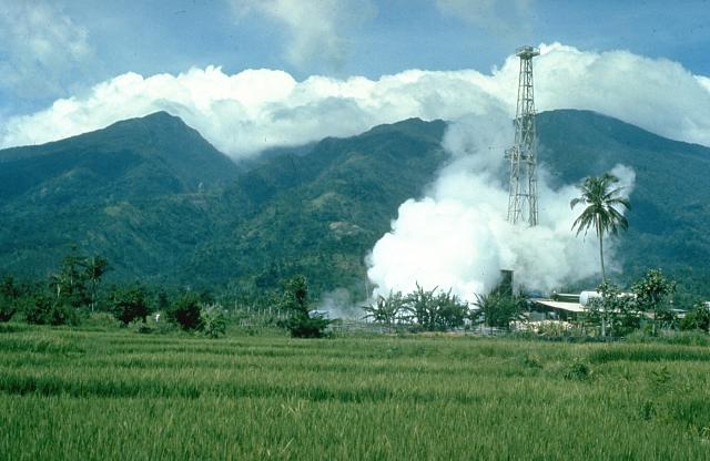
- Mount Malinao, Chris Newhall (U.S. Geological Survey), Public domain
- Saint Anthony Padua Hall, Mark Balang, CC BY-SA 4.0
- SAN PEDRO AND SAN PASCUAL VIEW, Neil de Leon, CC BY-SA 4.0
- Ukoy na Puso sa Batag, Free2barredo, CC BY-SA 4.0
- Buhi Rizal Park, Cam Sur, May 2025, Ralff Nestor Nacor, CC BY-SA 4.0


Page built November 7, 2026. Spotted a mistake? Tell us or suggest a place.